Logo
Blog
To the map
Blog header image

Snowshoeing from Gruyères by public transport

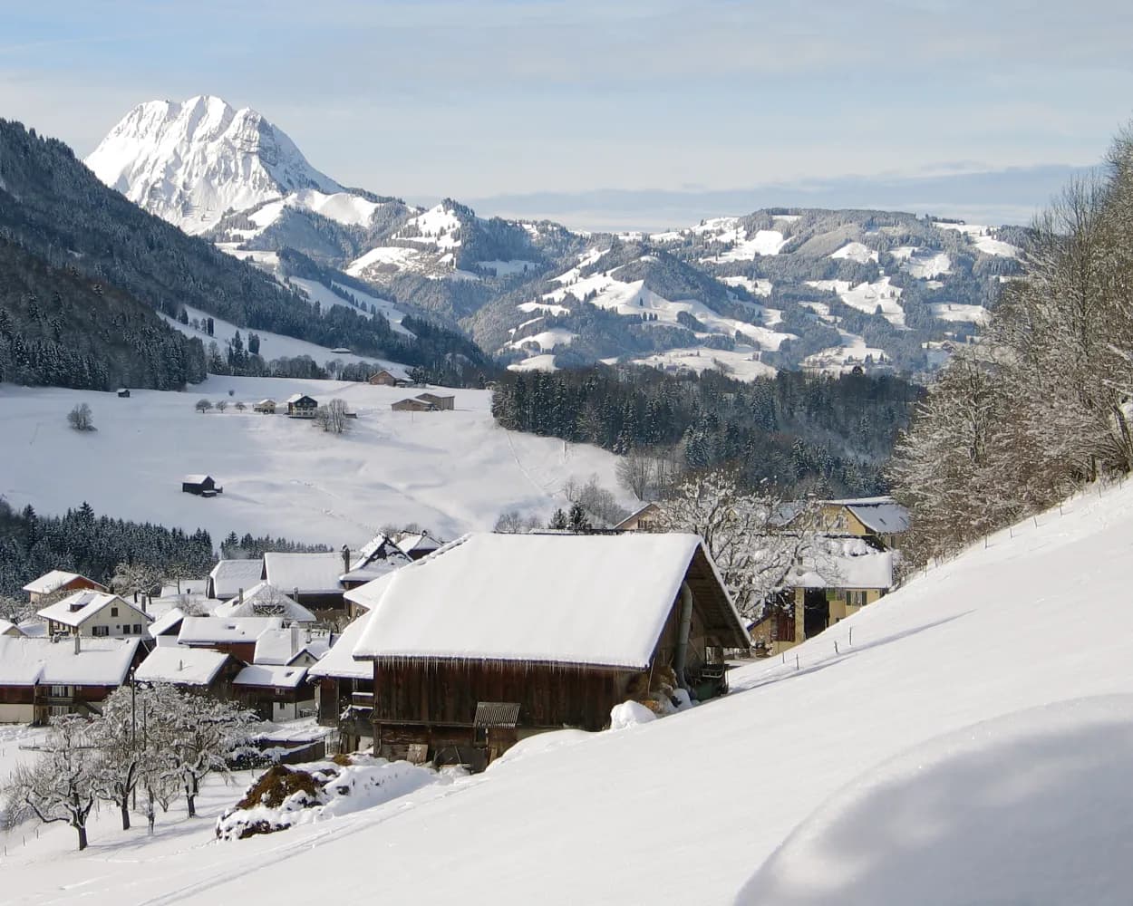
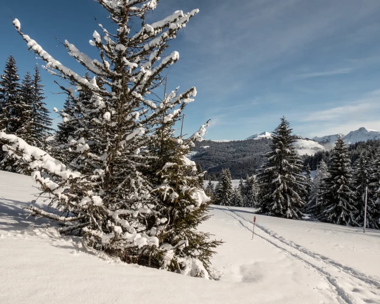
Discover a winter wonderland on these snowshoe hikes, all easily reachable from Gruyères by public transport. Snow-covered forests, wide alpine plateaus, and scenic routes offer memorable experiences in the heart of the Alps.

To make planning easier, the hikes below are sorted by travel time from Gruyères. Explore the map to find all snowshoe hikes and thousands of other outdoor activities accessible from anywhere in Switzerland.

Much more on ovunta.com/en/map

Discover other activities close to Gruyères

  • Ride the Rails, Hit the Slopes: Transit-Reachable Ski Areas Near Gruyères
  • Sledging runs from Gruyères by public transport
  • Scenic Hikes from Gruyères
  • Cross-country skiing resorts from Gruyères by public transport
  • Winter Hikes from Gruyères by public transport

Start from elsewhere?

  • Snowshoeing from Leukerbad by public transport
  • Snowshoeing from Sion by public transport
  • Snowshoeing from Bern by public transport
1/10

Parcours Charmey–Jaun

Minimum travel time: 32m to Charmey (Gruyère),La Fulateyre
Parcours Charmey–Jaun

The snowshoe trail «Charmey–Jaun» links the villages of Charmey and Jaun. The route offers a pleasant walk along the Jogne. The path ends at the foot of the Cantorama and the Jaun waterfall.

dist9 km
|
asce220 m
|
desc70 m
|
dura3h 30m

    Tour published by:

    SwitzerlandMobility

    Learn more on
    schweizmobil.ch

    Parcours Charmey–Jaun

    How to get to Parcours Charmey–Jaun

    Fastest connection from Gruyères to Charmey (Gruyère),La Fulateyre: 32m
    Walk from Gruyères to Gruyères, gare
    Gruyères, gare (08:43)
    260 (28m)
    Charmey (Gruyère),La Fulateyre (09:11)
    Search Connections & Buy Tickets on SBB
    2/10

    Soldatenhaus Trail

    Minimum travel time: 41m to Jaun, Dorf
    Soldatenhaus Trail

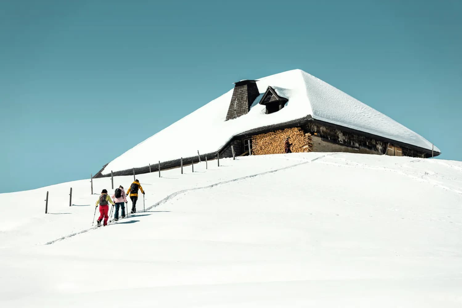
    The trail runs from the high Musersbergli station to the panoramic viewing area. Through the forest you reach the «Soldatenhaus» at the foot of the Gastlosen mountains. If you arrive at the right place, at the right time, you can admire the dazzling sun filtering through the «Grossmutterloch».

    dist10 km
    |
    asce380 m
    |
    desc950 m
    |
    dura4h 50m

      Tour published by:

      SwitzerlandMobility

      Learn more on
      schweizmobil.ch

      Soldatenhaus Trail

      How to get to Soldatenhaus Trail

      Fastest connection from Gruyères to Jaun, Dorf: 41m
      Walk from Gruyères to Gruyères, gare
      Gruyères, gare (08:43)
      260 (37m)
      Jaun, Dorf (09:20)
      Search Connections & Buy Tickets on SBB
      3/10

      Oberbach Trail

      Minimum travel time: 48m to Jaun, Bergbahnen
      Oberbach Trail

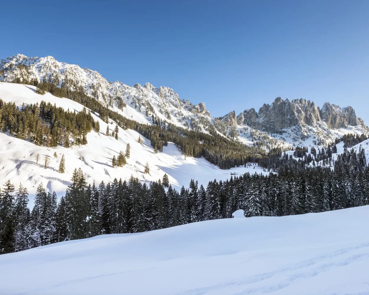
      This varied circular tour follows the Jaunbach stream and offers a nice view of the impressive jagged peaks of the Gastlosen mountain range.

      dist4 km
      |
      asce260 m
      |
      desc260 m
      |
      dura2h 10m

        Tour published by:

        SwitzerlandMobility

        Learn more on
        schweizmobil.ch

        Oberbach Trail

        How to get to Oberbach Trail

        Fastest connection from Gruyères to Jaun, Bergbahnen: 48m
        Walk from Gruyères to Gruyères, gare
        Gruyères, gare (08:43)
        260 (44m)
        Jaun, Bergbahnen (09:27)
        Search Connections & Buy Tickets on SBB
        4/10

        Parcours du Sommet de Vounetse

        Minimum travel time: 50m to Vounetse
        Parcours du Sommet de Vounetse

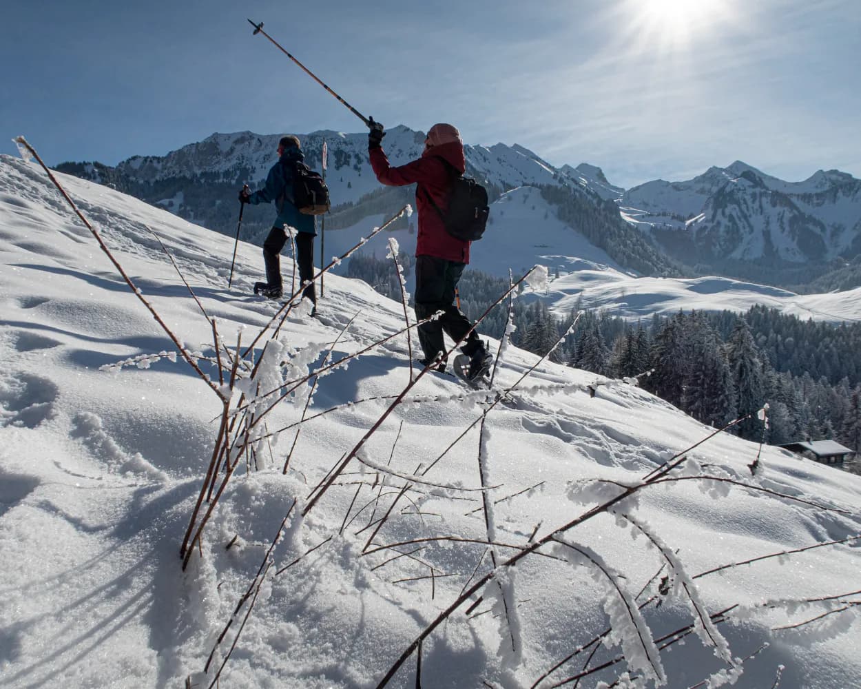
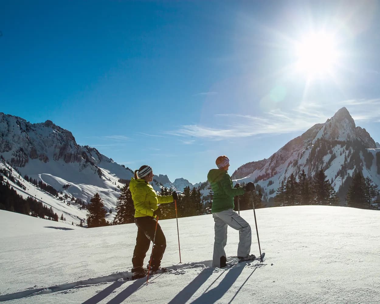
        This trail takes you to the top of Vounetse. From the midway station on the cable car, the route crosses the mountain pastures and the ski area before reaching the summit. The second part offers a beautiful panoramic view with the mountain Berra, the Vanil Noir and the Moléson.

        dist5 km
        |
        asce560 m
        |
        desc560 m
        |
        dura3h 45m

          Tour published by:

          SwitzerlandMobility

          Learn more on
          schweizmobil.ch

          Parcours du Sommet de Vounetse

          How to get to Parcours du Sommet de Vounetse

          Fastest connection from Gruyères to Vounetse: 50m
          Walk from Gruyères to Gruyères, gare
          Gruyères, gare (08:43)
          260 (26m)
          Charmey (Gruyère), village (09:09)
          Walk from Charmey (Gruyère), village to Charmey (Gruyère) (télécabine)
          Charmey (Gruyère) (télécabine) (09:14)
          2042 (15m)
          Vounetse (09:29)
          Search Connections & Buy Tickets on SBB
          5/10

          Grubenberg Trail

          Minimum travel time: 1h 25m to Abländschen, Jaungrund
          Grubenberg Trail

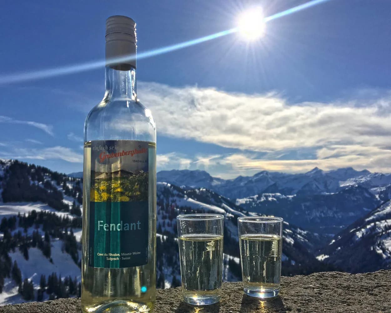
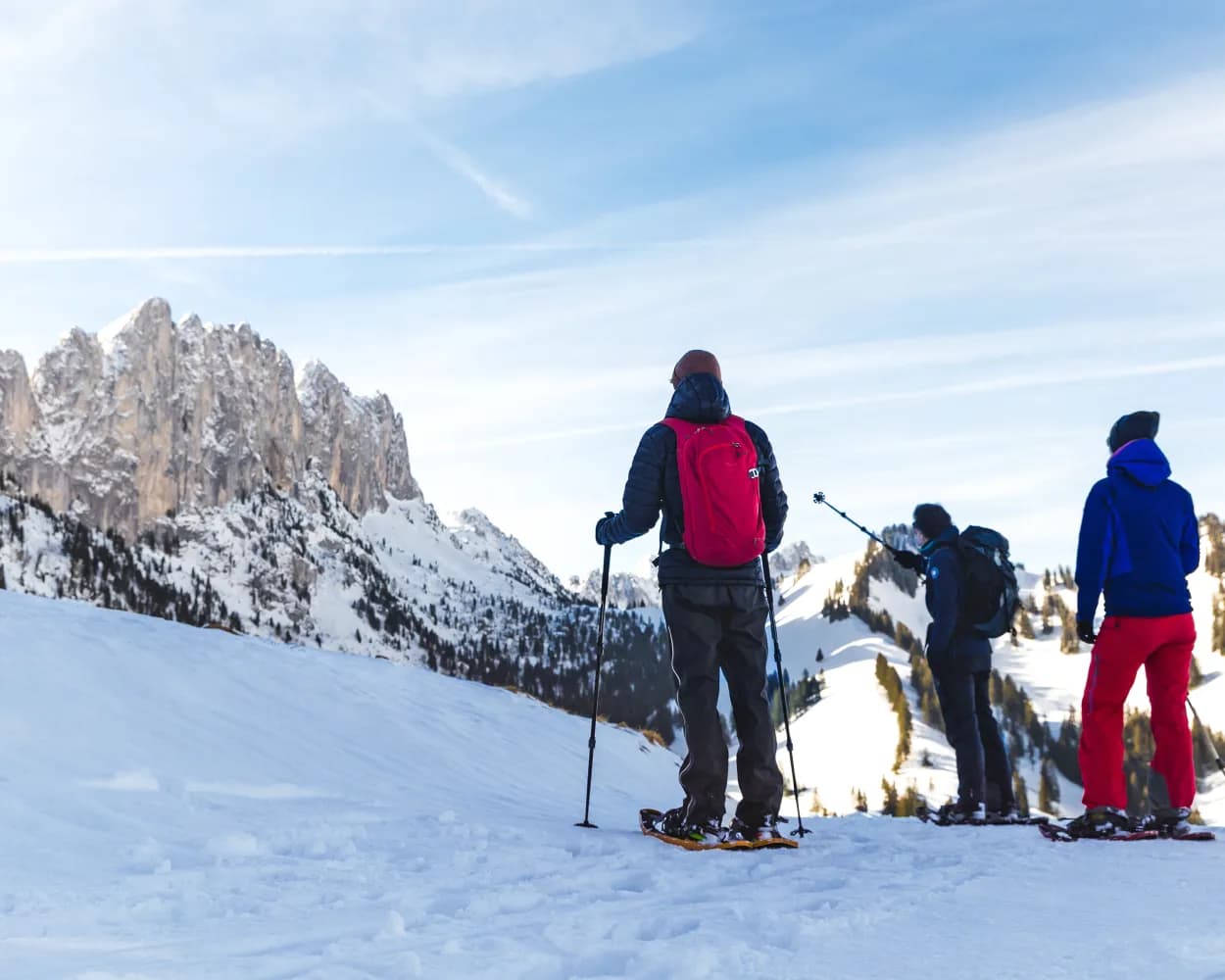
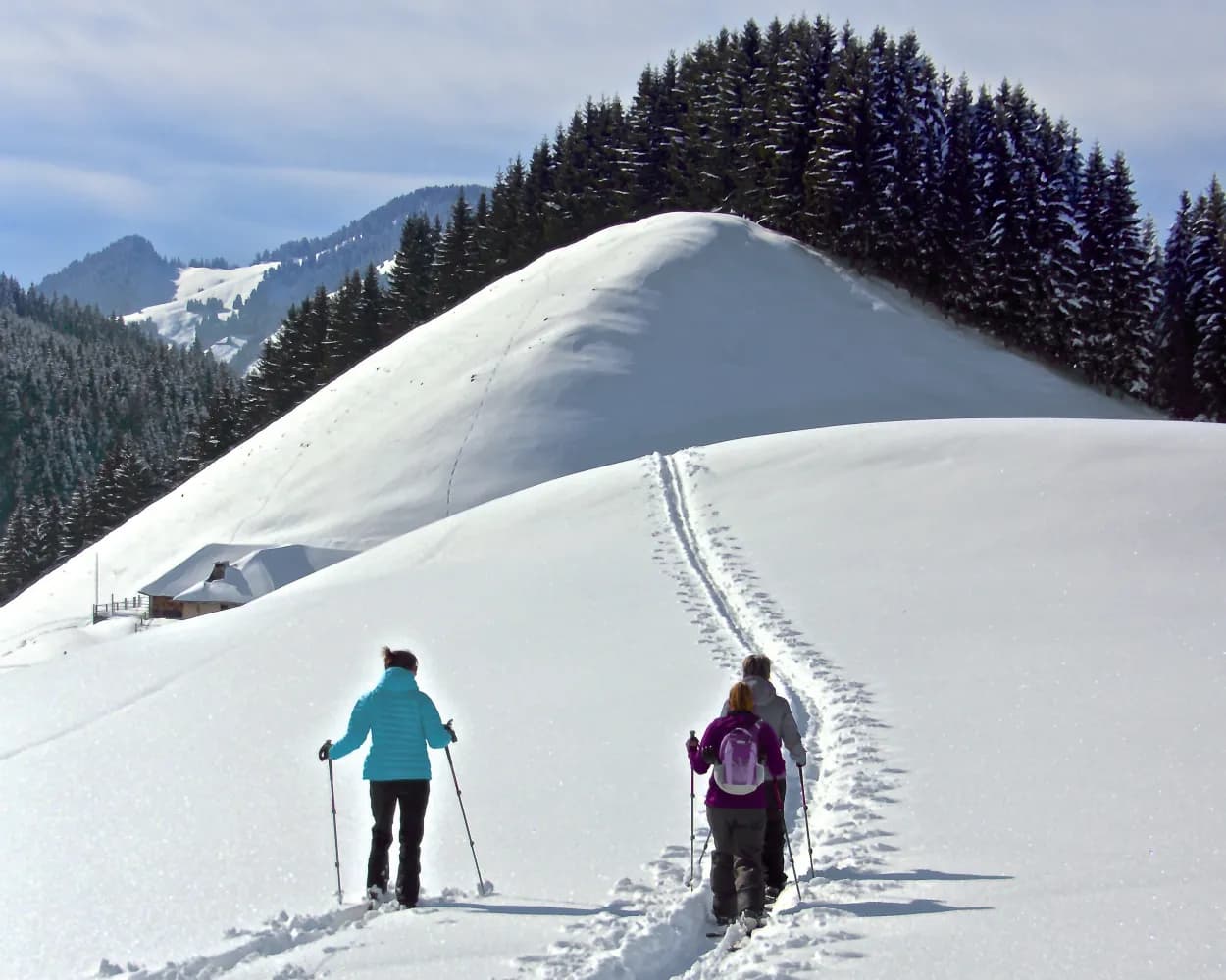
          Get away from it all here on this spectacular snowshoe trail to the Grubenberg Hut. This is located high above the lovely Saanenland, at the foot of the bizarre limestone crags of the Gastlosen mountains.

          dist8 km
          |
          asce540 m
          |
          desc540 m
          |
          dura4h 20m

            Tour published by:

            SwitzerlandMobility

            Learn more on
            schweizmobil.ch

            Grubenberg Trail

            How to get to Grubenberg Trail

            Fastest connection from Gruyères to Abländschen, Jaungrund: 1h 25m
            Walk from Gruyères to Gruyères, gare
            Gruyères, gare (08:43)
            260 (44m)
            Jaun, Bergbahnen (09:27)
            Jaun, Bergbahnen (09:44)
            185 (20m)
            Abländschen, Jaungrund (10:04)
            Search Connections & Buy Tickets on SBB
            6/10

            Parcours du Pré-de-l’Essert

            Minimum travel time: 1h 44m to La Valsainte, Couvent
            Parcours du Pré-de-l’Essert

            A circular walk, the ideal itinerary for people who enjoy peace and nature. The trail leads you through a "wild" valley, to Les Reposoirs and the Pré de l'Essert. Interesting buildings on the way: The site of the Chartreuse de la Valsainte at the starting point and the highest farm in the canton of Fribourg.

            dist9 km
            |
            asce400 m
            |
            desc400 m
            |
            dura4h 0m

              Tour published by:

              SwitzerlandMobility

              Learn more on
              schweizmobil.ch

              Parcours du Pré-de-l’Essert

              How to get to Parcours du Pré-de-l’Essert

              7/10

              Parcours d'Auta Chia

              Minimum travel time: 1h 44m to La Valsainte, Couvent
              Parcours d'Auta Chia

              During this circular hike, you will see the alpine chalets: Les Féguelenets, la Guisolanda or la Grosse Raynauda. Auta Chia offers you a magnificent panoramic view of La Gruyère and the peaks of the Fribourg Pre-Alps, before a pleasant descent into the forest.

              dist14 km
              |
              asce660 m
              |
              desc660 m
              |
              dura6h 20m

                Tour published by:

                SwitzerlandMobility

                Learn more on
                schweizmobil.ch

                Parcours d'Auta Chia

                How to get to Parcours d'Auta Chia

                Fastest connection from Gruyères to La Valsainte, Couvent: 1h 44m
                Walk from Gruyères to Gruyères, gare
                Gruyères, gare (08:43)
                260 (27m)
                Charmey (Gruyère), Le Chêne (09:10)
                Charmey (Gruyère), Le Chêne (10:04)
                290 (19m)
                La Valsainte, Couvent (10:23)
                Search Connections & Buy Tickets on SBB
                8/10

                Snowshoe adventure with a delicious fondue kit to enjoy on the way

                Minimum travel time: 1h 45m to Les Paccots, Les Rosalys
                Snowshoe adventure with a delicious fondue kit to enjoy on the way

                The charm of snow-covered mountain chalets and a view over Lake Geneva make this circular walk an unmissable experience in the Pre-Alps region. The path winds through the clearing and between La Mayetta and La Vuichouda pastures before climbing up to the summit of the Corbetta.

                dist7 km
                |
                asce400 m
                |
                desc400 m
                |
                dura3h 35m

                  Tour published by:

                  SwitzerlandMobility

                  Learn more on
                  schweizmobil.ch

                  Snowshoe adventure with a delicious fondue kit to enjoy on the way

                  How to get to Snowshoe adventure with a delicious fondue kit to enjoy on the way

                  Fastest connection from Gruyères to Les Paccots, Les Rosalys: 1h 45m
                  Gruyères (08:58)
                  S50 (8m)
                  Bulle (09:06)
                  Walk from Bulle to Bulle, gare routière
                  Bulle, gare routière (09:13)
                  EV5 (20m)
                  Semsales, gare (09:33)
                  Walk from Semsales, gare to Semsales
                  Semsales (09:35)
                  S50 (7m)
                  Châtel-St-Denis (09:42)
                  Walk from Châtel-St-Denis to Châtel-St-Denis, gare
                  Châtel-St-Denis, gare (10:23)
                  492 (20m)
                  Les Paccots, Les Rosalys (10:43)
                  Search Connections & Buy Tickets on SBB
                  9/10

                  Schwyberg Trail

                  Minimum travel time: 2h 14m to Schwarzsee, Gypsera
                  Schwyberg Trail

                  The Schwyberg trail makes for a wonderfully decelerating experience. Peace and nature have returned to what was once a bustling ski resort. Once you have climbed the Schwyberg, a breathtaking view from the alps to the Jura rewards the hikers.

                  dist9 km
                  |
                  asce660 m
                  |
                  desc660 m
                  |
                  dura5h 0m

                    Tour published by:

                    SwitzerlandMobility

                    Learn more on
                    schweizmobil.ch

                    Schwyberg Trail

                    How to get to Schwyberg Trail

                    Fastest connection from Gruyères to Schwarzsee, Gypsera: 2h 14m
                    Walk from Gruyères to Gruyères, gare
                    Gruyères, gare (08:43)
                    260 (7m)
                    Broc-Village, gare (08:50)
                    Walk from Broc-Village, gare to Broc-Village
                    Broc-Village (09:05)
                    RE3 (50m)
                    Fribourg/Freiburg (09:55)
                    Walk from Fribourg/Freiburg to Fribourg/Freiburg, gare rout.
                    Fribourg/Freiburg, gare rout. (10:03)
                    123 (50m)
                    Schwarzsee, Gypsera (10:53)
                    Search Connections & Buy Tickets on SBB
                    10/10

                    Riggisalp Trail

                    Minimum travel time: 2h 24m to Schwarzsee Gypsera (Talstat.)
                    Riggisalp Trail

                    Although it is in the Pre-Alps, walking the snowshoe trail in the Riggisalp will feel as though you are in the high mountains: the route is bordered by the Schwarzsee’s two impressive peaks, the Kaiseregg and the Spitzfluh.

                    dist4 km
                    |
                    asce480 m
                    |
                    desc40 m
                    |
                    dura2h 20m

                      Tour published by:

                      SwitzerlandMobility

                      Learn more on
                      schweizmobil.ch

                      Riggisalp Trail

                      How to get to Riggisalp Trail

                      Fastest connection from Gruyères to Schwarzsee Gypsera (Talstat.): 2h 24m
                      Walk from Gruyères to Gruyères, gare
                      Gruyères, gare (08:43)
                      260 (7m)
                      Broc-Village, gare (08:50)
                      Walk from Broc-Village, gare to Broc-Village
                      Broc-Village (09:05)
                      RE3 (50m)
                      Fribourg/Freiburg (09:55)
                      Walk from Fribourg/Freiburg to Fribourg/Freiburg, gare rout.
                      Fribourg/Freiburg, gare rout. (10:03)
                      123 (50m)
                      Schwarzsee, Gypsera (10:53)
                      Walk from Schwarzsee, Gypsera to Schwarzsee Gypsera (Talstat.)
                      Search Connections & Buy Tickets on SBB