These ten hiking trails are easily accessible from Gruyères by public transport, offering a diverse range of experiences in the stunning Swiss Prealps. From the iconic Moléson mountain to the tranquil Schwarzsee lake, and from the wild Breccaschlund to the charming Intyamon Valley, each trail showcases the region's natural beauty and rich cultural heritage. Whether you're looking for panoramic views, alpine pastures, or historical sites, there's a hike for every preference.
The hikes are sorted by travel time from Gruyères, making it easy to plan your adventure based on your schedule and preferences. Check out the map to explore thousands of destinations and activities, reachable from any starting point in Switzerland.
Much more on ovunta.com/en/map
The Alpine Panorama Trail from Bodensee to Lac Léman promises many views of Alpine peaks as well as of the Mittelland and Jura. The route leads through the traditional agricultural landscape of the Alpine foothills, still dominated by milk and cheese production.
 510km
510km 17800m
 17800m
Landscape: Onto a mountain peak,Onto an alp,Over a pass,With panoramic views
Tour published by:
SwitzerlandMobility
Learn more on
schweizmobil.ch
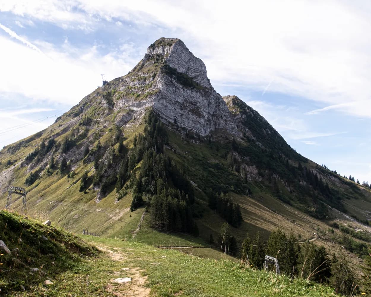
With the mighty Moléson mountain before you and the town of Gruyères behind you, you will climb towards the Plan-Francey middle station. Passing along the northwestern slopes of the Moléson, this leg ends after descending into the forested pre-Alpine resort of Les Paccots.
16km950m620m 5h 0m
5h 0mLandscape: Along the water,Over a pass,Past castles
Tour published by:
SwitzerlandMobility
Learn more on
schweizmobil.ch
| Gruyères, gare (08:33) | |
| 263 (1m) | |
| Pringy, village (08:34) |
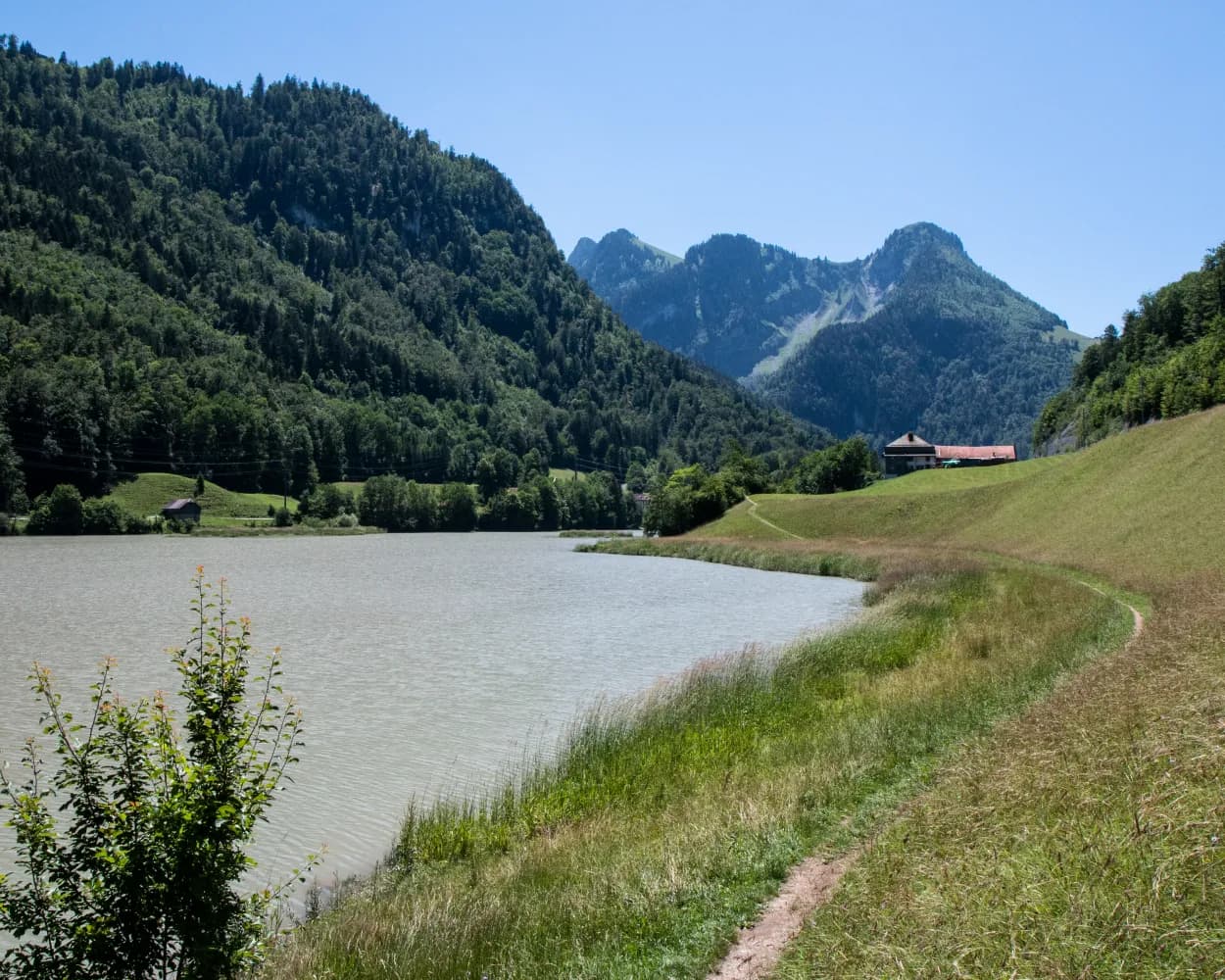
Leisure walkers, culture fans and nature lovers are sure to be in their element on this route from Jaun to Gruyères. The stretch that initially follows the Jaunbach stream and then the river Saane offers a fine demonstration of how water has shaped the landscape. Churches, chapels and the unique heritage of La Gruyère give this route its distinctive character.
22km500m780m6h 0mLandscape: Over a pass
Tour published by:
SwitzerlandMobility
Learn more on
schweizmobil.ch
From the Pays de Gruyère to the Three Lakes Region and through the canton's principle tourist resorts of Gruyères, Fribourg and Murten. Discover typical Swiss landscapes: Alpine foothills and the agricultural, rolling hills of the Mittelland.
68km1650m1950mLandscape: With panoramic views
Tour published by:
SwitzerlandMobility
Learn more on
schweizmobil.ch
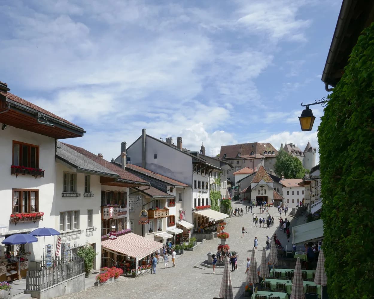
Passing through the medieval town of Gruyères with it cobblestone high street, the route descends to the river Saane. Following the bank of the river, you will soon arrive at Broc. At Broc, you will cross the wild river Saane on a bridge made of wood and stone. Surrounded by pre-Alpine landscapes, meadows and forested areas, this leg then ends shortly afterwards in Bulle.
10km240m220m2h 35mLandscape: Onto an alp
Tour published by:
SwitzerlandMobility
Learn more on
schweizmobil.ch
| Gruyères, gare (08:34) | |
| 260 (3m) | |
| Gruyères, ville (08:37) |
Woodland and meadows will be your guide on the way to the summit of Le Gibloux. The viewing platform offers a 360-degree panorama. Between Posat and the river Glâne, the route follows the Way of St. James through cultural and pastoral landscapes. After that, the rock faces along the river Saane are also striking. This long leg can easily be shortened if need be.
35km1000m1150m9h 25mLandscape: Onto an alp,With panoramic views
Tour published by:
SwitzerlandMobility
Learn more on
schweizmobil.ch
| Gruyères (08:58) | |
| S50 (8m) | |
| Bulle (09:06) |
The walk has some stunning viewpoints over the Fribourg mountains, such as the Moléson, the Dent de Broc and the Gibloux. There are also several places to stop for refreshments: Botterens with its delicious goat’s cheeses and the Maison Cailler in Broc, where you can explore the world of Cailler chocolate.
13km480m480m4h 0mLandscape: Along the water,With panoramic views
Tour published by:
SwitzerlandMobility
Learn more on
schweizmobil.ch
A hike downstream in the heart of La Gruyère, which through openings in the undergrowth offers unrivalled views of the Alpine foothills and creeks filled with turquoise water! It's a real pleasure to discover the flora and fauna and heritage of La Gruyère.
43km1500m1500mLandscape: Along the water,With panoramic views
Tour published by:
SwitzerlandMobility
Learn more on
schweizmobil.ch
| Gruyères, gare (08:43) | |
| 260 (7m) | |
| Broc-Village, gare (08:50) |
| Broc-Village (08:54) | |
| RE3 (3m) | |
| Broc-Chocolaterie (08:57) |
This hike through the border area of the Canton Fribourg is all about nature and history. It leads along the Saane River to a historic 17th century bridge and from Alp La Brâ the view opens up over the Intyamon Valley.
10km780m780m4h 0mLandscape: Along the water
Tour published by:
SwitzerlandMobility
Learn more on
schweizmobil.ch
| Gruyères (08:58) | |
| S50 (21m) | |
| Montbovon (09:19) |
This stage is rich in history, including the stately Vuippens with its castle and gardens, the isle of Ogoz and its vestiges of mediaeval life. Along the shore, you can enjoy bathing, water sports or fine food, before returning to Rossens along the path that overlooks the lake and the molasse cliffs.
17km560m580m4h 45mLandscape: Along the water,With panoramic views
Tour published by:
SwitzerlandMobility
Learn more on
schweizmobil.ch
| Gruyères (08:58) | |
| S50 (8m) | |
| Bulle (09:06) |
| Bulle, Place de la Gare (09:15) | |
| 201 (10m) | |
| Vuippens, village (09:25) |