Logo
Blog
To the map
Blog header image

Snowshoeing from Lenk by public transport

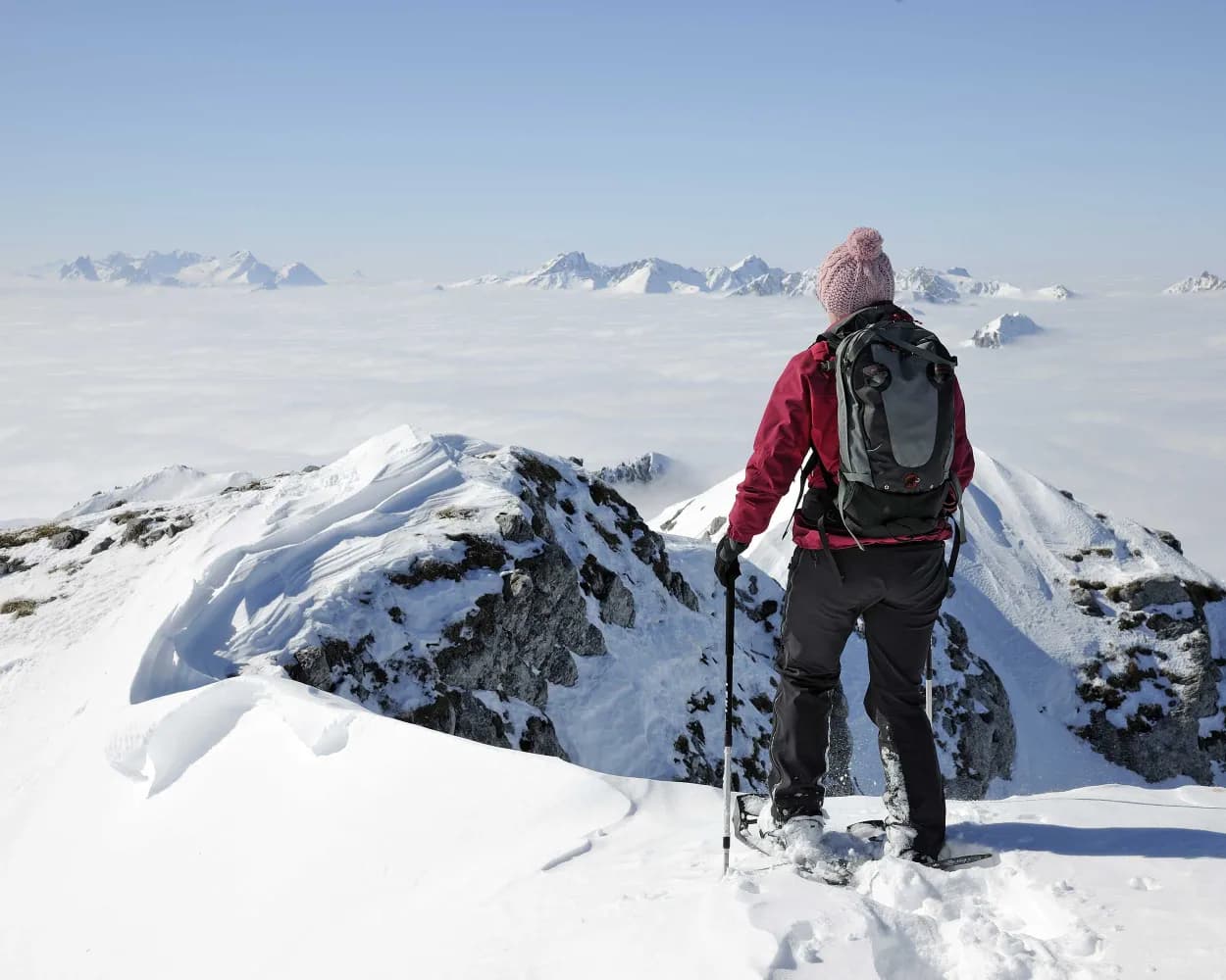
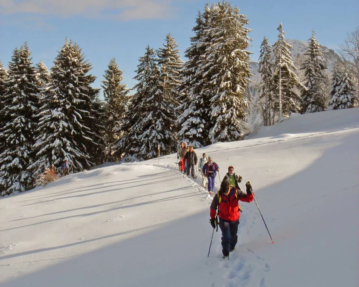
Discover a winter wonderland on these snowshoe hikes, all easily reachable from Lenk by public transport. Snow-covered forests, wide alpine plateaus, and scenic routes offer memorable experiences in the heart of the Alps.

To make planning easier, the hikes below are sorted by travel time from Lenk. Explore the map to find all snowshoe hikes and thousands of other outdoor activities accessible from anywhere in Switzerland.

Much more on ovunta.com/en/map

Discover other activities close to Lenk

  • Ride the Rails, Hit the Slopes: Transit-Reachable Ski Areas Near Lenk
  • Scenic Hikes Around Lenk
  • Accessible Adventures near Lenk
  • Cross-country skiing resorts from Lenk by public transport
  • Winter Hikes from Lenk by public transport

Start from elsewhere?

  • Snowshoeing from Vevey by public transport
  • Snowshoeing from Lauterbrunnen by public transport
  • Snowshoeing from Fribourg by public transport
1/10

Iffigfall Trail

Minimum travel time: 5m to Lenk, Tennisplatz
Iffigfall Trail

Lenkersee, Iffigbach and, as climax, the Iffigfall – water is the trump card on this snowshoe hike. From Lenk, the trail goes in the direction of the frozen natural phenomenon under the eyes of the mighty Wildstrubel.

dist11 km
|
asce360 m
|
desc360 m
|
dura4h 45m

    Tour published by:

    SwitzerlandMobility

    Learn more on
    schweizmobil.ch

    Iffigfall Trail

    How to get to Iffigfall Trail

    Fastest connection from Lenk im Simmental to Lenk, Tennisplatz: 5m
    Walk from Lenk im Simmental to Lenk im Simmental, Bahnhof
    Lenk im Simmental, Bahnhof (09:28)
    283 (1m)
    Lenk, Tennisplatz (09:29)
    Search Connections & Buy Tickets on SBB
    2/10

    Bühlberg Trail

    Minimum travel time: 19m to Lenk, Bühlberg
    Bühlberg Trail

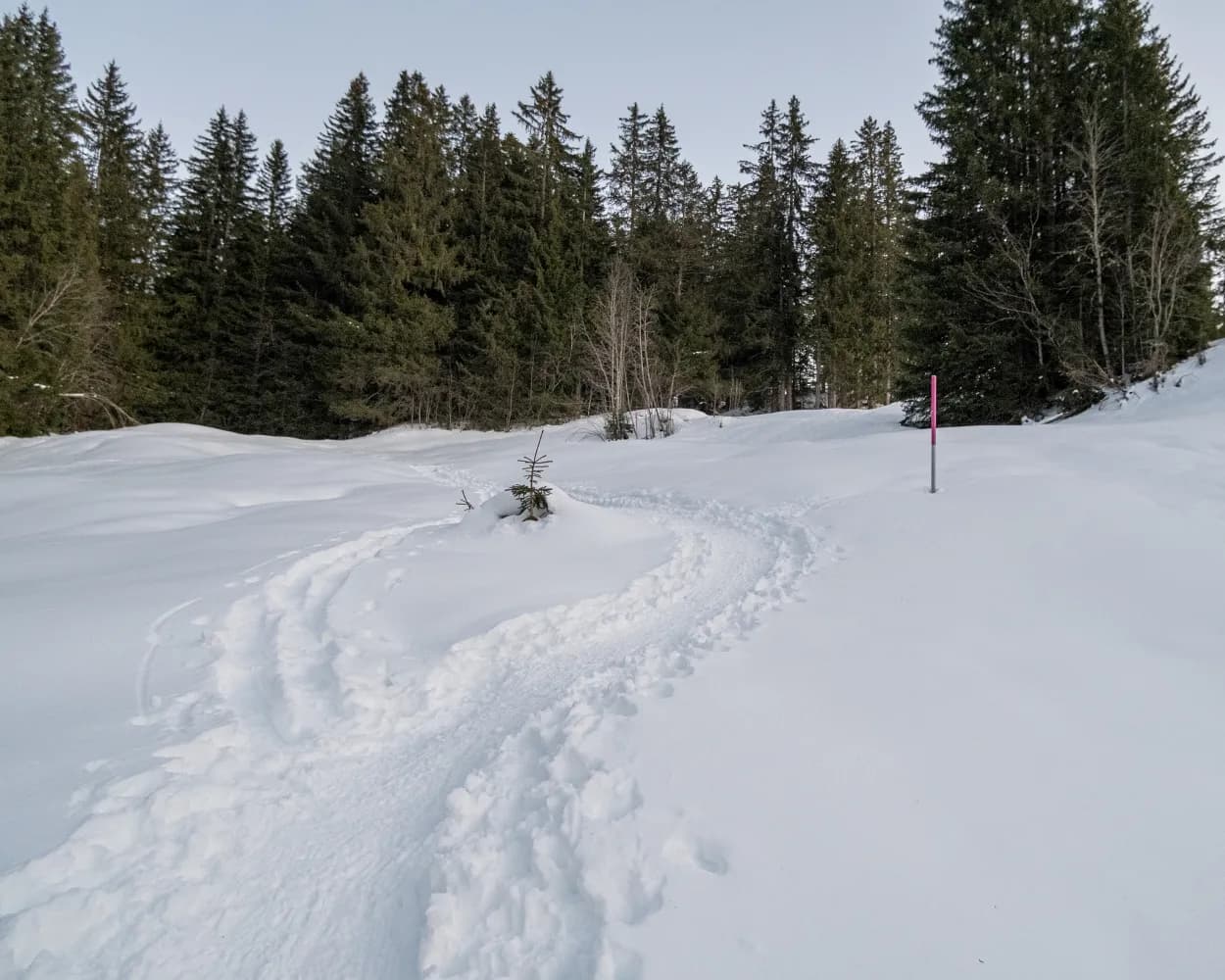
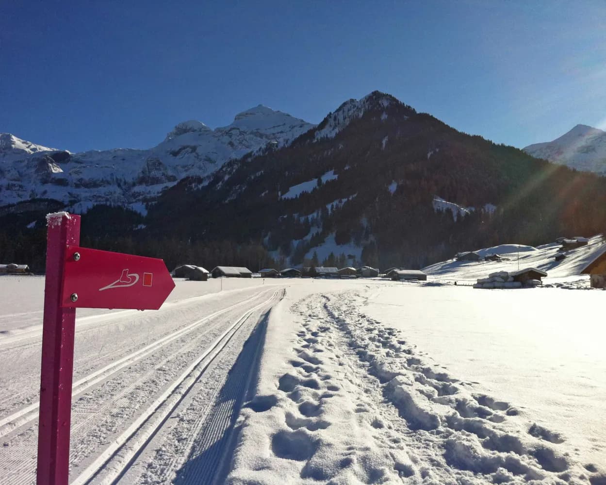
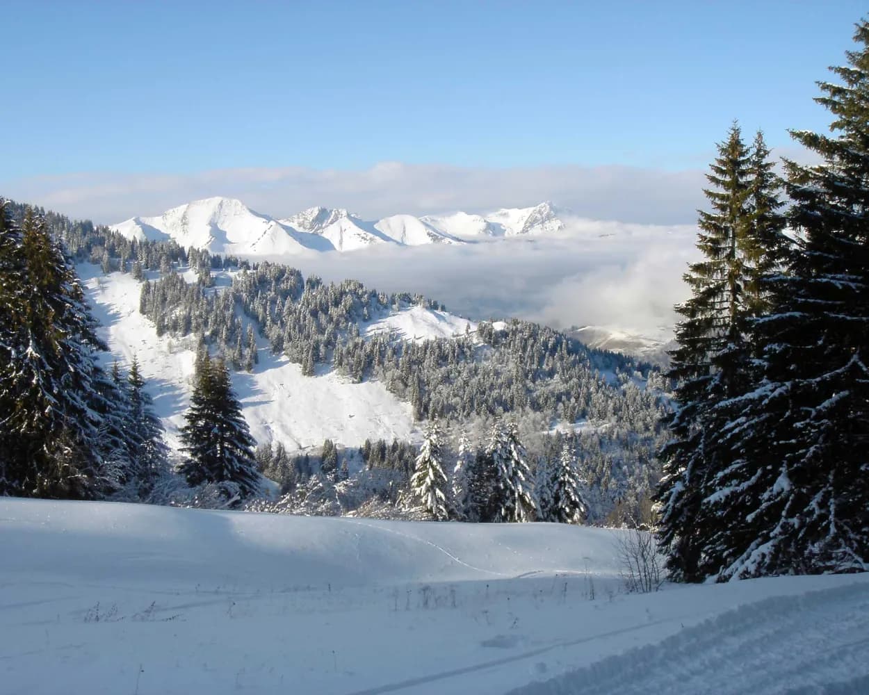
    An easy snowshoe hike through snowy mountain forests and across streams, away from any road or ski run. This trail with guaranteed snow leads from Bühlberg through pristine winter scenery with views of the Simmental's mighty peaks.

    dist2 km
    |
    asce140 m
    |
    desc140 m
    |
    dura1h 10m
    • land

      Landscape: Along the water,Onto a mountain peak,With panoramic views

    Tour published by:

    SwitzerlandMobility

    Learn more on
    schweizmobil.ch

    Bühlberg Trail

    How to get to Bühlberg Trail

    Fastest connection from Lenk im Simmental to Lenk, Bühlberg: 19m
    Walk from Lenk im Simmental to Lenk im Simmental, Bahnhof
    Lenk im Simmental, Bahnhof (09:30)
    281 (15m)
    Lenk, Bühlberg (09:45)
    Search Connections & Buy Tickets on SBB
    3/10

    Jaunpass Trail

    Minimum travel time: 1h 0m to Jaunpass, Restaurant
    Jaunpass Trail

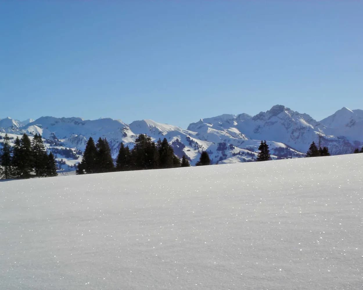
    A pass hike with panorama: Trudging through the versatile landscapes at the foot of Bäderhorn, you gaze into Niedersimmental and the Bernese Alps. Especially impressive: the rugged spikes of Gastlosen.

    dist8 km
    |
    asce260 m
    |
    desc260 m
    |
    dura3h 15m

      Tour published by:

      SwitzerlandMobility

      Learn more on
      schweizmobil.ch

      Jaunpass Trail

      How to get to Jaunpass Trail

      Fastest connection from Lenk im Simmental to Jaunpass, Restaurant: 1h 0m
      Lenk im Simmental (08:35)
      R31 (19m)
      Zweisimmen (08:54)
      Zweisimmen (09:02)
      R11 (8m)
      Boltigen (09:10)
      Walk from Boltigen to Boltigen, Bahnhof
      Boltigen, Bahnhof (09:13)
      259 (22m)
      Jaunpass, Restaurant (09:35)
      Search Connections & Buy Tickets on SBB
      4/10

      Parcours du Ramaclé

      Minimum travel time: 1h 17m to Les Granges-Gérignoz
      Parcours du Ramaclé

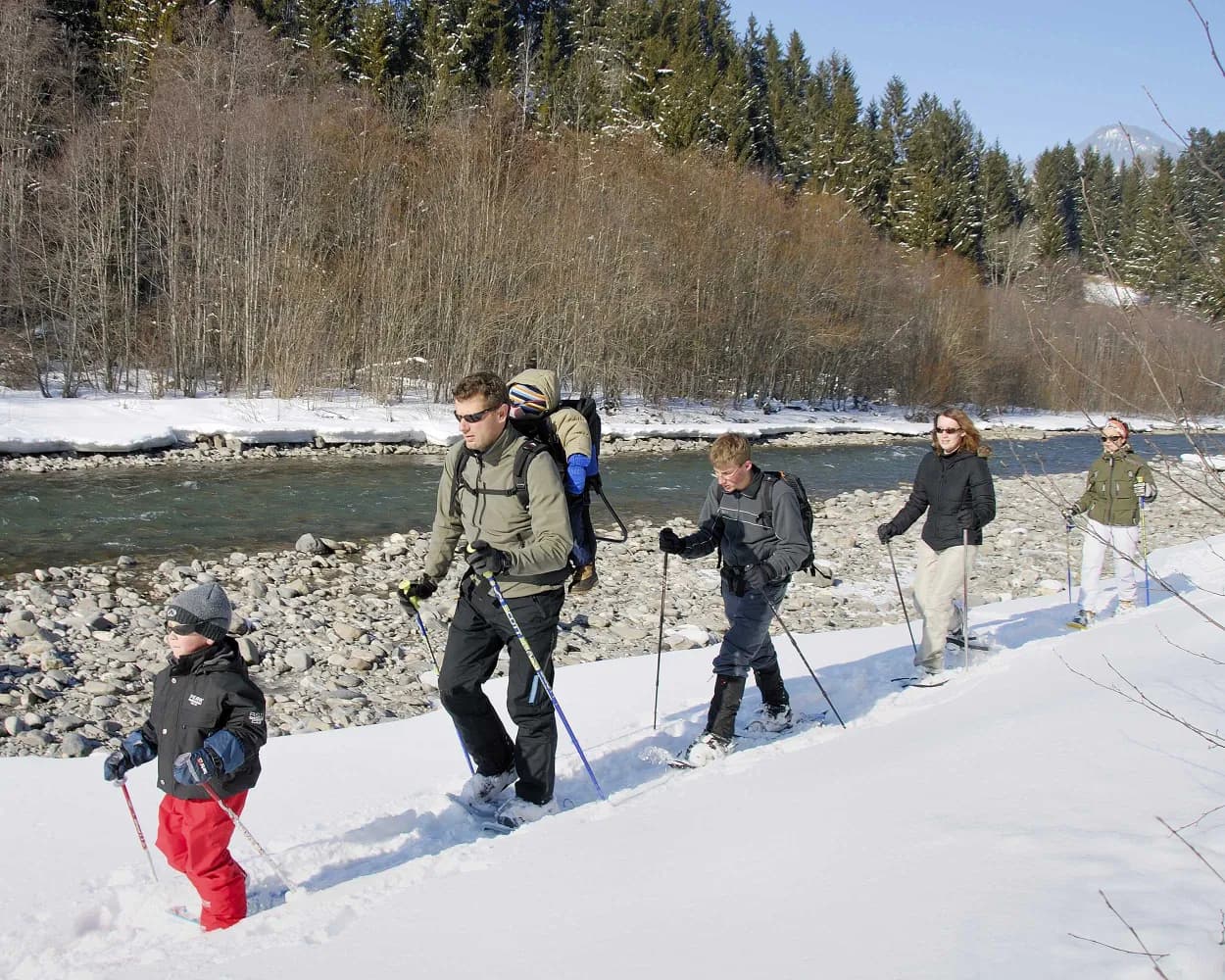
      Starting from Château-d’Oex, a family resort in the Vaud Alps, this all-ability trail runs along the Sarine across a suspension bridge and past an icefall, returning through spectacular snow-covered pastures to the site of the International Air Balloon Festival.

      dist6 km
      |
      asce160 m
      |
      desc160 m
      |
      dura2h 25m

        Tour published by:

        SwitzerlandMobility

        Learn more on
        schweizmobil.ch

        Parcours du Ramaclé

        How to get to Parcours du Ramaclé

        Fastest connection from Lenk im Simmental to Les Granges-Gérignoz: 1h 17m
        Lenk im Simmental (08:35)
        R31 (19m)
        Zweisimmen (08:54)
        Zweisimmen (09:04)
        30 (48m)
        Les Granges-Gérignoz (09:52)
        Search Connections & Buy Tickets on SBB
        5/10

        Cheibehorn-Rundtrail

        Minimum travel time: 1h 25m to Chrindi
        Cheibehorn-Rundtrail

        This circular tour with start and end point at Chrindli offers a varied hike through the Stockhorn region. Hike up instead of just around the Cheibenhorn peak and you will be rewarded with magnificent views of the Alpine summits.

        dist7 km
        |
        asce600 m
        |
        desc600 m
        |
        dura4h 30m
        • land

          Landscape: Onto a mountain peak,Along the water,With panoramic views

        Tour published by:

        SwitzerlandMobility

        Learn more on
        schweizmobil.ch

        Cheibehorn-Rundtrail

        How to get to Cheibehorn-Rundtrail

        Fastest connection from Lenk im Simmental to Chrindi: 1h 25m
        Lenk im Simmental (08:35)
        R31 (19m)
        Zweisimmen (08:54)
        Zweisimmen (09:02)
        R11 (28m)
        Erlenbach im Simmental (09:30)
        Walk from Erlenbach im Simmental to Erlenbach i.S. (Stockhornbahn)
        Erlenbach i.S. (Stockhornbahn) (09:50)
        2370 (10m)
        Chrindi (10:00)
        Search Connections & Buy Tickets on SBB
        6/10

        Parcours Les Moulins–Les Monts-Chevreuils

        Minimum travel time: 1h 37m to Les Moulins, village
        Parcours Les Moulins–Les Monts-Chevreuils

        When the Monts-Chevreuils ski area closed, the runs became fantastic winter trails. The Monts-Chevreuils hut at the top welcomes snowshoers for a well-deserved rest.

        dist6 km
        |
        asce760 m
        |
        desc760 m
        |
        dura5h 0m

          Tour published by:

          SwitzerlandMobility

          Learn more on
          schweizmobil.ch

          Parcours Les Moulins–Les Monts-Chevreuils

          How to get to Parcours Les Moulins–Les Monts-Chevreuils

          Fastest connection from Lenk im Simmental to Les Moulins, village: 1h 37m
          Lenk im Simmental (08:35)
          R31 (19m)
          Zweisimmen (08:54)
          Zweisimmen (09:04)
          30 (54m)
          Château-d'Oex (09:58)
          Walk from Château-d'Oex to Château-d'Oex, gare
          Château-d'Oex, gare (10:05)
          175 (7m)
          Les Moulins, village (10:12)
          Search Connections & Buy Tickets on SBB
          7/10

          Parcours du Rard

          Minimum travel time: 1h 41m to Col-du-Pillon (téléphérique)
          Parcours du Rard

          Between the Col du Pillon and the delightful little Lake Retaud, this snowshoe trail takes you to the Chalet du Rard and then to Lake Retaud, in a tranquil natural setting with impressive views of the legendary peaks of the Les Diablerets mountains.

          dist5 km
          |
          asce180 m
          |
          desc180 m
          |
          dura2h 5m

            Tour published by:

            SwitzerlandMobility

            Learn more on
            schweizmobil.ch

            Parcours du Rard

            How to get to Parcours du Rard

            Fastest connection from Lenk im Simmental to Col-du-Pillon (téléphérique): 1h 41m
            Lenk im Simmental (08:35)
            R31 (19m)
            Zweisimmen (08:54)
            Zweisimmen (09:04)
            30 (31m)
            Gstaad (09:35)
            Walk from Gstaad to Gstaad, Bahnhof
            Gstaad, Bahnhof (09:37)
            180 (29m)
            Col-du-Pillon, Glacier 3000 (10:06)
            Walk from Col-du-Pillon, Glacier 3000 to Col-du-Pillon (téléphérique)
            Search Connections & Buy Tickets on SBB
            8/10

            Parcours des Prés-d'Albeuve

            Minimum travel time: 1h 53m to Les Sciernes
            Parcours des Prés-d'Albeuve

            From the starting point at Les Sciernes d’Albeuve as far as the Prés d’Albeuve, enjoy the spectacular view of the circle of peaks from the Dent de Lys to the tops of the Vanil. Savour the charm and tranquillity of the region, where you might discover one of the bridges covered with timber shingles so typical of Intyamon or, if you are lucky, a wild animal in search of some dried grass.

            dist7 km
            |
            asce400 m
            |
            desc400 m
            |
            dura3h 25m

              Tour published by:

              SwitzerlandMobility

              Learn more on
              schweizmobil.ch

              Parcours des Prés-d'Albeuve

              How to get to Parcours des Prés-d'Albeuve

              Fastest connection from Lenk im Simmental to Les Sciernes: 1h 53m
              Lenk im Simmental (08:35)
              R31 (19m)
              Zweisimmen (08:54)
              Zweisimmen (09:04)
              30 (1h 24m)
              Les Sciernes (10:28)
              Search Connections & Buy Tickets on SBB
              9/10

              Parcours La Lécherette–Les Monts-Chevreuils

              Minimum travel time: 1h 56m to La Lécherette, village
              Parcours La Lécherette–Les Monts-Chevreuils

              This trail links the village of La Lécherette to the Monts-Chevreuils hut, a spectacular route with stunning views of Lake Hongrin and the Pays-d’Enhaut valley.

              dist9 km
              |
              asce480 m
              |
              desc480 m
              |
              dura4h 25m
              • land

                Landscape: Onto a mountain peak,With panoramic views

              Tour published by:

              SwitzerlandMobility

              Learn more on
              schweizmobil.ch

              Parcours La Lécherette–Les Monts-Chevreuils

              How to get to Parcours La Lécherette–Les Monts-Chevreuils

              Fastest connection from Lenk im Simmental to La Lécherette, village: 1h 56m
              Lenk im Simmental (08:35)
              R31 (19m)
              Zweisimmen (08:54)
              Zweisimmen (09:04)
              30 (54m)
              Château-d'Oex (09:58)
              Walk from Château-d'Oex to Château-d'Oex, gare
              Château-d'Oex, gare (10:05)
              175 (26m)
              La Lécherette, village (10:31)
              Search Connections & Buy Tickets on SBB
              10/10

              Parcours du Revers

              Minimum travel time: 1h 59m to Allières
              Parcours du Revers

              Winding through the upper reaches and along the right and left bank of the Hongrin as well as a protected natural area, the path offers a breathtaking view of the Cases valley and the jagged summits of the Cape aux Moines and the Vanil des Artses.

              dist7 km
              |
              asce280 m
              |
              desc280 m
              |
              dura3h 0m
              • land

                Landscape: With panoramic views,Along the water,Onto a mountain peak

              Tour published by:

              SwitzerlandMobility

              Learn more on
              schweizmobil.ch

              Parcours du Revers

              How to get to Parcours du Revers

              Fastest connection from Lenk im Simmental to Allières: 1h 59m
              Lenk im Simmental (08:35)
              R31 (19m)
              Zweisimmen (08:54)
              Zweisimmen (09:04)
              30 (1h 30m)
              Allières (10:34)
              Search Connections & Buy Tickets on SBB