Discover a variety of stunning hikes accessible by public transport from Glarus. From Roman paths along the Kerenzerberg to the UNESCO World Heritage Sardona, these routes offer diverse landscapes and rich cultural experiences. Enjoy panoramic views of the Churfirsten range, the deep blue Walensee, and the impressive Glarner Alps as you explore ancient trails and alpine meadows.
The hikes listed below are sorted by travel time from Glarus, making it easy to plan your next adventure. Check out the map to explore thousands of destinations and activities, reachable from any starting point in Switzerland.
Much more on ovunta.com/en/map
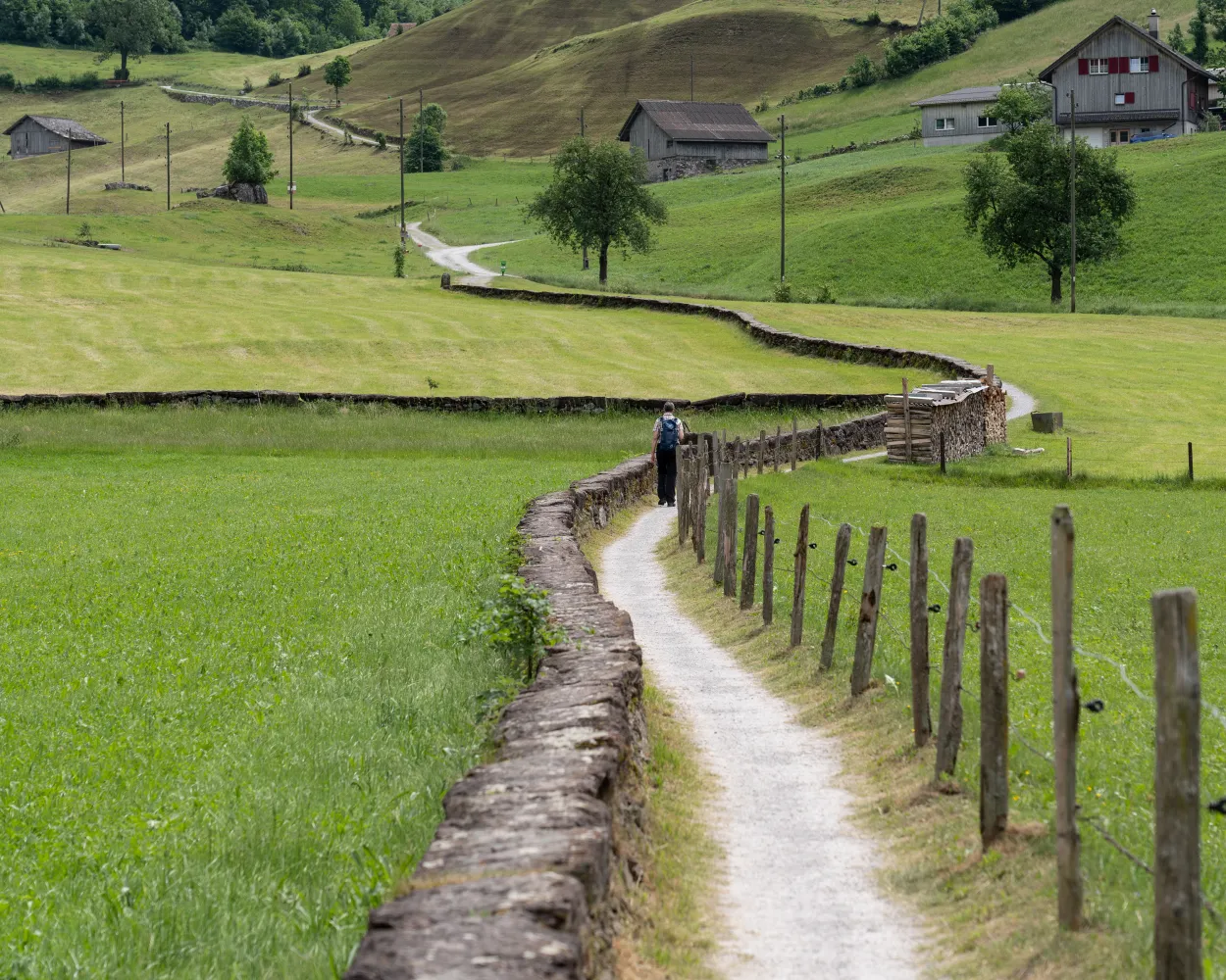
The route in Canton Glarus takes you from Schwanden to Netstal, through a broad and open valley surrounded by lush greenery and rugged mountain scenery. A route offering pure tranquillity and relaxation.
 9 km
9 km 40 m
40 m 110 m
110 m 2h 15m
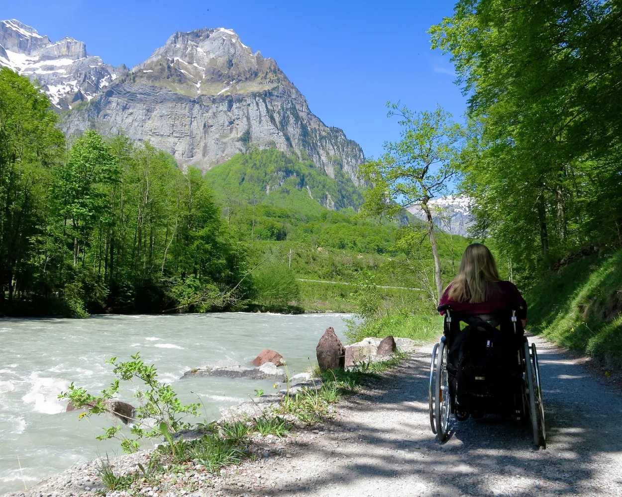
Barrier free: Yes

Landscape: Along the water
Tour published by:
SwitzerlandMobility
Learn more on
schweizmobil.ch
| Glarus (08:46) | |
| S25 (1m) | |
| Ennenda (08:47) |
This tour leads through the smallest capital town, Glarus. The hike is shaped by nature, culture, history and new discoveries. Along the paths of ancient streams, it provides delightful views of the entire Linthe valley from the Tödi to the Linthebene.
10 km400 m400 m2h 55mLandscape: With panoramic views
Tour published by:
SwitzerlandMobility
Learn more on
schweizmobil.ch
In autumn 1799, Russian General Suvorov and his army crossed through the Swiss Alps in order to oust the French from the country. The ViaSuworow follows the route of this campaign through breathtaking mountain landscape.
170 km7600 m8100 mLandscape: Over a pass
Tour published by:
SwitzerlandMobility
Learn more on
schweizmobil.ch
With the French in pursuit, Suvorov's troops marched southwards in snowfall towards Elm. The easy hike leads to Schwanden alongside the river Linth and then partly above, partly along, the river Sernf via Engi and Matt to Elm.
21 km660 m170 m5h 40mLandscape: Along the water
Tour published by:
SwitzerlandMobility
Learn more on
schweizmobil.ch
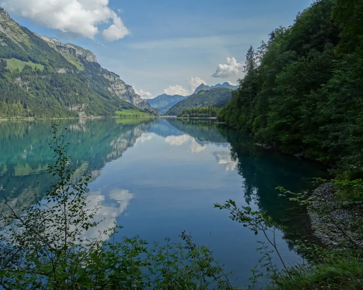
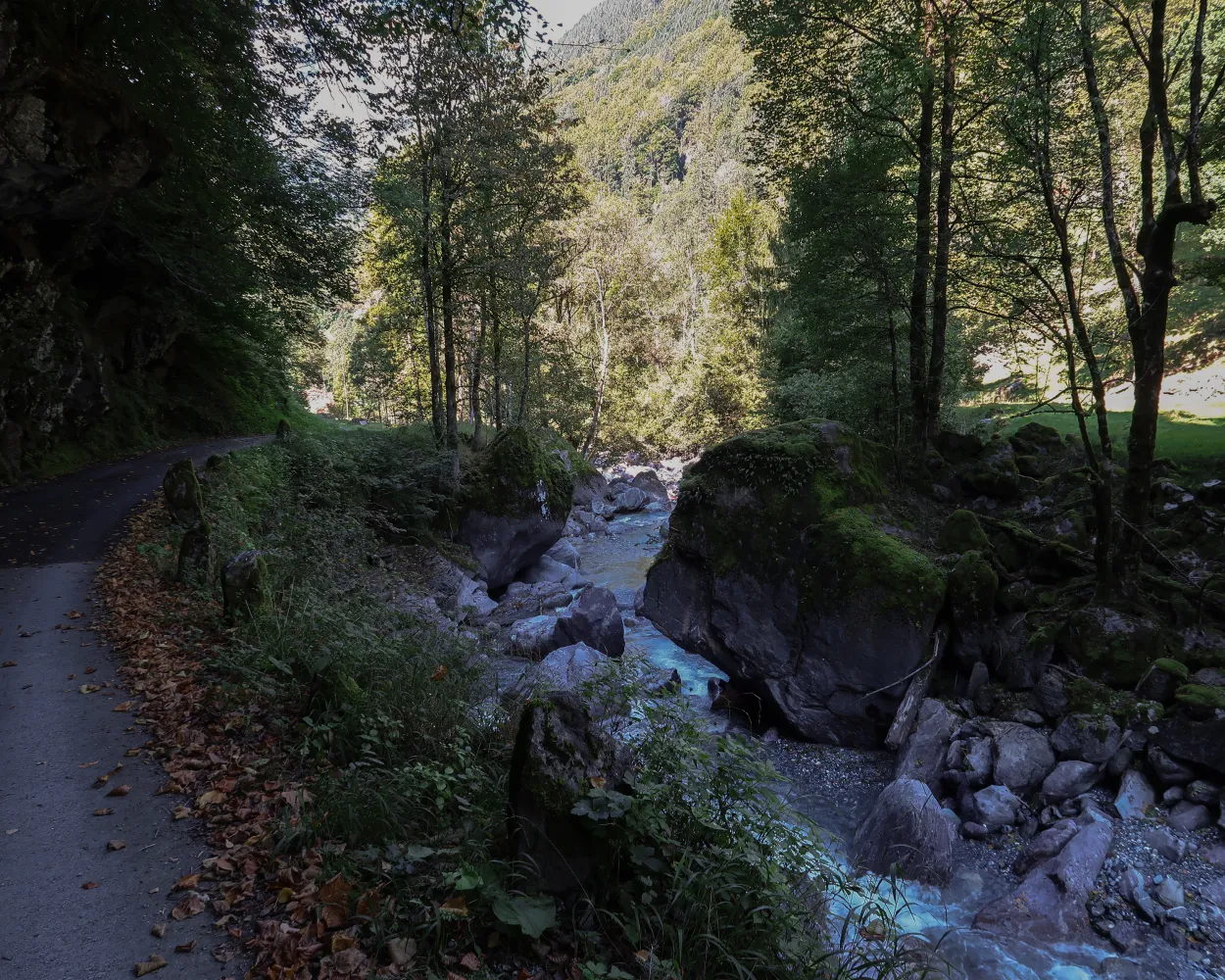
Firstly, along the Klöntalersee reservoir surrounded by steep rock faces. A decent to Glarus then follows - From the dam of the artificial lake through a narrow valley with steep rock faces and imposing boulders lapped by the bubbling Löntsch waters.
14 km180 m560 m3h 35mLandscape: Along the water
Tour published by:
SwitzerlandMobility
Learn more on
schweizmobil.ch
| Glarus, Bahnhof (09:18) | |
| 503 (2m) | |
| Glarus, Friedhof (09:20) |
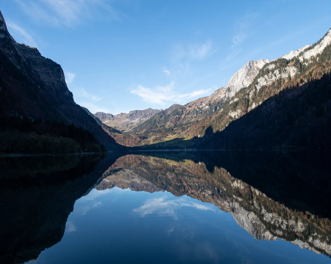
The trail leads alongside the Klöntalersee (lake) between mighty cliff faces down to Glarus. Anyone chancing a dip in the Klöntalsee may find the Russian war chest. It's reputed to have been sunk in the lake as the French attacked.
14 km180 m560 m3h 35mLandscape: With panoramic views,Along the water
Tour published by:
SwitzerlandMobility
Learn more on
schweizmobil.ch
The Pragelpass lives from its eventful history, but also from its beauty between the two different worlds of the cantons Schwyz and Glarus. A tranquil hike with the Schwammhöchi as an atmospheric finale.
48 km1600 m1650 mLandscape: Over a pass
Tour published by:
SwitzerlandMobility
Learn more on
schweizmobil.ch

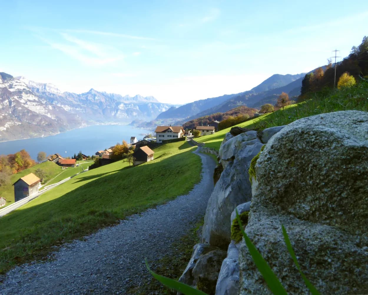
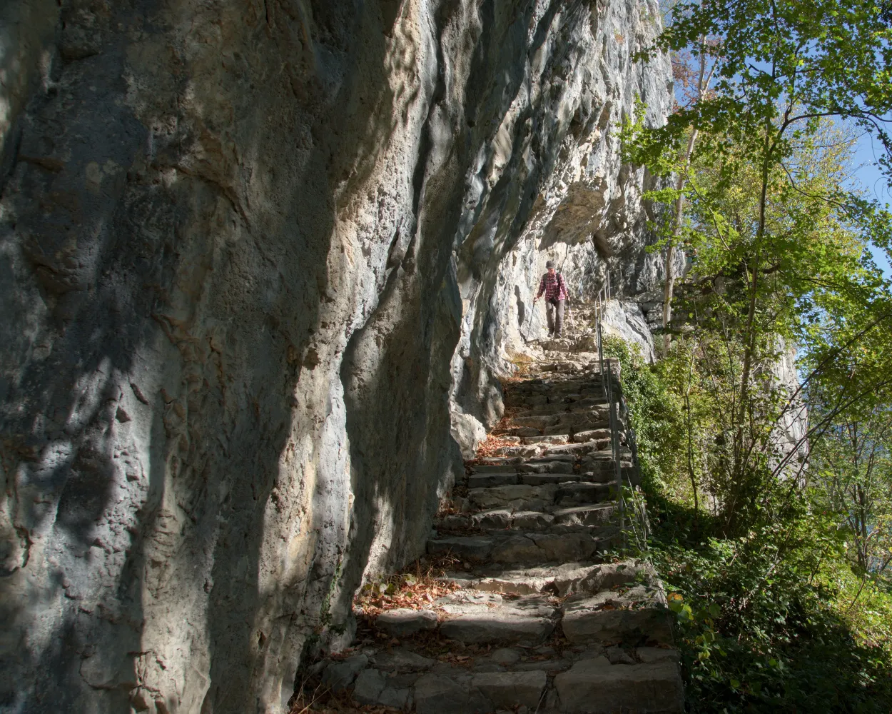
In the footsteps of the Romans, the tour leads from Näfels over Kerenzerberg to Mühlehorn. Testimony of the times let hikers' thoughts stray to worlds of a bygone age while at the same time, the Churfirsten mountain range and the deep-blue Lake Walensee are within sight.
13 km620 m640 m4h 0mLandscape: With panoramic views
Tour published by:
SwitzerlandMobility
Learn more on
schweizmobil.ch
| Glarus (08:44) | |
| S6 (7m) | |
| Näfels-Mollis (08:51) |
Three cantons, two lakes and a large valley - the Lindth plain - determine the characteristics of this crossover stage from Eastern to Central Switzerland. In addition it offers a historic stairway, a lakeside promenade and lots of level countryside.
26 km240 m700 m6h 30mLandscape: With panoramic views
Tour published by:
SwitzerlandMobility
Learn more on
schweizmobil.ch
This unobstructed hiking trail runs from Ziegelbrücke to Weesen along the Linth River. Besides the stunning view of the Glarus Alps, it offers a fantastic vista of deep blue Lake Walen in Weesen.
4 km20 m20 m50mBarrier free: Yes
Tour published by:
SwitzerlandMobility
Learn more on
schweizmobil.ch
| Glarus (08:44) | |
| S6 (13m) | |
| Ziegelbrücke (08:57) |


