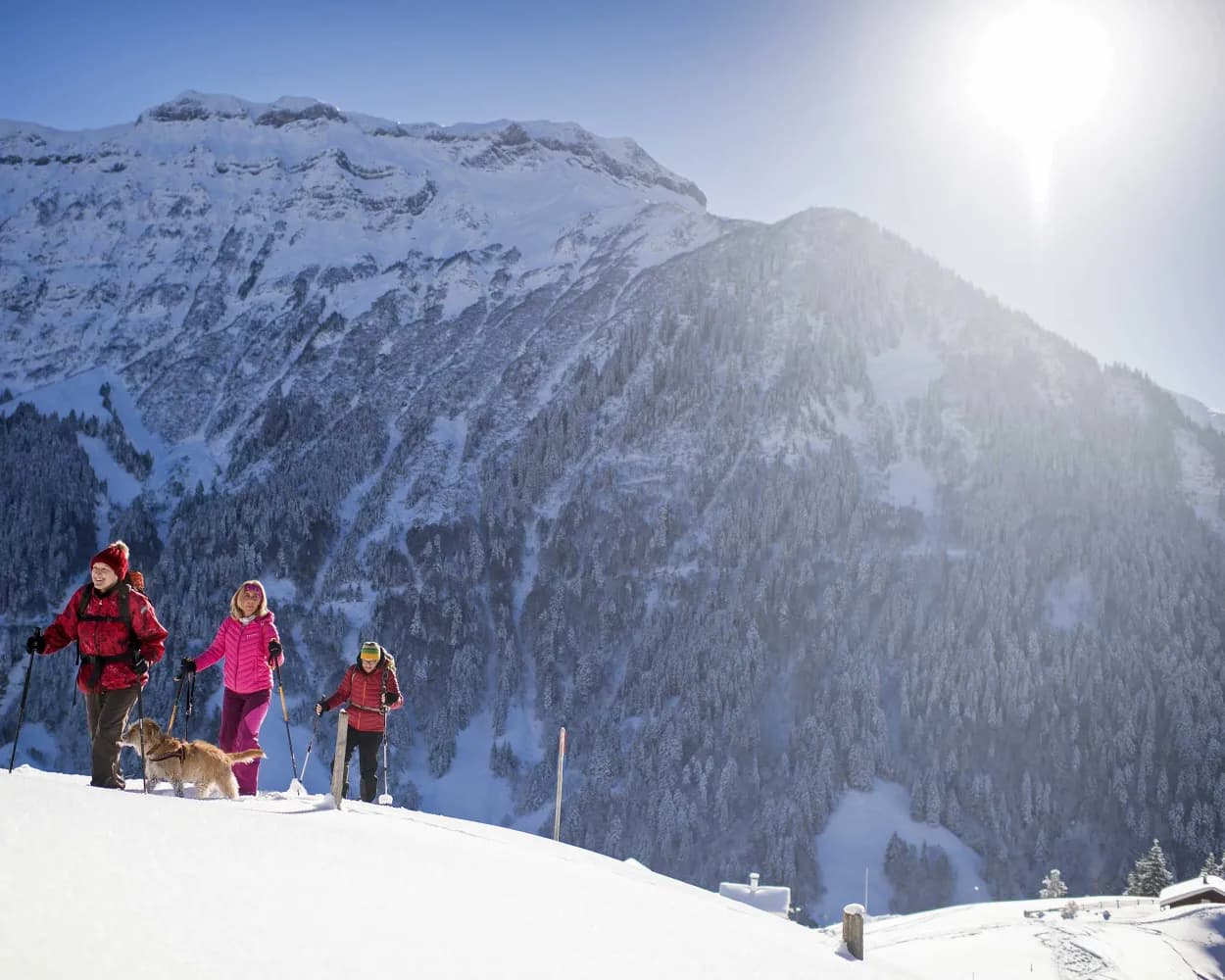
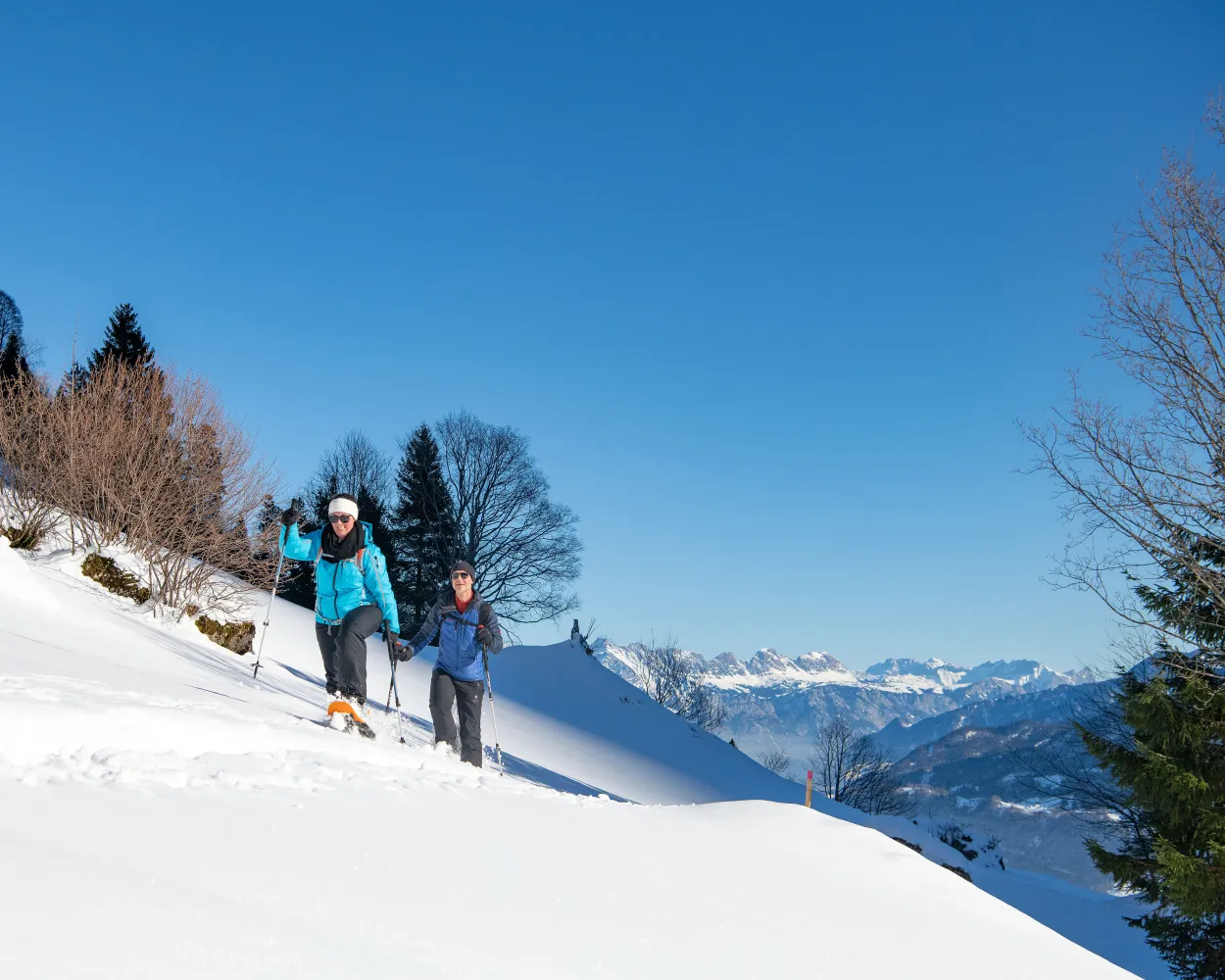
Discover a winter wonderland on these snowshoe hikes, all easily reachable from Glarus by public transport. Snow-covered forests, wide alpine plateaus, and scenic routes offer memorable experiences in the heart of the Alps.
To make planning easier, the hikes below are sorted by travel time from Glarus. Explore the map to find all snowshoe hikes and thousands of other outdoor activities accessible from anywhere in Switzerland.
Much more on ovunta.com/en/map
Plenty of sunshine, magnificent countryside, and panoramic views of the Leistchamm, the jagged Churfirsten, and the Toggenburg are among the highlights the trail from Arvenbüel to Vorder Höhi has to offer. After snowshoeing through sparse forest and over snowy Alpine meadows, the cosy, little mountain inn invites you to relax and refuel.
 9 km
9 km 520 m
520 m 520 m
520 m 4h 25m
Landscape: With panoramic views,Onto an alp
Tour published by:
SwitzerlandMobility
Learn more on
schweizmobil.ch
The Egg-Rör Trail leads through snowy forests, wintery Beerenbach, and through a natural landscape that is home to a variety of wild animals. The Glarner Alps provide the imposing backdrop.
5 km280 m280 m2h 20mTour published by:
SwitzerlandMobility
Learn more on
schweizmobil.ch
| Glarus (08:44) | |
| S6 (13m) | |
| Ziegelbrücke (08:57) |
| Ziegelbrücke, Bahnhof Süd (09:04) | |
| 650 (33m) | |
| Arvenbüel, Arven (09:37) |
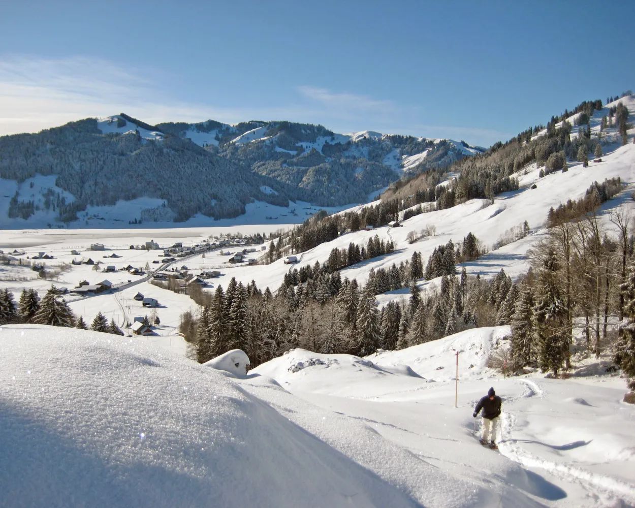
This snowshoe tour is made to enjoy the peace and quiet of the Niederurnertäli valley in winter. The snow-covered Alpine meadows, gnarled maple trees and stunning views of the Glarus region in this glacier valley are very appealing.
6 km380 m380 m3h 15mTour published by:
SwitzerlandMobility
Learn more on
schweizmobil.ch
| Glarus (08:44) | |
| S6 (13m) | |
| Ziegelbrücke (08:57) |
| Ziegelbrücke, Bahnhof Süd (09:04) | |
| 512 (4m) | |
| Niederurnen, Ochsenplatz (09:08) |
| Niederurnen (09:30) | |
| PB (10m) | |
| Morgenholz (09:40) |
Experience winter on snowshoes in Europe's oldest wildlife conservation area: the Freiberg Kärpf. This easy tour across meadows and through forests takes you to the Mettmenalp pasture area (1,600 m.a.s.l.) with Lake Garichti.
2 km80 m80 m55mTour published by:
SwitzerlandMobility
Learn more on
schweizmobil.ch
| Glarus (08:46) | |
| S25 (8m) | |
| Schwanden GL (08:54) |
| Schwanden GL, Bahnhof (08:58) | |
| 544 (40m) | |
| Kies (Niederental) (09:38) |
| Kies (Talstation) (09:45) | |
| LKM (4m) | |
| Mettmen (09:49) |

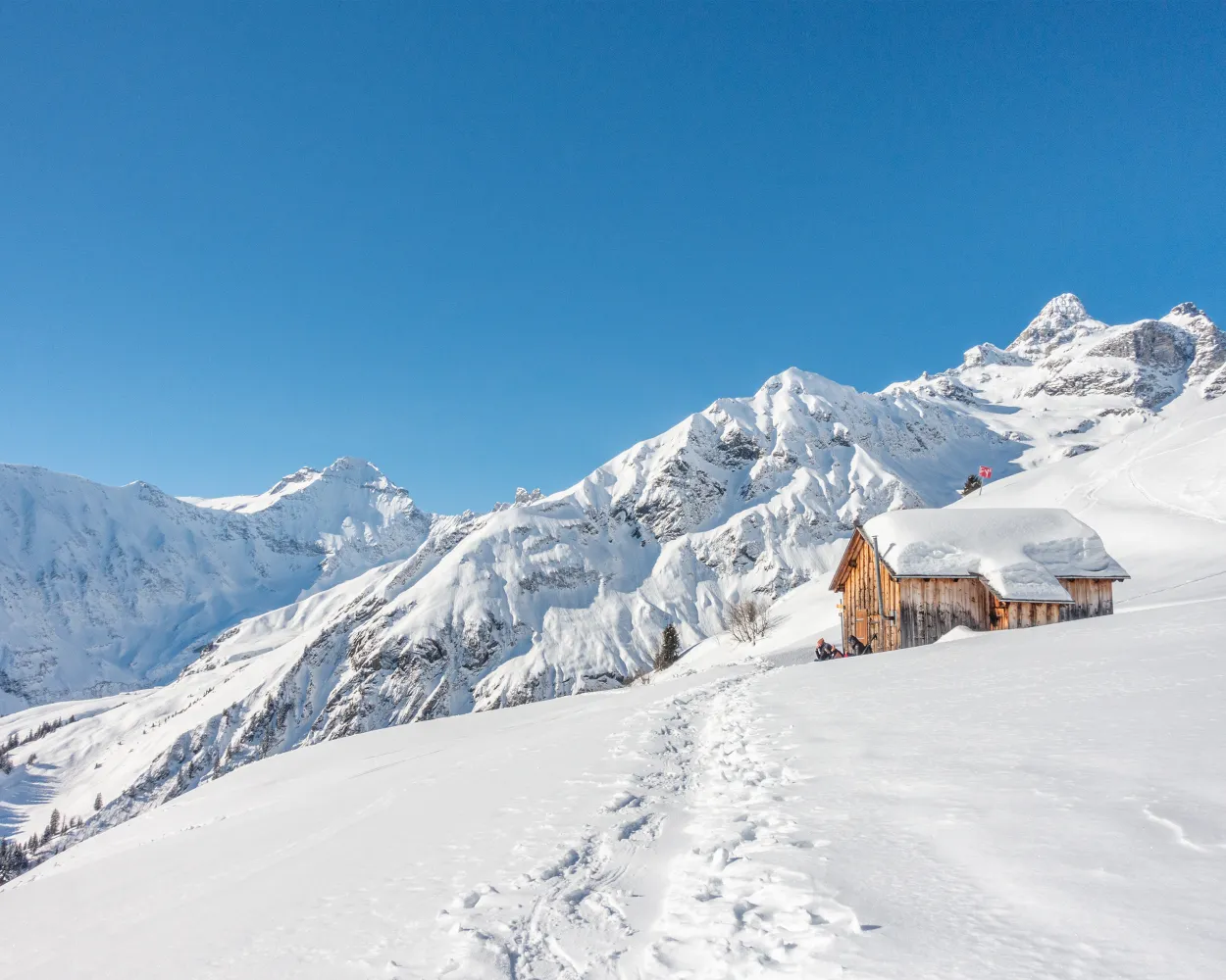
Get away from it all: this trail runs from the well-preserved Walser settlement of Weissenberge to the idyllic Stäfeli ski hut, where a spectacular panoramic view over the Sernf Valley awaits.
6 km520 m520 m3h 40mLandscape: With panoramic views,Onto an alp
Tour published by:
SwitzerlandMobility
Learn more on
schweizmobil.ch
| Glarus (08:46) | |
| S25 (8m) | |
| Schwanden GL (08:54) |
| Schwanden GL, Bahnhof (09:28) | |
| 541 (15m) | |
| Matt, Dorf (09:43) |
| Matt (Seilbahn) (09:55) | |
| LMW (4m) | |
| Weissenberge (09:59) |
A solitary trek through the winter paradise of Elm, even with winter sports facilities so close at hand? Yes – if you follow the Bischofalp snowshoe trail! Just above the tree line, this easily navigable trail gives you direct views of the circle of 3,000-meter peaks around Elm and the famous Martinsloch rock window.
5 km320 m320 m2h 40mTour published by:
SwitzerlandMobility
Learn more on
schweizmobil.ch
| Glarus (08:46) | |
| S25 (8m) | |
| Schwanden GL (08:54) |
| Schwanden GL, Bahnhof (09:28) | |
| 541 (25m) | |
| Elm, Sportbahnen (09:53) |
| Elm (Talstation) (09:54) | |
| GB (7m) | |
| Empächli (10:01) |
The snowshoe trail on Pizol leads above the timber line and offers spectacular views to the Alpine panorama and into the Tectonic Arena Sardona. Thanks to the altitude there is most likely a lot of snow.
4 km620 m10 m2h 45mTour published by:
SwitzerlandMobility
Learn more on
schweizmobil.ch
| Glarus (08:44) | |
| S6 (13m) | |
| Ziegelbrücke (08:57) |
| Ziegelbrücke (09:00) | |
| IR35 (30m) | |
| Bad Ragaz (09:30) |
| Bad Ragaz, Bahnhof (09:34) | |
| 456 (22m) | |
| Bad Ragaz, Pizolbahn (09:56) |
| Bad Ragaz Matells (Talst.) (09:58) | |
| GB (15m) | |
| Pardiel (10:13) |
The snowshoe hike to Obererbs is a perfect way to get back to nature, far from the bustle of everyday life. Pass through woodlands and meadows, always surrounded by mighty Glarus peaks like the Hausstock, Vorab and Tschingelhörner.
5 km440 m440 m3h 10mTour published by:
SwitzerlandMobility
Learn more on
schweizmobil.ch
| Glarus (08:46) | |
| S25 (8m) | |
| Schwanden GL (08:54) |
| Schwanden GL, Bahnhof (09:28) | |
| 541 (25m) | |
| Elm, Sportbahnen (09:53) |
| Elm, Sportbahnen (10:00) | |
| 545 (19m) | |
| Elm, Obererbs Skihütte (10:19) |
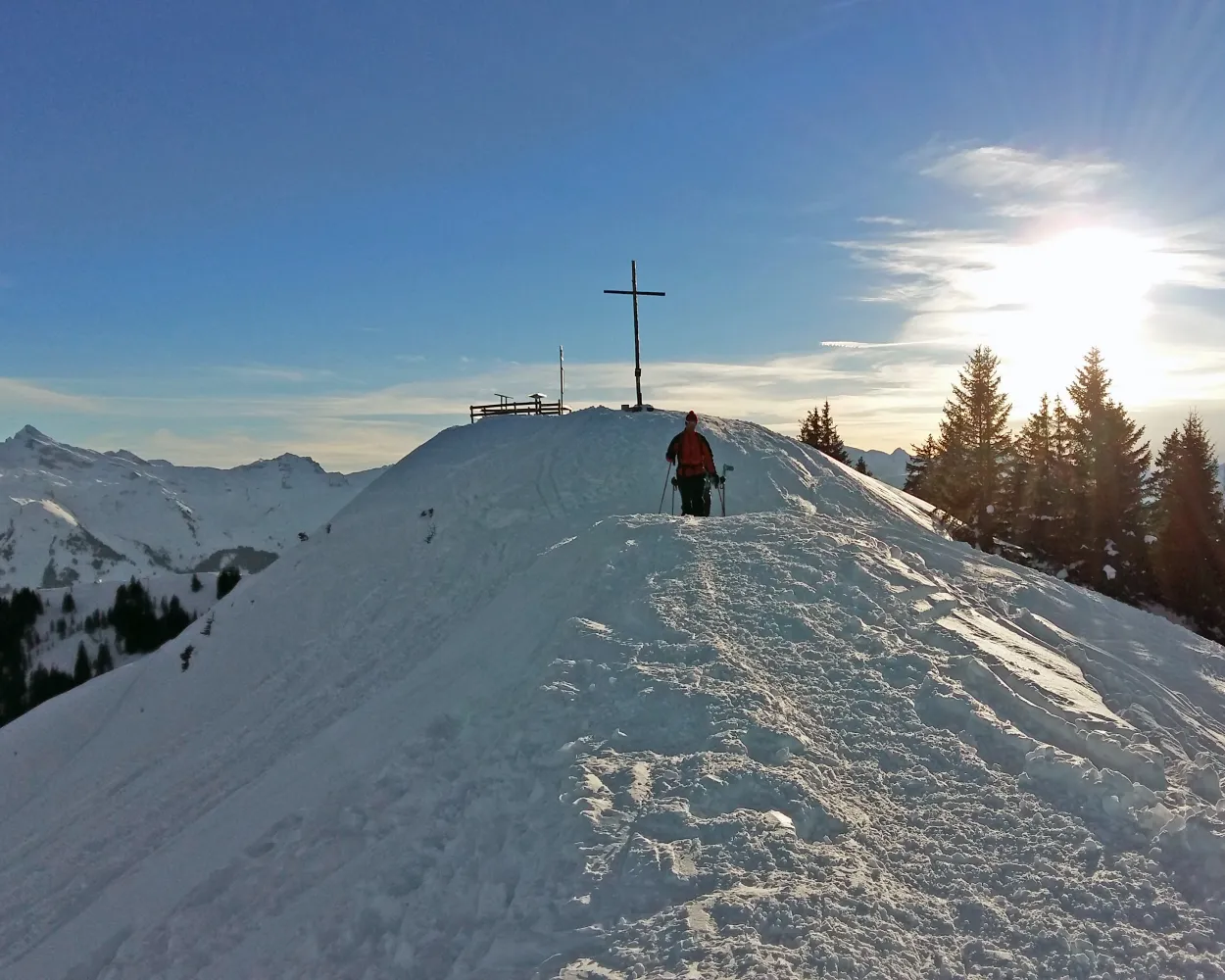
This snowshoe hike crosses remote yet busy areas, overseen in silence by the two Mythen peaks. It's well worth stopping along the way to admire the magnificent views of the Schwyz mountains and landscape.
7 km700 m400 m4h 25mLandscape: Onto a mountain peak,Onto an alp,With panoramic views
Tour published by:
SwitzerlandMobility
Learn more on
schweizmobil.ch
| Glarus (08:44) | |
| S6 (13m) | |
| Ziegelbrücke (08:57) |
| Ziegelbrücke (09:00) | |
| IR35 (27m) | |
| Wädenswil (09:27) |
| Wädenswil (09:34) | |
| S13 (24m) | |
| Einsiedeln (09:58) |
| Einsiedeln, Bahnhof (10:03) | |
| 554 (14m) | |
| Brunni SZ, Rest. Brunni (10:17) |
You don't need to be in peak condition to enjoy this snowshoe hike through remote areas, but watch out: the view of the Chli Aubrig could whet your appetite for more challenging tours.
6 km220 m220 m2h 35mTour published by:
SwitzerlandMobility
Learn more on
schweizmobil.ch
| Glarus (08:44) | |
| S6 (13m) | |
| Ziegelbrücke (08:57) |
| Ziegelbrücke (09:00) | |
| IR35 (27m) | |
| Wädenswil (09:27) |
| Wädenswil (09:34) | |
| S13 (24m) | |
| Einsiedeln (09:58) |
| Einsiedeln, Bahnhof (10:03) | |
| 555 (17m) | |
| Euthal, Schulhaus (10:20) |


