Logo
Blog
To the map
Blog header image

Winter Hikes from Glarus by public transport

Relaxed or more challenging: these winter hikes are all reachable from Glarus by public transport. From easy panoramic walks to longer alpine routes, there’s something for every level of winter hiker.

The destinations below are sorted by travel time from Glarus to make planning easier. Be sure to check the map to explore all winter hikes and thousands of other outdoor activities reachable from any starting point in Switzerland.

Much more on ovunta.com/en/map

Discover other activities close to Glarus

  • Snowshoeing from Glarus by public transport
  • Cross-country skiing resorts from Glarus by public transport
  • Plan Your Ski Day from Glarus: Resorts Sorted by Travel Time on Public Transport
  • Scenic Trails Around Glarus
  • Sledging runs from Glarus by public transport

Start from elsewhere?

  • Winter Hikes from Appenzell by public transport
  • Winter Hikes from Weggis by public transport
  • Winter Hikes from Zug by public transport
1/10

Nussbüel-Wanderung

Minimum travel time: 46m to Braunwald

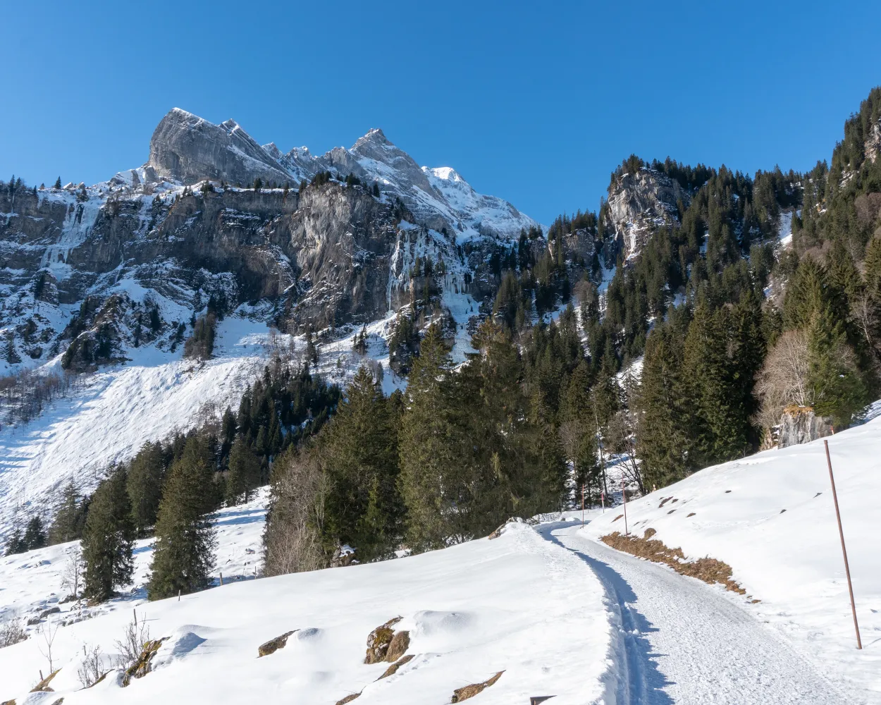
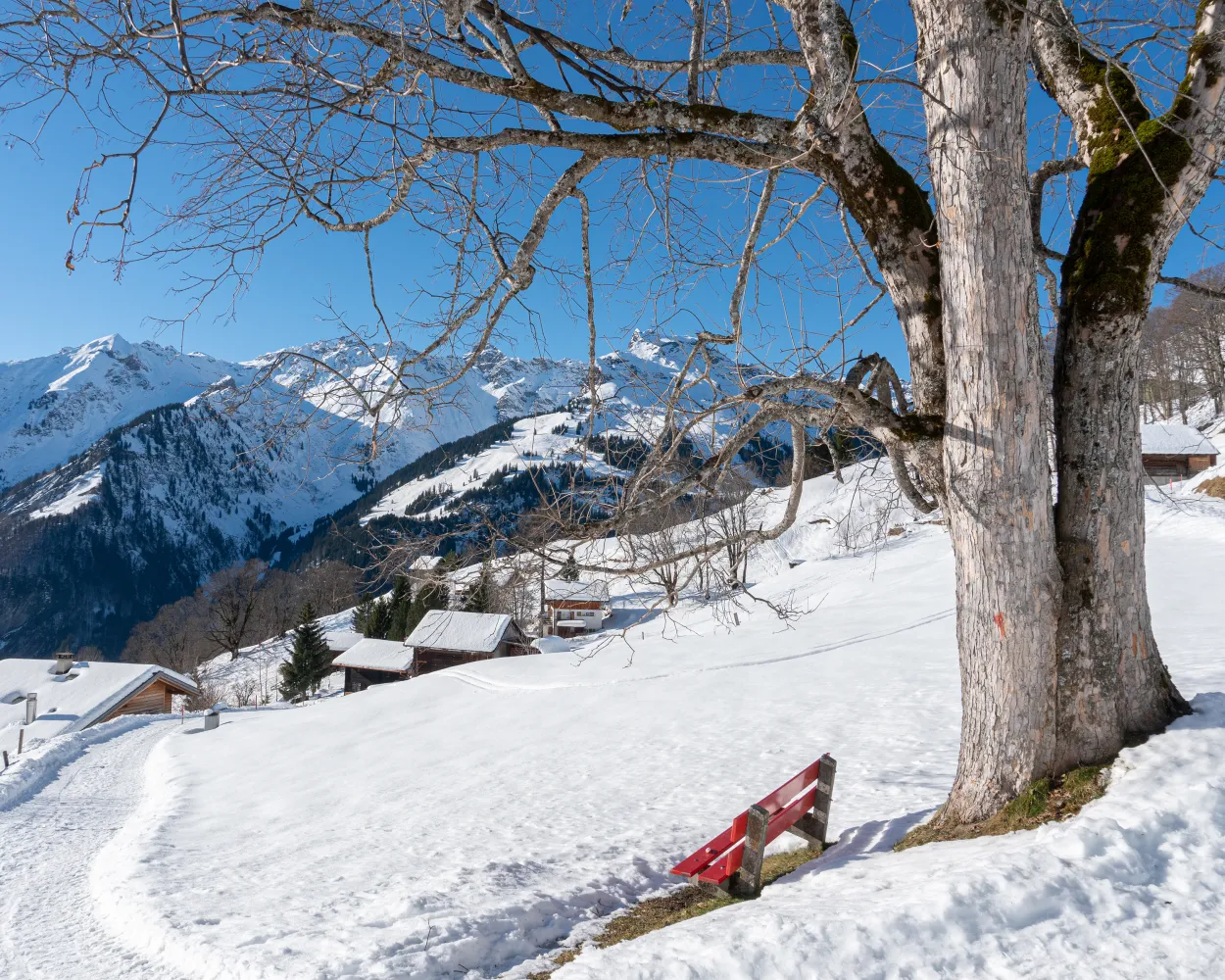
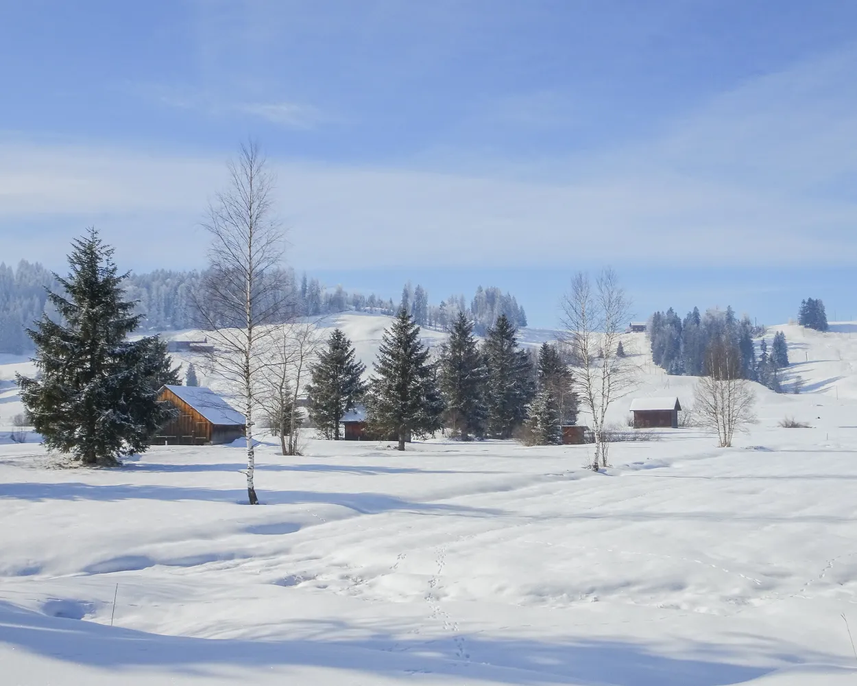
A family favourite in Braunwald: this easy and enjoyable hike runs through the enchanted forests of the Glarus mountain village with no challenging inclines.

dist7 km
|
asce220 m
|
desc220 m
|
dura2h 25m

    Tour published by:

    SwitzerlandMobility

    Learn more on
    schweizmobil.ch


    How to get to Nussbüel-Wanderung

    Fastest connection from Glarus to Braunwald: 46m
    Glarus (08:46)
    S25 (27m)
    Linthal Braunwaldbahn (09:13)
    Walk from Linthal Braunwaldbahn to Linthal Braunwaldbahn (Talst.)
    Linthal Braunwaldbahn (Talst.) (09:25)
    2840 (7m)
    Braunwald (09:32)
    Search Connections & Buy Tickets on SBB
    2/10

    Vorder-Höhi-Weg

    Minimum travel time: 53m to Arvenbüel, Arven

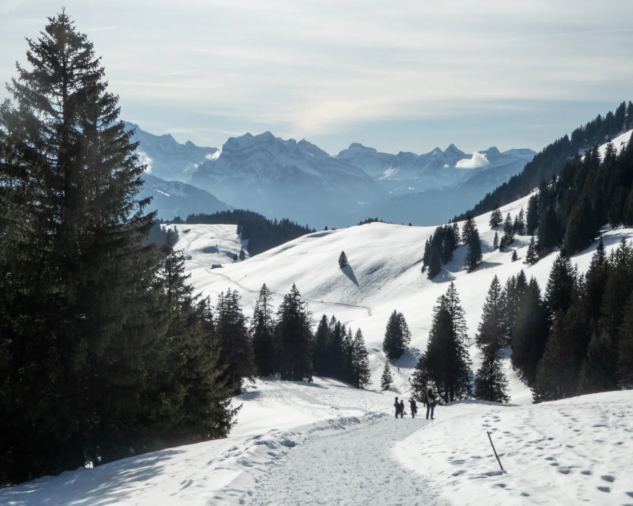
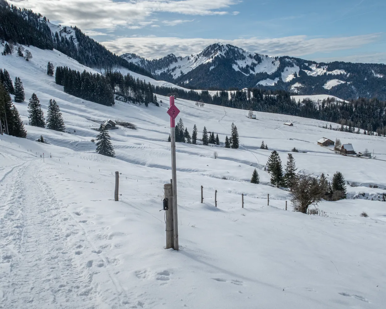
    This winter hike leads from the Arvenbüel through magical winter landscapes to the Vorder Höhi. It always offers impressive panoramic views: over the Toggenburg, the Alpstein, the Churfirsten and the Leistkamm.

    dist8 km
    |
    asce360 m
    |
    desc360 m
    |
    dura2h 55m
    • land

      Landscape: With panoramic views,Through a Swiss Park,Onto a mountain peak

    Tour published by:

    SwitzerlandMobility

    Learn more on
    schweizmobil.ch


    How to get to Vorder-Höhi-Weg

    Fastest connection from Glarus to Arvenbüel, Arven: 53m
    Glarus (08:44)
    S6 (13m)
    Ziegelbrücke (08:57)
    Walk from Ziegelbrücke to Ziegelbrücke, Bahnhof Süd
    Ziegelbrücke, Bahnhof Süd (09:04)
    650 (33m)
    Arvenbüel, Arven (09:37)
    Search Connections & Buy Tickets on SBB
    3/10

    Hinter-Höhi-Weg

    Minimum travel time: 59m to Niederschlag

    In summer and autumn, a popular nature paradise, in winter by far the sunniest winter hiking trail – a hike to the Hinter Höhi is well worth it at any time of the year.

    dist4 km
    |
    asce160 m
    |
    desc160 m
    |
    dura1h 25m

      Tour published by:

      SwitzerlandMobility

      Learn more on
      schweizmobil.ch


      How to get to Hinter-Höhi-Weg

      Fastest connection from Glarus to Niederschlag: 59m
      Glarus (08:44)
      S6 (13m)
      Ziegelbrücke (08:57)
      Walk from Ziegelbrücke to Ziegelbrücke, Bahnhof Süd
      Ziegelbrücke, Bahnhof Süd (09:04)
      650 (21m)
      Amden, Dorf (09:25)
      Walk from Amden, Dorf to Amden (Talstat. Niederschlag)
      Amden (Talstat. Niederschlag) (09:28)
      SL (15m)
      Niederschlag (09:43)
      Search Connections & Buy Tickets on SBB
      4/10

      Tannenboden-Seebenalp-Weg

      Minimum travel time: 1h 5m to Tannenboden (Maschgenkammbahn)

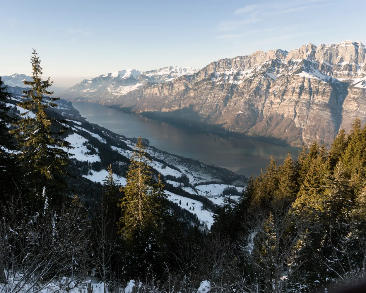
      The winter hiking path to Seebenalp offers a fantastic view to Churfirsten and Walensee. At the destination three mountain lakes lined by fir trees form a mystical scenery.

      dist8 km
      |
      asce320 m
      |
      desc320 m
      |
      dura2h 45m

        Tour published by:

        SwitzerlandMobility

        Learn more on
        schweizmobil.ch


        How to get to Tannenboden-Seebenalp-Weg

        Fastest connection from Glarus to Tannenboden (Maschgenkammbahn): 1h 5m
        Glarus (08:44)
        S6 (13m)
        Ziegelbrücke (08:57)
        Ziegelbrücke (09:00)
        IR35 (10m)
        Unterterzen (09:10)
        Walk from Unterterzen to Unterterzen (Talstation)
        Unterterzen (Talstation) (09:13)
        2790 (20m)
        Flumserberg Tannenboden (09:33)
        Walk from Flumserberg Tannenboden to Tannenboden (Maschgenkammbahn)
        Search Connections & Buy Tickets on SBB
        5/10

        Rundwanderung Schiben

        Minimum travel time: 1h 13m to Weissenberge

        Take it easy on the Weissenberge, the sun terrace of the Sernf Valley. This leisurely winter hike to Schiben is a perfect way to enjoy the tranquillity of nature and the views of the Elm mountains and the upper valley.

        dist4 km
        |
        asce180 m
        |
        desc180 m
        |
        dura1h 25m

          Tour published by:

          SwitzerlandMobility

          Learn more on
          schweizmobil.ch


          How to get to Rundwanderung Schiben

          Fastest connection from Glarus to Weissenberge: 1h 13m
          Glarus (08:46)
          S25 (8m)
          Schwanden GL (08:54)
          Walk from Schwanden GL to Schwanden GL, Bahnhof
          Schwanden GL, Bahnhof (09:28)
          541 (15m)
          Matt, Dorf (09:43)
          Walk from Matt, Dorf to Matt (Seilbahn)
          Matt (Seilbahn) (09:55)
          LMW (4m)
          Weissenberge (09:59)
          Search Connections & Buy Tickets on SBB
          6/10

          Hengstboden-Weg

          Minimum travel time: 1h 15m to Empächli

          The Tschingelhörner, the famous “Martin’s Hole” and the Tectonic Arena Sardona UNESCO World Heritage Site at a glance – experience all this on the Hengstboden-Weg winter hike.

          dist4 km
          |
          asce200 m
          |
          desc200 m
          |
          dura1h 25m

            Tour published by:

            SwitzerlandMobility

            Learn more on
            schweizmobil.ch


            How to get to Hengstboden-Weg

            Fastest connection from Glarus to Empächli: 1h 15m
            Glarus (08:46)
            S25 (8m)
            Schwanden GL (08:54)
            Walk from Schwanden GL to Schwanden GL, Bahnhof
            Schwanden GL, Bahnhof (09:28)
            541 (25m)
            Elm, Sportbahnen (09:53)
            Walk from Elm, Sportbahnen to Elm (Talstation)
            Elm (Talstation) (09:54)
            GB (7m)
            Empächli (10:01)
            Search Connections & Buy Tickets on SBB
            7/10

            Fadära-Weg

            Minimum travel time: 1h 25m to Seewis Dorf, Bühelstrasse

            The scenery around “Seewis” is charming all year round. The winter is most spectacular in the „Islatal“ where you find a winter wonderland of snow and ice.

            dist7 km
            |
            asce190 m
            |
            desc190 m
            |
            dura2h 15m

              Tour published by:

              SwitzerlandMobility

              Learn more on
              schweizmobil.ch


              How to get to Fadära-Weg

              Fastest connection from Glarus to Seewis Dorf, Bühelstrasse: 1h 25m
              Glarus (08:44)
              S6 (13m)
              Ziegelbrücke (08:57)
              Ziegelbrücke (09:00)
              IR35 (38m)
              Landquart (09:38)
              Landquart (09:45)
              S1 (8m)
              Grüsch (09:53)
              Walk from Grüsch to Grüsch, Bahnhof
              Grüsch, Bahnhof (09:57)
              201 (12m)
              Seewis Dorf, Bühelstrasse (10:09)
              Search Connections & Buy Tickets on SBB
              8/10

              Winterwanderweg Urnäsch

              Minimum travel time: 1h 29m to Urnäsch

              The ascent to Osteregg and Zimmermannslauftegg is not the easiest. But once you reach the top, the effort is soon forgotten. A stunning view stretching from the Appenzell hills all the way to Lake Constance is your reward.

              dist11 km
              |
              asce580 m
              |
              desc580 m
              |
              dura4h 15m

                Tour published by:

                SwitzerlandMobility

                Learn more on
                schweizmobil.ch


                How to get to Winterwanderweg Urnäsch

                Fastest connection from Glarus to Urnäsch: 1h 29m
                Glarus (08:44)
                S6 (30m)
                Uznach (09:14)
                Uznach (09:17)
                VAE (29m)
                Herisau (09:46)
                Walk from Herisau to Herisau, Bahnhof
                Herisau, Bahnhof (09:48)
                180 (5m)
                Herisau, Langelen (09:53)
                Walk from Herisau, Langelen to Herisau Wilen
                Herisau Wilen (10:00)
                S23 (13m)
                Urnäsch (10:13)
                Search Connections & Buy Tickets on SBB
                9/10

                Winterwanderweg Lag la Cresta

                Minimum travel time: 1h 32m to Trin, Mulin

                The burbling Turnigla brook, the Flem gorge, snow-covered fields, the mystical forest around Bot la Cresta hill – and, of course, charming Cresta Lake keep the winter hikers fascinated along their way.

                dist5 km
                |
                asce120 m
                |
                desc120 m
                |
                dura1h 30m
                • land

                  Landscape: Along the water,Through a Swiss Park,With panoramic views

                Tour published by:

                SwitzerlandMobility

                Learn more on
                schweizmobil.ch


                How to get to Winterwanderweg Lag la Cresta

                Fastest connection from Glarus to Trin, Mulin: 1h 32m
                Glarus (08:44)
                S6 (13m)
                Ziegelbrücke (08:57)
                Ziegelbrücke (09:00)
                IR35 (48m)
                Chur (09:48)
                Walk from Chur to Chur, Postautostation
                Chur, Postautostation (09:57)
                81 (19m)
                Trin, Mulin (10:16)
                Search Connections & Buy Tickets on SBB
                10/10

                Rothenthurm-Winterwanderweg

                Minimum travel time: 1h 33m to Rothenthurm, Erste Altmatt

                On this winter hiking trail, you can escape the fog and enjoy the mystical mood in the open landscape of the upland moor, the largest in Switzerland. It lies in a high valley where the Biber river flows in its natural bed.

                dist7 km
                |
                asce50 m
                |
                desc50 m
                |
                dura2h 5m

                  Tour published by:

                  SwitzerlandMobility

                  Learn more on
                  schweizmobil.ch


                  How to get to Rothenthurm-Winterwanderweg

                  Fastest connection from Glarus to Rothenthurm, Erste Altmatt: 1h 33m
                  Glarus (08:44)
                  S6 (43m)
                  Rapperswil SG (09:27)
                  Rapperswil SG (09:36)
                  S40 (27m)
                  Biberbrugg (10:03)
                  Walk from Biberbrugg to Biberbrugg, Bahnhof
                  Biberbrugg, Bahnhof (10:10)
                  507 (7m)
                  Rothenthurm, Erste Altmatt (10:17)
                  Search Connections & Buy Tickets on SBB