Discover the charm of Appenzell's surroundings with these ten hikes, all easily accessible by public transport. From the rolling hills of the Alpstein to the panoramic views of the Rhine Valley, each trail offers a unique glimpse into the region's natural beauty. Whether you're looking for a challenging alpine trek or a leisurely walk through picturesque landscapes, there's something for every hiker.
The hikes are listed in order of travel time from Appenzell, making it easy to plan your adventure based on your schedule. Check out the map to explore thousands of destinations and activities, reachable from any starting point in Switzerland.
Much more on ovunta.com/en/map
This picturesque circular trail passes eleven chapels in and around the village of Appenzell by way of back roads, forest tracks and meadow paths. A series of fantastic views and vistas greet you along the trail.
 16km
16km 460m
460m 460m
460m 4h 20m
Landscape: With panoramic views
Tour published by:
SwitzerlandMobility
Learn more on
schweizmobil.ch
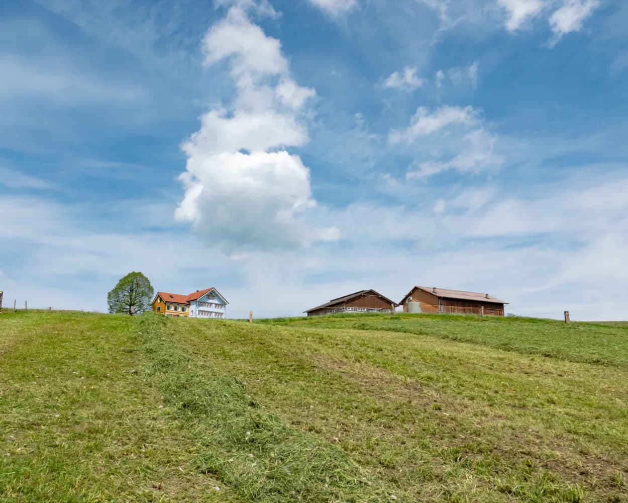
The Appenzell region has retained it's original charm, which makes it a particularly appealing area to visit. Time-honoured customs, flourishing agriculture and hospitality also play their part, and the region holds a magnetic attraction for tourists. This route gives you an extensive insight.
7km90m90m1h 45mLandscape: With panoramic views

Barrier free: Yes
Tour published by:
SwitzerlandMobility
Learn more on
schweizmobil.ch
Crossing the border, the Appenzellerweg leads from the pilgrimage place of Rankweil in Vorarlberg to the Toggenburg monastery village of St. Peterzell. Following old pilgrimage routes, the European culture trail crosses the culturally and scenically unique Appenzell region.
52km1550m1300mLandscape: With panoramic views
Tour published by:
SwitzerlandMobility
Learn more on
schweizmobil.ch
| Appenzell (08:31) | |
| S23 (2m) | |
| Steinegg (08:33) |
The fertile Rhine plains and Paspels bathing lake lie between the Rankweil fortified church and the Blatten hilltop castle in Oberriet. From Hirschensprung to Appenzell, the old pilgrimage path is lined with chapels, shrines and small pilgrimage churches.
28km740m420m7h 25mTour published by:
SwitzerlandMobility
Learn more on
schweizmobil.ch
| Appenzell (08:39) | |
| S21 (2m) | |
| Hirschberg (08:41) |
The Hauptgasse in Appenzell, the old Reichsstrasse to Gontenbad, the Barfussweg on Moosboden to Jakobsbad and the Besinnungsweg leading through Alpine pastures and woodlands offer a rich variety of hiking experiences. Urnäsch beckons with its Appenzell Customs Museum.
13km420m360m3h 35mLandscape: Onto an alp
Tour published by:
SwitzerlandMobility
Learn more on
schweizmobil.ch
| Appenzell (08:30) | |
| S23 (3m) | |
| Gontenbad (08:33) |
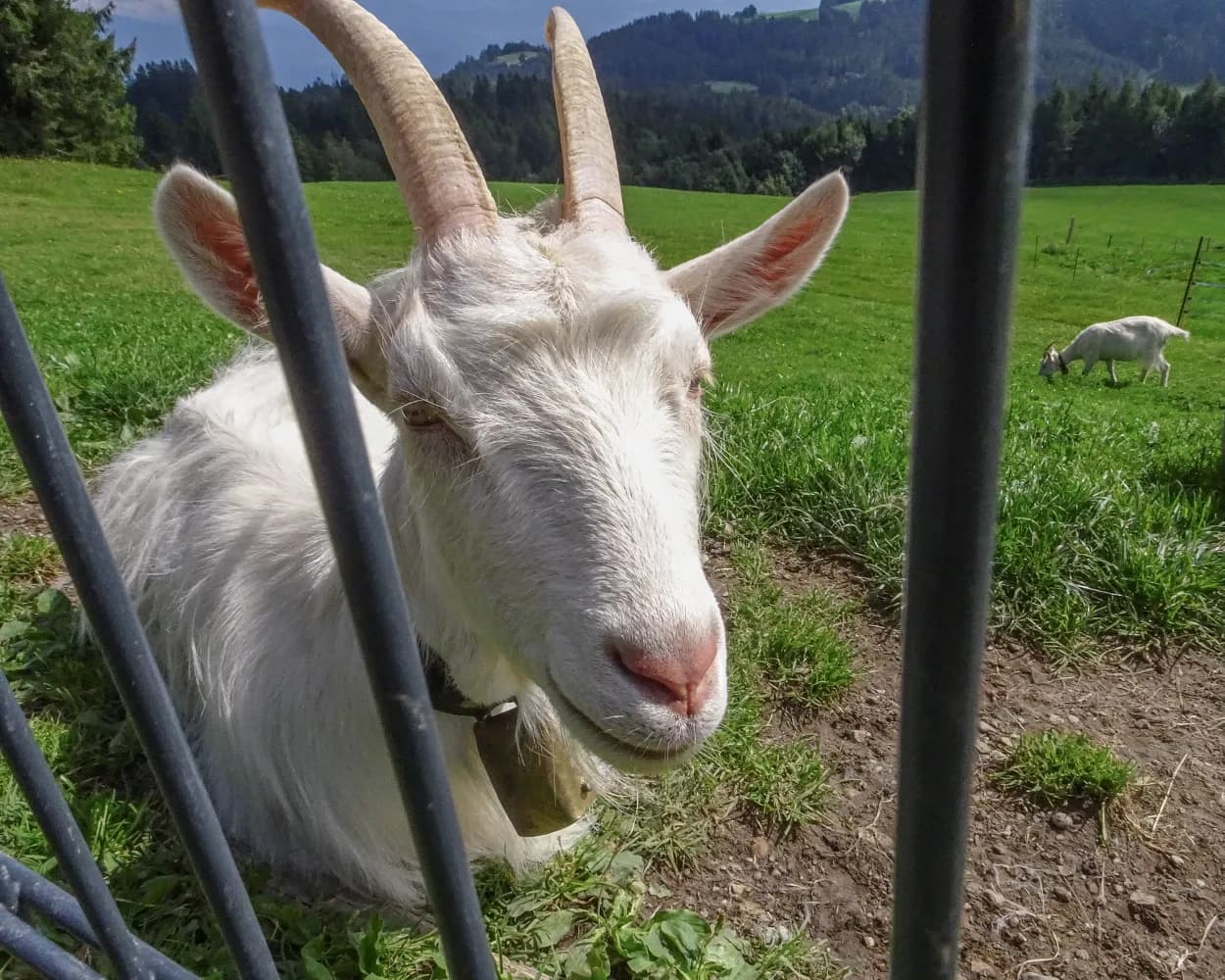
Laura the Goat is centre-stage on this tour of the environs of Gais. Hike through the moorlands with views of the hill country as you pass Laura's favourite spots: an idyllic lakelet, goat sheds, a training track for goat kids, and seats with views of Mount Säntis.
10km480m480m3h 10mLandscape: With panoramic views
Tour published by:
SwitzerlandMobility
Learn more on
schweizmobil.ch
| Appenzell (08:39) | |
| S21 (9m) | |
| Gais (08:48) |
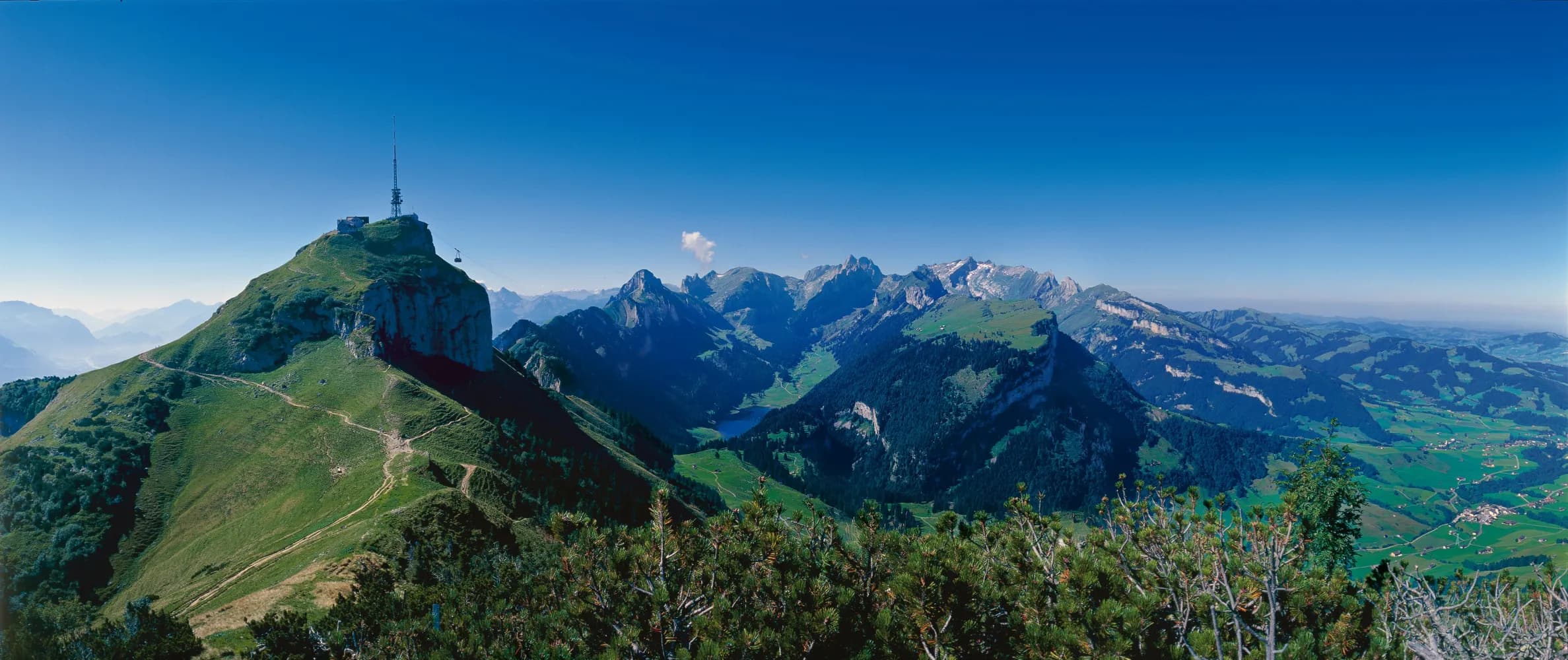
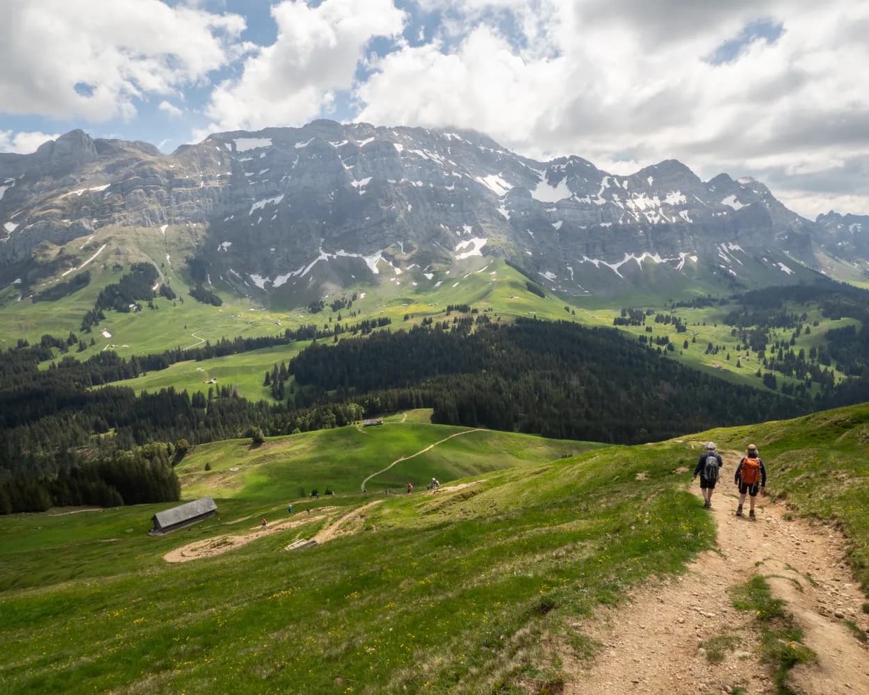
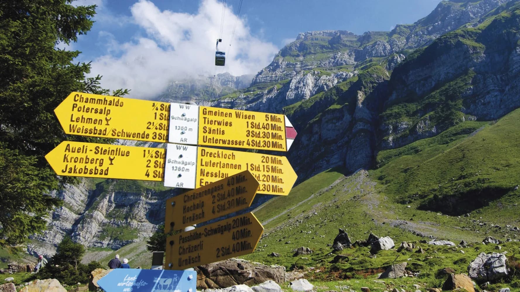
On the tracks of the earth's history – an educational hiking trail. The route leads from Hohe Kasten via Staubern to Bollenwees. Twenty modern information panels explain a variety of geological phenomena and provide surprising insights into the Alpstein Massif and the Säntis.
16km640m1500m5h 25mLandscape: With panoramic views
Tour published by:
SwitzerlandMobility
Learn more on
schweizmobil.ch
| Appenzell (08:31) | |
| S23 (4m) | |
| Weissbad (08:35) |
| Weissbad, Bahnhof (08:37) | |
| 192 (7m) | |
| Brülisau, Kastenbahn (08:44) |
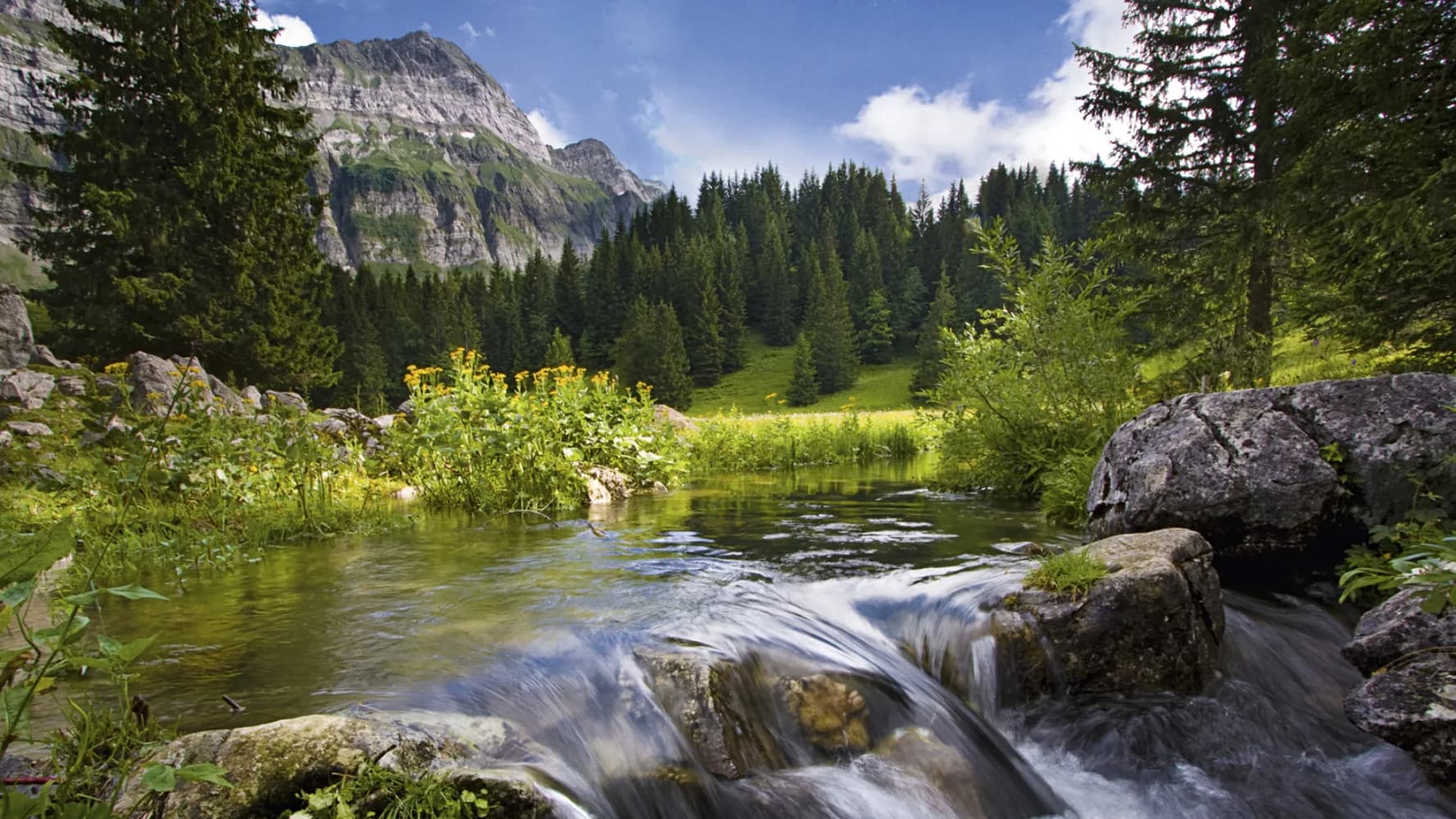
While there is noise and hustle and bustle around the valley station at the beginning of this trail, you are then almost completely alone on various Alps, in the middle of an untouched and unspoilt natural landscape. This stage leads over the Chammhalde.
13km600m1100m4h 25mLandscape: Onto an alp
Tour published by:
SwitzerlandMobility
Learn more on
schweizmobil.ch
The route leads along the old Kirchweg via Tüfenberg with panoramic views of Schönengrund, waiting with its traditional taverns. On the other side of the Tüfibach stream (cantonal boundary), the old Toggenburg Landstrasse leads to the St. Gallen region and the former St. Peterzell Propstei Church.
11km400m520m3h 10mLandscape: Onto an alp
Tour published by:
SwitzerlandMobility
Learn more on
schweizmobil.ch
This trail takes you to the alpine foothill landscape of Appenzellerland, from Urnäsch to Alpweiden at the foot of Säntis and Schwägalp. From the Hochalp to the Schwägalp you will walk through the Schwägalp natural park, a protected natural site with a very special appeal.
16km1100m600m5h 20mLandscape: Over a pass
Tour published by:
SwitzerlandMobility
Learn more on
schweizmobil.ch
| Appenzell (08:30) | |
| S23 (14m) | |
| Urnäsch (08:44) |