Relaxed or more challenging: these winter hikes are all reachable from Zurich by public transport. From easy panoramic walks to longer alpine routes, there’s something for every level of winter hiker.
The destinations below are sorted by travel time from Zurich to make planning easier. Be sure to check the map to explore all winter hikes and thousands of other outdoor activities reachable from any starting point in Switzerland.
Much more on ovunta.com/en/map
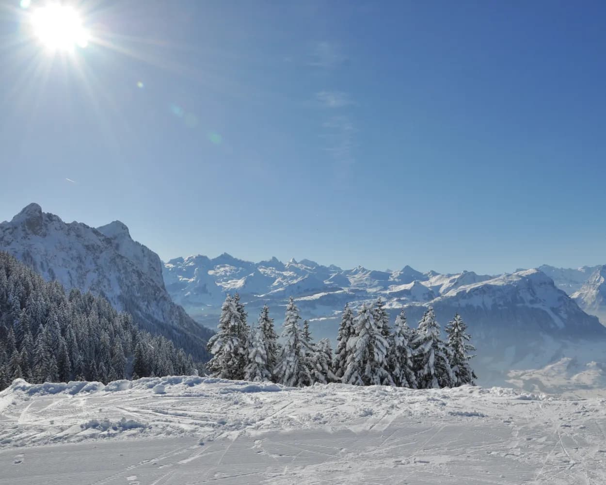
Combining the contemplation and baroque splendour of Einsiedeln Abbey with the wintry hush and scenic beauty of Lake Sihl, this panoramic hike also offers views of the Etzel and the Ybrig mountains.
 8km
8km 140m
140m 140m
140m 2h 40m
Landscape: Through a Swiss Park,With panoramic views
Tour published by:
SwitzerlandMobility
Learn more on
schweizmobil.ch
| Zürich HB (08:43) | |
| S25 (17m) | |
| Wädenswil (09:00) |
| Wädenswil (09:10) | |
| S13 (23m) | |
| Einsiedeln (09:33) |
| Einsiedeln, Bahnhof (09:37) | |
| 556 (2m) | |
| Einsiedeln, Brüel (09:39) |

The journey from the town of Zug into the open countryside takes just eight minutes. The Zugerberg circuit through the high moorlands offers much more than just a phenomenal view of the town, Lake Zug, and the surrounding mountain landscape.
9km240m240m3h 0mLandscape: Through a Swiss Park,With panoramic views
Tour published by:
SwitzerlandMobility
Learn more on
schweizmobil.ch
| Zürich HB (08:33) | |
| EC (26m) | |
| Zug (08:59) |
| Zug, Metalli/Bahnhof (09:08) | |
| 603 (12m) | |
| Zug, Schönegg (09:20) |
| Schönegg (09:26) | |
| 2566 (8m) | |
| Zugerberg (09:34) |
Water and a view of the mountains are the main features of this hike, which leads over bridges and along rivers and streams to Lake Sihl – always surrounded by the mountains of the Sihl Valley and Ybrig.
14km130m130m4h 15mTour published by:
SwitzerlandMobility
Learn more on
schweizmobil.ch
| Zürich HB (08:43) | |
| S25 (17m) | |
| Wädenswil (09:00) |
| Wädenswil (09:10) | |
| S13 (23m) | |
| Einsiedeln (09:33) |
| Einsiedeln, Bahnhof (09:37) | |
| 556 (17m) | |
| Euthal, Höhport (09:54) |
In summer and autumn, a popular nature paradise, in winter by far the sunniest winter hiking trail – a hike to the Hinter Höhi is well worth it at any time of the year.
4km160m160m1h 25mTour published by:
SwitzerlandMobility
Learn more on
schweizmobil.ch
| Zürich HB (08:43) | |
| S25 (42m) | |
| Ziegelbrücke (09:25) |
| Ziegelbrücke, Bahnhof Süd (09:34) | |
| 650 (17m) | |
| Amden, Dorf (09:51) |
| Amden (Talstat. Niederschlag) (09:54) | |
| SL (15m) | |
| Niederschlag (10:09) |

The scenery around “Seewis” is charming all year round. The winter is most spectacular in the „Islatal“ where you find a winter wonderland of snow and ice.
7km190m190m2h 15mTour published by:
SwitzerlandMobility
Learn more on
schweizmobil.ch
| Zürich HB (08:38) | |
| IC (1h 3m) | |
| Landquart (09:41) |
| Landquart (09:45) | |
| S1 (8m) | |
| Grüsch (09:53) |
| Grüsch, Bahnhof (09:57) | |
| 201 (12m) | |
| Seewis Dorf, Bühelstrasse (10:09) |
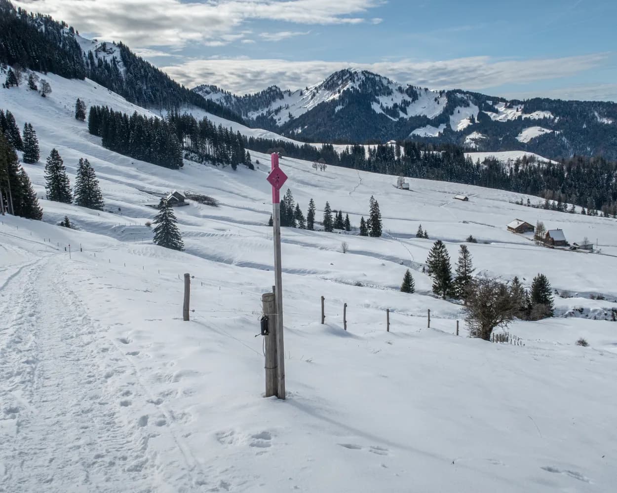
On this winter hiking trail, you can escape the fog and enjoy the mystical mood in the open landscape of the upland moor, the largest in Switzerland. It lies in a high valley where the Biber river flows in its natural bed.
7km50m50m2h 5mTour published by:
SwitzerlandMobility
Learn more on
schweizmobil.ch
| Zürich HB (08:43) | |
| S25 (17m) | |
| Wädenswil (09:00) |
| Wädenswil (09:10) | |
| S13 (16m) | |
| Biberbrugg (09:26) |
| Biberbrugg, Bahnhof (10:10) | |
| 507 (7m) | |
| Rothenthurm, Erste Altmatt (10:17) |
A revolving gondola, a foot suspension bridge and a spectacular view of the Schwyz basin, the surrounding mountains and lakes – the Engelstock Circuit Trail offers a leisurely hike full of variety.
5km220m220m1h 50mTour published by:
SwitzerlandMobility
Learn more on
schweizmobil.ch
| Zürich HB (08:33) | |
| EC (43m) | |
| Arth-Goldau (09:16) |
| Arth-Goldau, Bahnhof (09:21) | |
| 501 (21m) | |
| Schwyz, Zentrum (09:42) |
| Schwyz, Zentrum (09:45) | |
| 507 (11m) | |
| Sattel, Talstation (09:56) |
| Sattel (Talstat. Hochstuckli) (09:59) | |
| GB (8m) | |
| Sattel Mostelberg (Bergstat.) (10:07) |
The ascent to Osteregg and Zimmermannslauftegg is not the easiest. But once you reach the top, the effort is soon forgotten. A stunning view stretching from the Appenzell hills all the way to Lake Constance is your reward.
11km580m580m4h 15mTour published by:
SwitzerlandMobility
Learn more on
schweizmobil.ch
| Zürich HB (08:37) | |
| IC1 (1h 7m) | |
| Gossau SG (09:44) |
| Gossau SG (09:51) | |
| S23 (22m) | |
| Urnäsch (10:13) |
Always an experience – the mighty Grosse Mythen and the view straight down to the basin of Schwyz, the area’s main town with its widely scattered settlements. A couple of breezy tips: Watch the paragliders take off from their launch site and let your eyes wander to Einsiedeln’s ski jumps on the way back.
2km70m70m35mTour published by:
SwitzerlandMobility
Learn more on
schweizmobil.ch
| Zürich HB (08:33) | |
| EC (43m) | |
| Arth-Goldau (09:16) |
| Arth-Goldau, Bahnhof (09:21) | |
| 501 (13m) | |
| Schwyz, Bahnhof (09:34) |
| Schwyz, Bahnhof (09:41) | |
| 503 (12m) | |
| Rickenbach SZ, Rotenfluebahn (09:53) |
| Rickenbach SZ (Rotenfluebahn) (09:55) | |
| 2569 (15m) | |
| Rotenflue (Mythenregion) (10:10) |
This fascinating panorama trail follows the route of the old Rigi Scheidegg Railway on flat terrain as far as Unterstetten, then continues on a gentle incline to Rigi Scheidegg.
7km220m20m2h 20mTour published by:
SwitzerlandMobility
Learn more on
schweizmobil.ch
| Zürich HB (08:33) | |
| EC (43m) | |
| Arth-Goldau (09:16) |
| Arth-Goldau RB (09:55) | |
| 81 (8m) | |
| Kräbel (10:03) |
| Kräbel (Talstation Scheidegg) (10:05) | |
| 2564 (6m) | |
| Rigi Scheidegg (10:11) |