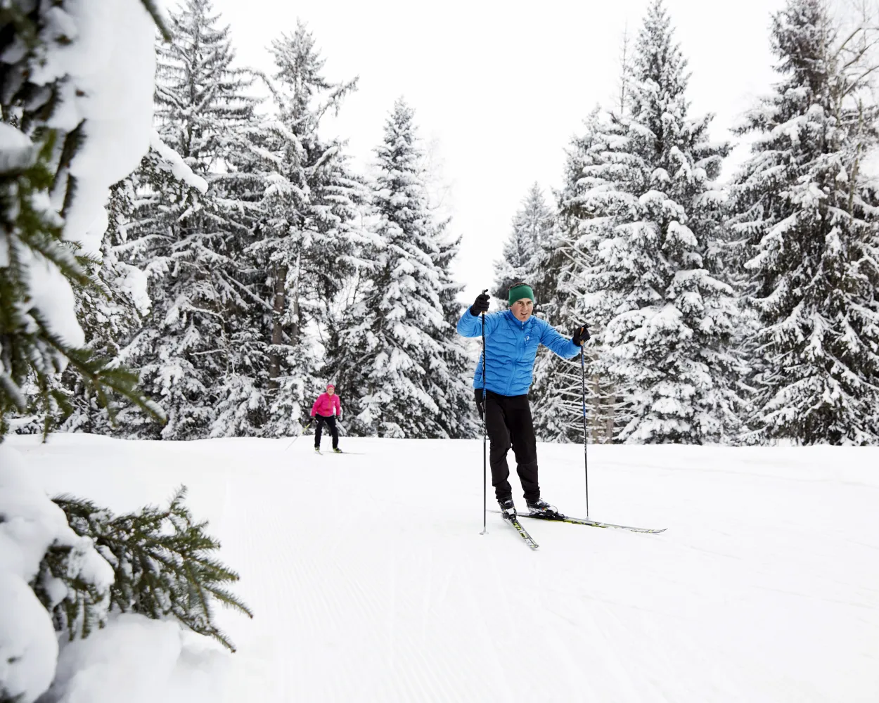
Whether skating or classic: these ten cross-country skiing destinations are all reachable from Zurich by public transport. From romantic forest tracks to scenic high-altitude loops, there’s something for every level of Nordic skier.
The destinations below are sorted by travel time from Zürich HB to make your planning easier. Make sure to visit the map to explore all cross-country skiing areas and thousands of other outdoor activities reachable from any starting point in Switzerland.
Much more on ovunta.com/en/map
Located in the Bernese Oberland near Adelboden, Feldenmaas provides a compact network of trails winding through gentle alpine meadows. This peaceful spot suits those looking for a relaxed outing amid mountain scenery without venturing into high-altitude terrain.
 5.4 km
Learn more on
loipe-feldenmaas.ch
| Zürich HB (08:39) | |
| S5 (16m) | |
| Birmensdorf ZH (08:55) |
| Birmensdorf ZH, Bahnhof (08:59) | |
| 227 (19m) | |
| Bonstetten, Sunnenberg (09:18) |
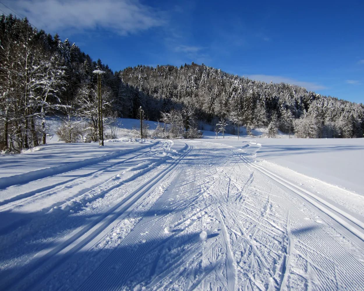
Traversing the forested Randen plateau near Schaffhausen, this extensive network ranks among the larger options in northeastern Switzerland. The rolling terrain through dense woodland offers variety for different skill levels, with the elevated position providing reliable snow conditions when winter settles in.
29.7 kmLearn more on
schweizmobil.ch
| Zürich HB (08:37) | |
| IC (36m) | |
| Schaffhausen (09:13) |
| Schaffhausen (09:19) | |
| S64 (6m) | |
| Beringerfeld (09:25) |
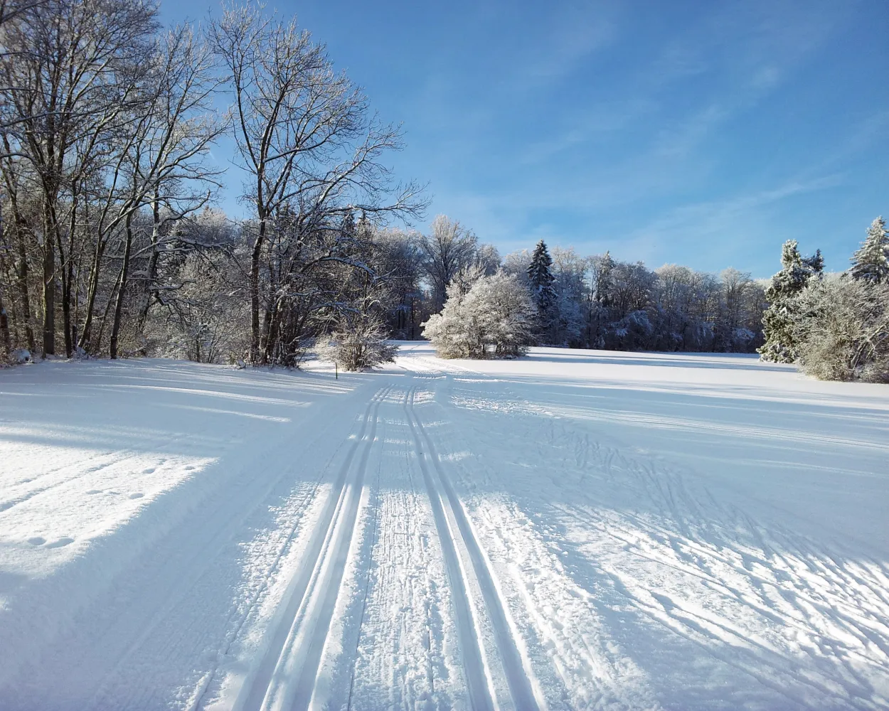
The canton of Zurich’s longest cross-country ski trail is a short distance from the city itself, yet still in the heart of a quiet rural area. The hilly route is almost 30 km long (18.5 miles) and runs along the back of Pfannenstiel, offering breathtaking views of Lake Zurich and the Swiss Alps.
24.3 kmTour published by:
SwitzerlandMobility
Learn more on
schweizmobil.ch
| Zürich HB (08:41) | |
| S7 (22m) | |
| Männedorf (09:03) |
| Männedorf, Bahnhof (09:06) | |
| 940 (6m) | |
| Männedorf, Widenbad (09:12) |

Located in the heart of the Zurich Oberland, the Bäretswil-Maiwinkel cross-country ski trail leads over undulated terrain and offers outstanding natural beauty. The region is a popular local recreation area as it is known to have little fog and is easily accessible.
10.7 kmTour published by:
SwitzerlandMobility
Learn more on
schweizmobil.ch
| Zürich HB (08:39) | |
| S15 (21m) | |
| Wetzikon ZH (09:00) |
| Wetzikon ZH, Bahnhof (09:05) | |
| 851 (14m) | |
| Bäretswil, Oberdorf (09:19) |
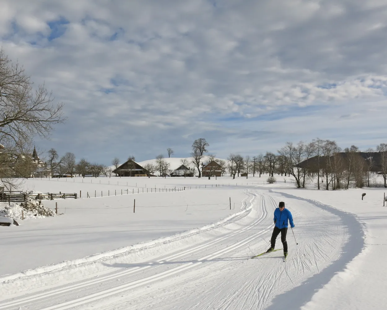
Escape the fog in the beautiful Ägerital valley and enjoy the winter landscape of Unterägeri on cross-country tracks with views of Ägerisee lake.
17.3 kmTour published by:
SwitzerlandMobility
Learn more on
schweizmobil.ch
| Zürich HB (08:33) | |
| EC (26m) | |
| Zug (08:59) |
| Zug, Bahnhofplatz (09:04) | |
| 601 (19m) | |
| Unterägeri, Spinnerei (09:23) |
A baroque abbey, the delightful landscape of Lake Sihl, the Schwyz mountains and the peaceful Schwantenau moor – the Schwedentritt half-marathon trail demands a huge effort from skiers, but also rewards them with magnificent views.
21.9 kmTour published by:
SwitzerlandMobility
Learn more on
snow.myswitzerland.com
and on
schweizmobil.ch
| Zürich HB (08:43) | |
| S25 (24m) | |
| Pfäffikon SZ (09:07) |
| Pfäffikon SZ (09:12) | |
| S40 (22m) | |
| Biberbrugg (09:34) |
With ideal winter and cross-country skiing conditions, the Menzingen-Loipe trail, also known as the Schurtannenloipe, has become a real insider tip for cross-country skiers. The beautifully designed cross-country trail leads through stunning countryside with views of Menzingen and its monastery.
5.2 kmTour published by:
SwitzerlandMobility
Learn more on
schweizmobil.ch
| Zürich HB (08:33) | |
| EC (26m) | |
| Zug (08:59) |
| Zug, Bahnhofplatz (09:08) | |
| 602 (16m) | |
| Menzingen, Dorf (09:24) |
The Kalthof-Wiliberg ski run is seen as an insider tip in the centre of the country. The varied and slightly hilly route over the plateau between the Suhrental and the Uerkental valley provides a view of the Alps and the Jura mountain chain.
7.3 kmTour published by:
SwitzerlandMobility
Learn more on
schweizmobil.ch
| Zürich HB (08:38) | |
| RE37 (27m) | |
| Aarau (09:05) |
| Aarau (09:12) | |
| S14 (21m) | |
| Schöftland (09:33) |
| Schöftland, Bahnhof (09:35) | |
| 85 (3m) | |
| Staffelbach, Gemeindehaus (09:38) |
The Trachslau cross-country ski track is a circuit for connoisseurs. A footpath leads from Einsiedeln station along the river to the start and finish area. The sunny and mostly flat route leads past farms, the Au convent and the Alp stream.
18.4 kmTour published by:
SwitzerlandMobility
Learn more on
snow.myswitzerland.com
and on
schweizmobil.ch
| Zürich HB (08:43) | |
| S25 (24m) | |
| Pfäffikon SZ (09:07) |
| Pfäffikon SZ (09:12) | |
| S40 (34m) | |
| Einsiedeln (09:46) |
Cross-country skiers can escape the hustle and bustle above the fog, within viewing distance of the pulsing economic hub of Zug. In the snowy highland moors, you can imagine you are in Scandinavia and enjoy views stretching as far as the Rigi and the Alpine foothills.
15.4 kmTour published by:
SwitzerlandMobility
Learn more on
schweizmobil.ch
| Zürich HB (08:33) | |
| EC (26m) | |
| Zug (08:59) |
| Zug, Metalli/Bahnhof (09:08) | |
| 603 (12m) | |
| Zug, Schönegg (09:20) |
| Schönegg (09:26) | |
| 2566 (8m) | |
| Zugerberg (09:34) |


