
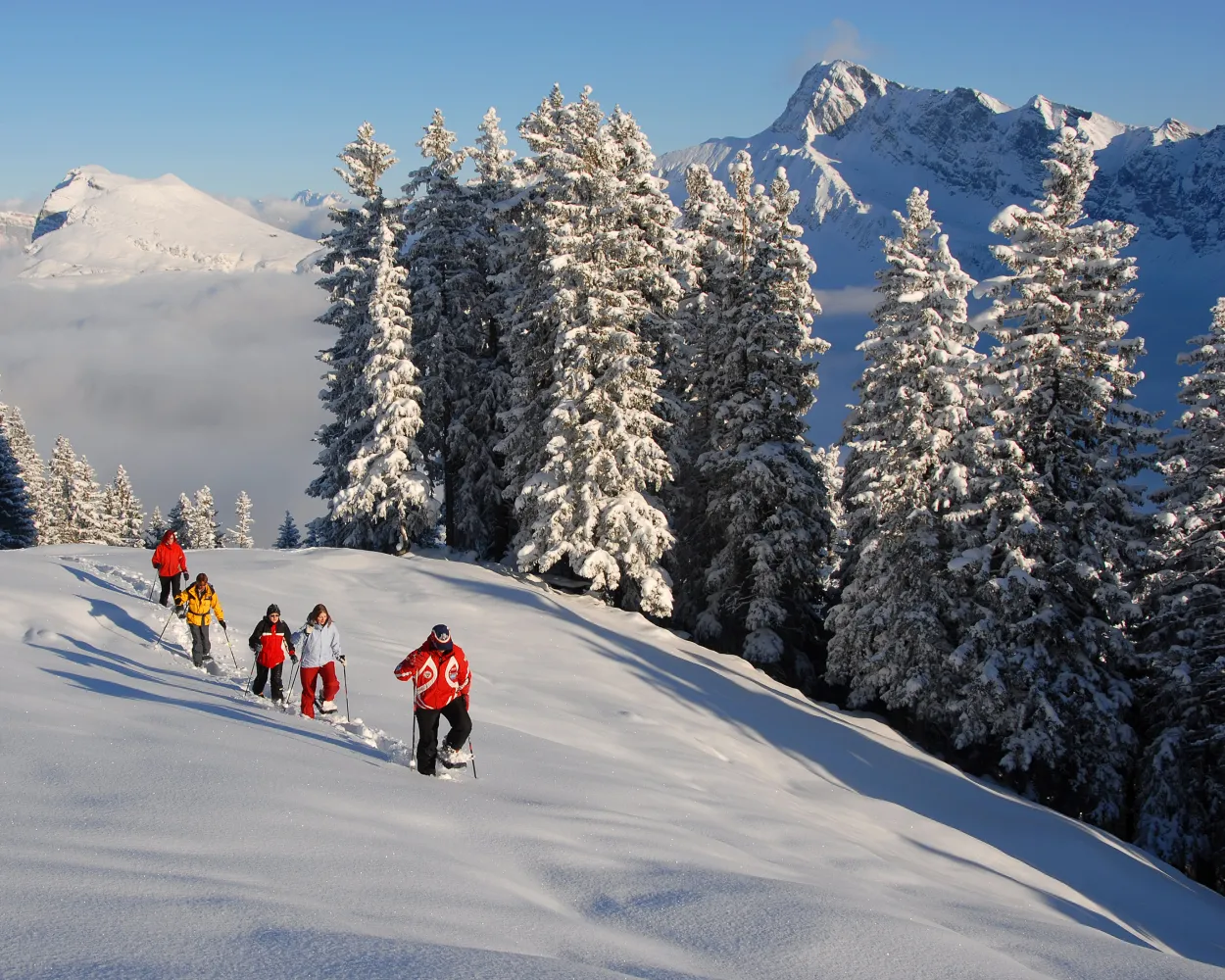
Discover a winter wonderland on these snowshoe hikes, all easily reachable from Sarnen by public transport. Snow-covered forests, wide alpine plateaus, and scenic routes offer memorable experiences in the heart of the Alps.
To make planning easier, the hikes below are sorted by travel time from Sarnen. Explore the map to find all snowshoe hikes and thousands of other outdoor activities accessible from anywhere in Switzerland.
Much more on ovunta.com/en/map
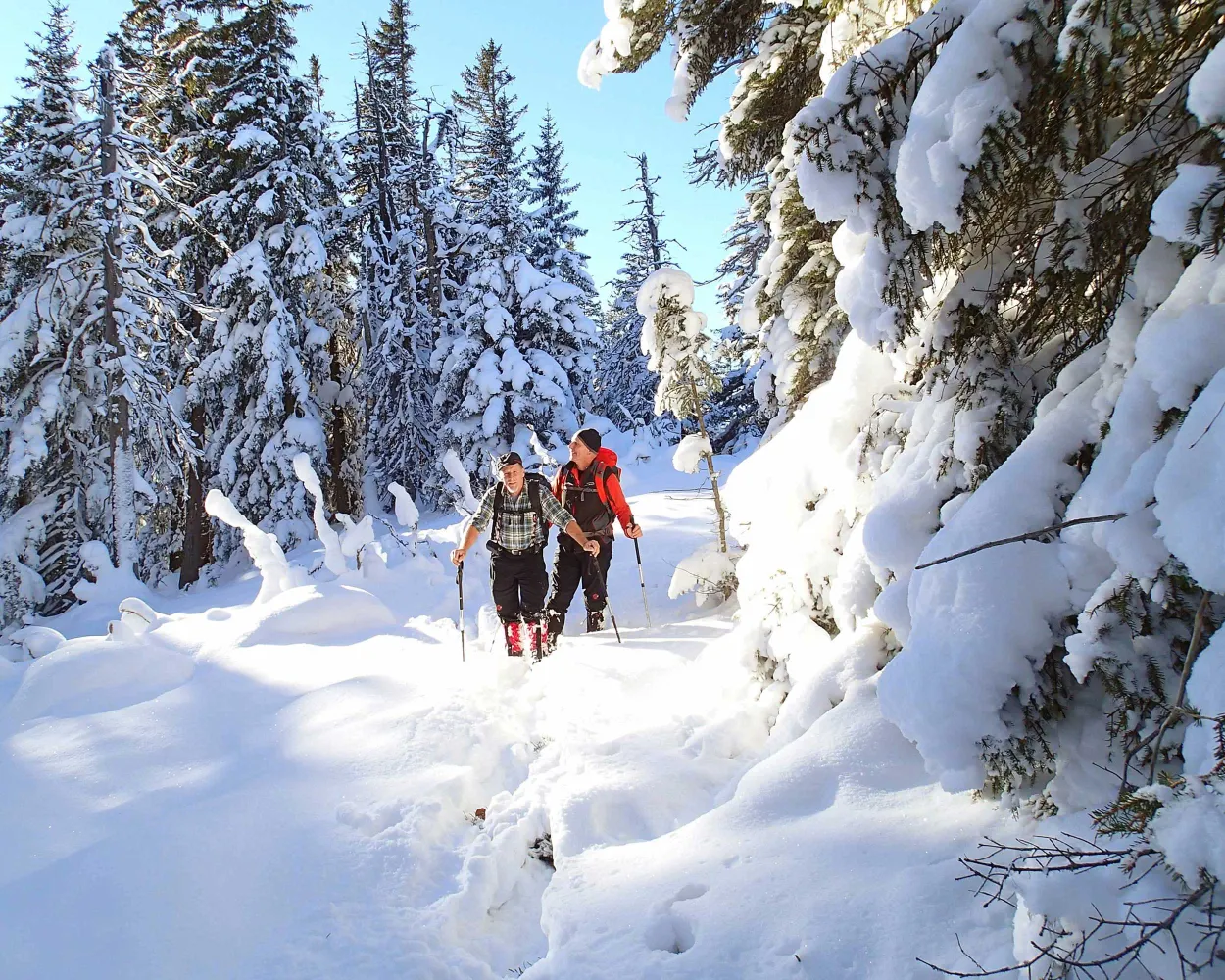
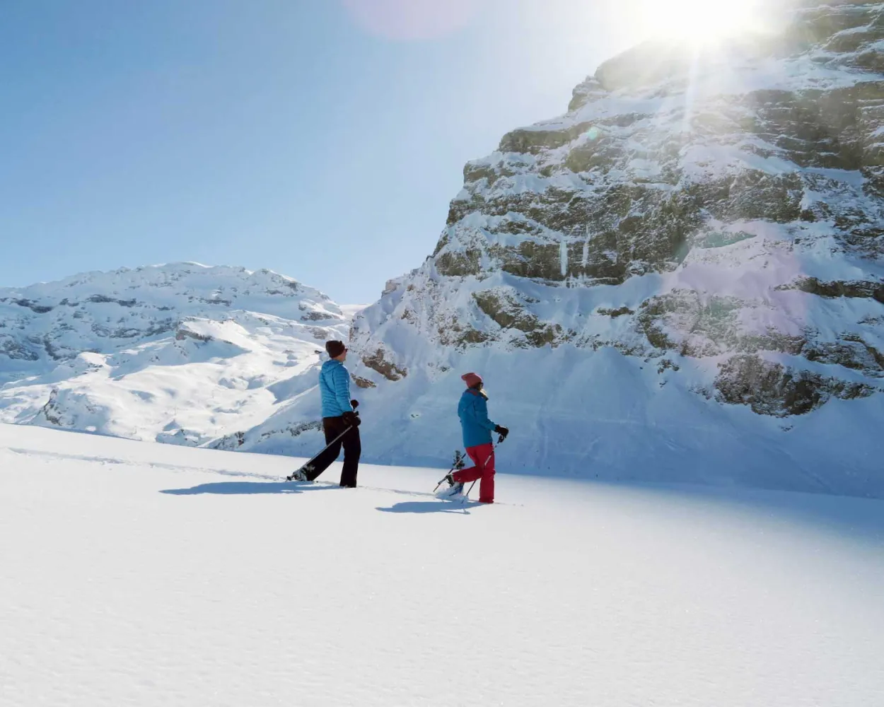
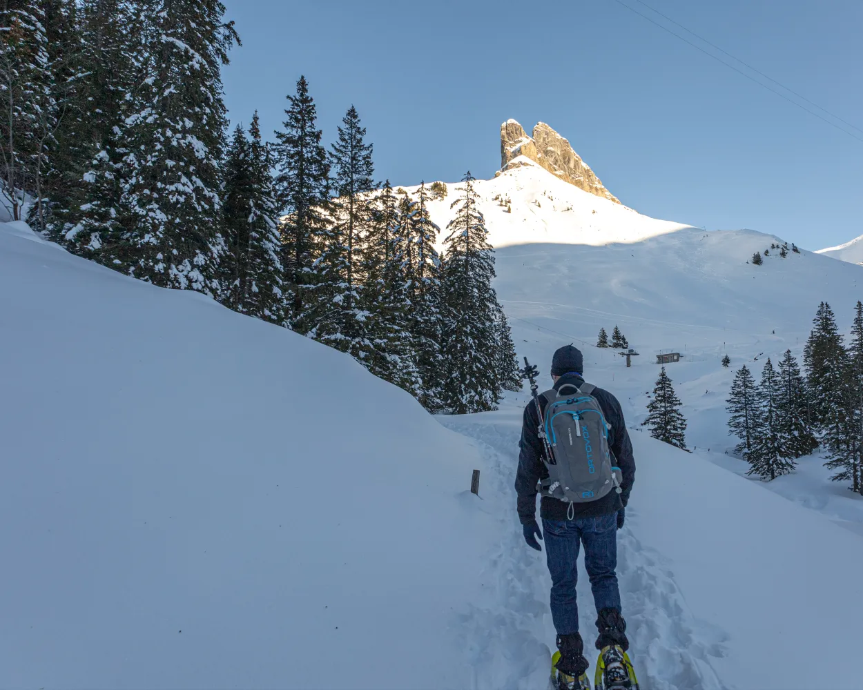
Here you feel as if you are in the far north: to reach the Jänzi, you snowshoe through the varied winter landscape of the Langis-Glaubenberg area. Once you have arrived at the top you can look forward to a magnificent 360-degree panorama of the surrounding mountain scenery and Sarnen Valley.
 12 km
12 km 580 m
580 m 580 m
580 m 5h 40m
Landscape: Onto a mountain peak,With panoramic views
Tour published by:
SwitzerlandMobility
Learn more on
schweizmobil.ch
| Sarnen, Bahnhof (09:16) | |
| 344 (31m) | |
| Langis (09:47) |
Short and sweet: this circuit from the car-free sun terrace of Melchsee-Frutt up to the magical Blauseeli takes just one hour, but it offers an impressive mountain panorama as well as superb peace and quiet. At the end there is time to pop into the village of Frutt-Dörfli.
4 km180 m180 m1h 55mTour published by:
SwitzerlandMobility
Learn more on
schweizmobil.ch
Above the car-free sun terrace Melchsee-Frutt, the snowshoe trail on the Gumm promises magnificent views of the Central Swiss and Bernese Alps.
13 km480 m480 m5h 35mLandscape: Through a Swiss Park,With panoramic views
Tour published by:
SwitzerlandMobility
Learn more on
schweizmobil.ch
The train from Melchsee-Frutt to Bonistock is full of wonders. Firstly there is the view across to Mount Titlis and the Obwalden peaks, then the idyllic magic of two lakes – Tannensee and Melchsee.
9 km420 m420 m4h 25mTour published by:
SwitzerlandMobility
Learn more on
schweizmobil.ch
| Sarnen, Bahnhof (08:44) | |
| 343 (34m) | |
| Stöckalp (09:18) |
| Melchtal Stöckalp (Talstation) (09:19) | |
| 2525 (20m) | |
| Melchsee-Frutt (Bergstation) (09:39) |
The remote Usseri Alp area, the superbly situated Bärghuis Schönbüel and the sleepy Alpine village of Breitenfeld – all this is enough to provide a unique hike circuit trail experience.
8 km580 m580 m4h 35mLandscape: With panoramic views,Onto a mountain peak
Tour published by:
SwitzerlandMobility
Learn more on
schweizmobil.ch
| Sarnen (09:24) | |
| LIX (26m) | |
| Lungern (09:50) |
| Lungern (Turren-Bahn) (10:20) | |
| PB (6m) | |
| Turren (10:26) |
From the start at the Klewenalp mountain station high above Lake Lucerne, the trail first leads downhill to Wangiboden. Further on, the Brämegg viewpoint boasts spectacular views of the lake and the mountains of Central Switzerland. Head back to the mountain station via Röthen.
3 km190 m190 m1h 40mLandscape: Onto an alp,With panoramic views,Onto a mountain peak
Tour published by:
SwitzerlandMobility
Learn more on
schweizmobil.ch
| Sarnen, Bahnhof (08:59) | |
| 312 (26m) | |
| Stans, Bahnhof (09:25) |
| Stans, Bahnhof (09:27) | |
| 311 (19m) | |
| Beckenried, Post (09:46) |
| Beckenried (Klewenalpbahn) (10:00) | |
| 2556 (10m) | |
| Klewenalp (10:10) |
This moderately challenging snowshoe trail surrounded by pristine nature offers stunning views into the Engelberg Valley, away from the hustle and bustle. It leads from the Maria-Rickenbach pilgrimage site with its famous monastery mainly through the forest and across meadows.
5 km240 m240 m2h 20mLandscape: With panoramic views,Onto an alp
Tour published by:
SwitzerlandMobility
Learn more on
schweizmobil.ch
| Sarnen (08:35) | |
| LIX (20m) | |
| Luzern (08:55) |
| Luzern (09:10) | |
| IRLEX (20m) | |
| Niederrickenbach Station (09:30) |
| Niederrickenbach Talstation (09:40) | |
| PB (8m) | |
| Niederrickenbach Dorf (09:48) |

The easy snowshoe tour on Pilatus leads from Fräkmüntegg over open meadows of Alp Bonern and back through the «Rehlöcher» forest. During the hike you cross the border from Lucerne to Nidwalden and enjoy a beautiful view of Lucerne, Lake Lucerne, the midland and the northern foothills of the Alps.
3 km180 m180 m1h 35mLandscape: With panoramic views,Onto an alp
Tour published by:
SwitzerlandMobility
Learn more on
schweizmobil.ch
| Sarnen (08:35) | |
| LIX (20m) | |
| Luzern (08:55) |
| Luzern, Bahnhof (09:01) | |
| 1 (11m) | |
| Kriens, Zentrum Pilatus (09:12) |
| Kriens (Pilatusbahn) (09:23) | |
| 2516 (30m) | |
| Fräkmüntegg (09:53) |
Bridges and views are the stars of this snowshoe trail. Along the way, hikers can take off their snowshoes and enjoy a special experience: the foot suspension bridge in Sattel-Hochstuckli.
10 km640 m640 m5h 20mLandscape: With panoramic views,Over a suspension bridge
Tour published by:
SwitzerlandMobility
Learn more on
schweizmobil.ch
| Sarnen (08:35) | |
| LIX (20m) | |
| Luzern (08:55) |
| Luzern (09:06) | |
| S3 (32m) | |
| Arth-Goldau (09:38) |
| Arth-Goldau (09:54) | |
| S31 (14m) | |
| Biberegg (10:08) |
The Bannalp is a secret gem in the Engelberg Valley. This high valley with the peaceful Bannalp reservoir at its centre is surrounded by the mighty Gross Walenstock, Klein Walenstock and Bietstock peaks. Close by, the circular walk up to the Urnerstaffel begins. Snowshoe hikers can enjoy wonderful views!
3 km110 m110 m1h 10mTour published by:
SwitzerlandMobility
Learn more on
schweizmobil.ch
| Sarnen (08:35) | |
| LIX (20m) | |
| Luzern (08:55) |
| Luzern (09:10) | |
| IRLEX (24m) | |
| Wolfenschiessen (09:34) |
| Wolfenschiessen, Bahnhof (09:37) | |
| 331 (14m) | |
| Oberrickenbach, Talstat. LFCH (09:51) |
| Fell (10:00) | |
| PB (10m) | |
| Chrüzhütte (10:10) |


