
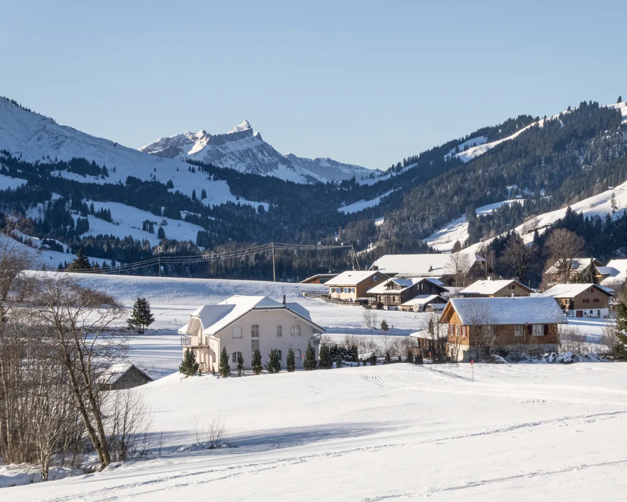
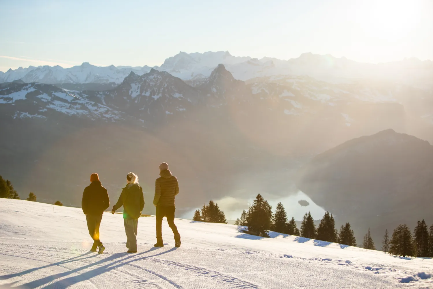
Relaxed or more challenging: these winter hikes are all reachable from Sarnen by public transport. From easy panoramic walks to longer alpine routes, there’s something for every level of winter hiker.
The destinations below are sorted by travel time from Sarnen to make planning easier. Be sure to check the map to explore all winter hikes and thousands of other outdoor activities reachable from any starting point in Switzerland.
Much more on ovunta.com/en/map
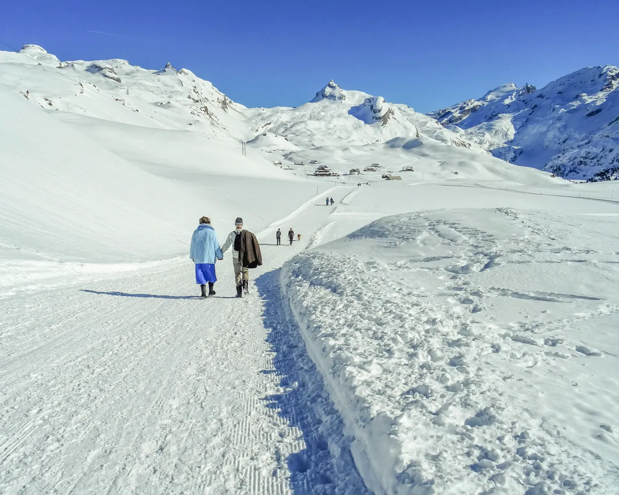
The winter hiking trail from the car-free upland plateau of Melchsee-Frutt to Tannalp passes through glittering winter landscapes. There are two picturesque chapels and lakes along the wayside.
 9 km
9 km 240 m
240 m 240 m
240 m 3h 0m
3h 0m
Landscape: Along the water,Onto an alp,With panoramic views
Tour published by:
SwitzerlandMobility
Learn more on
schweizmobil.ch
| Sarnen, Bahnhof (08:44) | |
| 343 (34m) | |
| Stöckalp (09:18) |
| Melchtal Stöckalp (Talstation) (09:19) | |
| 2525 (20m) | |
| Melchsee-Frutt (Bergstation) (09:39) |
A one-of-a-kind winter hiking experience with views down into the Lungern valley basin and across to the Bernese Alps. Far away from any hustle and bustle, this Alpine route slowly ascends up around Finsterbüel to the beautifully located, sleepy village of Breitenfeld.
5 km260 m260 m1h 50mTour published by:
SwitzerlandMobility
Learn more on
schweizmobil.ch
| Sarnen (09:24) | |
| LIX (26m) | |
| Lungern (09:50) |
| Lungern (Turren-Bahn) (10:20) | |
| PB (6m) | |
| Turren (10:26) |
Sweeping views far from the madding crowd: set among impressive mountain scenery wth a view on the Mythen, this winter trail leads through snow-covered pine forests.
5 km30 m340 m1h 40mTour published by:
SwitzerlandMobility
Learn more on
schweizmobil.ch
| Sarnen, Bahnhof (08:59) | |
| 312 (26m) | |
| Stans, Bahnhof (09:25) |
| Stans, Bahnhof (09:27) | |
| 311 (28m) | |
| Emmetten, Post (09:55) |
| Emmetten (Talstation) (09:57) | |
| 2557 (8m) | |
| Stockhütte (Bergstation) (10:05) |
The winter sports destination of Klewenalp-Stockhütte offer a wide range of highlights away from the ski pistes, too: one of these is the romantic winter trail hrough Ängi Valley with a superb view over Lake Lucerne.
4 km30 m240 m1h 10mLandscape: With panoramic views,Onto an alp
Tour published by:
SwitzerlandMobility
Learn more on
schweizmobil.ch
| Sarnen, Bahnhof (08:59) | |
| 312 (26m) | |
| Stans, Bahnhof (09:25) |
| Stans, Bahnhof (09:27) | |
| 311 (19m) | |
| Beckenried, Post (09:46) |
| Beckenried (Klewenalpbahn) (10:00) | |
| 2556 (10m) | |
| Klewenalp (10:10) |
The path goes from Käserstatt to Mägisalp via alpine meadows and enchanting forest passages. Here, winter hikers can always catch a glimpse of the Wetterhorn mountains opposite.
3 km70 m190 m55mTour published by:
SwitzerlandMobility
Learn more on
schweizmobil.ch
| Sarnen (09:24) | |
| LIX (39m) | |
| Brünig-Hasliberg (10:03) |
| Brünig-Hasliberg, Bahnhof (10:08) | |
| 158 (11m) | |
| Hasliberg Wasserwendi, Twing (10:19) |
| Hasliberg Twing (Gondelbahn) (10:24) | |
| 2485 (14m) | |
| Käserstatt (10:38) |
Engelberg’s Grotto Trail leads to the «End of the World». This high-altitude path takes walkers through a snowy landscape with views of Engelberg, past the famous «seven springs», and on to the Lourdes grotto and Horbis.
6 km170 m170 m2h 5mTour published by:
SwitzerlandMobility
Learn more on
schweizmobil.ch
| Sarnen (08:35) | |
| LIX (20m) | |
| Luzern (08:55) |
| Luzern (09:10) | |
| IRLEX (43m) | |
| Engelberg (09:53) |
This sunny winter outing in the Finsterwald forest is perfect for those seeking peace and quiet in the midst of the Entlebuch moorland scenery. You'll pass a drilling platform (an industrial monument) and enjoy an impressive backdrop featuring the Schimbrig and the Fürstein.
5 km130 m130 m1h 35mLandscape: With panoramic views,Through a Swiss Park
Tour published by:
SwitzerlandMobility
Learn more on
schweizmobil.ch
| Sarnen, Bahnhof (09:16) | |
| 344 (31m) | |
| Langis (09:47) |
| Langis (10:10) | |
| 232 (26m) | |
| Finsterwald LU, Kirche (10:36) |
The journey from the town of Zug into the open countryside takes just eight minutes. The Zugerberg circuit through the high moorlands offers much more than just a phenomenal view of the town, Lake Zug, and the surrounding mountain landscape.
9 km240 m240 m3h 0mLandscape: With panoramic views,Through a Swiss Park
Tour published by:
SwitzerlandMobility
Learn more on
schweizmobil.ch
| Sarnen (08:35) | |
| LIX (20m) | |
| Luzern (08:55) |
| Luzern (09:09) | |
| IR70 (19m) | |
| Zug (09:28) |
| Zug, Metalli/Bahnhof (09:38) | |
| 603 (12m) | |
| Zug, Schönegg (09:50) |
| Schönegg (09:56) | |
| 2566 (8m) | |
| Zugerberg (10:04) |
This fascinating panorama trail follows the route of the old Rigi Scheidegg Railway on flat terrain as far as Unterstetten, then continues on a gentle incline to Rigi Scheidegg.
7 km220 m20 m2h 20mTour published by:
SwitzerlandMobility
Learn more on
schweizmobil.ch
| Sarnen (08:35) | |
| LIX (20m) | |
| Luzern (08:55) |
| Luzern (09:06) | |
| S3 (32m) | |
| Arth-Goldau (09:38) |
| Arth-Goldau RB (09:55) | |
| 81 (8m) | |
| Kräbel (10:03) |
| Kräbel (Talstation Scheidegg) (10:05) | |
| PB (6m) | |
| Rigi Scheidegg (10:11) |
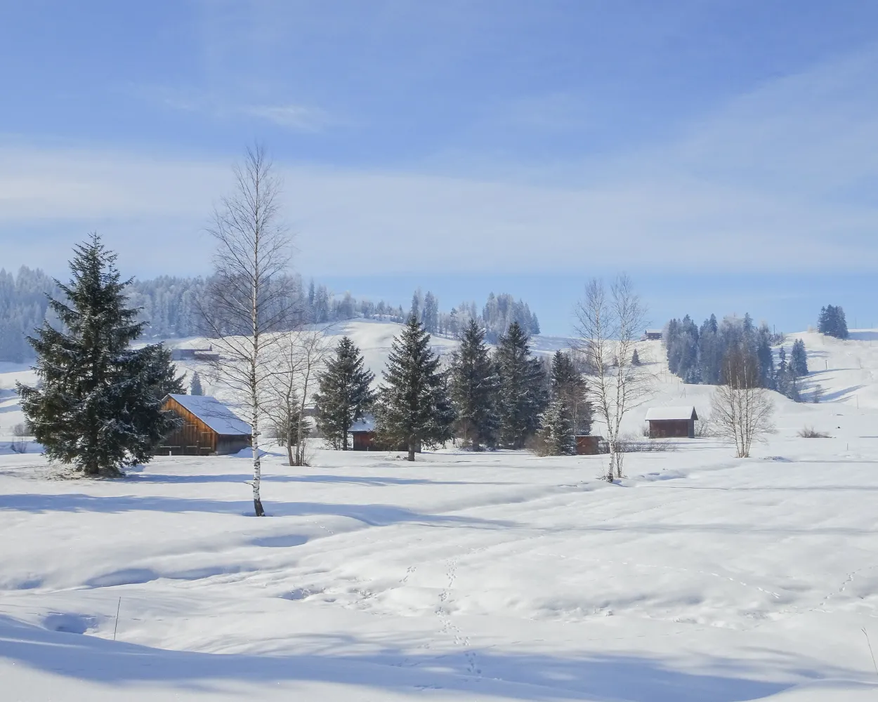
On this winter hiking trail, you can escape the fog and enjoy the mystical mood in the open landscape of the upland moor, the largest in Switzerland. It lies in a high valley where the Biber river flows in its natural bed.
7 km50 m50 m2h 5mTour published by:
SwitzerlandMobility
Learn more on
schweizmobil.ch
| Sarnen (08:35) | |
| LIX (20m) | |
| Luzern (08:55) |
| Luzern (09:06) | |
| S3 (32m) | |
| Arth-Goldau (09:38) |
| Arth-Goldau (09:54) | |
| S31 (17m) | |
| Rothenthurm (10:11) |


