Whether skating or classic: these ten cross-country skiing destinations are all reachable from Montreux by public transport. From romantic forest tracks to scenic high-altitude loops, there’s something for every level of Nordic skier.
The destinations below are sorted by travel time from Montreux to make your planning easier. Make sure to visit the map to explore all cross-country skiing areas and thousands of other outdoor activities reachable from any starting point in Switzerland.
Much more on ovunta.com/en/map
Perched on a sunny plateau high above the Rhône Valley, this renowned Valais resort offers sweeping views of the Alps from the Matterhorn to Mont Blanc. Trails traverse forests and open terrain across the broad, gently rolling highland landscape.
 9km
9kmLearn more on
snow.myswitzerland.com
and on
schweizmobil.ch
| Montreux (08:31) | |
| EC (36m) | |
| Sion (09:07) |
| Sion, poste/gare (09:12) | |
| 353 (39m) | |
| Crans-Montana, Essampilles (09:51) |
A picturesque lake village surrounded by forests and peaks along the Tour du Mont Blanc hiking route. Champex-Lac maintains a peaceful atmosphere with trails circling the frozen lake and extending into the surrounding woodland and alpine meadows.
10.7kmLearn more on
snow.myswitzerland.com
| Montreux (08:37) | |
| IR95 (27m) | |
| Martigny (09:04) |
| Martigny (09:17) | |
| R81 (15m) | |
| Sembrancher (09:32) |
| Sembrancher (09:34) | |
| R82 (8m) | |
| Orsières (09:42) |
| Orsières, gare (09:46) | |
| 271 (16m) | |
| Champex, Le Signal (10:02) |
Famous for its thermal baths, this Valais resort village sits in a dramatic mountain basin beneath towering cliffs. An extensive network of trails winds through the valley floor and surrounding terrain, combining winter sport with the possibility of wellness relaxation.
16kmLearn more on
snow.myswitzerland.com
| Montreux (08:37) | |
| IR95 (1h 1m) | |
| Leuk (09:38) |
| Leuk, Bahnhof (09:41) | |
| 471 (25m) | |
| Leukerbad, Birchen (10:06) |
Perched in the Jura mountains above Lake Geneva, this resort offers sweeping views across to the Alps. The forested trails wind through typical Jura landscape, combining gentle rolling terrain with more challenging sections through spruce woodlands.
17.4kmLearn more on
stgeorge.ch
| Montreux (08:38) | |
| RE33 (46m) | |
| Rolle (09:24) |
| Rolle, gare nord (09:39) | |
| 840 (29m) | |
| St-George, village (10:08) |
Winding through the forested hills of the Jorat plateau north of Lausanne, this area offers a respectable network of trails amid a peaceful woodland setting at moderate elevation.
12.7kmLearn more on
cn-froideville.ch
| Montreux (08:38) | |
| RE33 (21m) | |
| Lausanne (08:59) |
| Lausanne, gare (09:07) | |
| m2 (2m) | |
| Lausanne, Riponne-M. Béjart (09:09) |
| Lausanne, Riponne-M. Béjart (09:38) | |
| 60 (34m) | |
| Froideville, Laiterie (10:12) |
Framed by the iconic Diablerets massif and the Glacier 3000 area, this alpine village offers trails winding through a dramatic mountain setting. The terrain provides a genuine high-alpine atmosphere with views toward rugged peaks and glacial landscapes.
8.4kmLearn more on
snow.myswitzerland.com
| Montreux (08:37) | |
| IR95 (10m) | |
| Aigle (08:47) |
| Aigle (09:29) | |
| R71 (46m) | |
| Plan Morier (10:15) |
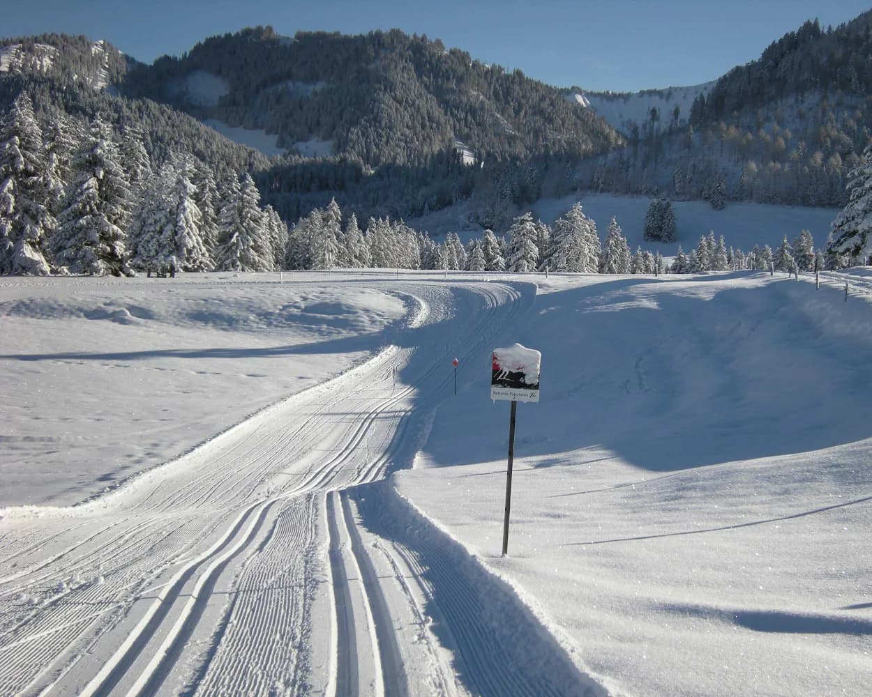
Spanning a gentle pass landscape between the Pays-d'Enhaut and the Ormonts valley, this area features rolling terrain across open moorland and light forests. The broad, undulating high plateau creates a serene setting favored by cross-country enthusiasts.
6.5kmLearn more on
snow.myswitzerland.com
and on
schweizmobil.ch
| Montreux (08:37) | |
| IR95 (10m) | |
| Aigle (08:47) |
| Aigle (09:29) | |
| R71 (28m) | |
| Le Sépey (09:57) |
| Le Sépey, gare (10:03) | |
| 175 (14m) | |
| Les Mosses, Col des Mosses (10:17) |
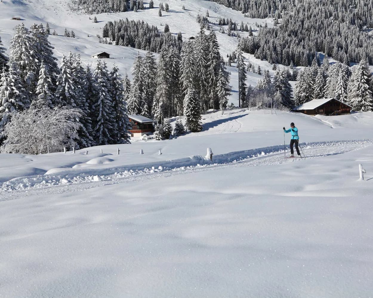
At the foot of the legendary family resort of Leysin, the cross-country ski trail in the lower part of the village is an ideal chance to exercise, enjoy the sunshine and relax and recharge in a stunning setting surrounded by spectacular mountain peaks.
6.9kmTour published by:
SwitzerlandMobility
Learn more on
snow.myswitzerland.com
and on
schweizmobil.ch
| Montreux (08:37) | |
| IR95 (10m) | |
| Aigle (08:47) |
| Aigle (09:12) | |
| R70 (22m) | |
| Leysin-Village (09:34) |
This trail is located on the closest peak to Vevey, Les Pléiades, which although not very high offers stunning views of Lake Geneva and the nearby Alps. Alternating flat sections with moderate descents and climbs through beautiful scenery.
11.6kmTour published by:
SwitzerlandMobility
Learn more on
snow.myswitzerland.com
and on
schweizmobil.ch
| Montreux (08:30) | |
| R1 (8m) | |
| Vevey (08:38) |
| Vevey (09:05) | |
| R35 (31m) | |
| Lally (09:36) |
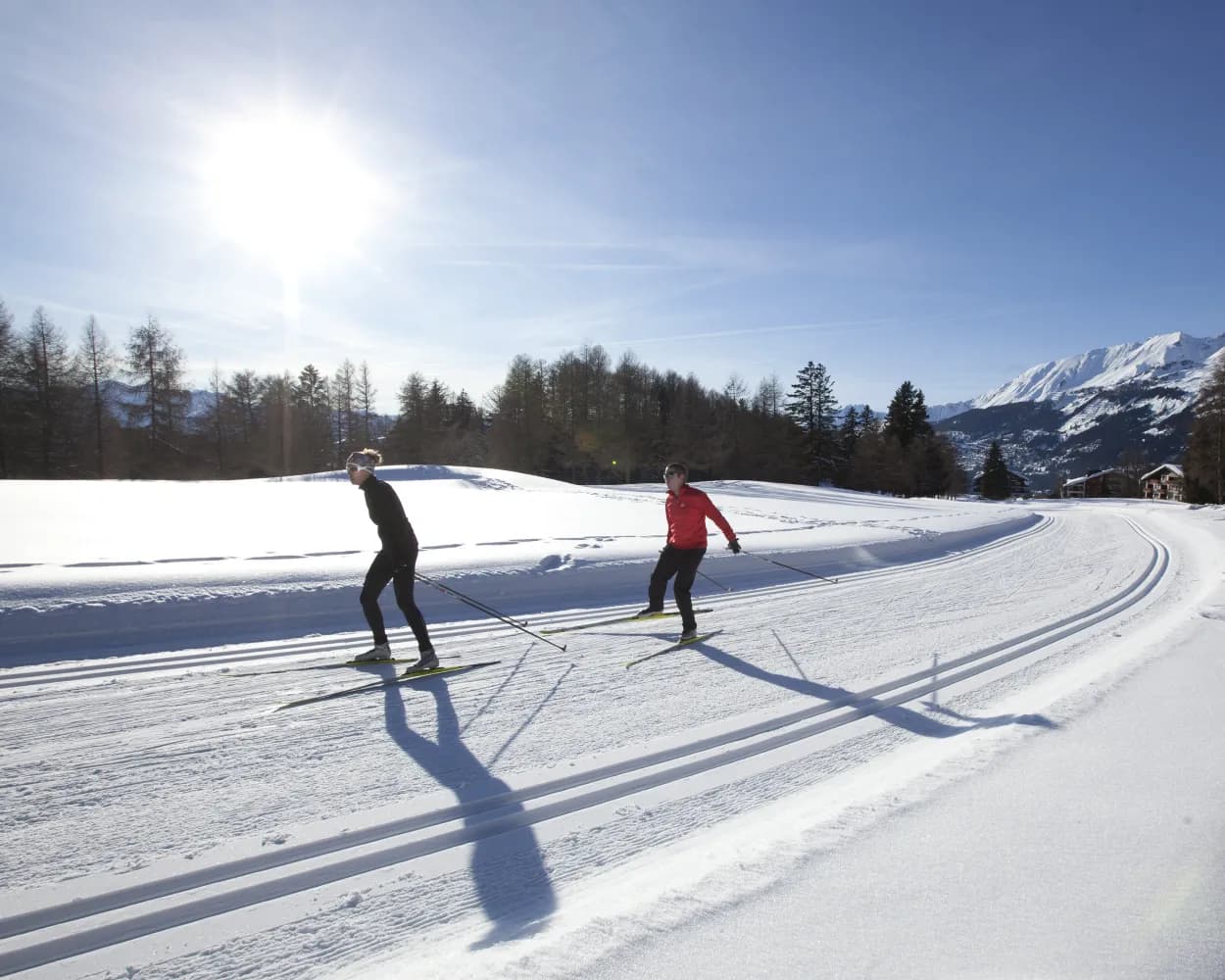
After leaving the Gstaad ski area for historic Gsteig, this cross-country trail takes you into the valley with the rushing Saane beside you. Its sunny and quiet location with its gentle gradients makes this route especially suitable for enthusiastic skiers.
14.7kmTour published by:
SwitzerlandMobility
Learn more on
schweizmobil.ch
| Montreux (08:43) | |
| 30 (1h 38m) | |
| Gstaad (10:21) |