Discover thrilling mountain bike rides accessible from Kandersteg by public transport, sorted by travel time. From scenic trails through the Spittelmatte plateau to challenging routes in the Lötschental Valley, these rides offer diverse terrains and breathtaking Alpine views.
The following mountain bike adventures are listed in order of travel time from Kandersteg. Check out the map to explore thousands of destinations and activities, reachable from any starting point in Switzerland.
Much more on ovunta.com/en/map
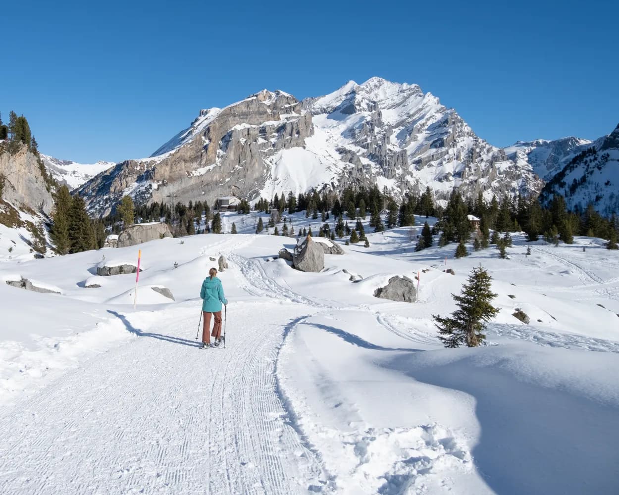
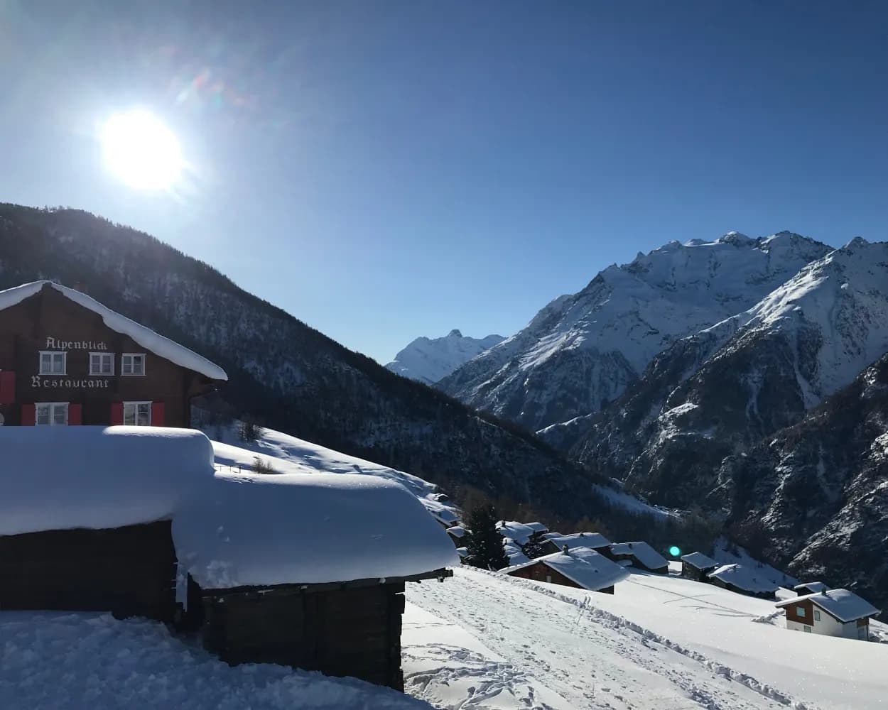
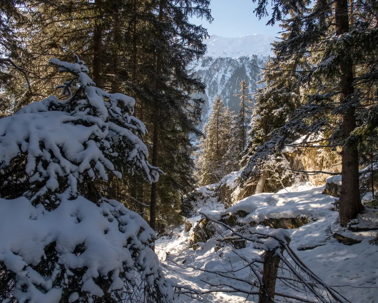
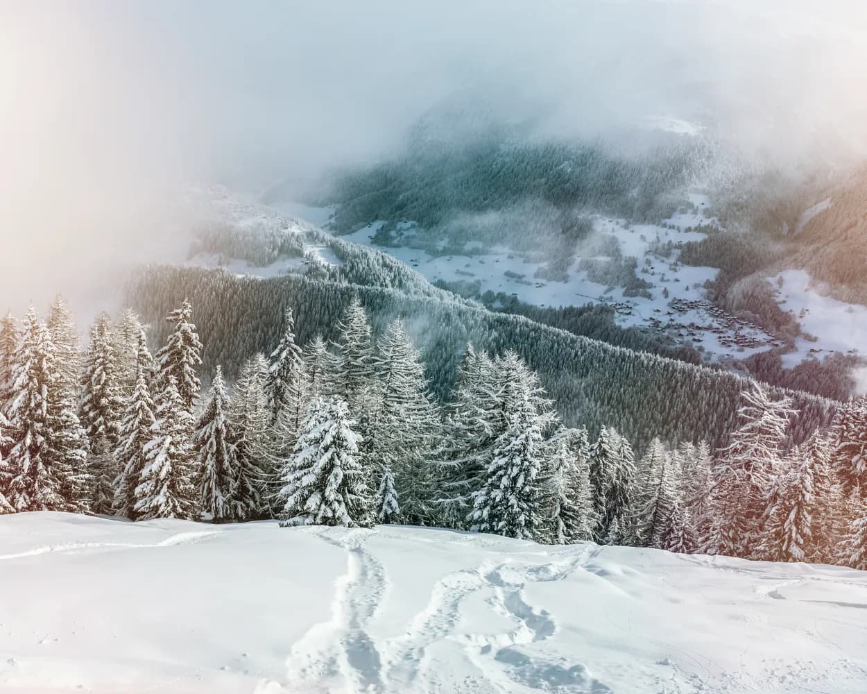
Immerse yourself in the protected plateau of Alp Spittelmatte, surrounded by a windswept winter wonderland and with views of the region's 3,000-metre peaks. Leading along the stone pine forest and the Schwarzbach river, the trail offers beginners and enthusiasts a safe and relaxing experience.
 5 km
5 km 170 m
170 m 170 m
170 m 2h 5m
2h 5m
Landscape: With panoramic views,Onto a mountain peak
Tour published by:
SwitzerlandMobility
Learn more on
schweizmobil.ch
| Kandersteg, Bahnhof (08:44) | |
| 241 (10m) | |
| Kandersteg, Talstat. Sunnbüel (08:54) |
| Kandersteg (Talst. Sunnbüel) (09:00) | |
| 2412 (8m) | |
| Sunnbüel (09:08) |
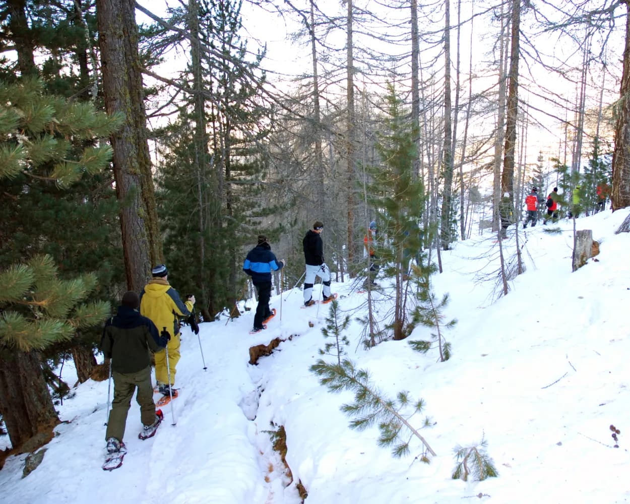
In 1957 the female citizens of Unterbäch were the first women in Switzerland to obtain the right to vote – 14 years before it was adopted nationwide. The Frauenzitate-Trail (Trail of Women’s Quotes) is dedicated to these courageous women. On the snowshoe tour from Brandalp to Unterbäch you will find a variety of quotes from world-famous women.
4 km90 m440 m1h 50mTour published by:
SwitzerlandMobility
Learn more on
schweizmobil.ch
| Kandersteg (08:41) | |
| RE1 (37m) | |
| Brig (09:18) |
| Brig (09:38) | |
| R91 (12m) | |
| Raron (09:50) |
| Raron (Talstation Unterbäch) (09:56) | |
| 2253 (8m) | |
| Unterbäch (Bergstation) (10:04) |
This snowshoe route is ideal for those in search of wild nature, tranquillity and rejuvenation. Throughout the route there are panoramic views of the Rhône Valley and the chain of 4000m-high mountains known as the «Imperial Crown».
8 km400 m400 m3h 45mLandscape: With panoramic views,Through a Swiss Park
Tour published by:
SwitzerlandMobility
Learn more on
schweizmobil.ch
| Kandersteg (08:41) | |
| RE1 (11m) | |
| Goppenstein (08:52) |
| Goppenstein, Bahnhof (08:55) | |
| 591 (20m) | |
| Gampel-Steg, Bahnhof (09:15) |
| Gampel-Steg (09:21) | |
| R91 (15m) | |
| Sierre/Siders (09:36) |
| Sierre/Siders (funi) (09:44) | |
| 2225 (13m) | |
| Crans-Montana gare (09:57) |
| Crans-Montana, gare (10:02) | |
| 431 (8m) | |
| Aminona (10:10) |
The trail is not signposted. On the Heimischgarte Trail the Saas Valley shows its quiet side. The delightful snowshoe hike above Saas-Balen leads through the snow-covered “Löübinobodme” natural forest reserve with views of the breathtaking mountains and the glacier landscape.
9 km640 m580 m4h 50mTour published by:
SwitzerlandMobility
Learn more on
schweizmobil.ch
| Kandersteg (08:41) | |
| RE1 (37m) | |
| Brig (09:18) |
| Brig (09:26) | |
| IR90 (7m) | |
| Visp (09:33) |
| Visp, Bahnhof Süd (09:44) | |
| 511 (29m) | |
| Saas-Balen, Dorf (10:13) |
Past the highest football pitch in Europe and then onto winding paths leading higher and higher – after hiking through the snow-covered larch forest, snowshoe hikers will reach the top of the route with wonderful views of the Bietschhorn, Aletschhorn and Finsteraarhorn.
4 km220 m220 m2h 0mTour published by:
SwitzerlandMobility
Learn more on
schweizmobil.ch

Between the hamlet of Rischinen and Aletschbord, you’ll experience nature at its most beautiful – via the hamlet of Egga with views into the valley, the trail continues until Holzji and the observation post. Once at Aletschbord, you can gaze in wonder at several four-thousand-metre peaks and the Great Aletsch Glacier.
7 km70 m840 m3h 0mTour published by:
SwitzerlandMobility
Learn more on
schweizmobil.ch
Starting from Blatten valley station, this short and easy trail takes you through the snow-covered Rischinu Forest. The trail initially passes through hilly landscapes in the direction of the Gibidum dam. It’s worth a detour for the views alone.
4 km240 m240 m2h 5mTour published by:
SwitzerlandMobility
Learn more on
schweizmobil.ch
| Kandersteg (08:41) | |
| RE1 (37m) | |
| Brig (09:18) |
| Brig, Bahnhof (09:48) | |
| 624 (22m) | |
| Blatten b. Naters,Luftseilbahn (10:10) |
A snowshoe experience at a height of over 2,000 metres above sea level: the trail leads through the mountain pastures of Gspon, offering virtually uninterrupted views of the village and imposing mountain landscapes. To cap it off, the route goes past Europe’s highest football stadium.
3 km200 m200 m1h 45mTour published by:
SwitzerlandMobility
Learn more on
schweizmobil.ch
| Kandersteg (08:41) | |
| RE1 (37m) | |
| Brig (09:18) |
| Brig (09:26) | |
| IR90 (7m) | |
| Visp (09:33) |
| Visp (09:37) | |
| R42 (12m) | |
| Stalden-Saas (09:49) |
| Stalden-Saas (Talstation) (09:55) | |
| 2270 (7m) | |
| Staldenried (10:02) |
| Staldenried (10:10) | |
| 2271 (6m) | |
| Gspon (Bergstation) (10:16) |
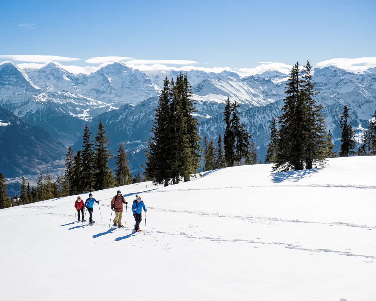
A snowshoe trek through unspoilt nature beckons below the Niederhorn, between gnarled Swiss stone pines, open meadows and sunny slopes. The backdrop with views over Lake Thun and the peaks of the Bernese Oberland will amaze you.
11 km440 m800 m5h 0mTour published by:
SwitzerlandMobility
Learn more on
schweizmobil.ch
| Kandersteg (09:14) | |
| RE1 (30m) | |
| Spiez (09:44) |
| Spiez (10:06) | |
| RE9 (15m) | |
| Interlaken West (10:21) |
| Interlaken West, Bahnhof (10:35) | |
| 101 (18m) | |
| Beatenberg, Waldegg (10:53) |
You’re sure to feel in perfect harmony with nature during this snowshoe experience in the region of Aletsch Arena. Over the course of the hike you will climb up through forests with snow-covered trees and along the Heimatt trail until you reach Fiescheralp.
5 km1100 m4h 40mTour published by:
SwitzerlandMobility
Learn more on
schweizmobil.ch
| Kandersteg (08:41) | |
| RE1 (37m) | |
| Brig (09:18) |
| Brig Bahnhofplatz (09:48) | |
| R42 (32m) | |
| Fiesch Feriendorf (10:20) |