Discover the natural wonders around Lauterbrunnen, all easily accessible by public transport. From the iconic Via Alpina trail starting right in town to the panoramic Lauberhorn Trail with views of the Eiger, Mönch, and Jungfrau, these hikes showcase the region's diverse landscapes. Explore lush meadows, dramatic waterfalls, and high alpine paths that wind through some of Switzerland's most breathtaking scenery.
The following hikes are sorted by travel time from Lauterbrunnen, making it simple to plan your adventure. Check out the map to explore thousands of destinations and activities, reachable from any starting point in Switzerland.
Much more on ovunta.com/en/map
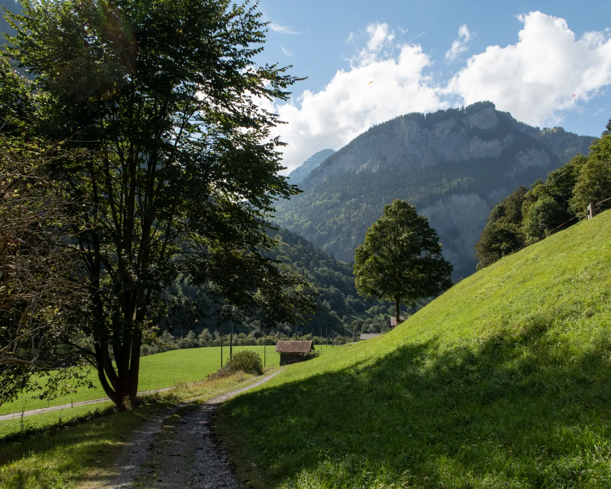
From Isenflue, the old mule track runs down steeply through wild mountain forest to Zweilütschinen. After Gündlischwand, up to the other side of the U-shaped Lauterbrunnen Valley. The path to Alp Schwand is steep and full of hairpin bends. See the view of the Oberland 4000-m-high peaks, then on to Schynige Platte.
 10 km
10 km 1350 m
 480 m
480 m 5h 0m
5h 0mTour published by:
SwitzerlandMobility
Learn more on
schweizmobil.ch
The Via Berna presents a cross-section of the diverse canton of Bern. From the gentle hills on the edge of the Franches-Montagnes, it crosses the highest Jura fold. Along the Aare to Lake Thun, across several Alpine passes and on mountain trails with incredible views, you can reach Susten Pass in 20 stages.
305 km13700 m12400 mTour published by:
SwitzerlandMobility
Learn more on
schweizmobil.ch
| Lauterbrunnen (08:31) | |
| R62 (9m) | |
| Zweilütschinen (08:40) |
The Via Alpina crosses 14 of the most beautiful Alpine passes. Straight through seven Swiss cantons with a vast variety of culture, geology and topography. Wide roads end in high ridge trails. The route is lined with one of the world’s most diverse variety of flora and fauna.
390 km23500 m24800 m
Landscape: Onto a mountain peak,Over a pass,With panoramic views
Tour published by:
SwitzerlandMobility
Learn more on
schweizmobil.ch
| Lauterbrunnen (08:30) | |
| 63 (11m) | |
| Wengen (08:41) |
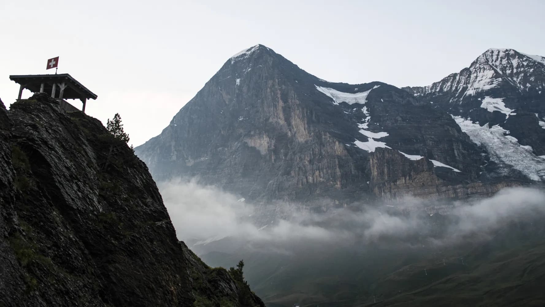
The climb to Kleine Scheidegg over undulating meadows is gentle, the rock and ice scenery of the Eiger North Wall close and awe-inspiring. Sunny high-level trail to Wengen, then deep into the Lauterbrunnen Valley with its vertical walls and spectacular waterfalls.
20 km1150 m1400 m6h 40mLandscape: With panoramic views
Tour published by:
SwitzerlandMobility
Learn more on
schweizmobil.ch
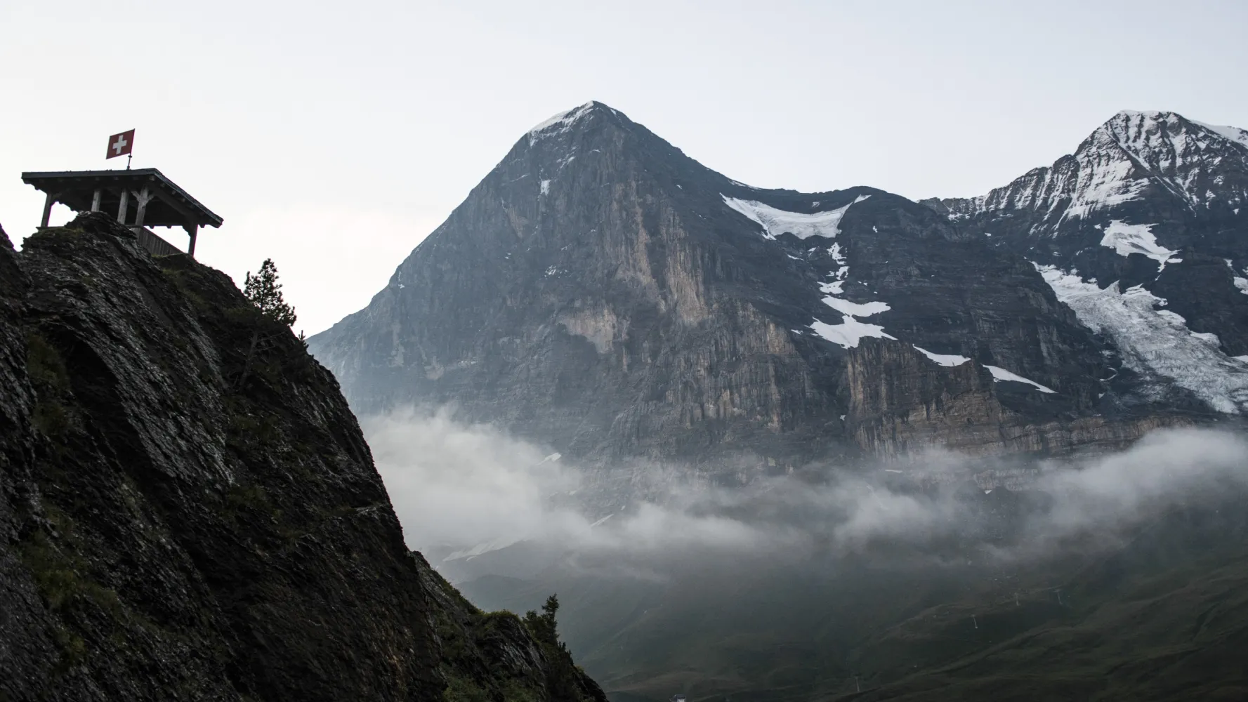
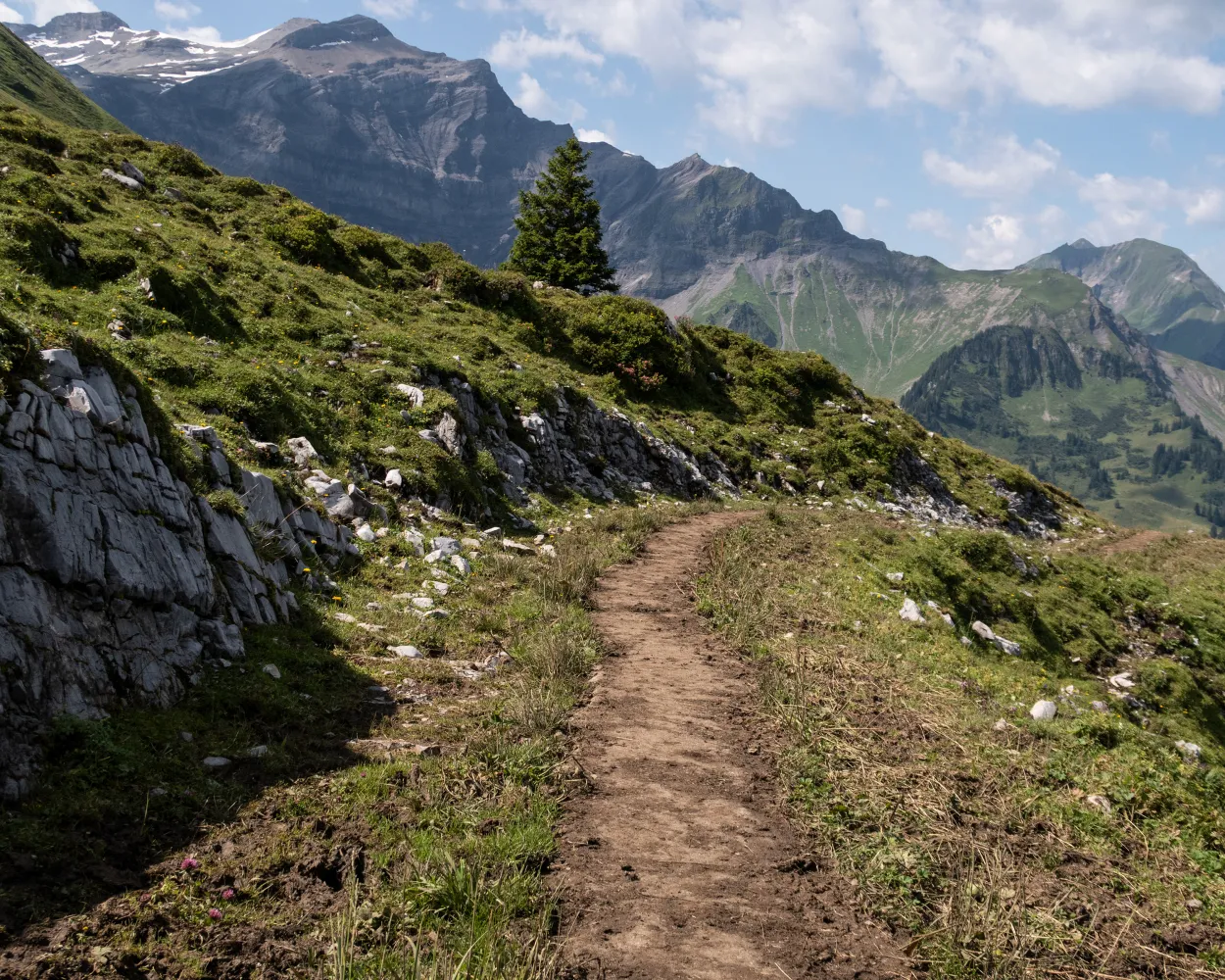
Follow the route of the legendary Lauberhorn downhill ski race in the opposite direction in summer. Discover just how high the Hundschopf jump is and how steep the pistes actually are. The views of the Eiger, Mönch & Jungfrau are absolutely unbeatable.
6 km820 m260 m2h 50mLandscape: With panoramic views
Tour published by:
SwitzerlandMobility
Learn more on
schweizmobil.ch
| Lauterbrunnen (08:30) | |
| 63 (21m) | |
| Allmend (08:51) |
The ViaJacobi leads from the Bodensee to Genève as part of the European Jakobsweg (Route of St. James). Lined by churches, monasteries and chapels, it offers a fabulous hiking experience along historic paths through a diverse cultural landscape.
450 km11900 m11800 mLandscape: With panoramic views
Tour published by:
SwitzerlandMobility
Learn more on
schweizmobil.ch
| Lauterbrunnen (08:31) | |
| R62 (23m) | |
| Interlaken Ost (08:54) |

Brünig boasts views of an impressive mountain panorama, featuring the high peaks of the Bernese Oberland and snow all year round. The route crosses sunny valley slopes above the shimmering turquoise waters of Lake Brienz, surrounding you with extraordinarily beautiful scenery.
30 km860 m1300 m8h 15mLandscape: With panoramic views,Over a pass,Along the water
Tour published by:
SwitzerlandMobility
Learn more on
schweizmobil.ch
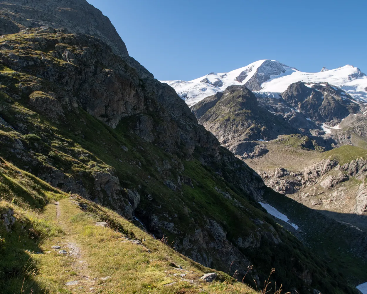
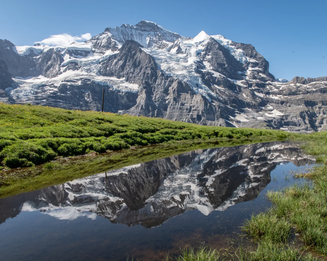
The sunny terrace of Mürren lies directly opposite the Eiger, Mönch &Jungfrau. The trail leads on via Alpine pastures, vantage points such as Bryndli and sturdy huts such as the Rotstockhütte to the Sefinenfurgge, the impressive pass into the Kiental.
22 km2000 m1400 m9h 0mLandscape: With panoramic views,Over a pass
Tour published by:
SwitzerlandMobility
Learn more on
schweizmobil.ch
| Lauterbrunnen, Bahnhof (08:35) | |
| 141 (12m) | |
| Stechelberg, Schilthornbahn (08:47) |
| Stechelberg (Schilthornbahn) (08:51) | |
| 2460 (4m) | |
| Mürren (Schilthornbahn) (08:55) |
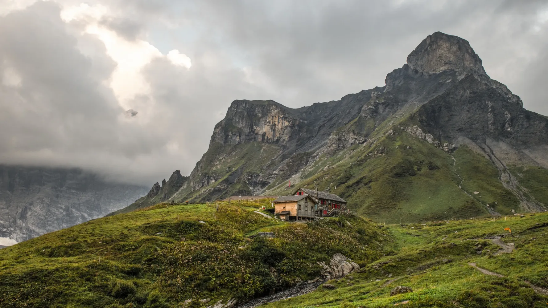
From Saxeten, you climb through the forest and later take a rocky path over two alps, up to the Tschingel mountain basin. This crosses a sloping mountain path. Past the Lobhornhüttli, steep and stony forest paths run down to Sulwald and over another steep step to Isenfluh.
13 km1100 m1100 m5h 25mTour published by:
SwitzerlandMobility
Learn more on
schweizmobil.ch
| Lauterbrunnen, Bahnhof (08:35) | |
| 142 (12m) | |
| Isenfluh, Dorf (08:47) |
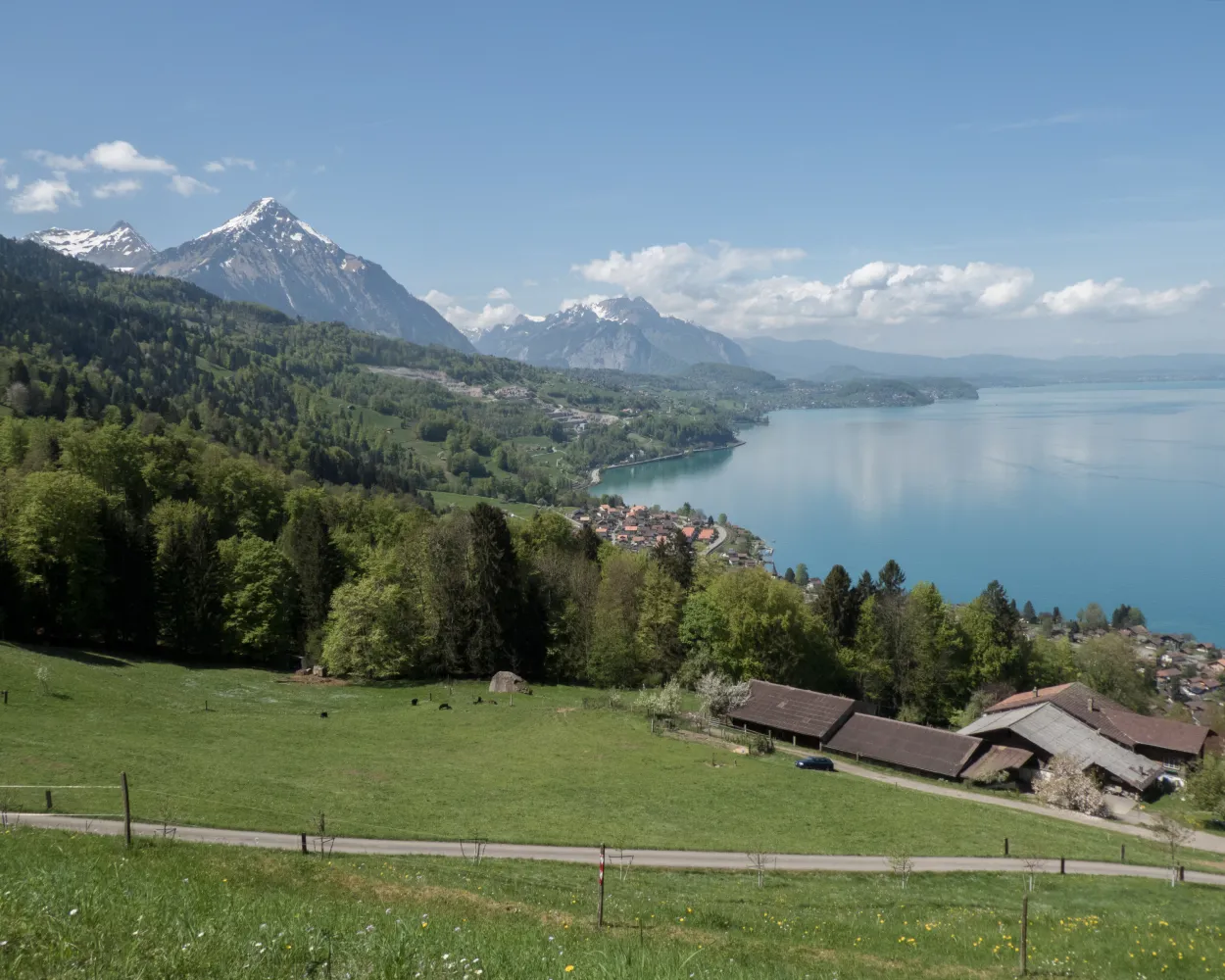
Starting in Interlaken, the hike hugs Lake Thun before continuing on via Därligen to the Meielisalp up above Leissigen. Enchanting panoramic views are provided by the suspension bridge over the Spissibach stream. Finally, the route continues past Faulensee via Krattigen. The end point for this stage is Spiez with its vineyards and castle – the latter, towering over the town, serves as its characteristic symbol.
20 km740 m740 m5h 50mLandscape: With panoramic views,Along the water,Onto an alp,Over a suspension bridge,Past castles
Tour published by:
SwitzerlandMobility
Learn more on
schweizmobil.ch
| Lauterbrunnen (08:31) | |
| R62 (23m) | |
| Interlaken Ost (08:54) |
| Interlaken Ost (08:59) | |
| IC61 (4m) | |
| Interlaken West (09:03) |


