
Scopri un mondo di bellezza alpina con queste dieci escursioni accessibili con i mezzi pubblici da Saas-Fee. Dai sentieri impegnativi ad alta quota con viste panoramiche su cime di 4.000 metri alle passeggiate pittoresche attraverso vigneti e lungo canali di irrigazione storici, ogni percorso offre una prospettiva unica sulla regione del Vallese. Che tu stia cercando un'impegnativa traversata di un passo montano o una tranquilla passeggiata attraverso affascinanti villaggi, c'è qualcosa per ogni escursionista.
Le escursioni sono elencate in ordine di tempo di viaggio da Saas-Fee, rendendo facile pianificare la tua avventura in base al tuo programma e livello di energia. Esplora la mappa per scoprire migliaia di destinazioni e attività, raggiungibili da qualsiasi punto di partenza in Svizzera.
Molto di più su ovunta.com/it/map
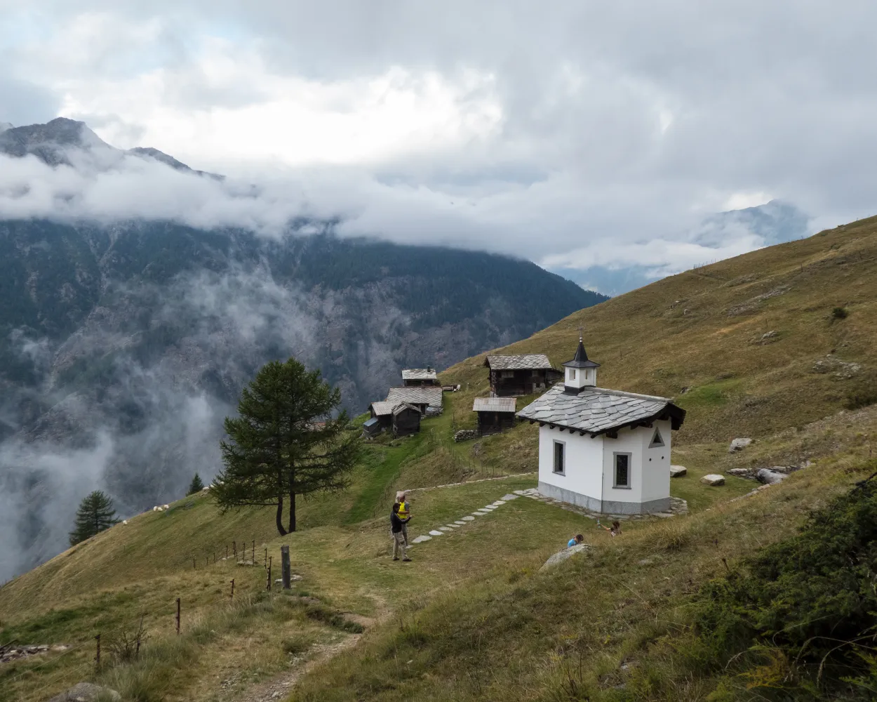
Above Saas-Balen, the Rittmal bisse winds its way discreetly from the Fellbach to the meadows of Rittmal. From the village, take the path towards Rittmal/Tewaldji until reaching a junction above the Rittmal house. This is where the Rittmal bisse trail, known as the ‘Wasserleitu’, begins. Following the gentle murmur of the water, the trail crosses a sparse forest to the north. A clearing reveals a rocky promontory with a breathtaking view towards the Mittaghorn and Allalin to the south-west. After a few minutes' walk, the meadows and chalets of the Unneri Brend mountain pasture come into view through the trees. Shortly after crossing the Fellbach, the path begins its final ascent. From here, the view opens up to the village of Saas-Balen, nestled in the valley. From Lengflüe, the highest point of the hike, descend via the road and path that pass through Matt and Grundbiele towards Saas-Balen. The hike finishes on a high note with the impressive waterfall at the end.
 7.6 km
 483 m
483 m 2h 24m
Difficoltá: Media

Paesaggio: Lungo un canale d'irrigazione,Lungo l'acqua
Learn more on
valais.ch
and on
saas-fee.ch
| Saas-Fee, Busterminal (08:50) | |
| 511 (11m) | |
| Saas-Balen, Edelweiss (09:01) |
Discover various cultural and historical buildings up close along this “bisse trail”, such as the new bridge over the Almagellerbach stream, the old "Heuwete" water conduit and the "Moosgufer" waterway. The Sentier du bisse starts at the bottom station of the Saas-Almagell chairlift and leads in a north-easterly direction. For the first third, follow the trail signs to "Zum Berg" through the Spisswald forest to the Almagellerbach, where the bridge is located. From here the path continues below Moosgufer to "Weiler zum Moos", and then over the valley road to Saas-Grund via the "Unter den Bodmen", "Zer Brigge" and "Ze Laubinu" villages. The path ends in the "Gasse" section located near the Place de la Poste in Saas-Grund.
6.2 km254 m1h 55mDifficoltá:
Paesaggio: Lungo l'acqua,Lungo un canale d'irrigazione
Learn more on
valais.ch
and on
saas-fee.ch
| Saas-Fee, Busterminal (08:48) | |
| 642 (5m) | |
| Saas-Grund, Post (08:53) |
| Saas-Grund, Post (09:00) | |
| 513 (3m) | |
| Saas-Grund, untere Brücke (09:03) |
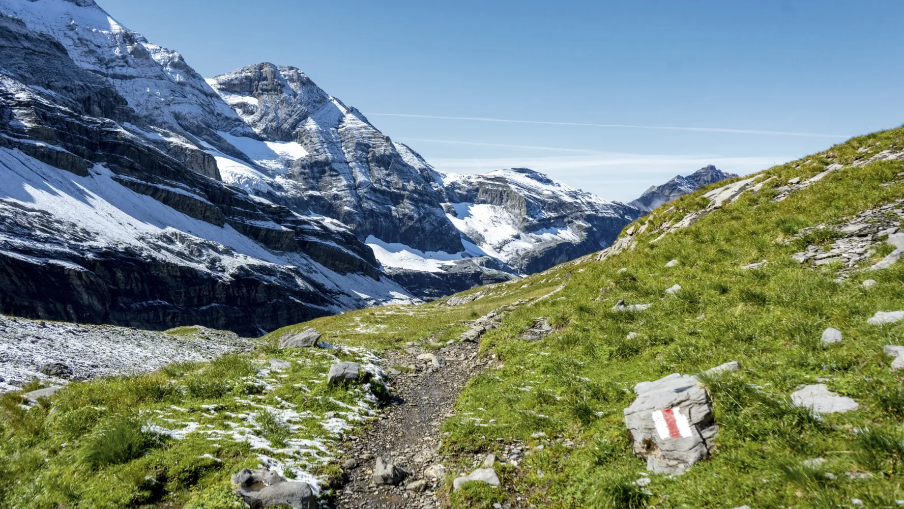
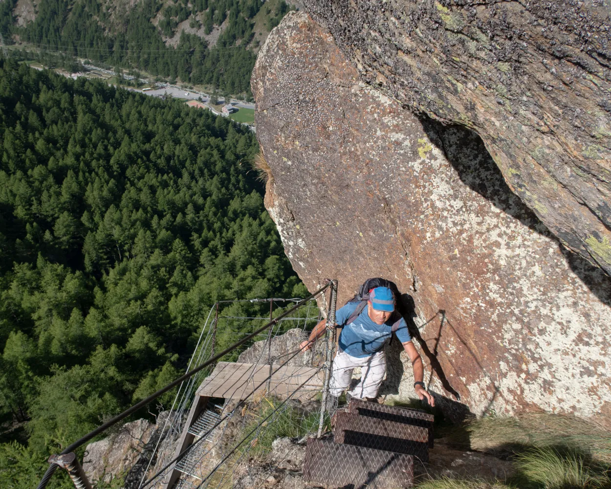
This exhilarating hike offers a thrilling combination of breathtaking views, pristine nature and high adventure. Add atmospheric mountain restaurants at the start, middle and finish, and you have the ingredients for an unforgettable day out. The hike starts at Kreuzboden by the gondola station, lake and adventure playground. The first half of the route leads at high level (between 2,400 m and 2,520 m) southwards along the Saastal valley. The views of the glaciated Mischabel massif – which culminates in the Dom (4,545 m), the highest mountain entirely within Switzerland – are bewitching. As the trail rounds the Triftgrätji ridge, hikers enjoy perhaps the finest view of all: up and down the whole valley, to the Mattmark reservoir and beyond. This initial stretch of trail as far as Triftgrätji also forms the first part of the alpine flower trail (from Kreuzboden to Saas-Grund), which showcases about 240 species of flower including edelweiss and gentian. Beyond the ridge, the trail continues south before turning east to descend into a side valley, the wild Almagellertal: expect pristine nature and blissful tranquillity. The mountain hotel framed by flower-filled pastures offers an ideal refreshment stop. Our route leads downstream before turning south again for the hike’s grand finale: the Almagell adventure trail. This leads across the steep, rocky slopes of the Almagellerhorn, and features exposed rock passages secured with hand-holds, rails and nets. Hikers need a sure foot and a good head for heights. After two suspension footbridges, 45 m and 60 m long, the trail finishes in grand style with a nearly vertical path down the rock face. Highlights: High-altitude trail with spectacular views of the Saastal valley and its glaciated peaks Alpine flowers, pristine nature Adventure trail with two giddy suspension footbridges
11.07 km202 m 931 m3h 15m
| Saas-Fee, Busterminal (08:48) | |
| 642 (5m) | |
| Saas-Grund, Post (08:53) |
| Saas-Grund, Post (09:00) | |
| 513 (7m) | |
| Saas-Almagell, Dorfplatz (09:07) |
From Saas-Almagell, the trail leads in the direction of the Mattmark dam before turning left at the Zermeiggern equalisation basin up to the Furggtäli. The ascent initially takes place in serpentines through the larch forest before the lonely Furggtal valley opens up and the trail climbs steadily towards the Antrona Pass. The easy trail becomes increasingly rocky and technical. At the Antrona Pass, you reach the Swiss-Italian border and a spectacular view of Italy opens up. The trail leads exposed around the Jazzihorn, here it gets technical and caution is advised. This is followed by a steep and technical downhill into the Ofental valley and down to the Mattmark reservoir, where a large crowd can be expected for the first time. The trail follows along the turquoise-blue water to the dam wall, where the downhill back to Saas-Almagell begins.
23.65 km1463 m1463 m5h 30m
Altitudine massima: 3087m

Altitudine minima: 1672m
Difficoltá: Difficile
Learn more on
valais.ch
| Saas-Fee, Busterminal (08:48) | |
| 642 (5m) | |
| Saas-Grund, Post (08:53) |
| Saas-Grund, Post (09:00) | |
| 513 (9m) | |
| Saas-Almagell, Sportplatz (09:09) |
The ibex is the emblematic animal of the Alps: a wild goat famous for the magnificent long, curved horns carried by adult males. These superb climbers favour steep, rough terrain at high altitude. Hikers who keep their eyes open and tread carefully have good chances of spotting these animals along the first half of the hike, above the treeline – and even of taking photographs close up. Our hike begins with a ride by gondola from Saas-Fee to Hannig, followed by a steep, zig-zag climb up the slopes of the Mällig. This leads past old avalanche defences, an ancient glacier moraine and across rocky terrain to the mountain’s four mini-peaks. These reveal glorious views of the Saastal valley and the circus of 4,000-metre summits that frame Saas-Fee – including the glaciated Mischabel massif with the Dom (4,545 m), the highest peak located entirely within Switzerland. The trail continues climbing the ridge beyond to reach the highest point of the hike, just above 2,750 m. Here it turns north-east, initially following the high ridge of the Senggflüe before zig-zagging down through boulder-strewn slopes to the treeline and through the upper limits of the Alpine forest. Soon after, the path reaches a junction with the high trail along the western slopes of the Saastal valley from Grächen to Saas-Fee. Here, our route turns right, following the high trail southwards through pine forest. The contrast with the exposed, rocky slopes higher up is dramatic: now the trail leads through shady glades, where the pine-scented air is decorated with filigree threads of bird song. Eventually our path reaches the first chalets of Saas-Fee before leading into the resort’s historical heart. Highlights: Hike of two contrasting halves: stony, panoramic high-altitude terrain, then fragrant pine forest Scenic gondola ride to start of walk, panoramic restaurant Good wildlife-spotting opportunities: ibex and birds of prey higher up, forest life lower down
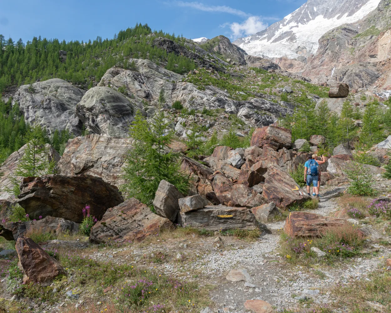
10.12 km418 m954 m4h 15mThe Chamois Trail sets off in a south/south-westerly direction from the Hannig mountain station. After a short walk, the trail splits from the main path and continues across the Torrenbach to Spissen. At the fork in the path, the trail continues along the lower path to Trift, where it then descends in short but steep zigzags down to the next turnoff. Here, hikers branch off to the right and continue along Route 10 over the Gand moraine to the Gletschersee. This peaceful and beautiful spot invites hikers to linger a while and contemplate the sheer might of this millennia-old glacier.
9.61 km149 m684 m2h 30mAltitudine massima: 2339m
Altitudine minima: 1785m
Difficoltá: Media
Learn more on
valais.ch
| Saas-Fee (Hannig) (09:00) | |
| 2306 (9m) | |
| Hannig (09:09) |
Sempre in cima senza dover scalare metri di altitudine. La tappa da Gspon a Saas-Fee è un'affascinante escursione lungo i pendii montani sopra la valle di Saas, attraverso boschi, pascoli alpini, antichi fienili e stalle con vista sui quattromila del Vallese.
17 km900 m1000 m5h 40mTour pubblicato da:
SvizzeraMobile
Learn more on
schweizmobil.ch
Il Sentiero del passi alpini riunisce in 43 tappe tanti valichi che contano fra i più belli delle Alpi grigionesi e vallesane. Un punto d'attrazione dopo l'altro, dall'altopiano della Greina ai paesaggi montani e lacustri ai piedi dei Dents du Midi.
695 km47100 m49200 mPaesaggio: Con vista panoramica,Attraverso un passo
Tour pubblicato da:
SvizzeraMobile
Learn more on
schweizmobil.ch
| Saas-Fee, Busterminal (08:48) | |
| 642 (5m) | |
| Saas-Grund, Post (08:53) |
Dall‘idillico lago Kreuzbodensee e dalla variopinta passeggiata lungo l’Alpenblumenpromenade attraverso la romantica valle di Almagell fino ad Almagelleralp, seguendo il percorso avventura fino a Furggstalden; la vita alta dell’Almagelleralp non ha paragoni in termini di varietà.
11 km300 m1050 m3h 25mPaesaggio: Con vista panoramica,Su un alpeggio
Tour pubblicato da:
SvizzeraMobile
Learn more on
schweizmobil.ch
Escursione panoramica sui fianchi del gruppo montuoso del Mischabel e lungo lo spettacolare ghiacciaio. Dalle rive del lago glaciale si procede fino al ristorante Gletschergrotte. Nel ritorno verso Saas-Fee si segue il canale d’irrigazione Bodmerwasser.
8 km180 m720 m2h 20mPaesaggio: Con vista panoramica
Tour pubblicato da:
SvizzeraMobile
Learn more on
schweizmobil.ch
Altitudine massima: 2523m
Altitudine minima: 1671m
Difficoltá: Media
Altitudine massima: 2756m
Altitudine minima: 1803m
Difficoltá: Media
Learn more on
valais.ch
Learn more on
valais.ch


