Scopri una varietà di splendide escursioni accessibili con i mezzi pubblici da Crans-Montana. Dal impegnativo Trail des Patrouilleurs alle tranquille passeggiate tra i vigneti, questi percorsi mostrano i diversi paesaggi della regione del Vallese. Esplora le vette alpine, le foreste rigogliose e i caratteristici villaggi di montagna godendo di viste panoramiche sulla Valle del Rodano e sulle Alpi circostanti.
Le seguenti escursioni sono ordinate per tempo di viaggio da Crans-Montana, rendendo facile pianificare la tua perfetta gita in montagna. Esplora la mappa per scoprire migliaia di destinazioni e attività, raggiungibili da qualsiasi punto di partenza in Svizzera.
Molto di più su ovunta.com/it/map
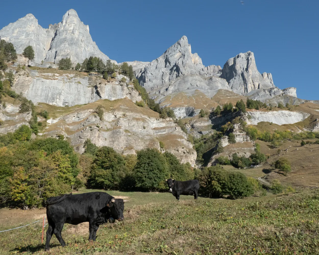
Crans-Montana celebrated its 100th birthday in 1993 with a delightful gift for all its guests: the «Promenade du 100ème» or «Centenary Walk». This gently undulating trail offers a timeless journey through the resort’s glamorous history, with fascinating information panels en route. Located at 1,500 m on a spacious, sunny plateau, Crans-Montana has charmed visitors from its earliest days with magnificent views of snow-capped peaks from the Matterhorn to Mont Blanc. Today, the superb summer and winter sports facilities, gourmet restaurants, seductive shopping, five swimming lakes, a vast network of footpaths and coveted «Family Destination» status draw visitors from all over the world. Our trail begins beside the greens of the Crans-sur-Sierre Golf Club, home of the Omega European Masters – and without doubt the most spectacular venue on the whole European tour. The itinerary leads eastwards to the historical heart of the resort. Overlooking the sparkling waters of the Etang du Grenon, the Bella Lui is a gem of modernist architecture: built in 1930 as a luxury sanatorium, it was recently converted into a youth hostel. Our route continues into the delightful Ycoor park. This was a favourite haunt of the New Zealand writer Katherine Mansfield, who stayed in the resort for several months in 1921 and 1922 and wrote some of her most famous stories here. The hill to the right, Colline du Parc, marks the site of the resort’s first hotel. Further east, our trail passes the end of ski slopes that made sporting history: at the World Championships in 1987, Switzerland won its best-ever haul of medals, including 8 of the 10 golds up for grabs. From here, the final stretch of trail leads through fragrant pine forests and alpine pastures to Aminona. Highlights: Variety: parks, forest, lakes, shopping, architecture and history Two of the world’s most iconic sporting venues: legends of ski and golf Chic alpine town or authentic mountain village? Walk gives a taste of both
 8.83 km
 260 m
260 m 196 m
196 m 2h 30m
| Crans-Montana, gare (09:02) | |
| 431 (2m) | |
| Crans-Montana, Lucernois (09:04) |
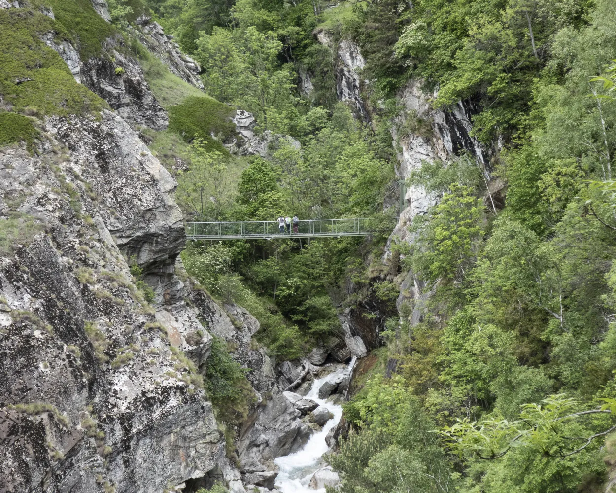
The Bisse du Tsittoret, which was mentioned in the 15th century, carries water from the Tièche to the Noble Contrée region where it is used to irrigate the meadows and vineyards of Venthône, Randogne, Mollens, Miège, Sierre and Veyras. Shortly after its water intake, the bisse forms a turbulent waterfall as it drops over a rock wall, as if it were trying to rejoin the river. Once the waters have been tamed again, they flow through metal conduits leading out of the Raspille valley.
10.7 km350 m3h 25m
Difficoltá: Media

Paesaggio: Lungo un canale d'irrigazione,Lungo l'acqua
Learn more on
valais.ch
and on
valrando.ch
| Crans-Montana, gare (08:41) | |
| 431 (4m) | |
| Crans-Montana, Ycoor (08:45) |
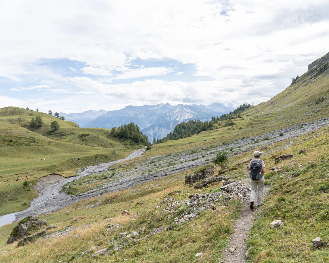
Follow the route of the famous Trail des Patrouilleurs team race (15 km course), which takes you up to the Bella Lui and then the iconic Col du Pochet. Starting at the Ycoor ice rink in Montana, the loop begins with a gentle climb as far as the Lac de Chermignon. The itinerary then becomes steeper, following the course of the famous Chetzeron ski piste up to the hotel of the same name, which reveals superb views of the Rhône valley and the surrounding peaks. Continue your climb as far as Cry d’Er, and then pass via Tsa Bonna to reach the Bella Lui, at an altitude of more than 2,500 metres. From here, do a loop that allows you to climb the ladders of the Col du Pochet for a guaranteed blast of adrenalin. Head back down via the initial section of the Chetzeron piste course before traversing to access Merbé and Arnouvaz. Eventually you reach the centre of Montana after a total descent of more than 1,200 metres, having enjoyed magnificent views of the Alps along the way.
17.15 km1198 m1198 m3h 50m
Altitudine massima: 2539m

Altitudine minima: 1499m
Difficoltá: Media
Learn more on
valais.ch
The name of this hike neatly encapsulates its star attraction: panoramic views of the Rhône valley and the glittering 4,000-metre peaks on the far side. Walkers also enjoy a clear view down the Val d’Anniviers opposite, majestically framed by five 4,000-metre summits, with the Matterhorn in the background. Starting point is the Cry d’Er gondola summit station, with its popular restaurant and panoramic sun terrace. The first section of trail is roughly level, and leads to the Cabane des Violettes (2,208 m), run by a mountain guide. The traditional, seasonal Valais cuisine is simple but excellent: the Michelin-starred chef also runs one of the top gourmet restaurants in Crans-Montana. From here the trail sweeps around to the slopes of the Petit Mont Bonvin to begin its descent to Aminona where the hike ends. One of the most delightful sections follows part of the Bisse du Tsittoret, an irrigation channel built in the 15th century. This takes its water from the river La Tièche, just to the east – which downstream becomes the Raspille, linguistic border of Valais.
13.42 km500 m1240 m4h 20mAltitudine massima: 2347m
Altitudine minima: 1499m
Difficoltá: Media
Learn more on
valais.ch
| Crans-Montana, gare (09:02) | |
| 431 (8m) | |
| Aminona (09:10) |
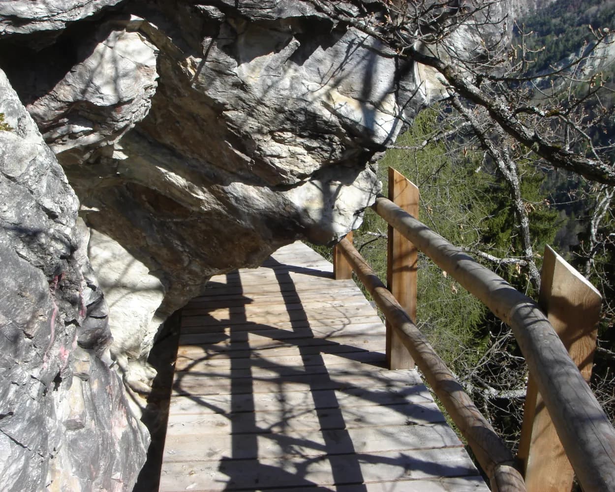
The upper section of the bisse has been replaced thanks to a tunnel leading through Mont Lachaux. This path is well developed for hikers, and the route includes spectacular sections of breathtaking beauty, passing between cliff walls where restored ruins can be seen.
12 km160 m3h 15mDifficoltá: Media
Paesaggio: Lungo l'acqua,Lungo un canale d'irrigazione
Learn more on
valais.ch
and on
valrando.ch
| Crans-Montana, gare (08:41) | |
| 431 (9m) | |
| Crans-Montana, Grand-Place (08:50) |
The challenge of the « Chemin des Contrées » is to link the districts known as the Louable & Noble Contrée (the territory which connects Sierre to the Plaine Morte) by a new route. The inhospitable areas of the Gouffre du Boup and the Echerts and Chertines forests were until now impassable. To the east, Mollens is the departure point for this hike in a bucolic landscape, which can be enjoyed almost year-round. The area previously covered by the old commune is immense – over 3,000 hectares – stretching from the Planige plateau above Miège to the Faverges, on the boundary with the canton of Bern. Along the route, different historic buildings such as the chapel, the Maison Bourgeoisiale and the communal building in Mollens allow walkers to witness the wealth of local heritage. The parish church of St-Maurice de Laques, which has Medieval origins, was once an important place of worship in the area. Walkers can therefore contemplate over 750 years of history. Further, the « Le Boup » site (a patois name which means « hole » or « ravine ») is a legacy of the glacial retreat. This amazing natural arena will delight geology fans. This mineral area transforms into an area resembling an Amazonian forest when vegetation starts growing in spring.
14.82 km268 m290 m4h 26mAltitudine massima: 1088m
Altitudine minima: 951m
Difficoltá: Media
Learn more on
valais.ch
| Crans-Montana, gare (08:40) | |
| 422 (10m) | |
| Randogne, La Côte (08:50) |
The protected area of the Pfyn Forest in the regional nature park Pfyn-Finges - one of the largest pine forests in the Alps - is a protected area of national importance. The Pfyn Forest borders one of the last wild branches of the Rhone and is home to a large number of animals and plants. Since 1997, the region has been under protection and in the 2000's, the local communities founded an association to develop soft tourism in the reserve and to establish a nature park. Since November 2005, the Pfyn Forest has been proudly named regional nature park.
11.72 km152 m66 m3h 10mAltitudine massima: 634m
Altitudine minima: 532m
Difficoltá: Media
Learn more on
valais.ch
| Crans-Montana gare (08:44) | |
| 2225 (13m) | |
| Sierre/Siders (funi) (08:57) |
Panoramico sentiero in cresta con vista sulle Alpi vallesane e sulla valle del Rodano. Tracciato molto variegato: piscine termali a Leukerbad, viadotti sulla rampa sud del Lötschberg, bisses gorgoglianti e, a Naters il Museo della Guardia Svizzera.
76 km3300 m4100 mPaesaggio: Con vista panoramica
Tour pubblicato da:
SvizzeraMobile
Learn more on
schweizmobil.ch
| Crans-Montana, gare (08:41) | |
| 431 (6m) | |
| Crans-Montana, Lac Grenon (08:47) |
Piacevole escursione da Montana lungo la Bisse du Tsittoret, superando invitanti locande alpine, fino alla valle della Tièche. Si prosegue sul versante soleggiato attraverso la Varneralp fino a Leukerbad, dove ci si può rilassare nell’acqua termale.
24 km1150 m1250 m7h 40mPaesaggio: Su un alpeggio,Con vista panoramica
Tour pubblicato da:
SvizzeraMobile
Learn more on
schweizmobil.ch
Escursione panoramica sopra Crans-Montana. L'attrazione principale è la vista spettacolare sulla catena di 4000 e sulla valle del Rodano. Una perla paesaggistica è il tratto nella valle della Tièche.
14 km520 m1250 m4h 25mPaesaggio: Con vista panoramica
Tour pubblicato da:
SvizzeraMobile
Learn more on
schweizmobil.ch
Altitudine massima: 1525m
Altitudine minima: 1425m
Difficoltá: Media
Learn more on
valais.ch


