Queste dieci destinazioni escursionistiche sono tutte raggiungibili con i mezzi pubblici da Kandersteg, offrendo una vasta gamma di esperienze alpine. Dai sentieri panoramici lungo la ferrovia del Lötschberg ai percorsi impegnativi attraverso alti passi di montagna, la zona offre viste mozzafiato su ghiacciai, laghi incontaminati e vette iconiche. Che tu stia cercando una tranquilla passeggiata attraverso prati fioriti o un'escursione avventurosa verso un rifugio di montagna, c'è qualcosa per ogni escursionista.
Le escursioni sono elencate in ordine di tempo di viaggio da Kandersteg, rendendo facile pianificare la tua prossima avventura alpina. Esplora la mappa per scoprire migliaia di destinazioni e attività, raggiungibili da qualsiasi punto di partenza in Svizzera.
Molto di più su ovunta.com/it/map
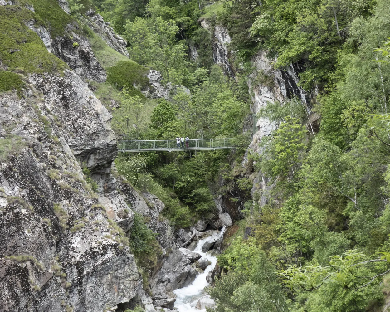
In 2005, the Commune of Niedergesteln built a suspension bridge and a metal stairway to provide an access route that is dry underfoot in order to descend below the roaring waters of the Jolibach stream to the Stägeru’s water intake at 900 m. Part of the Stägeru was channelled into the Lüegjeru, because its former intake fell victim to a storm. Reports of the Stägeru date back to 1552 and the Lüegjer was probably constructed in the 17th century.
 11.6 km
 450 m
450 m 3h 45m
Difficoltá: Media

Paesaggio: Lungo l'acqua,Lungo un canale d'irrigazione
Learn more on
valais.ch
and on
valrando.ch
| Kandersteg (08:41) | |
| RE1 (15m) | |
| Hohtenn (08:56) |
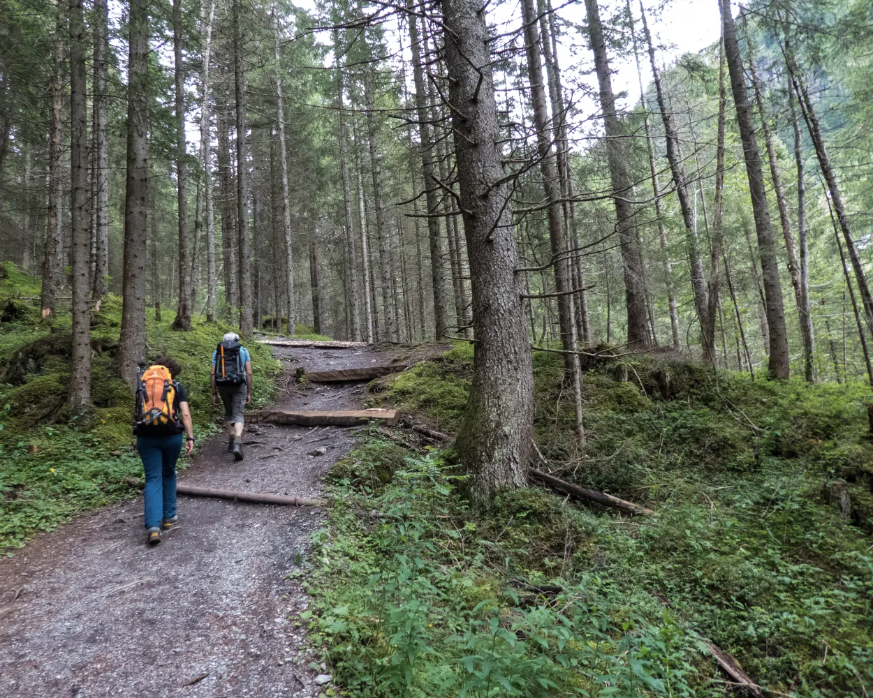
Percorso in cresta prealpino da Kiental a Kandersteg. Il percorso segue sopra la valle del Kander fra boschi e pascoli alpini; splendide vedute sui treni della ferrovia del Lötschberg che, come modellini, sfrecciano attraverso la Kandertal.
20 km1150 m 950 m6h 35m
Paesaggio: Con vista panoramica
Tour pubblicato da:
SvizzeraMobile
Learn more on
schweizmobil.ch
Quattro giorni all’insegna del divertimento nella regione del Lötschberg - fra la Kandertal e la selvaggia Gasteretal. Dopo l’attraversamento del ghiacciaio del Lötschen, classica escursione sul percorso in cresta della Lötschental.
51 km3100 m2300 mPaesaggio: Con vista panoramica,Su un alpeggio,Lungo un ghiacciaio
Tour pubblicato da:
SvizzeraMobile
Learn more on
schweizmobil.ch
| Kandersteg, Bahnhof (08:58) | |
| 230 (3m) | |
| Kandersteg, Museum (09:01) |
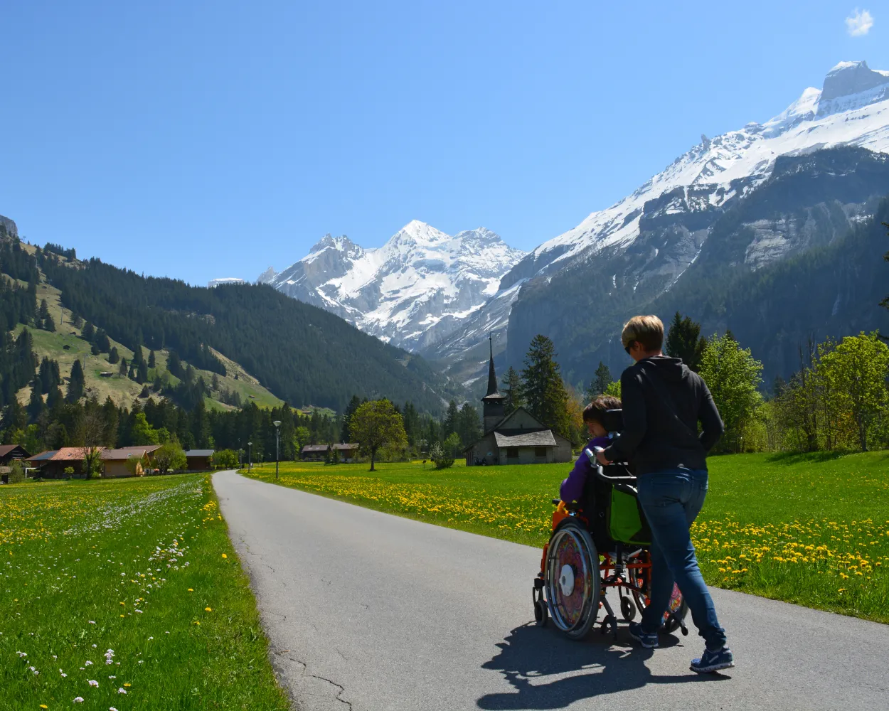
Un paese di montagna immerso in un paesaggio da favola invita a soffermarsi e a stupirsi. Accanto ai prati e lungo il Kander, il fiume che ha dato il nome a Kandersteg. Gli scorci sul paesaggio di montagna si evolvono in continuazione.
3 km40 m40 m50m
Accessibile: Si
Paesaggio: Lungo l'acqua
Tour pubblicato da:
SvizzeraMobile
Learn more on
schweizmobil.ch
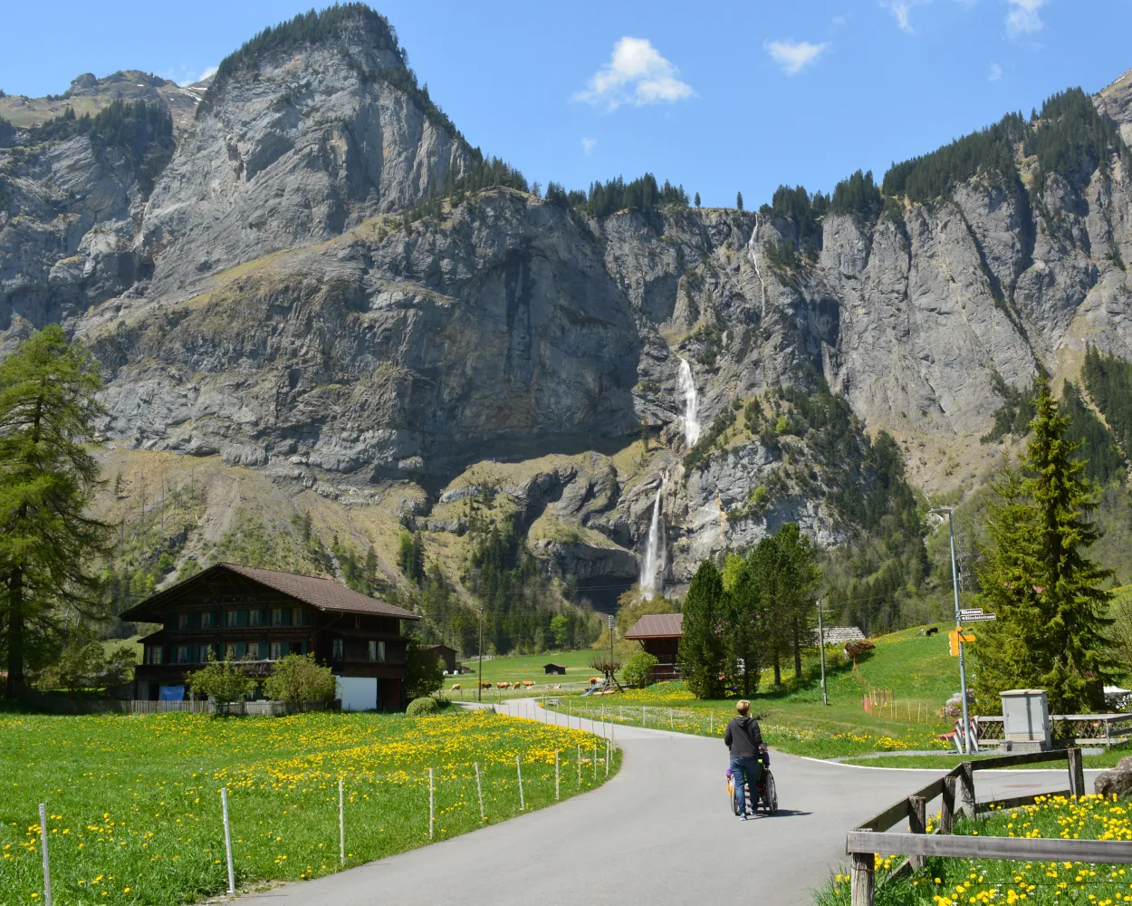
Questo sentiero molto frequentato lungo il fiume Kander offre uno scorcio sull’imponente paesaggio di montagna che circonda Kandersteg. Costeggia l’International Scout Centre, case coloniche riccamente decorate e l’idilliaco Muggenseeli.
4 km30 m30 m55mAccessibile: Si
Paesaggio: Lungo l'acqua
Tour pubblicato da:
SvizzeraMobile
Learn more on
schweizmobil.ch
| Kandersteg, Bahnhof (08:44) | |
| 241 (3m) | |
| Kandersteg, Ruedi Hus (08:47) |
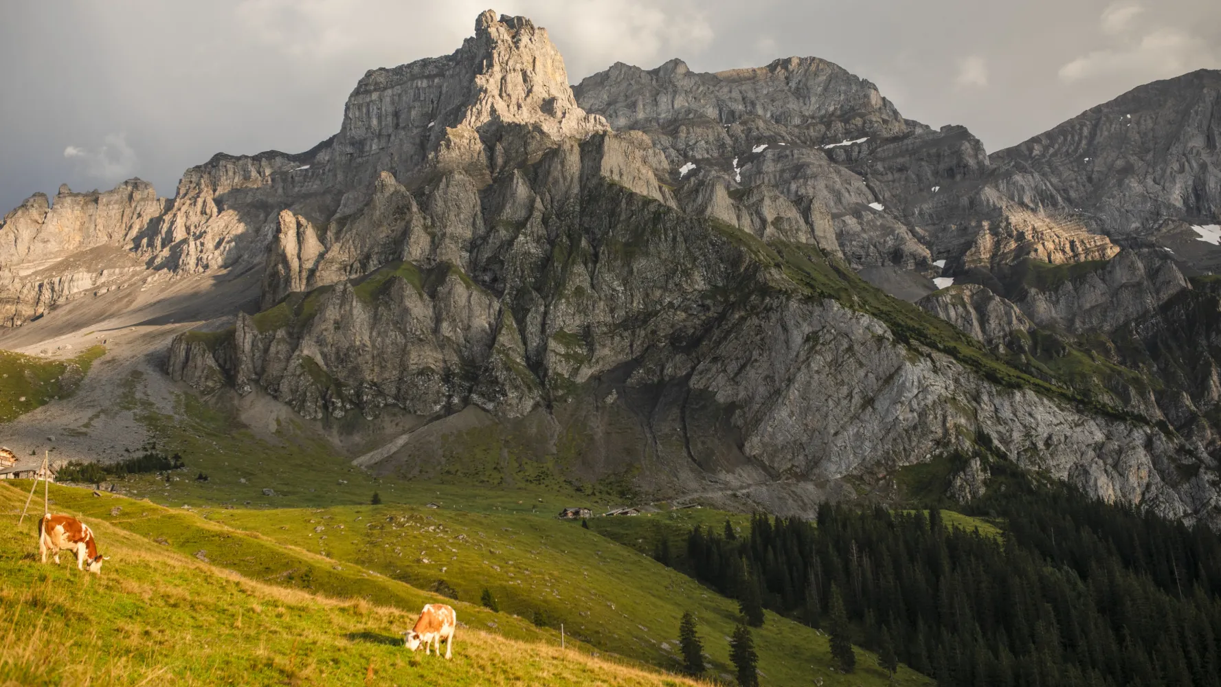
Dalle tradizionali case in legno di Kandersteg per pascoli alpini fioriti, sulle pareti rocciose del Lohner popolate di camosci. Per diversi gradini ripidi si raggiunge Bunderchrinde, il passaggio mozzafiato nella Engstligental, verso Adelboden.
16 km1400 m1250 m6h 45mPaesaggio: Con vista panoramica,Attraverso un passo
Tour pubblicato da:
SvizzeraMobile
Learn more on
schweizmobil.ch
La Via Alpina supera 14 passi fra i più belli delle Alpi. Attraversa sette cantoni svizzeri ricchi di spunti culturali, geologici e topografici. Ampie carrozzabili e ventosi sentieri di crinale. Un mondo di fauna e flora fra i più variati al mondo.
390 km23500 m24800 mPaesaggio: Con vista panoramica,Attraverso un passo,Su una vetta
Tour pubblicato da:
SvizzeraMobile
Learn more on
schweizmobil.ch
| Kandersteg, Bahnhof (08:44) | |
| 241 (4m) | |
| Kandersteg, Simplon (08:48) |
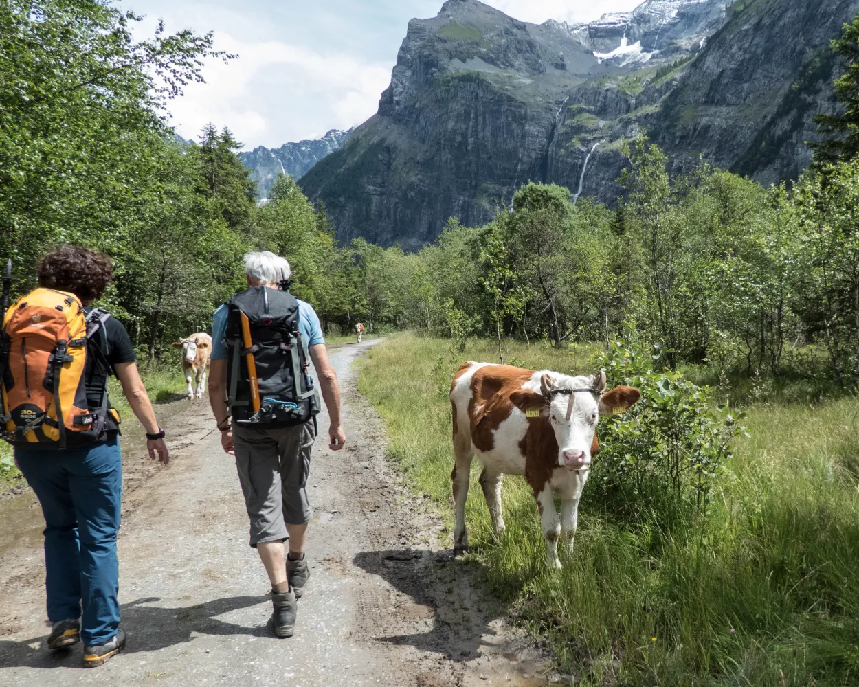
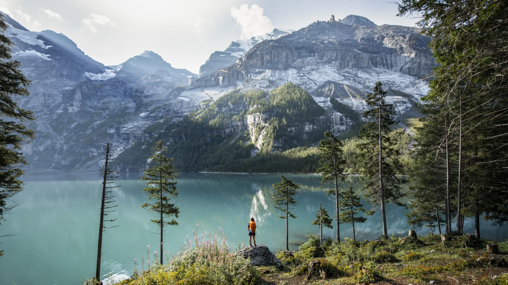
Emozionante escursione nella Gasteretal, una delle valli di alta montagna più belle delle Alpi. Incorniciata da ripide pareti rocciose, la «Junge Kander» scorre placida, diventando a tratti fragorosa. In primavera, rigogliosa e variegata flora alpina.
11 km460 m90 m3h 10mPaesaggio: Con vista panoramica,Lungo l'acqua
Tour pubblicato da:
SvizzeraMobile
Learn more on
schweizmobil.ch
| Kandersteg, Bahnhof (08:44) | |
| 241 (5m) | |
| Kandersteg, Pfadizentrum (08:49) |
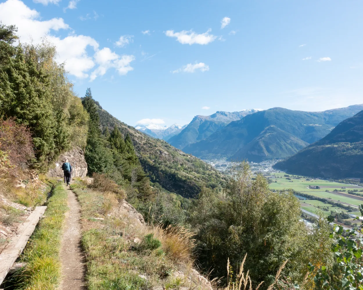
Panoramico sentiero in cresta con vista sulle Alpi vallesane e sulla valle del Rodano. Tracciato molto variegato: piscine termali a Leukerbad, viadotti sulla rampa sud del Lötschberg, bisses gorgoglianti e, a Naters il Museo della Guardia Svizzera.
76 km3300 m4100 mPaesaggio: Con vista panoramica
Tour pubblicato da:
SvizzeraMobile
Learn more on
schweizmobil.ch
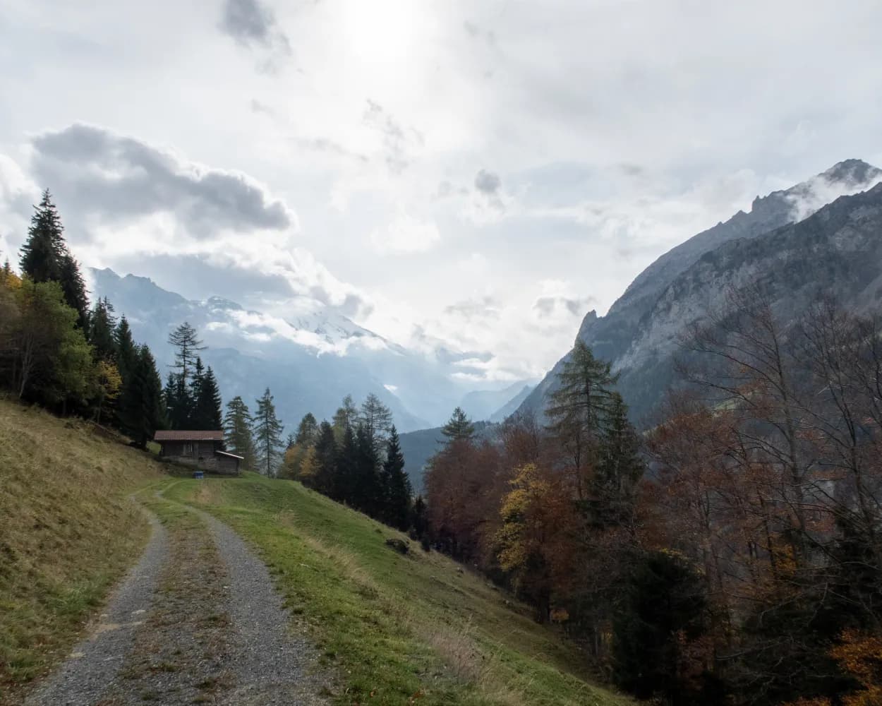
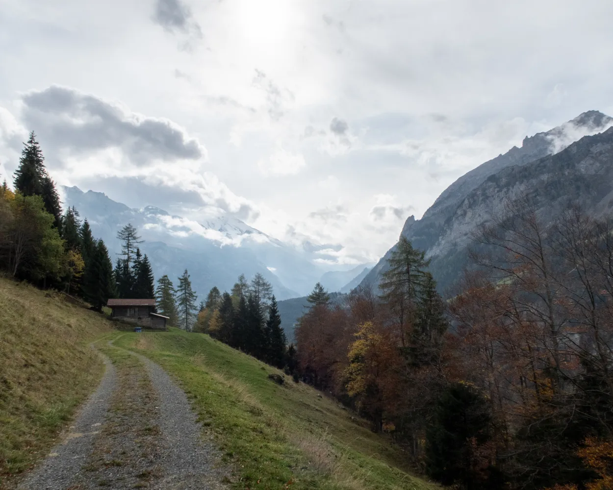
Escursione panoramica sul sentiero in cresta della rampa sud della BLS, lungo i binari della ferrovia del Lötschberg fino al sulla Bietschtal. Splendido sentiero lungo le bisses fino al ponte sospeso; bei punti panoramici presso Brägji e Riedgarten.
12 km640 m260 m3h 40mPaesaggio: Con vista panoramica
Tour pubblicato da:
SvizzeraMobile
Learn more on
schweizmobil.ch


