Logo
Blog
To the map
Blog header image

Winter Hikes from Rapperswil-Jona by public transport

Relaxed or more challenging: these winter hikes are all reachable from Rapperswil-Jona by public transport. From easy panoramic walks to longer alpine routes, there’s something for every level of winter hiker.

The destinations below are sorted by travel time from Rapperswil-Jona to make planning easier. Be sure to check the map to explore all winter hikes and thousands of other outdoor activities reachable from any starting point in Switzerland.

Much more on ovunta.com/en/map

Discover other activities close to Rapperswil-Jona

  • Cross-country skiing resorts from Rapperswil-Jona by public transport
  • Explore Swiss ski resorts from Rapperswil-Jona: Ski Areas Linked by Train and Bus
  • Snowshoeing from Rapperswil-Jona by public transport
  • Sledging runs from Rapperswil-Jona by public transport

Start from elsewhere?

  • Winter Hikes from Appenzell by public transport
  • Winter Hikes from Stans by public transport
  • Winter Hikes from Glarus by public transport
1/10

Rothenthurm-Winterwanderweg

Minimum travel time: 41m to Rothenthurm, Erste Altmatt

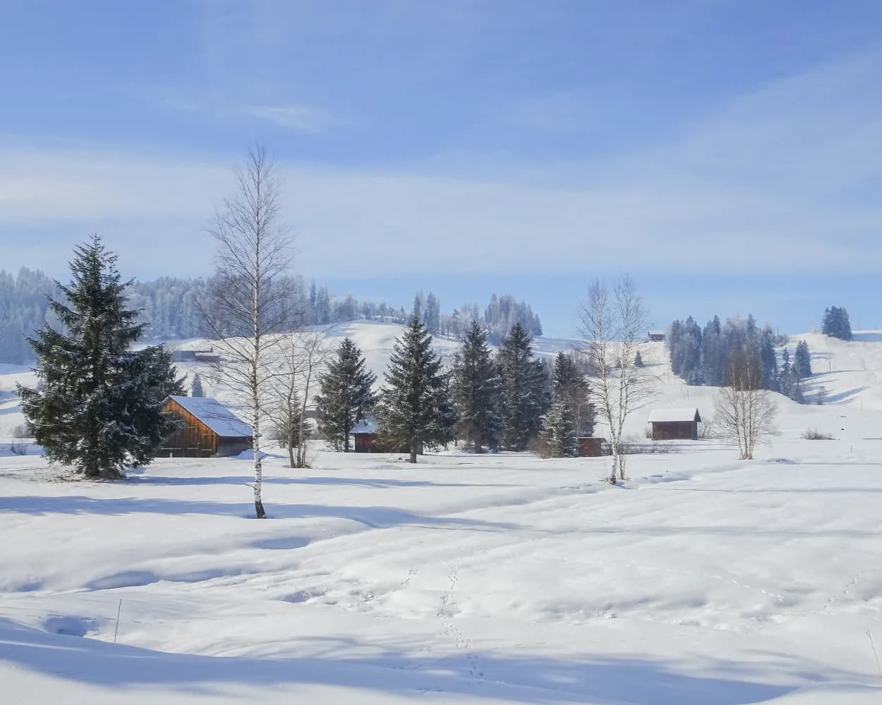
On this winter hiking trail, you can escape the fog and enjoy the mystical mood in the open landscape of the upland moor, the largest in Switzerland. It lies in a high valley where the Biber river flows in its natural bed.

dist7 km
|
asce50 m
|
desc50 m
|
dura2h 5m

    Tour published by:

    SwitzerlandMobility

    Learn more on
    schweizmobil.ch


    How to get to Rothenthurm-Winterwanderweg

    Fastest connection from Rapperswil SG to Rothenthurm, Erste Altmatt: 41m
    Rapperswil SG (08:36)
    S40 (27m)
    Biberbrugg (09:03)
    Walk from Biberbrugg to Biberbrugg, Bahnhof
    Biberbrugg, Bahnhof (09:10)
    507 (7m)
    Rothenthurm, Erste Altmatt (09:17)
    Search Connections & Buy Tickets on SBB
    2/10

    Sihlsee-Winterwanderweg

    Minimum travel time: 48m to Einsiedeln, Brüel

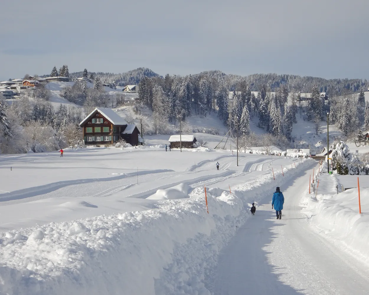
    Combining the contemplation and baroque splendour of Einsiedeln Abbey with the wintry hush and scenic beauty of Lake Sihl, this panoramic hike also offers views of the Etzel and the Ybrig mountains.

    dist8 km
    |
    asce140 m
    |
    desc140 m
    |
    dura2h 40m
    • land

      Landscape: With panoramic views,Through a Swiss Park

    Tour published by:

    SwitzerlandMobility

    Learn more on
    schweizmobil.ch


    How to get to Sihlsee-Winterwanderweg

    Fastest connection from Rapperswil SG to Einsiedeln, Brüel: 48m
    Rapperswil SG (08:36)
    S40 (36m)
    Einsiedeln (09:12)
    Walk from Einsiedeln to Einsiedeln, Bahnhof
    Einsiedeln, Bahnhof (09:22)
    554 (2m)
    Einsiedeln, Brüel (09:24)
    Search Connections & Buy Tickets on SBB
    3/10

    Winterwanderweg Wolzenalp–Nesslau

    Minimum travel time: 50m to Nesslau-Neu St. Johann

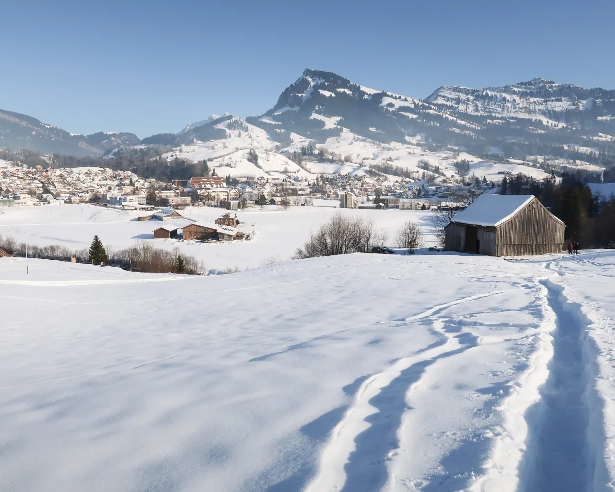
    Trudge downhill on the sunny side, through the enchanting, silent landscape of Wolzenalp. Views of the Alpstein and Toggenburg mountains are your constant companions along the groomed trail.

    dist5 km
    |
    asce60 m
    |
    desc420 m
    |
    dura1h 45m

      Tour published by:

      SwitzerlandMobility

      Learn more on
      schweizmobil.ch


      How to get to Winterwanderweg Wolzenalp–Nesslau

      Fastest connection from Rapperswil SG to Nesslau-Neu St. Johann: 50m
      Rapperswil SG (08:37)
      S4 (22m)
      Wattwil (08:59)
      Walk from Wattwil to Wattwil, Bahnhof
      Wattwil, Bahnhof (09:06)
      790 (19m)
      Nesslau-Neu St.Johann, Bahnhof (09:25)
      Walk from Nesslau-Neu St.Johann, Bahnhof to Nesslau-Neu St. Johann
      Search Connections & Buy Tickets on SBB
      4/10

      Engelstock-Rundweg

      Minimum travel time: 1h 3m to Sattel Mostelberg (Bergstat.)

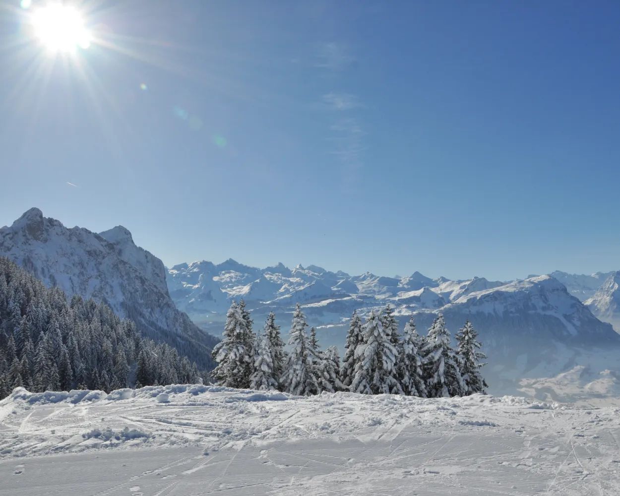
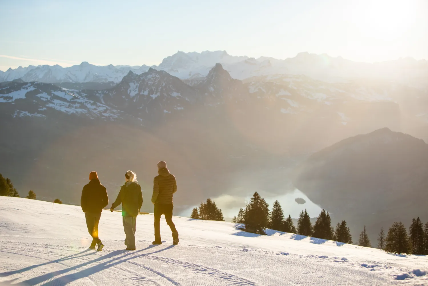
      A revolving gondola, a foot suspension bridge and a spectacular view of the Schwyz basin, the surrounding mountains and lakes – the Engelstock Circuit Trail offers a leisurely hike full of variety.

      dist5 km
      |
      asce220 m
      |
      desc220 m
      |
      dura1h 50m

        Tour published by:

        SwitzerlandMobility

        Learn more on
        schweizmobil.ch


        How to get to Engelstock-Rundweg

        Fastest connection from Rapperswil SG to Sattel Mostelberg (Bergstat.): 1h 3m
        Rapperswil SG (08:36)
        S40 (27m)
        Biberbrugg (09:03)
        Walk from Biberbrugg to Biberbrugg, Bahnhof
        Biberbrugg, Bahnhof (09:10)
        507 (18m)
        Sattel, Talstation (09:28)
        Walk from Sattel, Talstation to Sattel (Talstat. Hochstuckli)
        Sattel (Talstat. Hochstuckli) (09:31)
        GB (8m)
        Sattel Mostelberg (Bergstat.) (09:39)
        Search Connections & Buy Tickets on SBB
        5/10

        Vorder-Höhi-Weg

        Minimum travel time: 1h 4m to Arvenbüel, Arven

        This winter hike leads from the Arvenbüel through magical winter landscapes to the Vorder Höhi. It always offers impressive panoramic views: over the Toggenburg, the Alpstein, the Churfirsten and the Leistkamm.

        dist8 km
        |
        asce360 m
        |
        desc360 m
        |
        dura2h 55m
        • land

          Landscape: With panoramic views,Through a Swiss Park,Onto a mountain peak

        Tour published by:

        SwitzerlandMobility

        Learn more on
        schweizmobil.ch


        How to get to Vorder-Höhi-Weg

        Fastest connection from Rapperswil SG to Arvenbüel, Arven: 1h 4m
        Rapperswil SG (08:33)
        S6 (24m)
        Ziegelbrücke (08:57)
        Walk from Ziegelbrücke to Ziegelbrücke, Bahnhof Süd
        Ziegelbrücke, Bahnhof Süd (09:04)
        650 (33m)
        Arvenbüel, Arven (09:37)
        Search Connections & Buy Tickets on SBB
        6/10

        Hinter-Höhi-Weg

        Minimum travel time: 1h 10m to Niederschlag

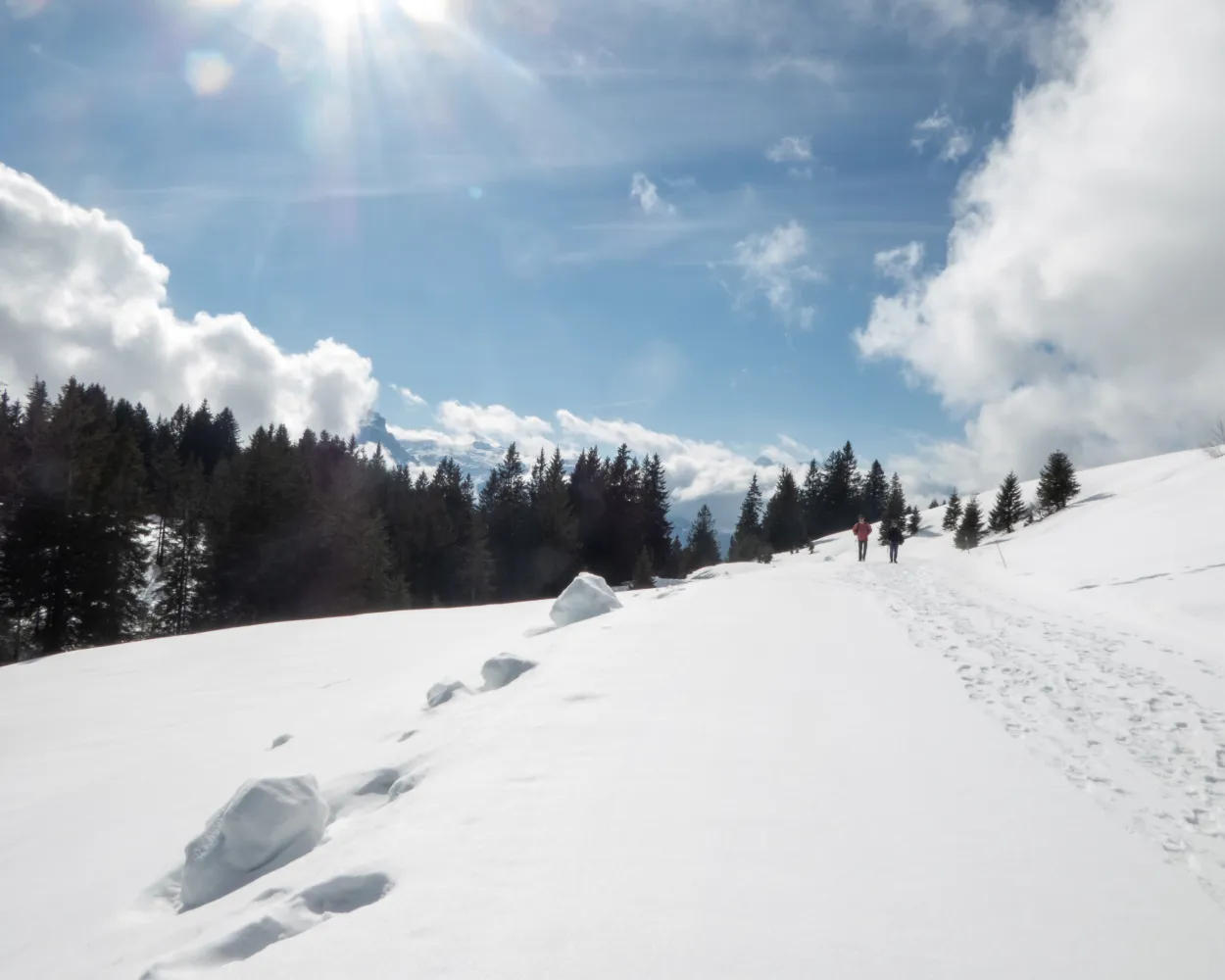
        In summer and autumn, a popular nature paradise, in winter by far the sunniest winter hiking trail – a hike to the Hinter Höhi is well worth it at any time of the year.

        dist4 km
        |
        asce160 m
        |
        desc160 m
        |
        dura1h 25m

          Tour published by:

          SwitzerlandMobility

          Learn more on
          schweizmobil.ch


          How to get to Hinter-Höhi-Weg

          Fastest connection from Rapperswil SG to Niederschlag: 1h 10m
          Rapperswil SG (08:33)
          S6 (24m)
          Ziegelbrücke (08:57)
          Walk from Ziegelbrücke to Ziegelbrücke, Bahnhof Süd
          Ziegelbrücke, Bahnhof Süd (09:04)
          650 (21m)
          Amden, Dorf (09:25)
          Walk from Amden, Dorf to Amden (Talstat. Niederschlag)
          Amden (Talstat. Niederschlag) (09:28)
          SL (15m)
          Niederschlag (09:43)
          Search Connections & Buy Tickets on SBB
          7/10

          Rigi-Panoramaweg

          Minimum travel time: 1h 15m to Rigi Scheidegg

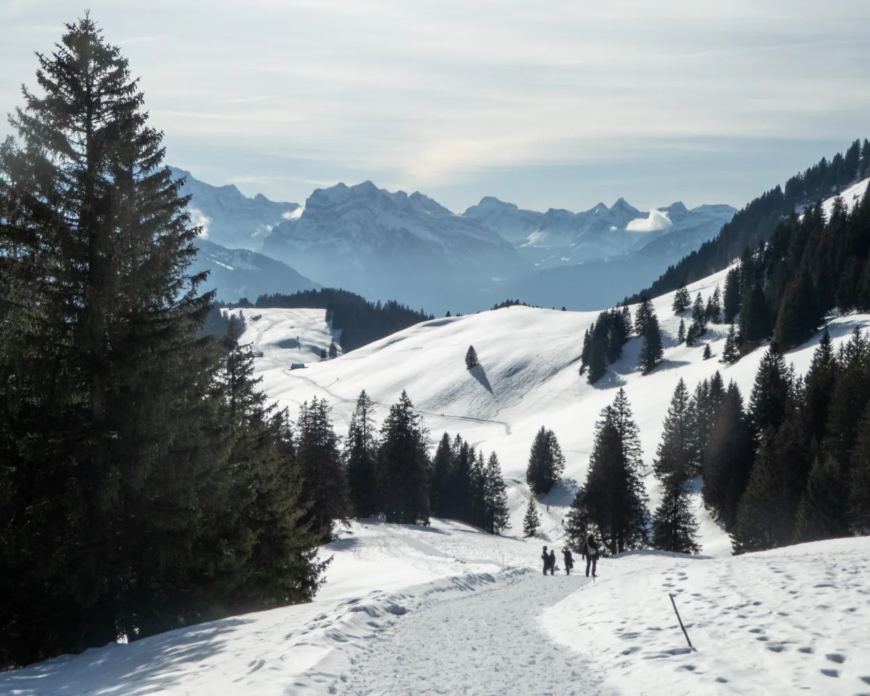
          This fascinating panorama trail follows the route of the old Rigi Scheidegg Railway on flat terrain as far as Unterstetten, then continues on a gentle incline to Rigi Scheidegg.

          dist7 km
          |
          asce220 m
          |
          desc20 m
          |
          dura2h 20m

            Tour published by:

            SwitzerlandMobility

            Learn more on
            schweizmobil.ch


            How to get to Rigi-Panoramaweg

            Fastest connection from Rapperswil SG to Rigi Scheidegg: 1h 15m
            Rapperswil SG (08:56)
            VAE (49m)
            Arth-Goldau (09:45)
            Walk from Arth-Goldau to Arth-Goldau RB
            Arth-Goldau RB (09:55)
            81 (8m)
            Kräbel (10:03)
            Walk from Kräbel to Kräbel (Talstation Scheidegg)
            Kräbel (Talstation Scheidegg) (10:05)
            PB (6m)
            Rigi Scheidegg (10:11)
            Search Connections & Buy Tickets on SBB
            8/10

            Toggenburger Sagenweg

            Minimum travel time: 1h 16m to Alp Sellamatt

            The winter hiking path over Alp Sellamatt leads through the fabulous natural landscape in the bosom of Churfirsten. The view reaches far down into Thur Valley and the sea of fog, which is in winter often spreading over the lowland. Boards at the wayside tell legends from Toggenburg.

            dist9 km
            |
            asce260 m
            |
            desc260 m
            |
            dura2h 55m

              Tour published by:

              SwitzerlandMobility

              Learn more on
              schweizmobil.ch


              How to get to Toggenburger Sagenweg

              Fastest connection from Rapperswil SG to Alp Sellamatt: 1h 16m
              Rapperswil SG (08:37)
              S4 (22m)
              Wattwil (08:59)
              Walk from Wattwil to Wattwil, Bahnhof
              Wattwil, Bahnhof (09:06)
              790 (33m)
              Alt St. Johann, Dorf (09:39)
              Walk from Alt St. Johann, Dorf to Alt St. Johann (Sellamattbahn)
              Alt St. Johann (Sellamattbahn) (09:46)
              2765 (7m)
              Alp Sellamatt (09:53)
              Search Connections & Buy Tickets on SBB
              9/10

              Wildhaus-Gamplüt-Weg

              Minimum travel time: 1h 16m to Wildhaus, Dorf

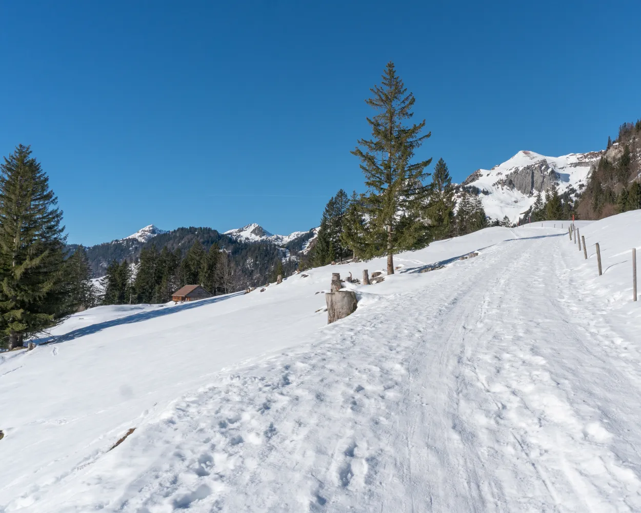
              On the sunny side of Wildhaus – with spectacular view to the Churfirsten – this circular tour leads form Wildhaus over the high plateau Gamplüt to Alp Fros and back again.

              dist7 km
              |
              asce360 m
              |
              desc360 m
              |
              dura2h 45m
              • land

                Landscape: Onto an alp,With panoramic views

              Tour published by:

              SwitzerlandMobility

              Learn more on
              schweizmobil.ch


              How to get to Wildhaus-Gamplüt-Weg

              Fastest connection from Rapperswil SG to Wildhaus, Dorf: 1h 16m
              Rapperswil SG (08:37)
              S4 (22m)
              Wattwil (08:59)
              Walk from Wattwil to Wattwil, Bahnhof
              Wattwil, Bahnhof (09:06)
              790 (47m)
              Wildhaus, Dorf (09:53)
              Search Connections & Buy Tickets on SBB
              10/10

              Tannenboden-Seebenalp-Weg

              Minimum travel time: 1h 17m to Tannenboden (Maschgenkammbahn)

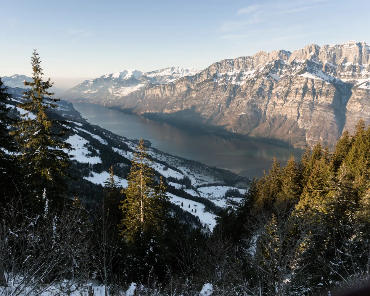
              The winter hiking path to Seebenalp offers a fantastic view to Churfirsten and Walensee. At the destination three mountain lakes lined by fir trees form a mystical scenery.

              dist8 km
              |
              asce320 m
              |
              desc320 m
              |
              dura2h 45m

                Tour published by:

                SwitzerlandMobility

                Learn more on
                schweizmobil.ch


                How to get to Tannenboden-Seebenalp-Weg

                Fastest connection from Rapperswil SG to Tannenboden (Maschgenkammbahn): 1h 17m
                Rapperswil SG (08:32)
                S5 (6m)
                Pfäffikon SZ (08:38)
                Pfäffikon SZ (08:41)
                IR35 (29m)
                Unterterzen (09:10)
                Walk from Unterterzen to Unterterzen (Talstation)
                Unterterzen (Talstation) (09:13)
                2790 (20m)
                Flumserberg Tannenboden (09:33)
                Walk from Flumserberg Tannenboden to Tannenboden (Maschgenkammbahn)
                Search Connections & Buy Tickets on SBB