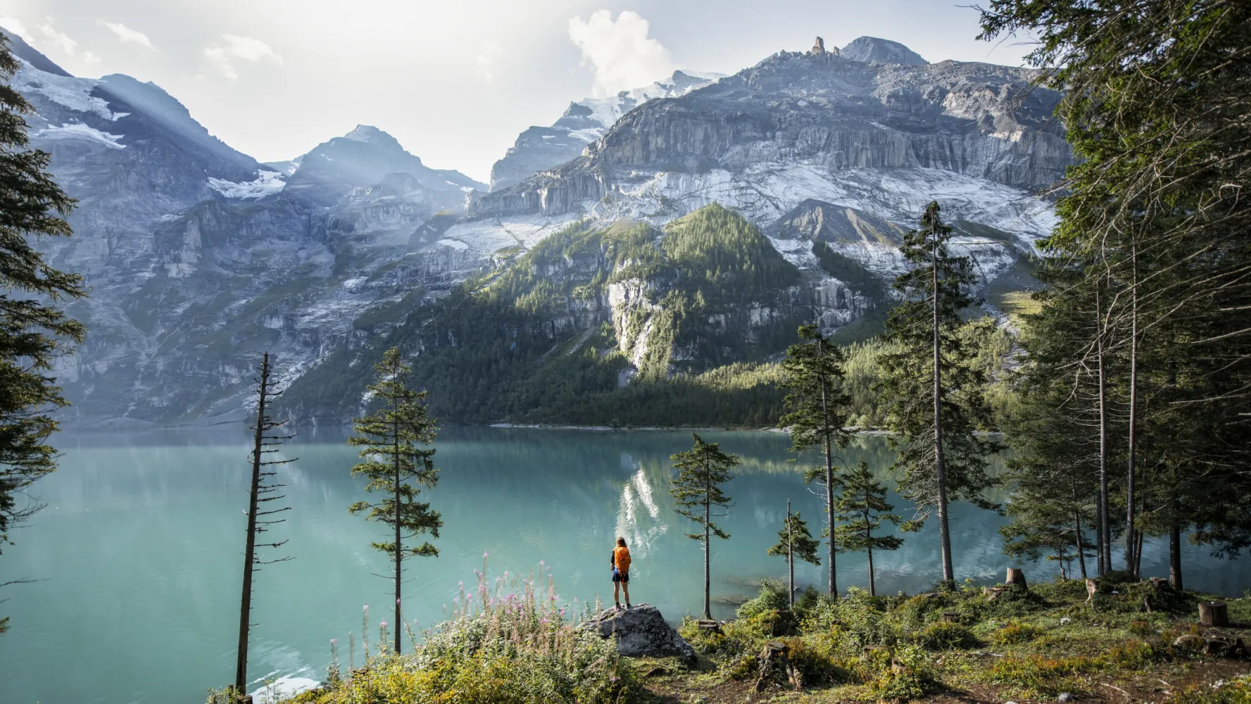
Discover a variety of stunning hikes easily accessible from Vevey by public transport. From the Alpine Panorama Trail offering breathtaking views of Lake Geneva to the historic Route des Diligences in the Vallée du Trient, these routes showcase the region's diverse landscapes. Explore picturesque villages, lush forests, and dramatic mountain scenery, all within reach of Vevey's charming lakeside setting.
The following hikes are sorted by travel time from Vevey, making it easy to plan your adventure, whether you're looking for a quick escape or a full-day excursion. Check out the map to explore thousands of destinations and activities, reachable from any starting point in Switzerland.
Much more on ovunta.com/en/map
Established 2000 years ago, in medieval times the ViaFrancigena became the most important pilgrims’ path in Europe. In Switzerland it leads through beautiful Jura and Alpine landscapes, the stage on the Grossen St. Bernhard being particularly magnificent.
 200 km
 5600 m
 4000 m
Landscape: With panoramic views
Tour published by:
SwitzerlandMobility
Learn more on
schweizmobil.ch

A pleasant hike through the steep Lavaux vineyards, a UNESCO World Heritage since 2007. Along the way you meet the old traditional wine villages of St-Saphorin, Rivaz and Epesses, and the lovely little towns of Cully and Lutry on Lac Léman.
19 km360 m440 m 5h 0m
5h 0mTour published by:
SwitzerlandMobility
Learn more on
schweizmobil.ch
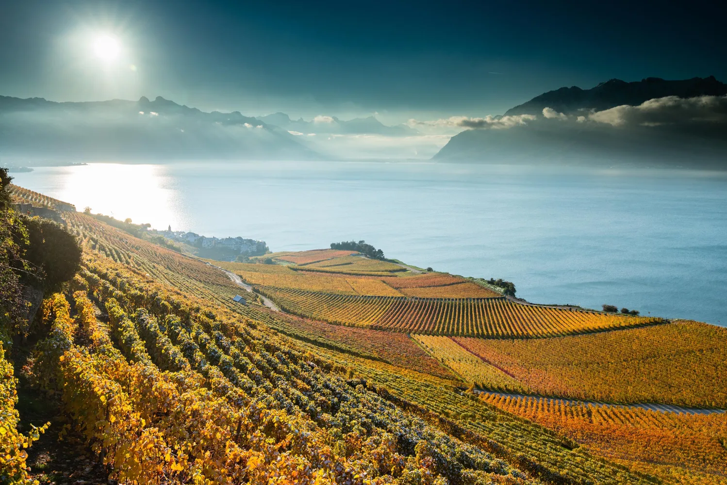
This trail zigzags across the prestigious Lavaux terraced vineyards, a UNESCO World Heritage site. Created through wine-related activities over the years, this land-scape and its typical villages are of universal beauty.
11 km440 m420 m3h 15mLandscape: With panoramic views,Along the water,Through a vineyard
Tour published by:
SwitzerlandMobility
Learn more on
schweizmobil.ch
From the quays in Ouchy, the Via Francigena runs along the banks of Lake Geneva to Villette. It then winds its way through the Lavaux Terraces, a UNESCO World Heritage Site, offering a superb view across Lake Geneva.
20 km440 m420 m5h 20mLandscape: Along the water
Tour published by:
SwitzerlandMobility
Learn more on
schweizmobil.ch
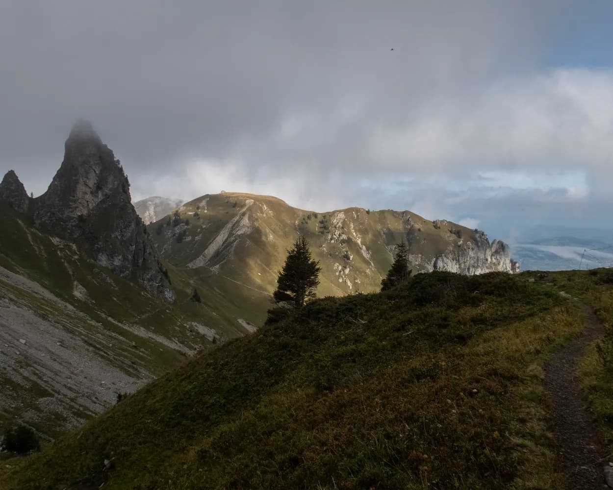
The Alpine Panorama Trail from Bodensee to Lac Léman promises many views of Alpine peaks as well as of the Mittelland and Jura. The route leads through the traditional agricultural landscape of the Alpine foothills, still dominated by milk and cheese production.
510 km17800 m17800 mLandscape: With panoramic views,Over a pass,Onto an alp,Onto a mountain peak
Tour published by:
SwitzerlandMobility
Learn more on
schweizmobil.ch
| Vevey (09:03) | |
| R4 (3m) | |
| St-Saphorin (09:06) |
From Vevey, the trail runs along the lake to Villeneuve. On the way you can visit the games museum in Tour-de-Peilz Castle or the famous Chillon Castle, before arriving in the Chablais wine region.
27 km220 m200 m6h 30mLandscape: With panoramic views,Along the water
Tour published by:
SwitzerlandMobility
Learn more on
schweizmobil.ch
| Vevey (08:30) | |
| IR95 (6m) | |
| Montreux (08:36) |
Spectacular views of Lac Léman are the hallmark of this varied level hike. From fashionable Montreux, the route leads past the famous Chateau Chillon to Villeneuve. Along this stretch the lake shore is often less than 10 metres from the trail.
6 km30 m50 m1h 25m
Barrier free: Yes
Landscape: Along the water
Tour published by:
SwitzerlandMobility
Learn more on
schweizmobil.ch
| Vevey (08:46) | |
| RE33 (9m) | |
| Villeneuve VD (08:55) |
The route to Vevey from Les Paccots crosses the border from Fribourg into the canton of Vaud. It is also a walk full of new discoveries: the magnificently preserved Lac des Joncs, the Fégire footbridge (marking the border between the cantons) and enchanting views over the Prealps and Lake Geneva, as well as local culinary specialities.
19 km640 m1300 m6h 0mLandscape: With panoramic views
Tour published by:
SwitzerlandMobility
Learn more on
schweizmobil.ch
| Vevey, gare (08:37) | |
| 213 (7m) | |
| Jongny, Châtillon (08:44) |
The Via Alpina crosses 14 of the most beautiful Alpine passes. Straight through seven Swiss cantons with a vast variety of culture, geology and topography. Wide roads end in high ridge trails. The route is lined with one of the world’s most diverse variety of flora and fauna.
390 km23500 m24800 mLandscape: With panoramic views,Over a pass,Onto a mountain peak
Tour published by:
SwitzerlandMobility
Learn more on
schweizmobil.ch
| Vevey (08:30) | |
| IR95 (6m) | |
| Montreux (08:36) |
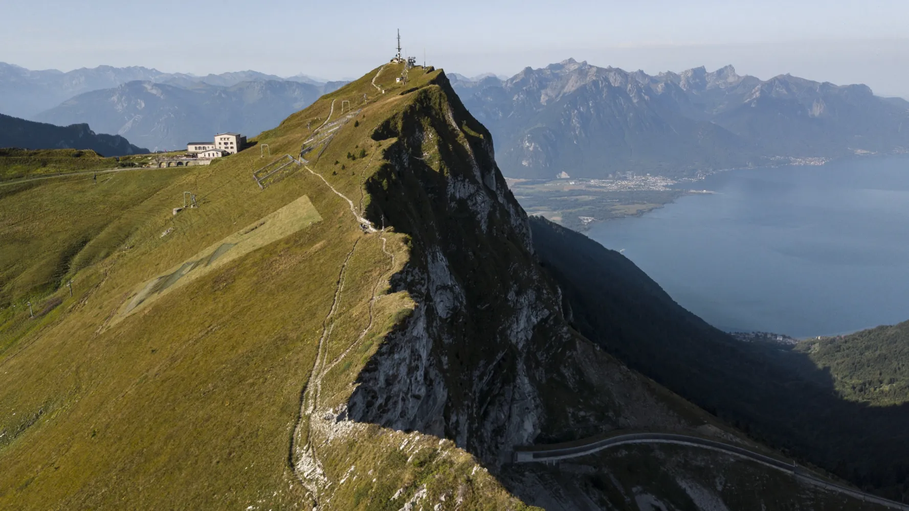
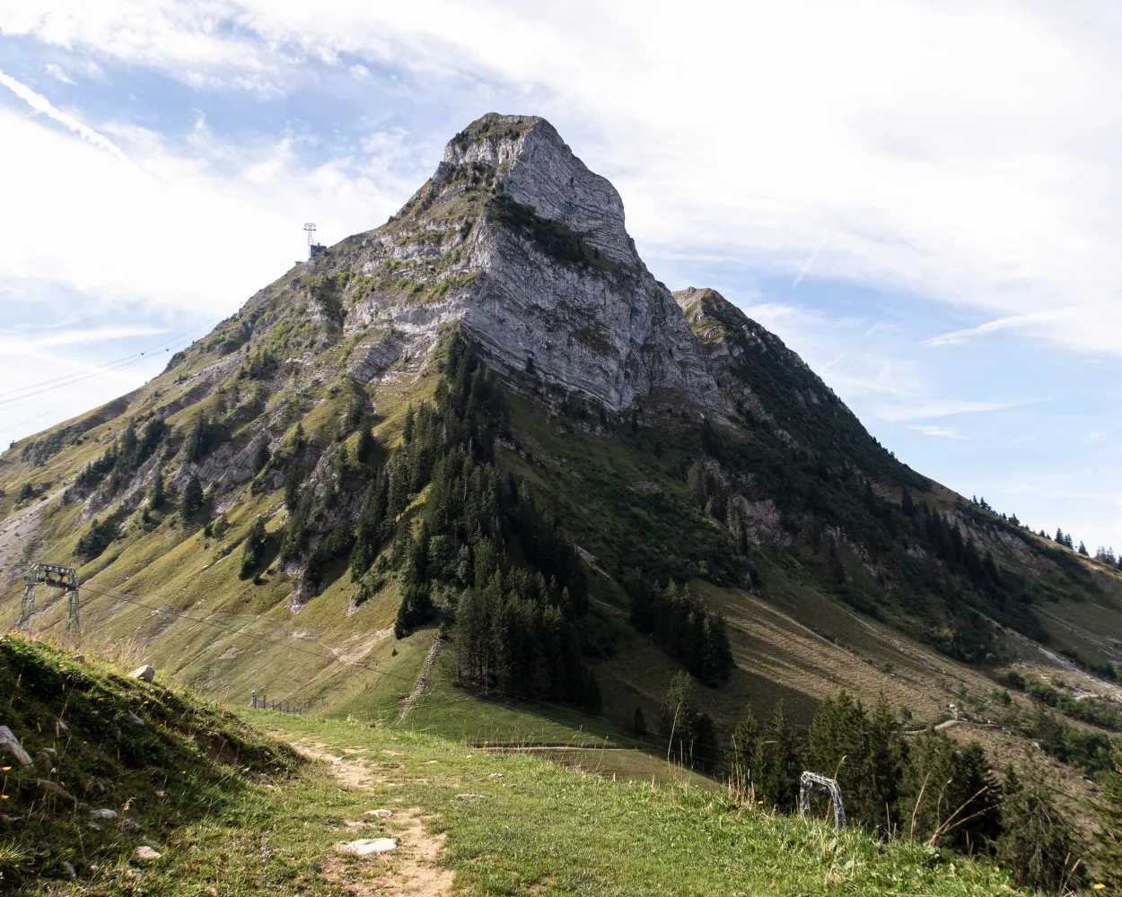
From Rochers de Naye, rock-restaurant and panorama of hundreds of crags and summits, the route leads along a steep ridge and sandstone cliff trail, later down over Mediterranean hills to Montreux.
13 km90 m1650 m3h 50mLandscape: With panoramic views,Onto a mountain peak
Tour published by:
SwitzerlandMobility
Learn more on
schweizmobil.ch


