
Discover a variety of hiking trails accessible by public transport from Lenzerheide. From the historic ViaSett route starting in Chur to the scenic paths of the Walserweg, these trails offer diverse experiences. Explore alpine meadows, historic sites like Riom Castle, and enjoy panoramic views of the Grison Alps.
The hikes are listed in order of travel time from Lenzerheide, making it easy to plan your adventure. Check out the map to explore thousands of destinations and activities, reachable from any starting point in Switzerland.
Much more on ovunta.com/en/map
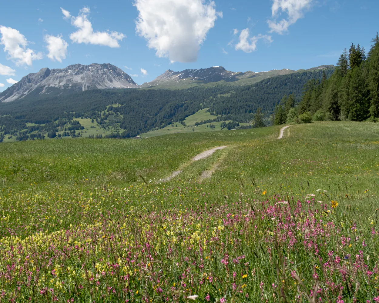
A cozy round trip with a great viewpoint Crap la Tretscha awaits you. Enjoy peace, experience the features of the Lenzer nature and marvel at the wonderful mountain hut district Tschividains.
 7 km
7 km 200 m
200 m 200 m
200 m 1h 55m
Landscape: With panoramic views
Tour published by:
SwitzerlandMobility
Learn more on
schweizmobil.ch
| Lenzerheide/Lai, Post (08:52) | |
| 572 (3m) | |
| Lantsch/Lenz, St. Cassian (08:55) |
Leading away from Domleschg, there is a spectacular road through the Schin Gorge. The climb to the little village of Muldain is rewarded with a magnificent view. Several castles and churches, including the 8th century St. Peter’s Church in Mistail, are further highlights along this hike.
20 km950 m740 m6h 0mLandscape: With panoramic views
Tour published by:
SwitzerlandMobility
Learn more on
schweizmobil.ch
The hiking trail along the UNESCO World Heritage section of the Rhaetian Railway runs as near as possible to the Albula and Bernina railway line, regularly affording enchanting open views of an over 100-year-old total artwork in stunning Alpine scenery.
130 km5100 m5400 mLandscape: With panoramic views
Tour published by:
SwitzerlandMobility
Learn more on
schweizmobil.ch
| Lenzerheide/Lai, Post (08:41) | |
| 184 (7m) | |
| Vaz/Obervaz, Muldain (08:48) |
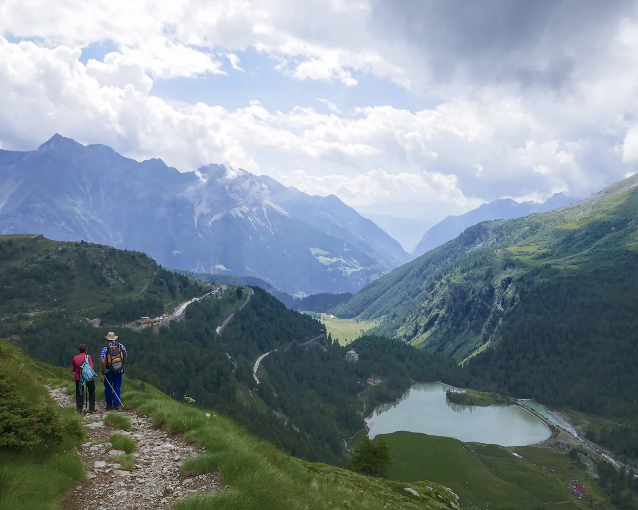
The second leg takes you to one of the highlights of the entire route: the imposing Landwasser Viaduct. But first you will walk along the burbling river Albula, past the central point of the canton of the Grisons and onward to one of the photo opportunities for taking a souvenir picture of the world-famous Rhaetian Railways viaduct.
12 km420 m260 m3h 20mLandscape: Along the water
Tour published by:
SwitzerlandMobility
Learn more on
schweizmobil.ch
| Lenzerheide/Lai, Post (08:52) | |
| 572 (19m) | |
| Tiefencastel, staziun (09:11) |
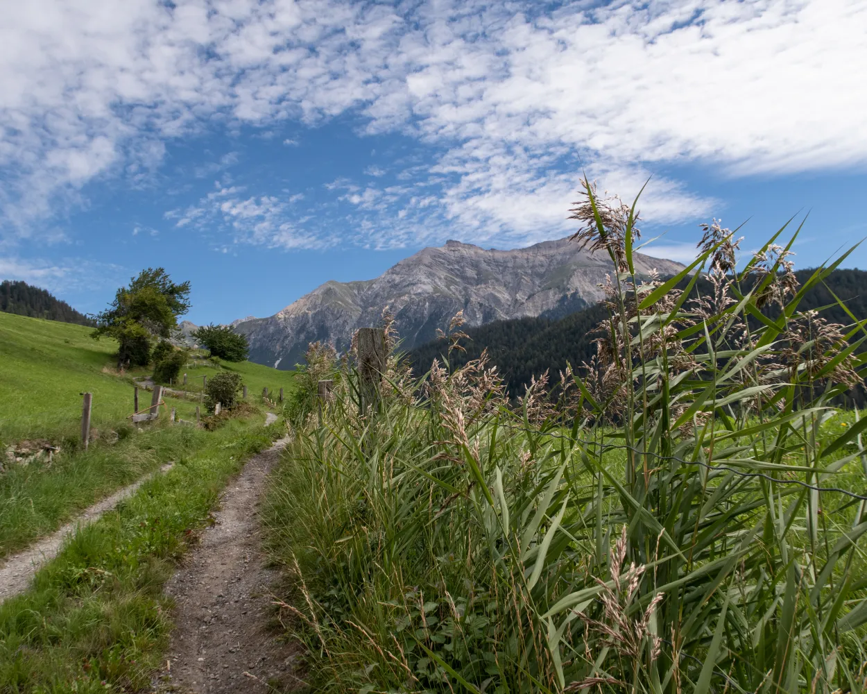
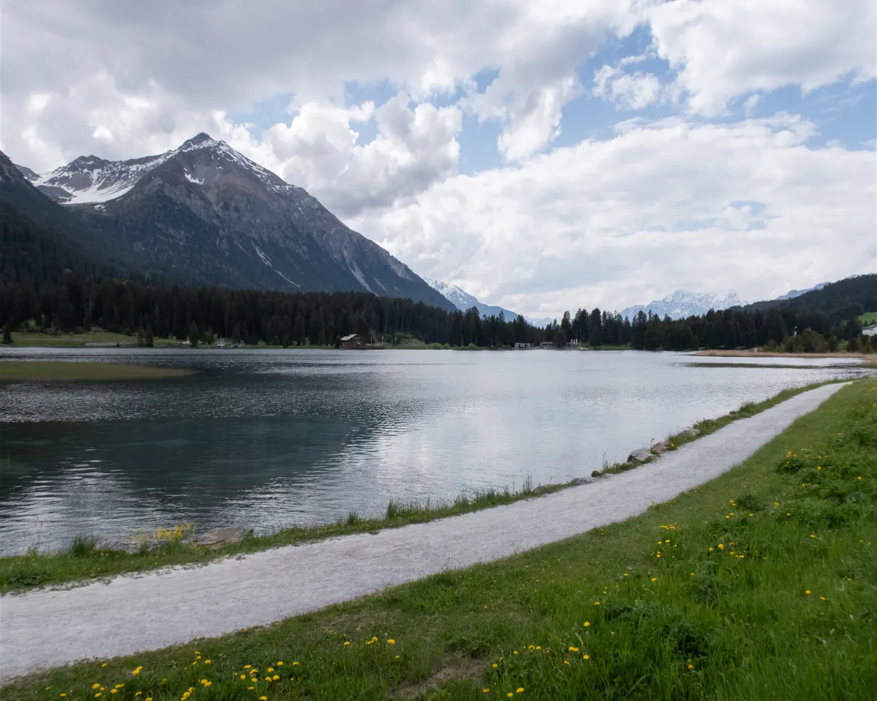
This route promises lovely panoramic views entailing little altitude difference and minimal effort. Starting at 1915 m a. s. l., the high-level trail leads from Heidbüel to Tgantieni. You will enjoy a magnificent view of the Heid lake and the valley.
6 km300 m480 m2h 0mTour published by:
SwitzerlandMobility
Learn more on
schweizmobil.ch
| Lenzerheide/Lai, Post (08:45) | |
| 191 (4m) | |
| Lenzerheide/Lai, Val Sporz (08:49) |
| Lenzerheide/Lai Val Sporz (08:54) | |
| 2932 (11m) | |
| Tgantieni (09:05) |
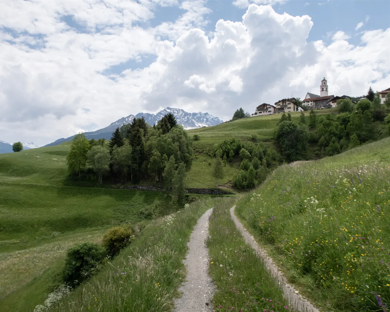
The path climbs to Del and then leads past Riom Castle, home of the Rhaeto-Romanic “Origen” musical theatre. Savognin is the destination for this stage. In addition to free mountain railways, it offers its summer guests a wide range of experiences in nature.
12 km780 m420 m4h 0mTour published by:
SwitzerlandMobility
Learn more on
schweizmobil.ch
| Lenzerheide/Lai, Post (08:52) | |
| 572 (28m) | |
| Tiefencastel, vischnanca (09:20) |
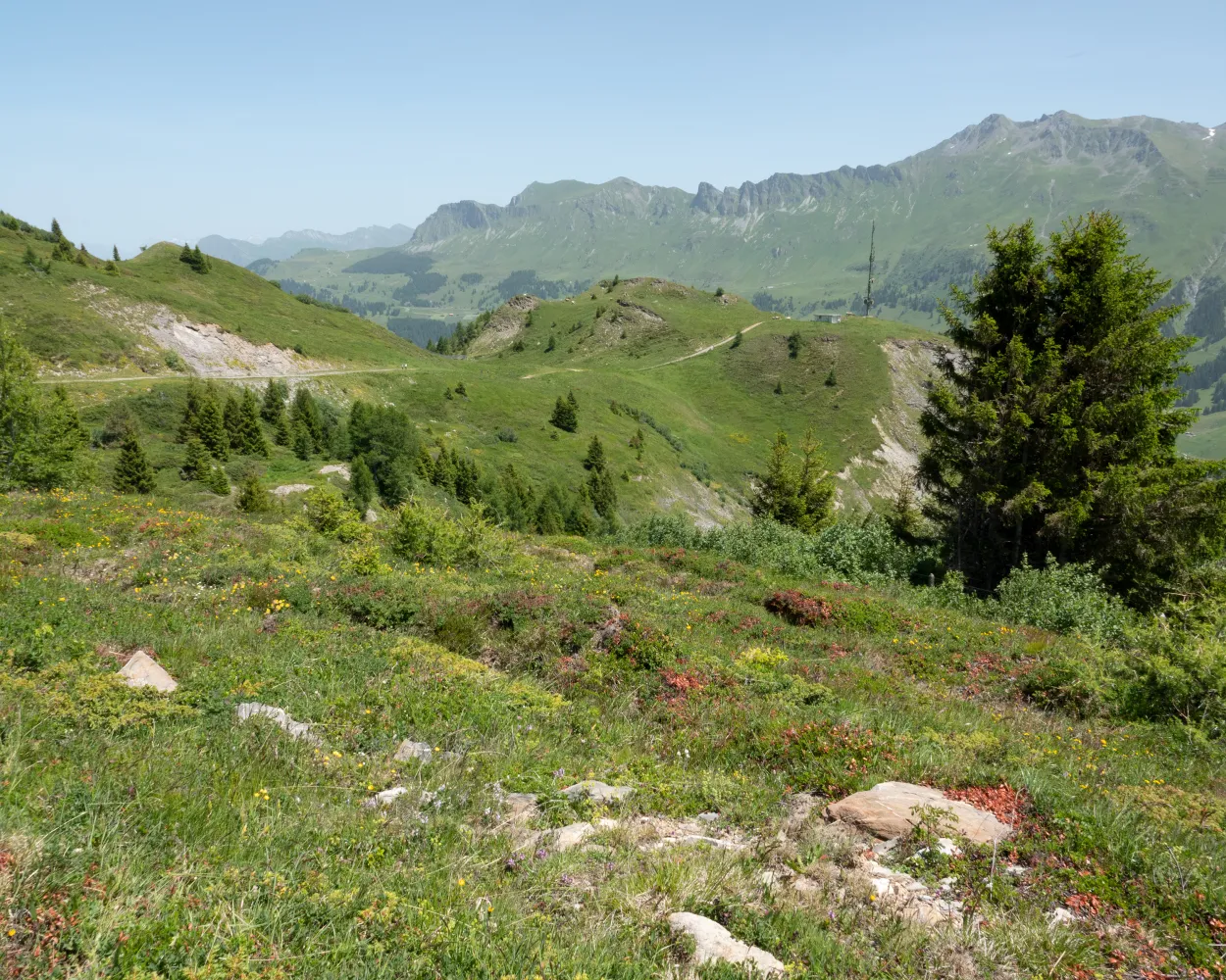
Witness the pioneering efforts of man and nature on the Path of the Pioneers, which takes you to the geographic centre of Grisons. The Crap Furò natural forest reserve is home to one of the most diverse forests in Switzerland on such a small area.
9 km400 m400 m2h 45mLandscape: Along the water
Tour published by:
SwitzerlandMobility
Learn more on
schweizmobil.ch
| Lenzerheide/Lai, Post (08:52) | |
| 572 (32m) | |
| Surava, Dorf (09:24) |
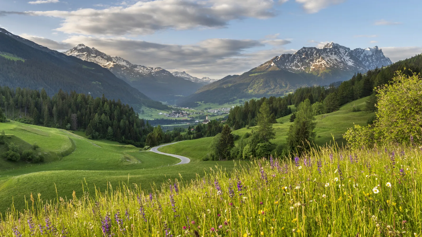
Cross the Septimer on foot, from one Alpine town to another: the route runs from Chur through the Churwalden Valley, Lenzerheide, Surses in Parc Ela and Bregaglia to Chiavenna (Italy). Explore three linguistic and cultural regions and a diverse cultural landscape – from pastures to chestnut groves.
110 km4500 m4800 mLandscape: Through a Swiss Park
Tour published by:
SwitzerlandMobility
Learn more on
schweizmobil.ch
From the episcopal city of Chur up to the spa hotel Passugg with its mineral springs. Past the ruins of Strassberg Malix Castle, once a customs station on the Septimer route. Continue to the Churwalden monastery church, across the heights of the Parpaner Höhe and around the Heidsee lake to the original Maiensäss (summer pasture) village of Lenzerheide.
20 km1250 m360 m6h 15mTour published by:
SwitzerlandMobility
Learn more on
schweizmobil.ch
South of Lenzerheide is the entrance gate to Parc Ela, the largest nature park in Switzerland. You cross meadows full of flowers to the Son Cassian chapel in the mountain village of Lenz, once a transport cooperative on the Septimer Trail. You continue on to the Carolingian church of Mistail near Tiefencastel.
13 km110 m740 m3h 15mTour published by:
SwitzerlandMobility
Learn more on
schweizmobil.ch


