
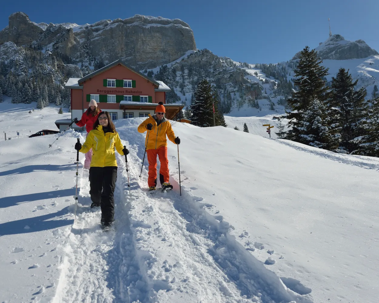
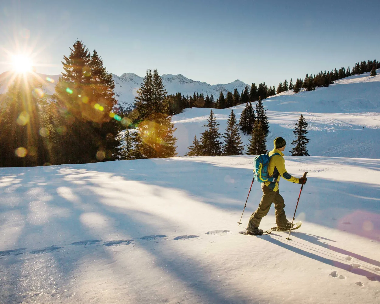
Discover a winter wonderland on these snowshoe hikes, all easily reachable from Romanshorn by public transport. Snow-covered forests, wide alpine plateaus, and scenic routes offer memorable experiences in the heart of the Alps.
To make planning easier, the hikes below are sorted by travel time from Romanshorn. Explore the map to find all snowshoe hikes and thousands of other outdoor activities accessible from anywhere in Switzerland.
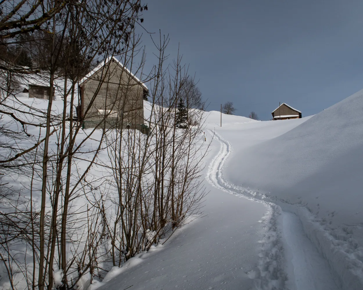
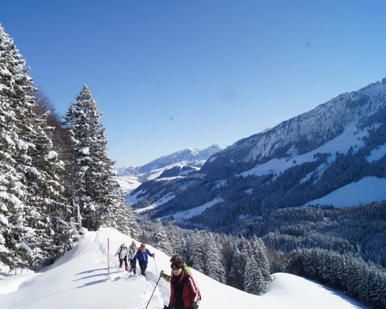
Quietly exploring Appenzell’s rolling countryside: from Schwellbrunn, highest-located village in Ausserrhoden, the trail leads across a ridge with views of the hills, to the Alpstein mountain range with the Säntis Mountain and Lake Constance. Afterwards you delve into the forest and hike downhill.
 8 km
8 km 440 m
440 m 440 m
440 m 4h 0m
4h 0m
Landscape: Onto an alp,Over a pass,With panoramic views
Tour published by:
SwitzerlandMobility
Learn more on
schweizmobil.ch
| Romanshorn (09:26) | |
| RE1 (28m) | |
| Herisau (09:54) |
| Herisau, Bahnhof (10:08) | |
| 171 (12m) | |
| Schwellbrunn, Dorf (10:20) |
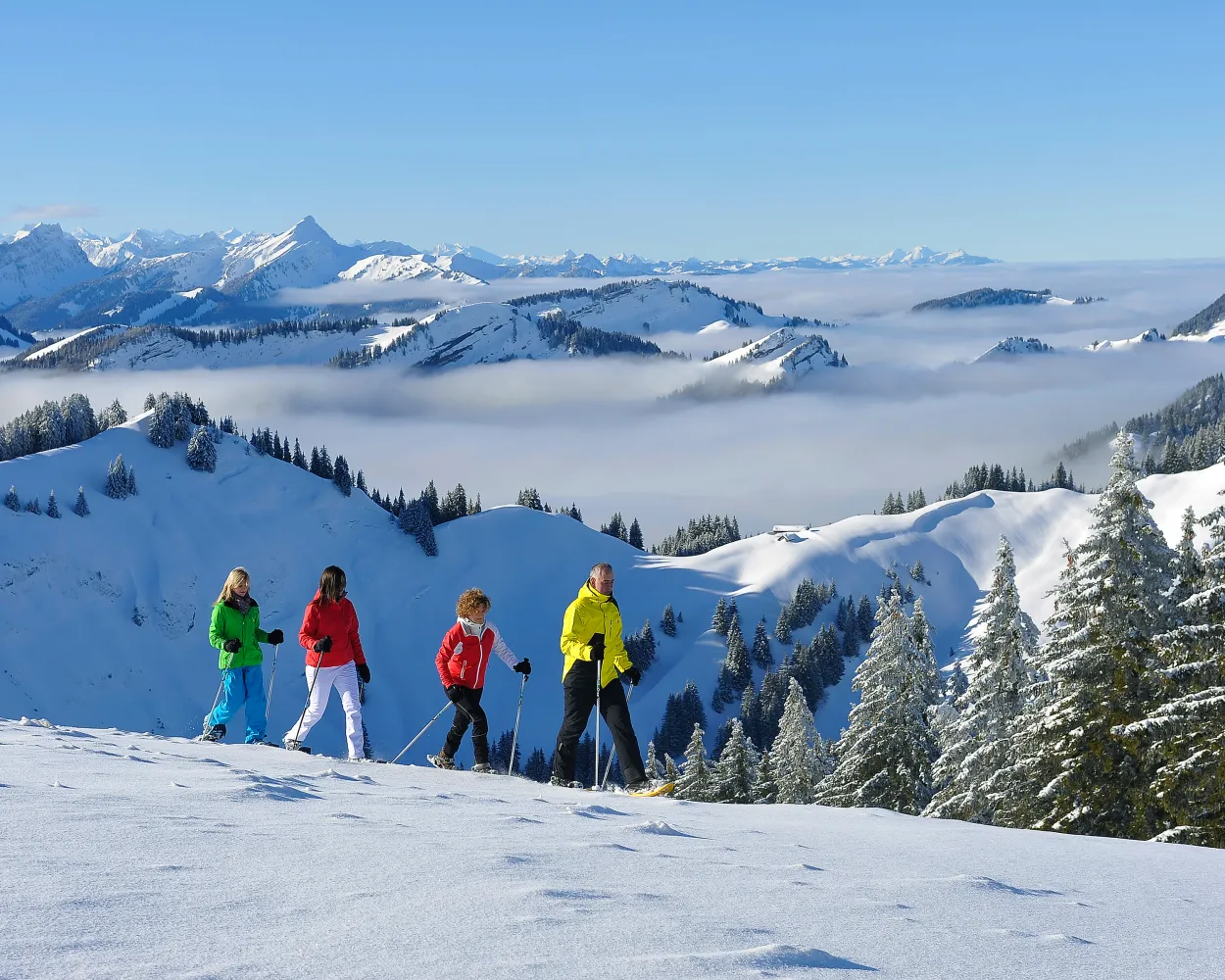
This tour through the snowy hills of the Appenzeller countryside is particularly suitable for beginners and snowshoe enthusiasts who want to take things easy. The ascent is rewarded with circular views, which stretch right to the peaks of the Vorarlberg.
7 km280 m280 m2h 55mTour published by:
SwitzerlandMobility
Learn more on
schweizmobil.ch
| Romanshorn (08:44) | |
| S1 (27m) | |
| St. Gallen (09:11) |
| St. Gallen (09:22) | |
| S21 (30m) | |
| Sammelplatz (09:52) |
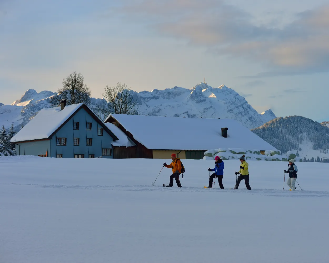
Trudge over the wonderful Gössigenhöchi, the view wanders into the Thur valley and from Lake Constance to Lake Zurich: The tour from the elevated health resort Hemberg to Ennetbühl is right up the street of those who like untouched landscapes. Your constant companion is the Säntis, the highest mountain in the Alpstein region.
9 km660 m740 m5h 15mTour published by:
SwitzerlandMobility
Learn more on
schweizmobil.ch
| Romanshorn (09:26) | |
| RE1 (28m) | |
| Herisau (09:54) |
| Herisau, Bahnhof (10:10) | |
| 182 (28m) | |
| St. Peterzell, Dorf (10:38) |
| St. Peterzell, Dorf (10:40) | |
| 185 (14m) | |
| Hemberg, Dorf (10:54) |
On the sunny side of Wildhaus – with a spectacular view to the Churfirsten – this round trip leads from Wildhaus up to the high plateau of Gamplüt and the Alp Fros on the foothills of Schafberg at Wildhaus.
4 km300 m300 m2h 20mLandscape: With panoramic views,Onto an alp
Tour published by:
SwitzerlandMobility
Learn more on
schweizmobil.ch
| Romanshorn (08:46) | |
| S7 (20m) | |
| Rorschach (09:06) |
| Rorschach (09:09) | |
| IR13 (35m) | |
| Buchs SG (09:44) |
| Buchs SG, Bahnhof (09:53) | |
| 797 (35m) | |
| Wildhaus, Dorf (10:28) |
From the bottom to the top, a direct route to Kronberg: Snowshoe enthusiasts with a very good level of fitness will find the challenge they are looking for here. This sunny route promises quietness and solitude. Arrived on Kronberg, a beautiful panorama opens up right into the lowlands and Lake Constance.
6 km740 m70 m3h 50mTour published by:
SwitzerlandMobility
Learn more on
schweizmobil.ch
| Romanshorn (08:44) | |
| S1 (42m) | |
| Gossau SG (09:26) |
| Gossau SG (09:51) | |
| S23 (27m) | |
| Jakobsbad (10:18) |
| Jakobsbad (Kronbergbahn) (10:30) | |
| 2725 (10m) | |
| Kronberg (10:40) |
Breathtaking views and breathtaking climbs: Hikers on showshoes with a very good level of fitness can enjoy this varied route between Kronberg and Säntis.
5 km460 m170 m3h 0mLandscape: With panoramic views,Over a suspension bridge,Onto a mountain peak
Tour published by:
SwitzerlandMobility
Learn more on
schweizmobil.ch
| Romanshorn (08:44) | |
| S1 (42m) | |
| Gossau SG (09:26) |
| Gossau SG (09:51) | |
| S23 (22m) | |
| Urnäsch (10:13) |
| Urnäsch, Bahnhof (10:17) | |
| 791 (23m) | |
| Schwägalp, Säntis-Schwebebahn (10:40) |
This tour for beginners with just a few inclines and declines leads through the landscape around the two Schwendi Lakes. Without major efforts you can enjoy the winter landscape and the view to Chäserrugg and the Alpstein massif.
4 km180 m180 m1h 55mTour published by:
SwitzerlandMobility
Learn more on
schweizmobil.ch
| Romanshorn (08:46) | |
| S7 (20m) | |
| Rorschach (09:06) |
| Rorschach (09:09) | |
| IR13 (35m) | |
| Buchs SG (09:44) |
| Buchs SG, Bahnhof (09:53) | |
| 797 (35m) | |
| Wildhaus, Dorf (10:28) |
| Wildhaus, Dorf (10:34) | |
| 790 (2m) | |
| Wildhaus, Lisighaus (10:36) |
| Wildhaus Thur (Talstation) (10:41) | |
| 2770 (5m) | |
| Wildhaus Oberdorf (10:46) |
This circular tour leads you over the dreamy Bachers holiday village on Fähnerenspitz, one of the most beautiful vantage points in the Appenzellerland.
8 km620 m620 m4h 40mLandscape: With panoramic views,Onto an alp
Tour published by:
SwitzerlandMobility
Learn more on
schweizmobil.ch
| Romanshorn (08:44) | |
| S1 (42m) | |
| Gossau SG (09:26) |
| Gossau SG (09:51) | |
| S23 (44m) | |
| Weissbad (10:35) |
| Weissbad, Bahnhof (10:37) | |
| 192 (7m) | |
| Brülisau, Kastenbahn (10:44) |
This tour is suitable for snowshoe enthusiasts with an average level of fitness, who are looking for traditional landscapes, beautiful Appenzeller farmhouses and a fantastic panorama. The most beautiful section of the hike: the walk over the «Mäder», a sheltered hill moor.
6 km400 m400 m3h 15mTour published by:
SwitzerlandMobility
Learn more on
schweizmobil.ch
| Romanshorn (08:44) | |
| S1 (42m) | |
| Gossau SG (09:26) |
| Gossau SG (09:51) | |
| S23 (44m) | |
| Weissbad (10:35) |
| Weissbad, Bahnhof (10:37) | |
| 192 (7m) | |
| Brülisau, Kastenbahn (10:44) |
This tour over the Dreibündenstein connects the regions of Chur and Lenzerheide for snowshoe hikers. Great vistas and an optional downhill run experience make them a real insider tip.
8 km680 m540 m5h 0mTour published by:
SwitzerlandMobility
Learn more on
schweizmobil.ch
| Romanshorn (08:46) | |
| S7 (20m) | |
| Rorschach (09:06) |
| Rorschach (09:09) | |
| IR13 (1h 9m) | |
| Chur (10:18) |
| Chur, Bahnhofplatz (10:28) | |
| 11 (2m) | |
| Chur, Brambrüeschb./Stadthalle (10:30) |
| Chur (Brambrüeschbahn) (10:40) | |
| 2880 (7m) | |
| Känzeli (Chur) (10:47) |
| Känzeli (Chur) (10:49) | |
| 2880 (8m) | |
| Brambrüesch (10:57) |
Much more on ovunta.com/en/map


