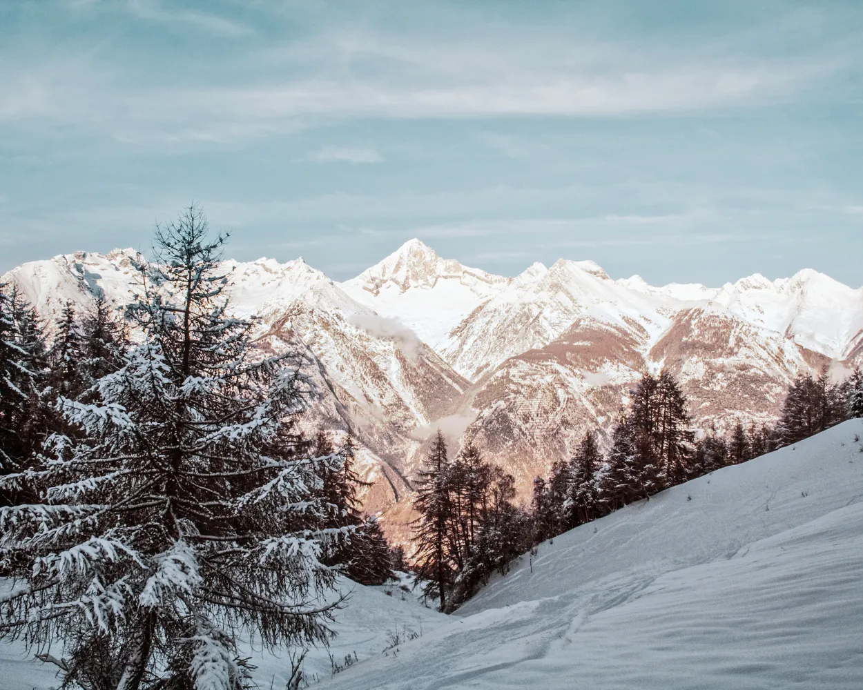
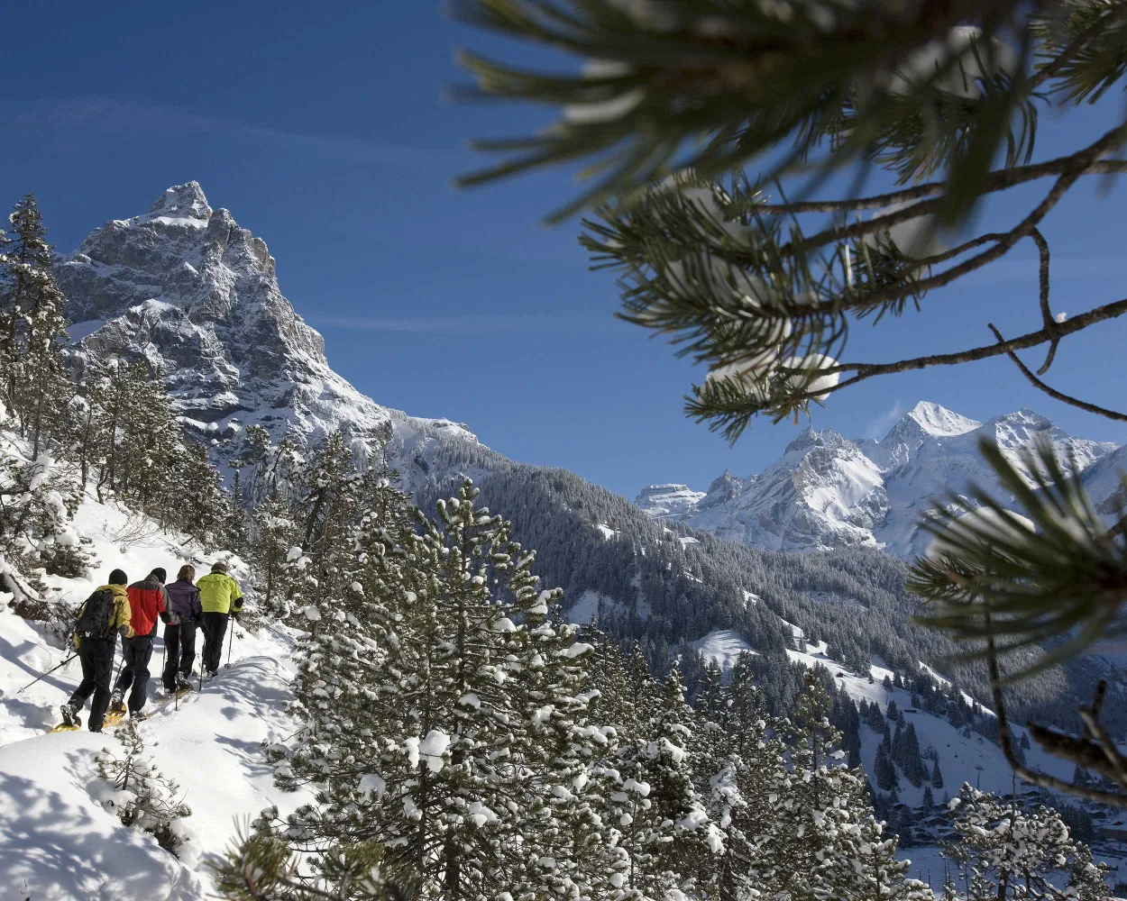
Discover a winter wonderland on these snowshoe hikes, all easily reachable from Martigny by public transport. Snow-covered forests, wide alpine plateaus, and scenic routes offer memorable experiences in the heart of the Alps.
To make planning easier, the hikes below are sorted by travel time from Martigny. Explore the map to find all snowshoe hikes and thousands of other outdoor activities accessible from anywhere in Switzerland.
Much more on ovunta.com/en/map
This lofty sport route is primarily ideal for nature lovers, offering stunning views of Lake Geneva and the surrounding peaks.
 5 km
5 km 360 m
360 m 360 m
360 m 2h 40m
Tour published by:
SwitzerlandMobility
Learn more on
schweizmobil.ch
| Martigny (08:35) | |
| RE33 (21m) | |
| Aigle (08:56) |
| Aigle (09:12) | |
| R70 (24m) | |
| Versmont (09:36) |
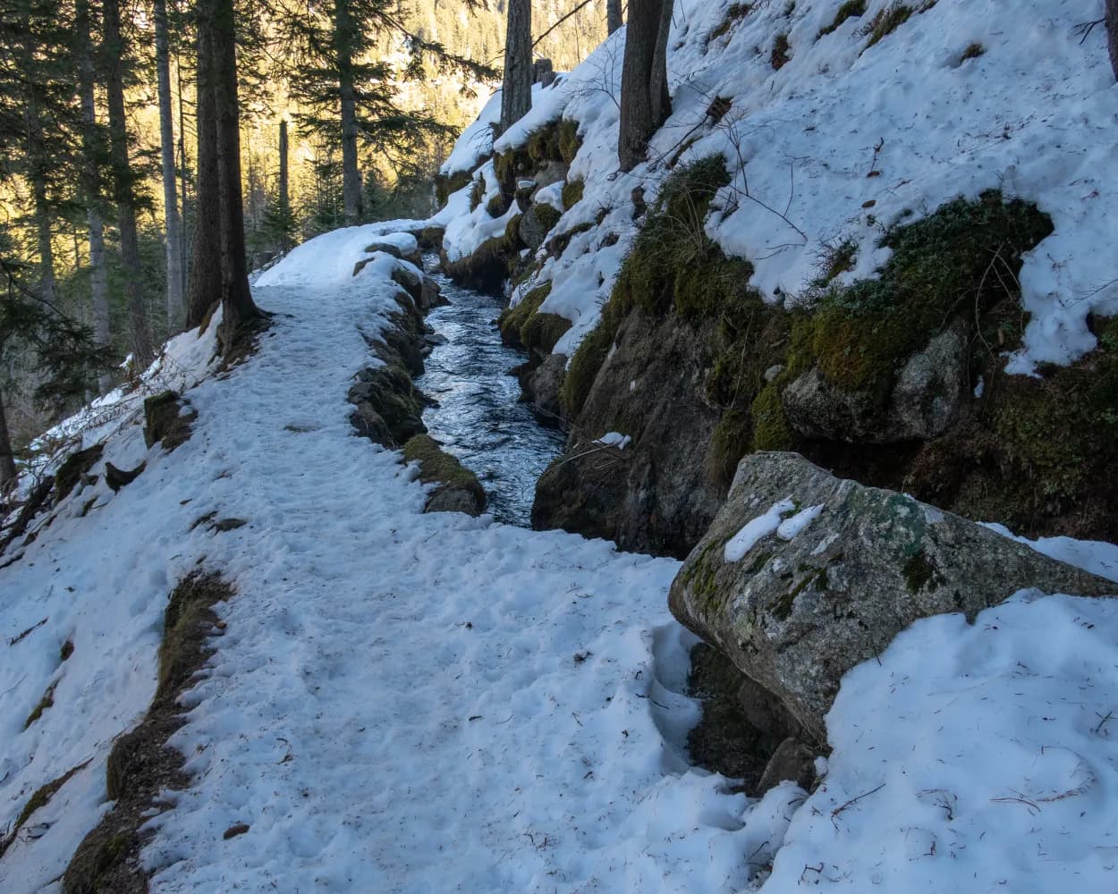
This snowshoe hike takes you from the Alpe des Chaux at the foot of the flattening Diablerets mountain range past the charming hamlet of Taveyanne with its wooden shingle roofs. Following the course of the Gryonne river, you pass some sleepy alpine huts and cross quiet streams winding their way under the snow.
10 km190 m420 m3h 50mTour published by:
SwitzerlandMobility
Learn more on
schweizmobil.ch
| Martigny (08:35) | |
| RE33 (15m) | |
| Bex (08:50) |
| Bex, place de la gare (09:17) | |
| EV74 (35m) | |
| Arveyes, gare (09:52) |
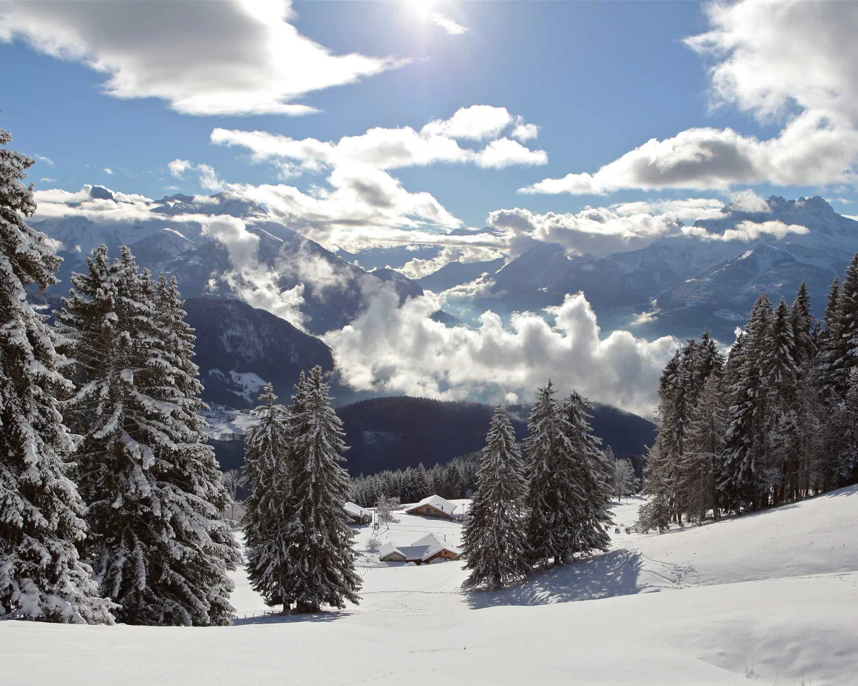
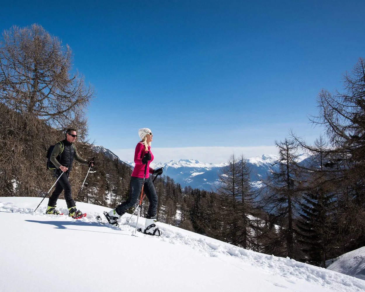
Explore the forests above Grimentz on snowshoes. While the ascent affords views of St-Luc and Chandolin, the return journey promises an even more spectacular Alpine panorama with the Valais's 4,000-metre peaks as a backdrop.
9 km560 m560 m4h 50m
Landscape: Onto an alp,With panoramic views
Tour published by:
SwitzerlandMobility
Learn more on
schweizmobil.ch
| Martigny (08:42) | |
| IR90 (25m) | |
| Sierre/Siders (09:07) |
| Sierre/Siders, gare routière (09:15) | |
| 451 (33m) | |
| Vissoie, poste (09:48) |
| Vissoie, poste (09:50) | |
| 452 (15m) | |
| Grimentz, Roua (10:05) |
In 1957 the female citizens of Unterbäch were the first women in Switzerland to obtain the right to vote – 14 years before it was adopted nationwide. The Frauenzitate-Trail (Trail of Women’s Quotes) is dedicated to these courageous women. On the snowshoe tour from Brandalp to Unterbäch you will find a variety of quotes from world-famous women.
4 km90 m440 m1h 50mTour published by:
SwitzerlandMobility
Learn more on
schweizmobil.ch
| Martigny (08:37) | |
| R91 (1h 3m) | |
| Raron (09:40) |
| Raron (Talstation Unterbäch) (09:56) | |
| 2253 (8m) | |
| Unterbäch (Bergstation) (10:04) |
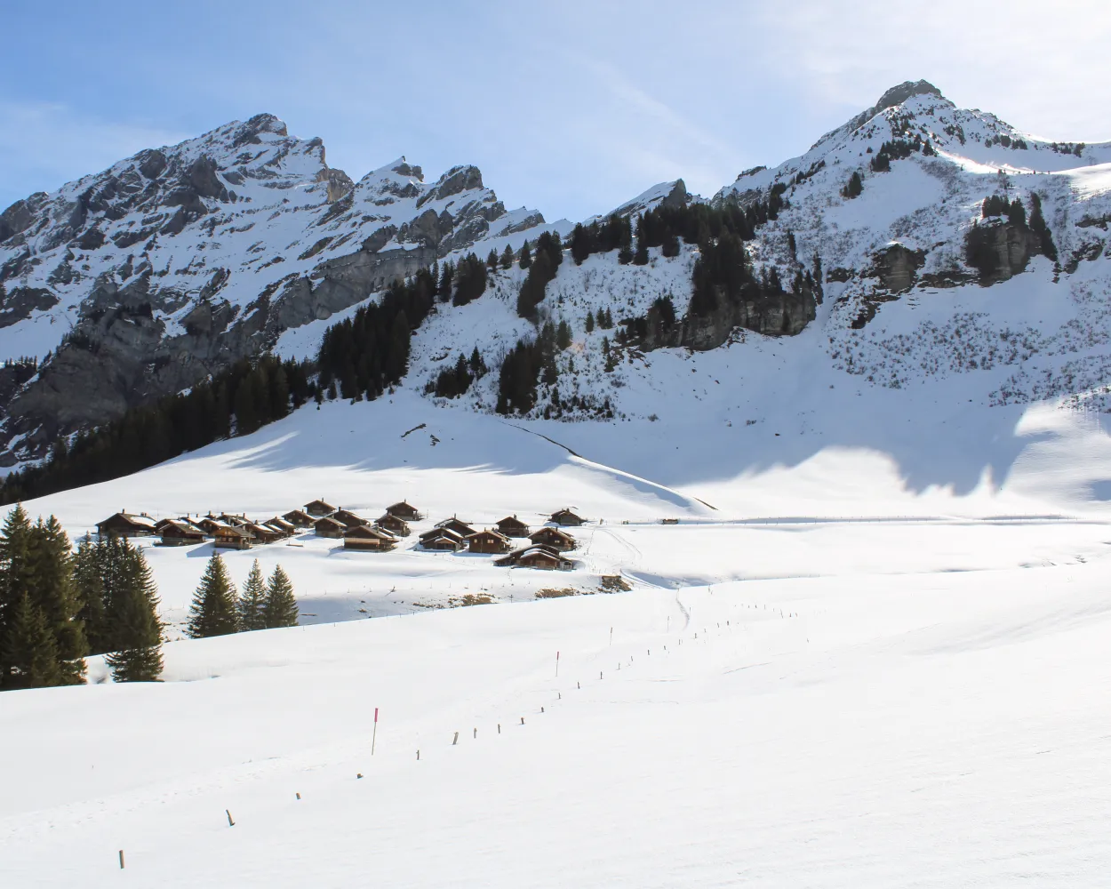
This snowshoe route is ideal for those in search of wild nature, tranquillity and rejuvenation. Throughout the route there are panoramic views of the Rhône Valley and the chain of 4000m-high mountains known as the «Imperial Crown».
8 km400 m400 m3h 45mLandscape: With panoramic views,Through a Swiss Park
Tour published by:
SwitzerlandMobility
Learn more on
schweizmobil.ch
| Martigny (08:42) | |
| IR90 (25m) | |
| Sierre/Siders (09:07) |
| Sierre/Siders (funi) (09:24) | |
| 2225 (14m) | |
| Crans-Montana gare (09:38) |
| Crans-Montana, gare (10:02) | |
| 431 (8m) | |
| Aminona (10:10) |
A fantastic snowshoe trail starting in Bouquetins, accessible from Villars via cogwheel railway. Along the way: many stretches of forest, the Maison de Montagne de Bretaye founded by General Guisan, and a unique backdrop with Mont Blanc and the Vaud Alps.
5 km120 m540 m2h 20mTour published by:
SwitzerlandMobility
Learn more on
schweizmobil.ch
| Martigny (08:35) | |
| RE33 (15m) | |
| Bex (08:50) |
| Bex, place de la gare (09:17) | |
| EV74 (38m) | |
| Villars-sur-Ollon, gare (09:55) |
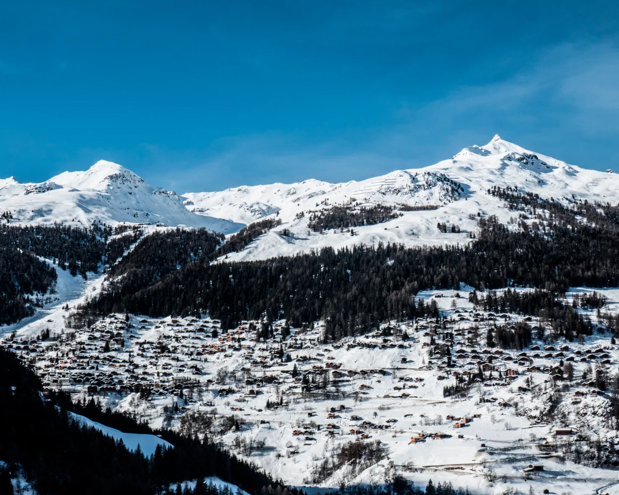
The trail is not signposted. On the Heimischgarte Trail the Saas Valley shows its quiet side. The delightful snowshoe hike above Saas-Balen leads through the snow-covered “Löübinobodme” natural forest reserve with views of the breathtaking mountains and the glacier landscape.
9 km640 m580 m4h 50mTour published by:
SwitzerlandMobility
Learn more on
schweizmobil.ch
| Martigny (08:42) | |
| IR90 (41m) | |
| Visp (09:23) |
| Visp, Bahnhof Süd (09:44) | |
| 511 (29m) | |
| Saas-Balen, Dorf (10:13) |
A great combination of easy but still very scenic snow shoe tour is waiting for you. After a the hike to the viewpoint on the top of «Höh», snow shoe hikers will be rewarded with the most beautiful panorama of Kandersteg and the mountain range of the UNESCO World heritage site.
2 km160 m160 m1h 15mTour published by:
SwitzerlandMobility
Learn more on
schweizmobil.ch
| Martigny (08:42) | |
| IR90 (50m) | |
| Brig (09:32) |
| Brig (09:36) | |
| RE1 (37m) | |
| Kandersteg (10:13) |
Between the hamlet of Rischinen and Aletschbord, you’ll experience nature at its most beautiful – via the hamlet of Egga with views into the valley, the trail continues until Holzji and the observation post. Once at Aletschbord, you can gaze in wonder at several four-thousand-metre peaks and the Great Aletsch Glacier.
7 km70 m840 m3h 0mTour published by:
SwitzerlandMobility
Learn more on
schweizmobil.ch
| Martigny (08:42) | |
| IR90 (50m) | |
| Brig (09:32) |
| Brig, Bahnhof (09:48) | |
| 624 (22m) | |
| Blatten b. Naters,Luftseilbahn (10:10) |
Past the highest football pitch in Europe and then onto winding paths leading higher and higher – after hiking through the snow-covered larch forest, snowshoe hikers will reach the top of the route with wonderful views of the Bietschhorn, Aletschhorn and Finsteraarhorn.
4 km220 m220 m2h 0mTour published by:
SwitzerlandMobility
Learn more on
schweizmobil.ch
| Martigny (08:42) | |
| IR90 (41m) | |
| Visp (09:23) |
| Visp (09:37) | |
| R42 (12m) | |
| Stalden-Saas (09:49) |
| Stalden-Saas (Talstation) (09:55) | |
| 2270 (7m) | |
| Staldenried (10:02) |
| Staldenried (10:10) | |
| 2271 (6m) | |
| Gspon (Bergstation) (10:16) |


