
Discover the stunning alpine landscapes surrounding Zinal, all accessible by public transport. From gentle meadow walks to challenging mountain trails, the Val d'Anniviers offers a diverse range of hiking experiences for every level of adventurer.
The following destinations are sorted by travel time from Zinal, making it easy to plan your next mountain getaway. Check out the map to explore thousands of destinations and activities, reachable from any starting point in Switzerland.
Much more on ovunta.com/en/map
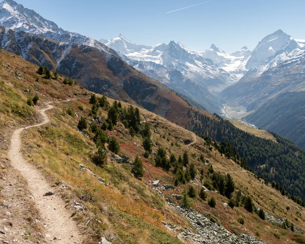
From the Moiry hut, go back on the path on which you arrived the day before. After a two-kilometre descent, when the path intersect, follow the direction of Fêta d'Août de Châteaupré and walk along the entire length of the lake below. A short ascent then takes you to the Sorebois pass, which is the route into the Zinal valley. Don’t miss the view of the Zinalrothorn, the Weisshorn and the Dent Blanche, some of the impressive 4000-metre peaks in the Val d'Anniviers. Cross the mountain pastures where black-nosed sheep graze and make your way through the rocks to Crevache. The path descends steeply for 1,200 metres to the valley, then follows the Navizence River directly to Zinal. This is the first night you not spent in a hut, so enjoy a good shower and visit this welcoming mountain village.
 22.71 km
 755 m
755 m 1910 m
 4h 40m
Difficulty: Hard

Maximum elevation: 2836m

Minimum elevation: 1671m
Learn more on
valais.ch
Travel between rocky passes and intensely green valleys from Verbier to Zermatt, through larch forests and juniper bushes, across vast expanses and along icy blue glaciers. Be sure to observe the changes in landscape, language, cuisine and culture as you move through the valleys. This high altitude route for trail runners does not follow the most direct line from start to finish, but skirts the buttresses, choosing the most picturesque and practicable paths through the Valais in the heart of the Swiss Alps. Each leg finishes in a charming mountain village or in a hut if the route continues at high altitude.
308.24 km18498 m18537 m69h 15mDifficulty: Hard
Maximum elevation: 3346m
Minimum elevation: 688m
Learn more on
valais.ch
| Zinal, centre (08:33) | |
| 453 (1m) | |
| Zinal, Les Plats de la Lé (08:34) |
This hike starts at the top of the Zinal - Sorebois cable car, with a superb view of the Imperial Crown. The path climbs along steep slopes to reach the Sorebois pass, before descending into the Val de Moiry. Below, the Moiry dam holds back the turquoise waters of the lake, fed by the Moiry glacier, nestled at the bottom of the valley. Near the dam, a restaurant with a panoramic terrace, a via ferrata and guided tours of the interior of the dam await you. The second part of the hike is a long and beautiful descent through pastures and forests into the Val de Moiry to Grimentz.
14.36 km1195 m1270 m4h 30mDifficulty: Medium
Maximum elevation: 2856m
Minimum elevation: 1586m
Learn more on
valais.ch
| Zinal (télépherique) (08:32) | |
| GB (6m) | |
| Sorebois (08:38) |
The diversity of the Val d'Anniviers is highlighted by two villages and the high mountain path that links them. Overlooked by the highest peaks in the Valais, Grimentz stands out with its wooden houses festooned with flowers. Vercorin, on the other hand, lies on a sunny plateau overlooking the Rhone Valley. The panorama trail between the two towns runs along the western slopes of the Val d'Anniviers. Apart from a steep climb at the start and the descent to the finish, it follows a high-altitude route, from which spectacular views can be enjoyed. While Grimentz has trails devoted to everything from geraniums to local legends, Vercorin has a handful of art galleries and museums, including one dedicated to the painter Édouard Vallet, who lived in the village for many years. Events are held here every year, including R&Art (contemporary art installations) and Vercojazz.
12.93 km585 m860 m4h 30mDifficulty: Medium
Maximum elevation: 2139m
Minimum elevation: 1313m
Learn more on
valais.ch
| Zinal (télépherique) (08:32) | |
| GB (6m) | |
| Sorebois (08:38) |
| Sorebois (08:40) | |
| GB (3m) | |
| La Vouarda (08:43) |
| La Vouarda (09:00) | |
| PB (7m) | |
| Grimentz (télé) (09:07) |
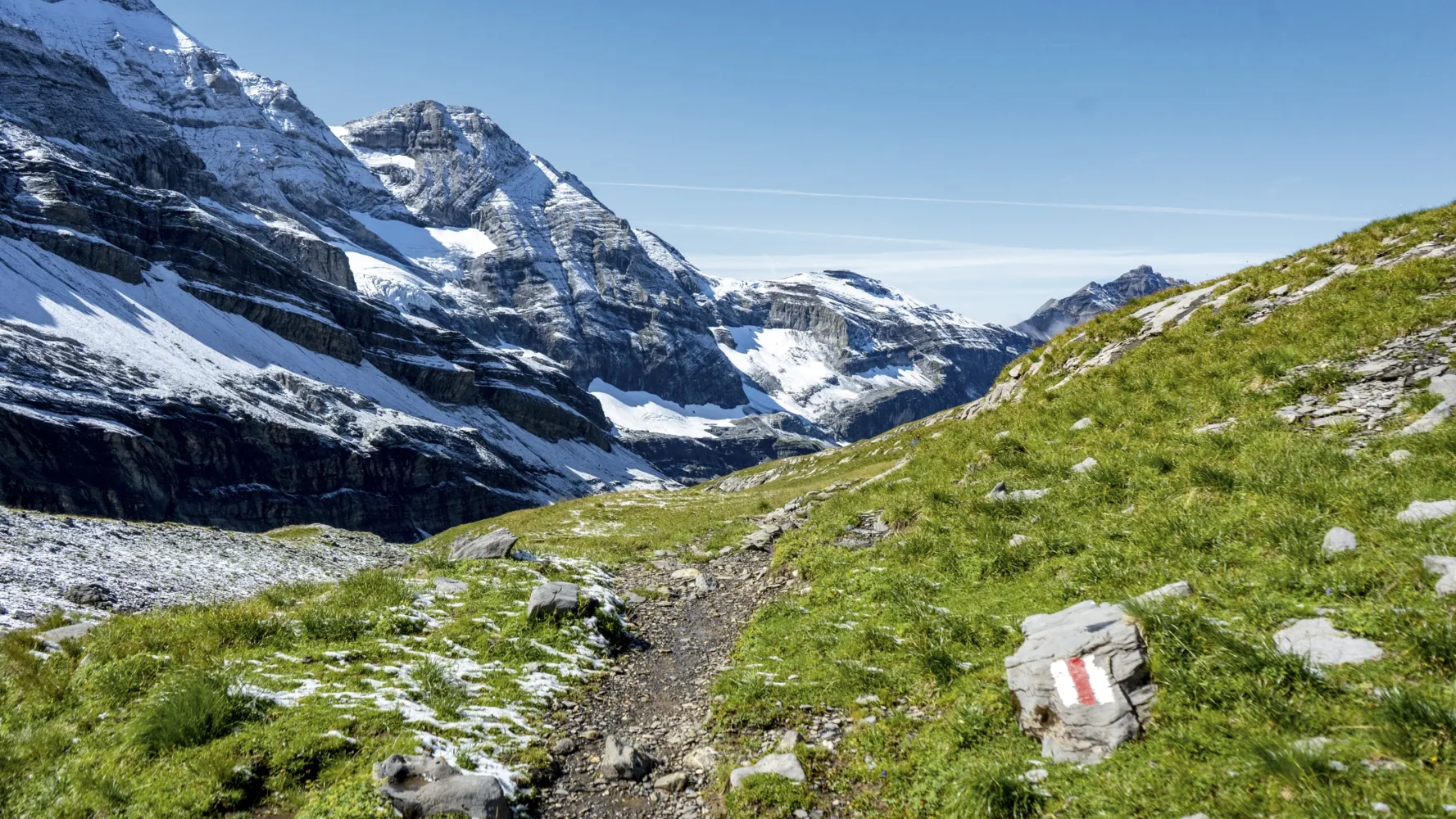
This scenic circuit loops around the turquoise waters of the Lac de Moiry – not at the level of the lake, but a couple of hundred meters higher up, at an altitude of roughly 2,500 m. Hikers may encounter various different names for the trail including «Tour du Lac de Moiry 2500», «Tour du Lac 2500», «Haut Tour du Lac» and «Chemin 2500». At the far end of the lake, the trail drops down to cross the river La Gougra, which feeds the reservoir – and which is in turn fed by the Glacier de Moiry higher up the valley. The path snakes past the glacial lake of Lac de Châteaupré before scaling an impressive glacial moraine to return to the 2,500-metre level – this time on the western side of the valley. The start and finish point of the circuit is the crest of the Moiry dam. The reservoir it has created also collects water from neighbouring valleys via a network of tunnels before channeling it down to the Rhône valley, 1,722 vertical meters below. On the way the water passes through three hydroelectric power stations, which produce enough electricity to meet the annual needs of more than 120,000 homes. Close to the crest, the dam restaurant has a large sunny terrace looking out over the lake. Climbing enthusiasts can tackle the via ferrata that scales the cliffs just below the dam, revealing dramatic views of the lower valley and the arched curtain of concrete, 148 m high. Highlights Panoramic high trail through a dramatic alpine landscape sculpted by glaciers Moiry dam – guided visits, restaurant with sun terrace, via ferrata
13.36 km805 m805 m4h 35mDifficulty: Medium
Maximum elevation: 2594m
Minimum elevation: 2249m
Learn more on
valais.ch
| Zinal, centre (10:07) | |
| 455 (42m) | |
| Moiry VS, glacier (10:49) |
The hike begins at Hotel Weisshorn and follows the tracks of the Sierre-Zinal mountain run down to Grimentz. You hike below the Pointes de Nava on a scenic stretch of path. This is a winding descent through the forest to Grimentz, a typical Valais village with wooden houses darkened by the sun.
12 km500 m1250 m4h 0mTour published by:
SwitzerlandMobility
Learn more on
schweizmobil.ch
| Zinal, centre (08:51) | |
| 453 (15m) | |
| Ayer, anc. poste (09:06) |
The Alpine Passes Trail strings together many of the most beautiful passes in the Graubunden and Valais Alps in 43 stages. One highlight follows another from the Greina Plateau to the passes and lake landscape at the foot of the Dents du Midi.
695 km47100 m49200 m
Landscape: With panoramic views,Over a pass
Tour published by:
SwitzerlandMobility
Learn more on
schweizmobil.ch
The around 500-year-old suone (irrigation channel) «Bisse des Sarrasin» and its 17 information panels are of great historical and technical interest. The route then leads via the «Grand Bisse de St-Jean» suone to the typical Valais village of Grimentz.
17 km900 m680 m5h 25mTour published by:
SwitzerlandMobility
Learn more on
schweizmobil.ch
| Zinal, centre (08:51) | |
| 453 (27m) | |
| Vissoie, poste (09:18) |
| Vissoie, poste (09:20) | |
| 452 (9m) | |
| St-Jean VS, village (09:29) |

The skilfully laid «bisses» irrigation channels are evidence of Valais history and culture. Fabulous flora along the way, the babbling water so soothing. The «Chemin des Bisses», a hike for all senses, follows the holy waters.
105 km4700 m4600 mLandscape: Along the water,Onto an alp,With panoramic views
Tour published by:
SwitzerlandMobility
Learn more on
schweizmobil.ch
High-altitude trail around the lake of Moiry at 2,500 m.a.s.l. The hike through the spectacular alpine landscapes shaped by glaciers promises beautiful views of the dam with its lake, the wild Moiry valley at the end of the Val d'Anniviers, and the glittering Moiry glacier.
14 km840 m840 m4h 45mLandscape: Along the water
Tour published by:
SwitzerlandMobility
Learn more on
schweizmobil.ch


