Discover ten fantastic hiking trails accessible by public transport from Le Châble, nestled in the heart of the Swiss Alps. From historic routes like the ViaFrancigena to challenging alpine treks in the Haut Val de Bagnes nature reserve, these paths offer diverse experiences for all levels of hikers. Enjoy panoramic views of glaciers, spot local wildlife, and explore charming mountain villages along the way.
The hikes are listed in order of travel time from Le Châble, making it easy to plan your adventure based on your schedule. Check out the map to explore thousands of destinations and activities, reachable from any starting point in Switzerland.
Much more on ovunta.com/en/map
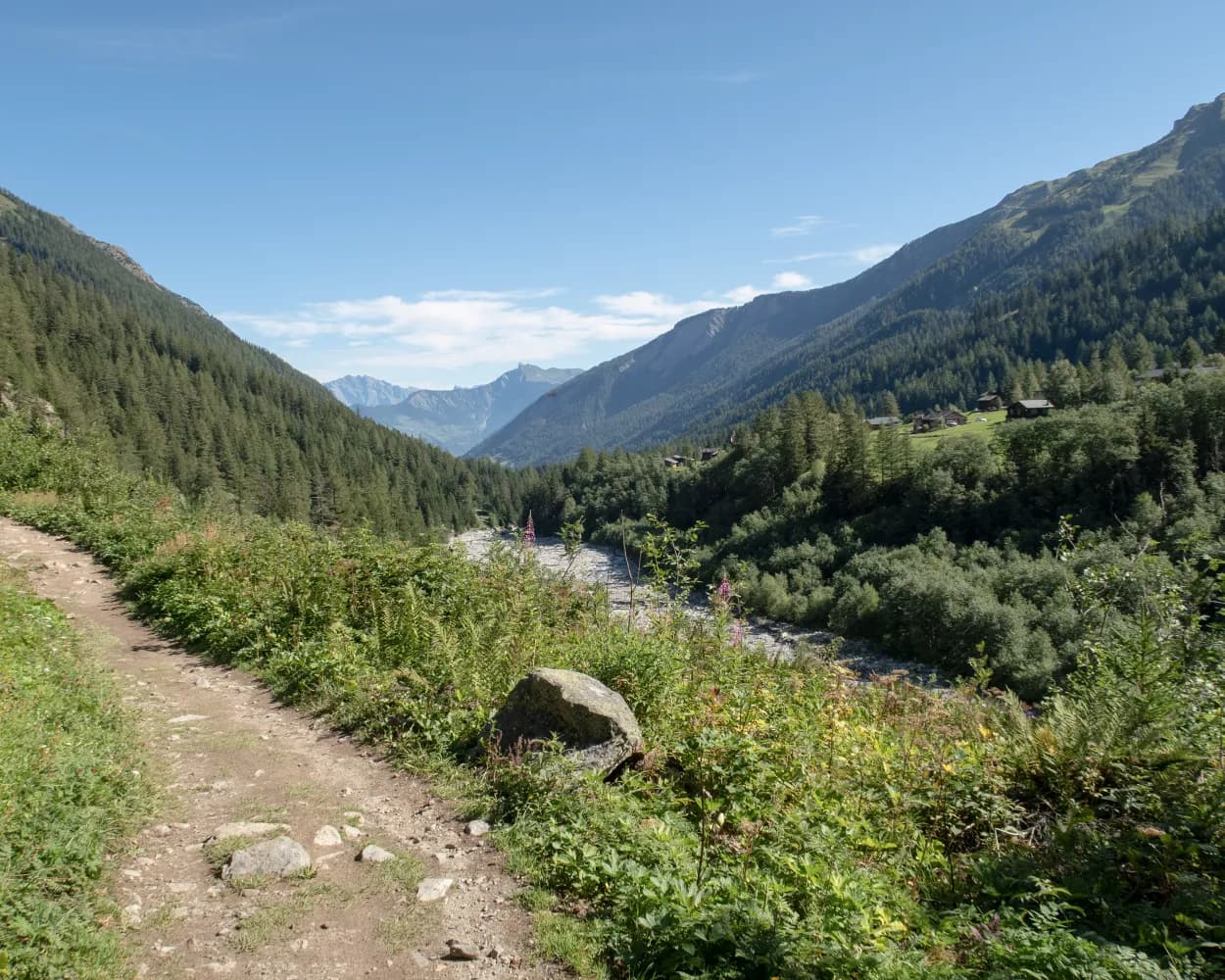
The Val d’Entremont, which leads up to the Great St Bernard Pass, has been an important transit route for thousands of years. The historical villages and hamlets that overlook the valley are beautifully preserved and full of charm. This delightful trail links some of the prettiest: Liddes, Chandonne, Commeire, La Rosière, Chamoille d’Orsières and La Douay. The oldest and best-known trail through the valley is the Via Francigena historical pilgrimage route from Canterbury to Rome. Our hike, however, follows a higher path through sunny alpine pastures, forest – and sleepy mountain villages off the beaten track. The hike starts at Liddes, with its 13th-century church and attractive small museum created in 2007. Next comes Chandonne, a hamlet perched on a sunny terrace at 1,454 m: a haven of tranquillity, like all the villages. They all also boast a rich architectural heritage in the form of traditional alpine houses and wooden barns. Commeire is a special example: a hamlet of barns converted for an innovative sustainable tourism project called «Montagne Alternative». This welcomes holidaymakers and seminar groups and also hosts events focusing on sustainable lifestyles. The hamlet has another surprise: an underground artillery fort, built from 1940-43 to house up to 140 soldiers to defend this strategic valley. The complex was disarmed long ago, but can be visited by the public – and part is even available for rental. The next village, La Rosière, attracts pilgrims in its own right as the childhood home of Maurice Tornay (1910–1949), a Roman Catholic priest who served in missions in China and Tibet and was beatified in 1993 by Pope John Paul II. The house in which he was born is open to the public. After passing through sleepy Chamoille, the trail finishes at La Douay, down in the floor of the valley. Highlights: Beautifully preserved villages – traditional architecture, historical charm Sweeping views – over the Val d’Entremont and to the Mont Blanc massif
 13.88 km
 405 m
405 m 910 m
910 m 3h 55m
| Le Châble VS (08:59) | |
| R81 (8m) | |
| Sembrancher (09:07) |
| Sembrancher (09:09) | |
| R (4m) | |
| La Douay (09:13) |
This easy circular walk through flower-bedecked meadows and larch forests starts at the Raclett'House restaurant in Bruson, at an altitude of about 1,000 metres. After an initial climb, the itinerary follows a gentle slope along the Bisse des Ravines, which was filled with water at the beginning of the 19th century, then abandoned in 1942 before being rehabilitated in October 2013. A pretty waterfall cascades under the gaze of a wolf carved in wood at the level of its water intake at an altitude of 1,300 metres, while the return journey offers an opportunity to discover the typical barns in the village of Bruson. This route is ideal for a family outing during the summer, as the bisse runs from mid-May to mid-October.
4.3 km160 m1h 50m
Difficulty:

Landscape: Along the water,Along a Suone/Bisse
Learn more on
valais.ch
and on
verbier.ch
| Le Châble VS, gare (09:48) | |
| 252 (13m) | |
| Bruson, Valbord (10:01) |
For generations, winemakers have grown vines on the sunny slopes overlooking Martigny. These are steep – hence the complex network of terraces and supporting dry-stone walls, carefully maintained by hand.This walk is a loop through the vineyards, with a series of illustrated panels covering vinegrowing techniques, local traditions, wildlife and history. Along the way, the trail leads past Martigny’s medieval castle, with reconstructions of siege weapons in the open courtyard. Climb the tower for a 360-degree panorama from the roof terrace. At the far end of the loop, the winemaking hamlet of Plan Cerisier is home to pretty houses, traditional wooden “mazot” barns and Switzerland’s smallest “mazot-museum”. The views from the café-restaurant’s wide, shady terrace over Martigny and the Rhône valley are superb. The final stretch of walk is a pleasant stroll along the river Dranse back into town. Highlights: Château de la Batiaz – courtyard with siege weapons, panoramic tower Plan Cerisier – pretty winemaking village, tiny “mazot” museum Martigny – many attractions within a few minutes’ walk of the trail, including Barryland (museum devoted to St. Bernard dogs and local history); Fondation Gianadda (world-class temporary art exhibitions plus collections of local Roman artefacts, vintage cars, sculpture garden); Roman amphitheatre; Museum of Earth Sciences (crystal collection); Le Manoir arts centre (exhibitions, live music)
6.39 km200 m199 m1h 45mDifficulty:

Maximum elevation: 666m

Minimum elevation: 467m
Learn more on
valais.ch
| Le Châble VS (08:59) | |
| R81 (19m) | |
| Martigny-Croix (09:18) |
Dazzling views await you throughout this hike, which overlooks the famous Verbier resort and offers a splendid panorama of the Rhône Valley, Val de Bagnes and the Combins and Mont Blanc massifs. Located at 2,343 metres in altitude, Savoleyres is the starting point for your hike. Stroll towards Croix-de-Cœur and walk along the mountain ridge until Col des Mines, before admiring the valley of the Lac des Vaux, whose waters are known for their clear reflections of the surrounding summits. This is the ideal spot to stop for a picnic before tackling the Col du Creblet ascent that winds around Mont Rogneux. After a long descent you’ll reach Les Ruinettes, where a cable car will take you back to Verbier.
8.76 km467 m606 m3h 0mDifficulty: Medium
Maximum elevation: 2639m
Minimum elevation: 2173m
Learn more on
valais.ch
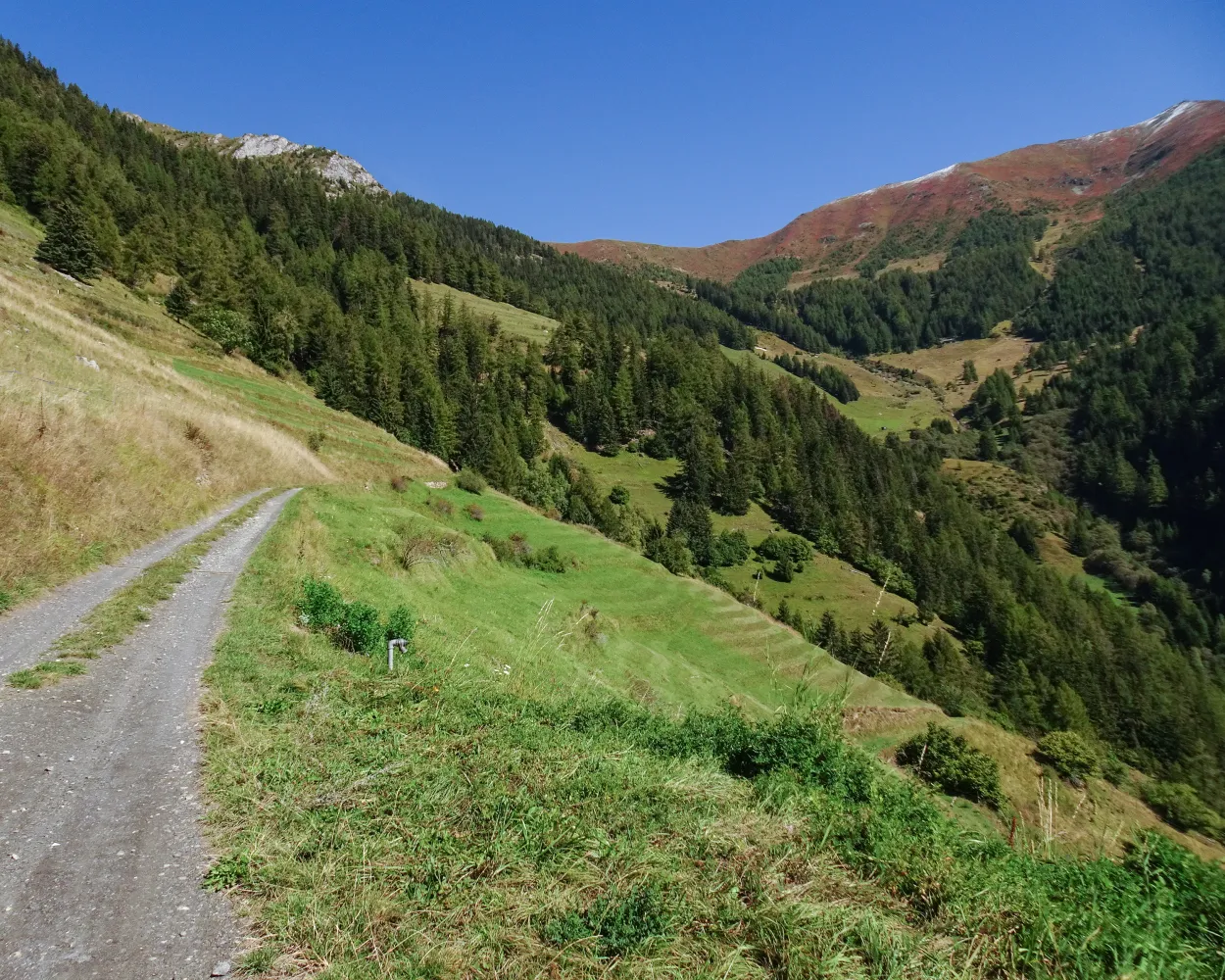
It drew its water from the Torrent de Versegères below the Chaux glacier at an altitude of 2,500 metres; this channel irrigated the entire territory of Vollèges commune. Another source, La Raye des Verbierins, added its waters to the channel’s flow below the Mont Fort hut. Since 1957 when the Mauvoisin Dam was built, a tunnel from Louvie to the Col du Lin has carried water to Le Levron and Vollèges.
14.6 km60 m4h 0mDifficulty: Hard
Landscape: Along the water,Along a Suone/Bisse
Learn more on
valais.ch
and on
valrando.ch
| Le Châble TV (08:32) | |
| GB (13m) | |
| Verbier (télécabine) (08:45) |
| Verbier (télécabine) (08:47) | |
| GB (6m) | |
| Croix-des-Ruinettes (08:53) |
With a little over 1,100 metres of difference in altitude, this first 29 kilometer leg links Verbier to the Essertze hut. Start off along the calm water of the Bisse du Levron for several kilometres, before setting off on beautiful climbs. The route takes you to the Col Termin and, higher up, the Col de Louvie, offering impressive views of the Val de Bagnes and the Combins range. The path then descends towards the Grand Désert lake, allowing you to walk through a landscape dotted with rocks and home to many ibex. Return to flat ground along the Bisse de Chervé, which leads you to the Mont-Rouge overlooking the Cleuson dam. After a last descent, you’ll arrive at the Essertze hut, managed by Hérémencia ski club volunteers. The wide variety of terrain offered by this initial leg is a perfect preview of the diversity and quality of the entire route.
29.65 km1183 m1179 m5h 40mDifficulty: Hard
Maximum elevation: 2921m
Minimum elevation: 2168m
Learn more on
valais.ch
Established 2000 years ago, in medieval times the ViaFrancigena became the most important pilgrims’ path in Europe. In Switzerland it leads through beautiful Jura and Alpine landscapes, the stage on the Grossen St. Bernhard being particularly magnificent.
200 km5600 m4000 mLandscape: With panoramic views
Tour published by:
SwitzerlandMobility
Learn more on
schweizmobil.ch
| Le Châble VS (08:59) | |
| R81 (8m) | |
| Sembrancher (09:07) |
This stage marks the beginning of the ascent to the Great St. Bernard Pass. From Martigny, a path that is steep in parts leads across the narrow Les Trappistes Pass to the medieval village of Sembrancher. From there, the route follows the Napoleon Trail.
20 km900 m500 m6h 0mLandscape: Through a gorge
Tour published by:
SwitzerlandMobility
Learn more on
schweizmobil.ch
Splendid hike across the sunny slopes of the Val d'Entremont. The trail leads through well-preserved villages with traditional architecture and historical charm, accompanied by a wonderful view of the valley and the Mont Blanc massif.
14 km420 m900 m4h 0mLandscape: With panoramic views
Tour published by:
SwitzerlandMobility
Learn more on
schweizmobil.ch

Spectacular panoramic views of the Valais Alps await the visitor on the Chemin des Ruinettes path above Verbier. Take the aerial gondola to the Croix-des-Ruinettes top station, where this breath-taking tour begins and ends.
2 km80 m10 m35m
Barrier free: Yes
Landscape: With panoramic views
Tour published by:
SwitzerlandMobility
Learn more on
schweizmobil.ch
Difficulty:
Maximum elevation: 1643m
Minimum elevation: 797m
Learn more on
valais.ch

