
Discover the natural beauty surrounding Disentis with these ten hikes, all accessible by public transport. From the historic Senda Sursilvana trail to the mystical Hexenplatte-Weg, each route offers unique landscapes and cultural experiences. Enjoy panoramic views of the Surselva region, traverse alpine meadows, and explore charming Grisons villages.
The hikes are listed in order of travel time from Disentis, making it easy to plan your adventure. Check out the map to explore thousands of destinations and activities, reachable from any starting point in Switzerland.
Much more on ovunta.com/en/map
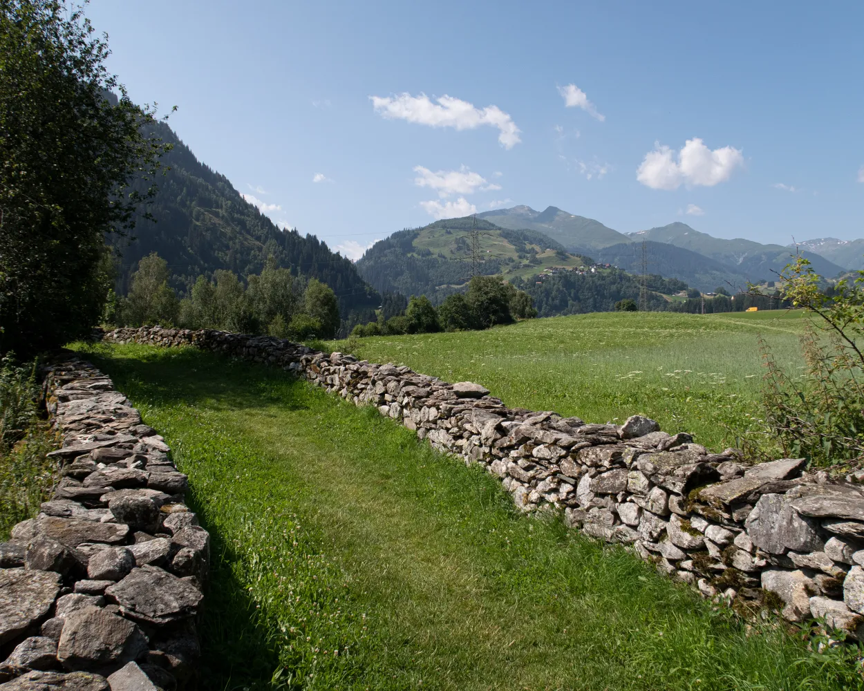
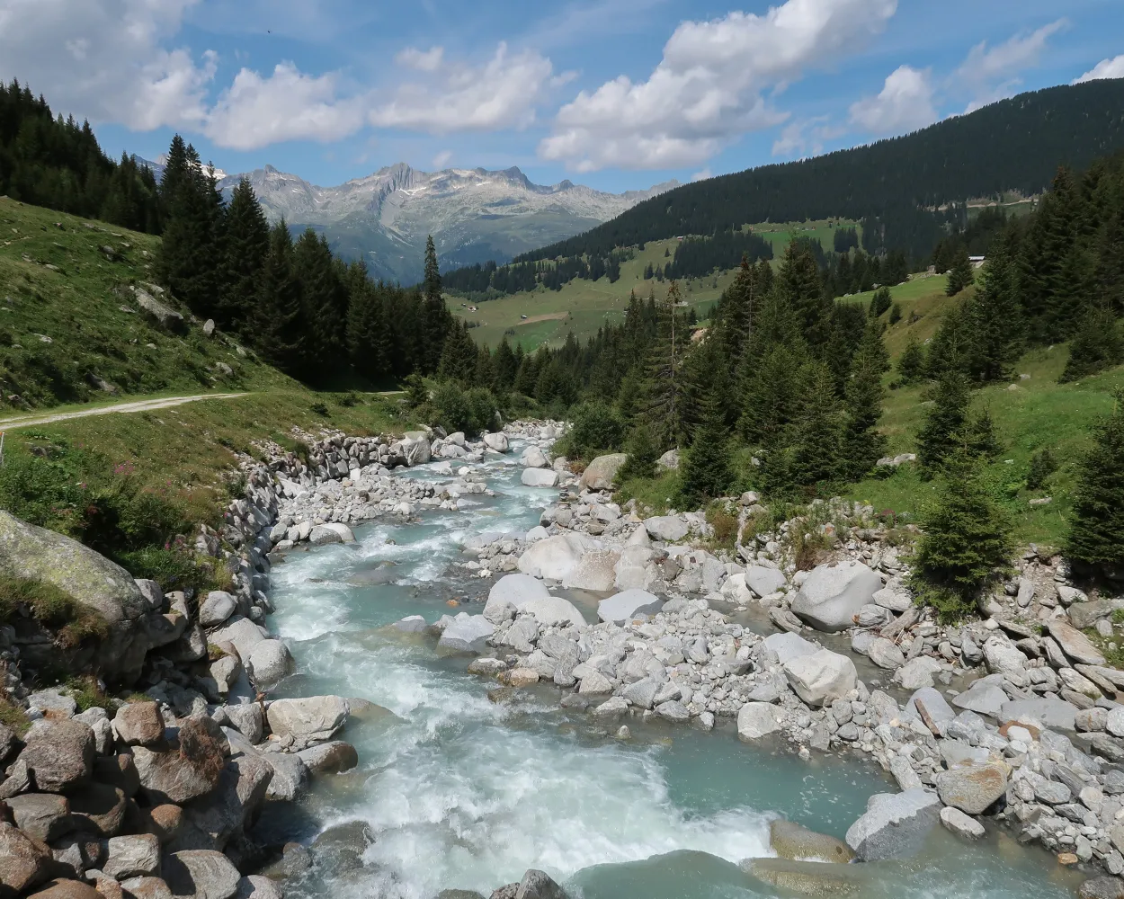
Relax by the side of the rushing Anterior Rhine and enjoy fantastic views of the Surselva from the Muntatsch. In between, visit chapels and churches with beautiful wall frescoes and dreamy little villages with typical farmhouses in Oberland style. The circular walk is usually passable even in winter.
 13 km
13 km 540 m
540 m 540 m
540 m 3h 45m
Landscape: With panoramic views
Tour published by:
SwitzerlandMobility
Learn more on
schweizmobil.ch
| Disentis/Mustér, staziun/posta (09:00) | |
| 491 (2m) | |
| Disentis/Mustér, Sogn Placi (09:02) |
Scenic pass and valley landscapes on the Jakobsweg route through multifaceted Graubünden. Cultural and historical signs of the Santiago pilgrim’s path – and stunning scenery inviting one to reflect on own values and the beauty of nature.
260 km11100 m10300 mLandscape: With panoramic views,Over a pass
Tour published by:
SwitzerlandMobility
Learn more on
schweizmobil.ch
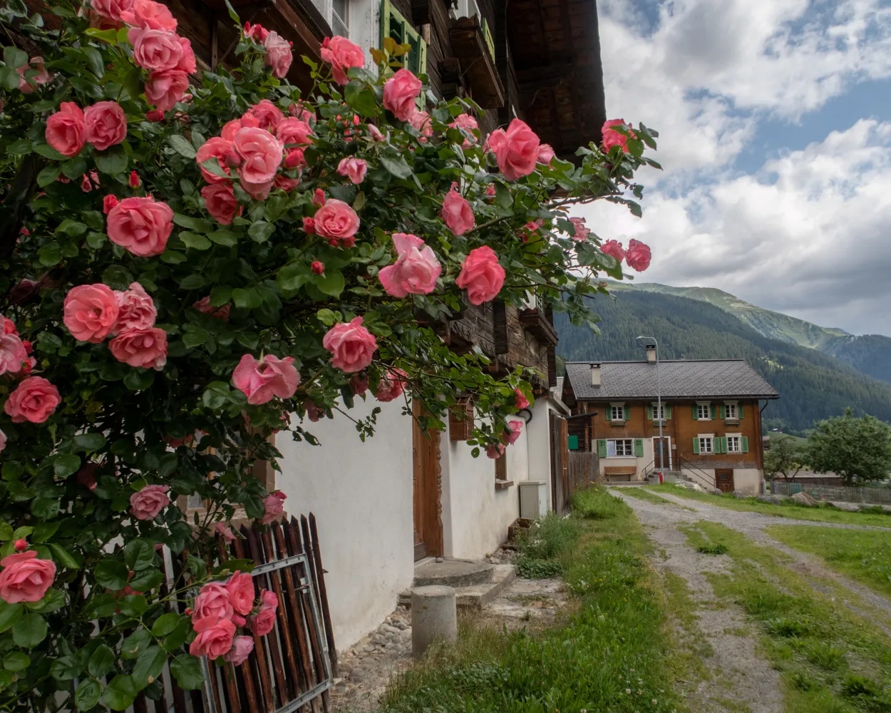
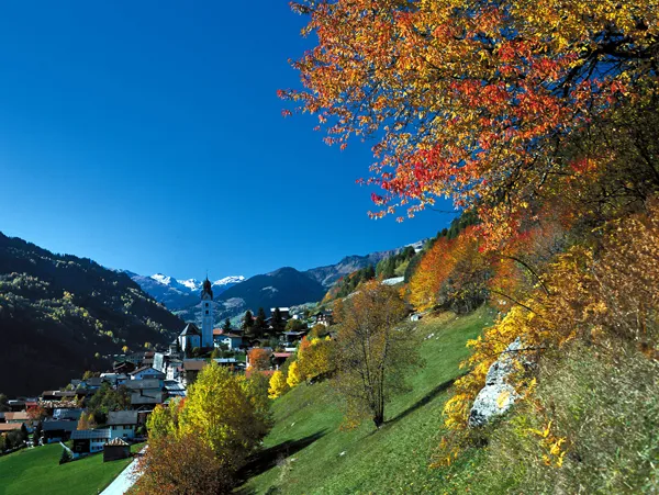
This stage of the Grisons Way of St. James leads through the dreamy villages of the Surselva along the Vorderrhein, which winds through the valley in countless loops. Densely wooded meadows and historic churches and decorated town houses line the route to Disentis.
13 km580 m300 m3h 35mTour published by:
SwitzerlandMobility
Learn more on
schweizmobil.ch
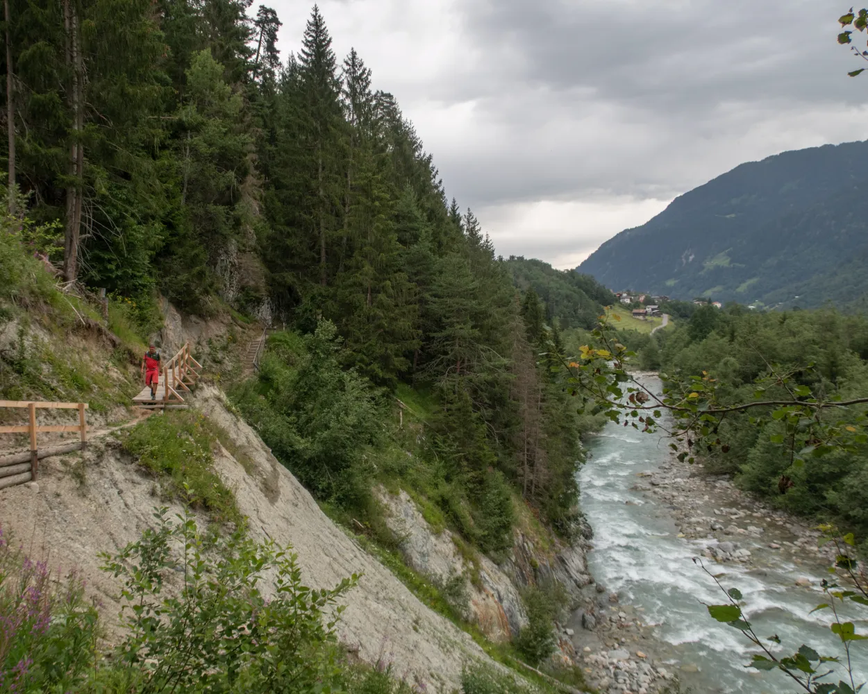
At the heart of this stage is Disentis with its Benedictine monastery. The legend about the chapel near Disla is also interesting. The riverside path along the Young Rhine leads to Sumvitg. We recommend taking a detour up to Bostg at the start.
18 km420 m820 m4h 50mLandscape: Along the water
Tour published by:
SwitzerlandMobility
Learn more on
schweizmobil.ch
| Disentis/Mustér (08:50) | |
| RE7 (8m) | |
| Sumvitg-Cumpadials (08:58) |
The Senda Sursilvana affords an insight into a whole region, one which holds many natural and cultural treasures. A high-level hike with several detours to the banks of the young Rhine.
105 km3300 m4800 mLandscape: With panoramic views,Over a pass
Tour published by:
SwitzerlandMobility
Learn more on
schweizmobil.ch
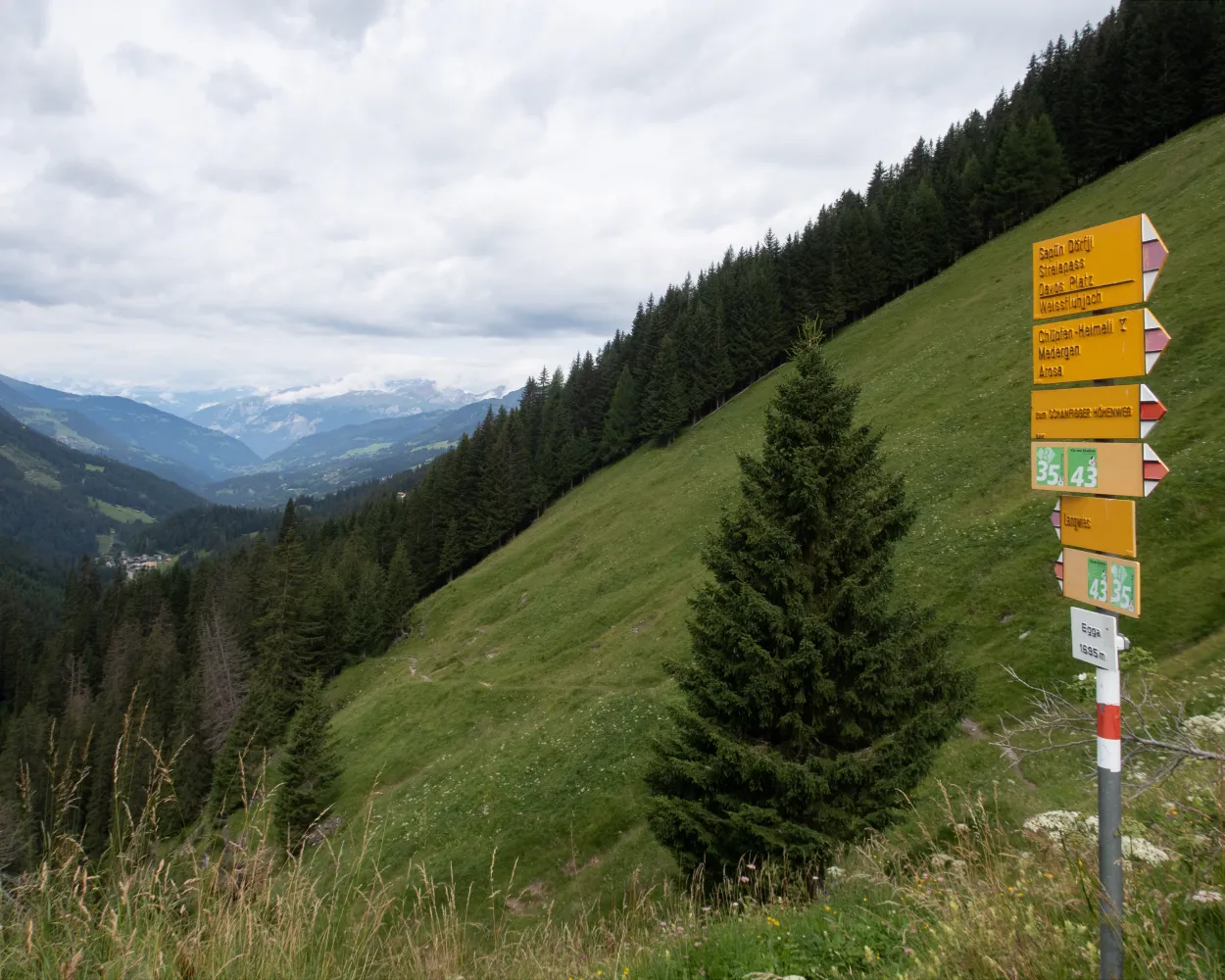
On the move in the world of the Walser people: from the Valais homeland, the trail follows in the footsteps of the settlers to areas in Surselva in Grisons. The route includes secluded pass routes from Binn to the upper Maggia Valley via Formazza in Italy. Other more well-known crossings lead to the Gotthard area and the Oberalp Pass. The long hike ends on isolated trails in Obersaxen, after you have covered more than 200 kilometres and an altitude difference of 14,000 metres.
210 km13900 m14000 mTour published by:
SwitzerlandMobility
Learn more on
schweizmobil.ch
From the Oberalp Pass, mountain paths that are mainly narrow wind down to the hamlet of Tschamut and then onwards across the golf course to the Walser settlement of Selva. After Cavorgia, the route climbs uphill again through the forest, and continues to the saddle above Mutschnengia. The stage ends just as steeply, through wild mountain forests and over freight roads in the Walser village of Curaglia.
21 km700 m1400 m6h 0mTour published by:
SwitzerlandMobility
Learn more on
schweizmobil.ch
| Disentis/Mustér, staziun/posta (10:01) | |
| 140 (8m) | |
| Curaglia, posta (10:09) |
Steep climb through a gorge and to the heights of Alp Soliva. High above the valley floor with superb views of Disentis and the Surselva, the path winds through torrent gorges, and across alpine meadows to the idyllic Lag da Laus. Finally, there follows the long descent to Val, located in a quiet side valley of the Surselva.
16 km1300 m1400 m6h 40mTour published by:
SwitzerlandMobility
Learn more on
schweizmobil.ch
The loop trail leads from Curaglia into the Val Plattas. Surrounded by an almost untouched natural and cultural landscape, you hike through forests, over alpine meadows and past picturesque mountain settlements. Along the route you will find instructions on how to use your senses consciously to experience nature in a holistic way.
6 km420 m420 m2h 10mLandscape: Along the water
Tour published by:
SwitzerlandMobility
Learn more on
schweizmobil.ch
This stage goes past small Oberland municipalities in Grisons such as Capaul, Capeder and Casu. The Sant’Onna chapel in Trun is steeped in history. Brigels is a friendly family holiday destination. Attractive view from Adlerstein on the edge of the village.
14 km880 m640 m4h 40mLandscape: Onto a mountain peak,With panoramic views
Tour published by:
SwitzerlandMobility
Learn more on
schweizmobil.ch
| Disentis/Mustér (08:50) | |
| RE7 (13m) | |
| Rabius-Surrein (09:03) |


