Relaxed or more challenging: these winter hikes are all reachable from Pontresina by public transport. From easy panoramic walks to longer alpine routes, there’s something for every level of winter hiker.
The destinations below are sorted by travel time from Pontresina to make planning easier. Be sure to check the map to explore all winter hikes and thousands of other outdoor activities reachable from any starting point in Switzerland.
Much more on ovunta.com/en/map
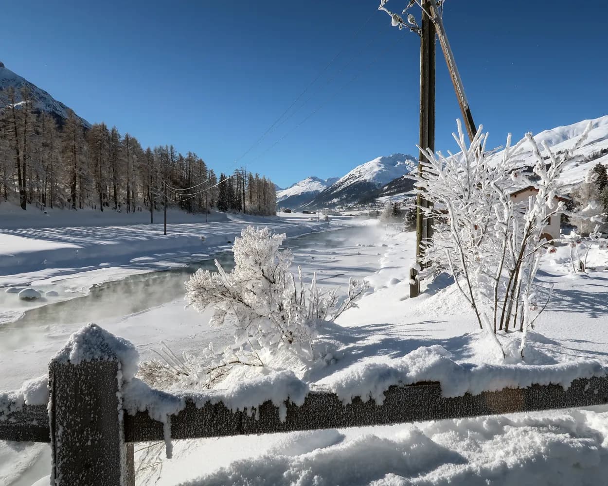
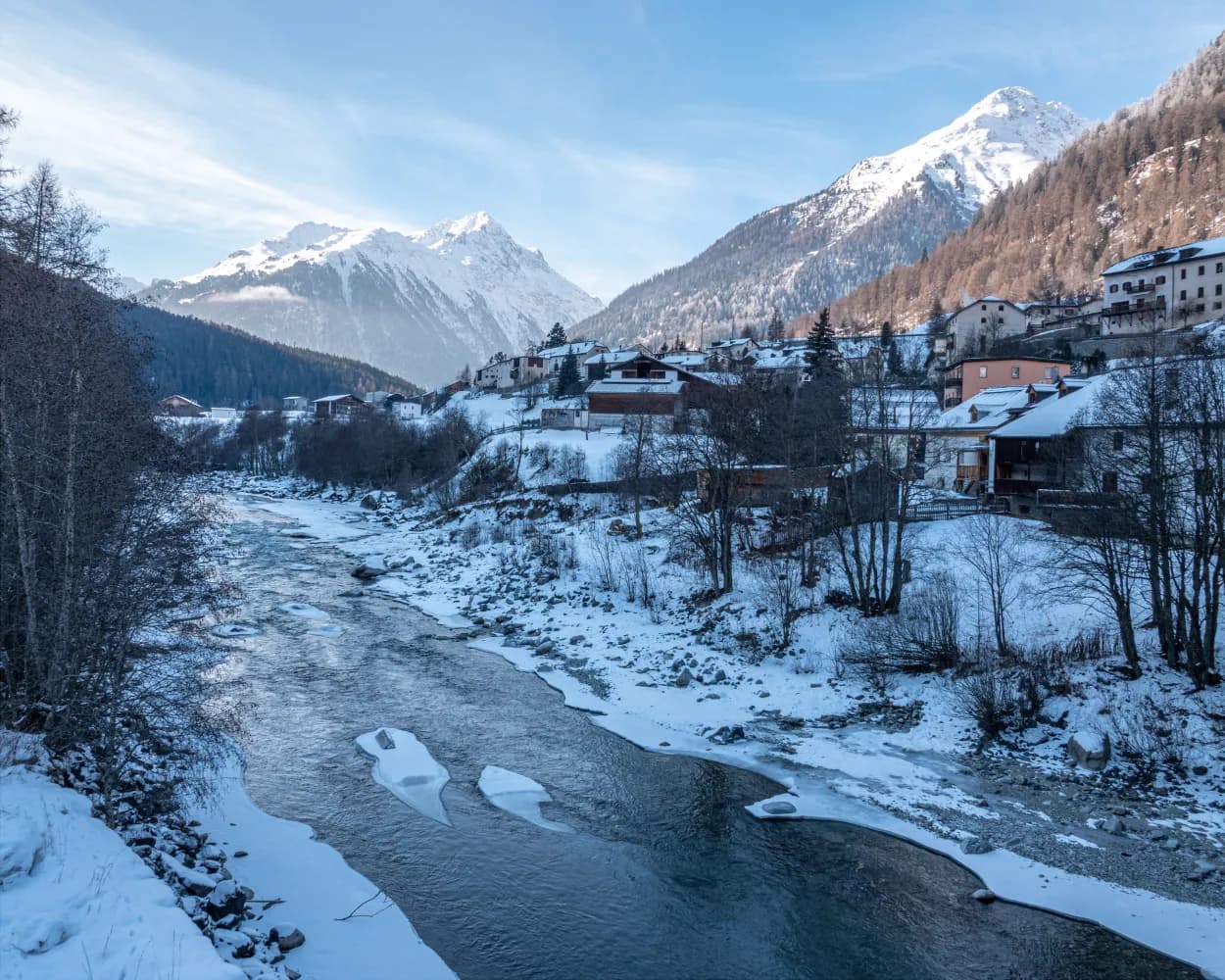
The vastness, the light – it’s simply incredible: On the way through the river landscape of the Upper Engadin, the vista sweeps across the broad valley with the Inn in the middle. The river’s restored sections are particularly appealing. They are the highlight of the winter hike from Samedan to La Punt.
 7km
7km 20m
20m 40m
40m 2h 5m
2h 5mTour published by:
SwitzerlandMobility
Learn more on
schweizmobil.ch
| Pontresina (09:05) | |
| R15 (7m) | |
| Samedan (09:12) |
A short trail through thousands of years of the Earth’s history. The Morteratsch Glacier Trail takes hikers along an easy path directly to the glacier tongue of the third longest glacier in the eastern Alps. An educational trail provides information on this receding glacier.
7km180m180m2h 10mTour published by:
SwitzerlandMobility
Learn more on
schweizmobil.ch
| Pontresina (09:04) | |
| RE9 (9m) | |
| Morteratsch (09:13) |
What space. What light. What joy! The La Plaiv winter hiking trail is one of the most beautiful trails in the Engadin. Your gaze wanders across the wide open valley as the Inn river rushes past and skiers weave their way down the slopes above Zuoz.
13km150m220m3h 50mTour published by:
SwitzerlandMobility
Learn more on
schweizmobil.ch
| Pontresina (09:05) | |
| R15 (18m) | |
| La Punt Chamues-ch (09:23) |
The region of Engadin St. Moritz owes much of its world-famous beauty to its unique lake plateau. And there is certainly something particularly poetic about a winter hike across these three frozen lakes.
17km120m80m5h 40mTour published by:
SwitzerlandMobility
Learn more on
schweizmobil.ch
| Pontresina (09:01) | |
| R19 (10m) | |
| St. Moritz (09:11) |
| St. Moritz, Bahnhof (09:16) | |
| 601 (22m) | |
| Surlej, Punt (09:38) |
A comfortable, wide winter hiking trail from Maloja village, mostly through forest. You pass Lake Cavloc with its nearby pasture, and turn at Plan Canin. Forest clearings afford unimpeded views of the Piz da la Margna and Piz Salacina peaks.
11km380m380m3h 45mTour published by:
SwitzerlandMobility
Learn more on
schweizmobil.ch
| Pontresina (09:01) | |
| R19 (10m) | |
| St. Moritz (09:11) |
| St. Moritz, Bahnhof (09:18) | |
| 604 (32m) | |
| Maloja, Cad'Maté (09:50) |
Easy and quiet winter hike between Susch and Lavin, two villages in the Lower Engadin. The path climbs gently through the forest to a clearing. At the end, it crosses open terrain and ultimately the Inn River on the way to the destination.
4km140m180m1h 20mTour published by:
SwitzerlandMobility
Learn more on
schweizmobil.ch
| Pontresina (09:05) | |
| R15 (54m) | |
| Susch (09:59) |
A winter hiking route on the sunny hillside at Bergün. Take a gentle walk through snow-covered forests to the hamlet of Latsch, where the Heidi films were shot, and enjoy the views into the Albula Valley and of the striking Bergünerstöcke peaks.
6km240m240m2h 5m
Landscape: With panoramic views
Tour published by:
SwitzerlandMobility
Learn more on
schweizmobil.ch
| Pontresina, Bahnhof (08:45) | |
| 602 (16m) | |
| Celerina, Cresta Palace (09:01) |
| Celerina (09:08) | |
| IR38 (38m) | |
| Bergün/Bravuogn (09:46) |
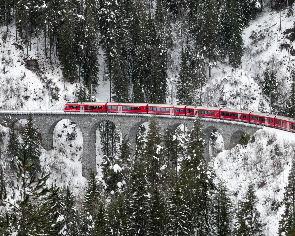
Pleasant winter hike through snowy forests to a viewing point with a dizzying view of the famous Landwasser Viaduct and down below to the Landwasser River. Take the same route back with firm ground underfoot.
2km90m90m50mLandscape: Through a Swiss Park,With panoramic views
Tour published by:
SwitzerlandMobility
Learn more on
schweizmobil.ch
This circular hike on the sunny pastures of the former mountain pass and trading village of Filisur passes scenic Schönboden and takes you via forests to the ruins of Greifenstein Castle from which the Graubünden nobility once dominated the region.
6km240m240m2h 5mTour published by:
SwitzerlandMobility
Learn more on
schweizmobil.ch
| Pontresina, Bahnhof (08:45) | |
| 602 (16m) | |
| Celerina, Cresta Palace (09:01) |
| Celerina (09:08) | |
| IR38 (51m) | |
| Filisur (09:59) |
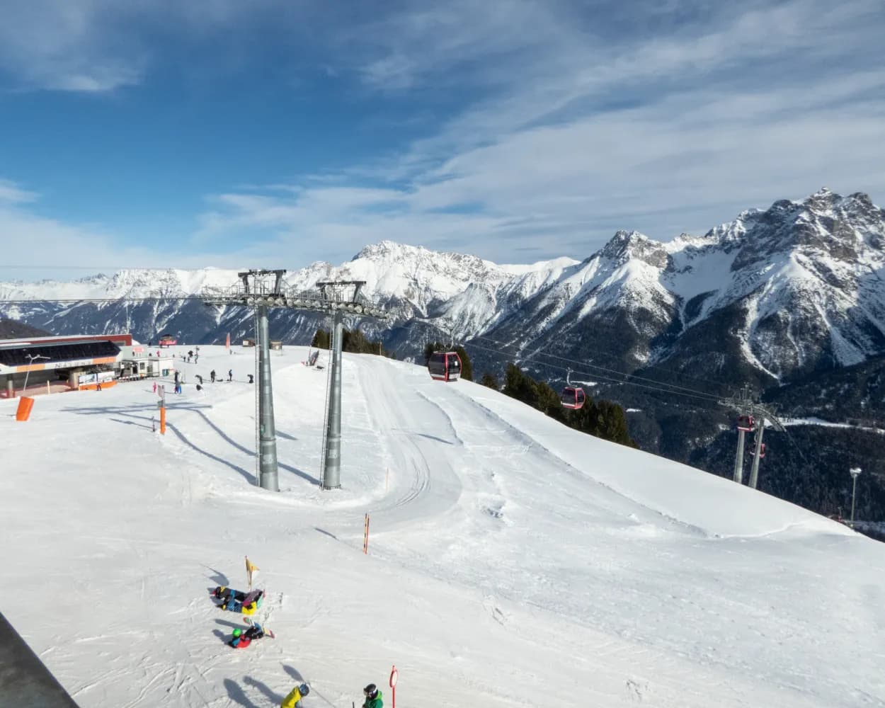
Alpine winter hike at over 2,000 m a.s.l.: in open countryside, alongside the «Traumpiste» and accompanied by a panoramic view of the Lower Engadine, this route links the Motta Naluns ski area to the Engadine village of Sent.
11km300m1000m4h 10mTour published by:
SwitzerlandMobility
Learn more on
schweizmobil.ch
| Pontresina (09:05) | |
| R15 (1h 20m) | |
| Scuol-Tarasp (10:25) |
| Scuol-Tarasp, staziun (10:31) | |
| 923 (11m) | |
| Sent, Sala (10:42) |