Discover a diverse range of hiking trails accessible by public transport from Sedrun, a charming village in the Swiss Alps. From the legendary Hexenplatte to the historic Walserweg Gottardo, these routes offer something for every hiker. Enjoy panoramic views of the Uri Alps, cross the source of the Rhine, or follow ancient mule trails through romantic valleys.
The hikes listed below are sorted by travel time from Sedrun, making it easy to plan your adventure based on your schedule. Check out the map to explore thousands of destinations and activities, reachable from any starting point in Switzerland.
Much more on ovunta.com/map
The Hexenplatte, (Witches' Stone), is a flat rock in the middle of a meadow on the Alp Caschlé. Legend has it that it was brought to Caschlé from the opposite side of the valley, suspended from the thread of a spider's web, and that witches once danced upon it.
 12km
12km 860m
860m 860m
860m 4h 20m
Barrier free: No

Landscape: With panoramic views
Tour provided by:
SwitzerlandMobility
Learn more on
schweizmobil.ch
Select an alternative stop on the map.
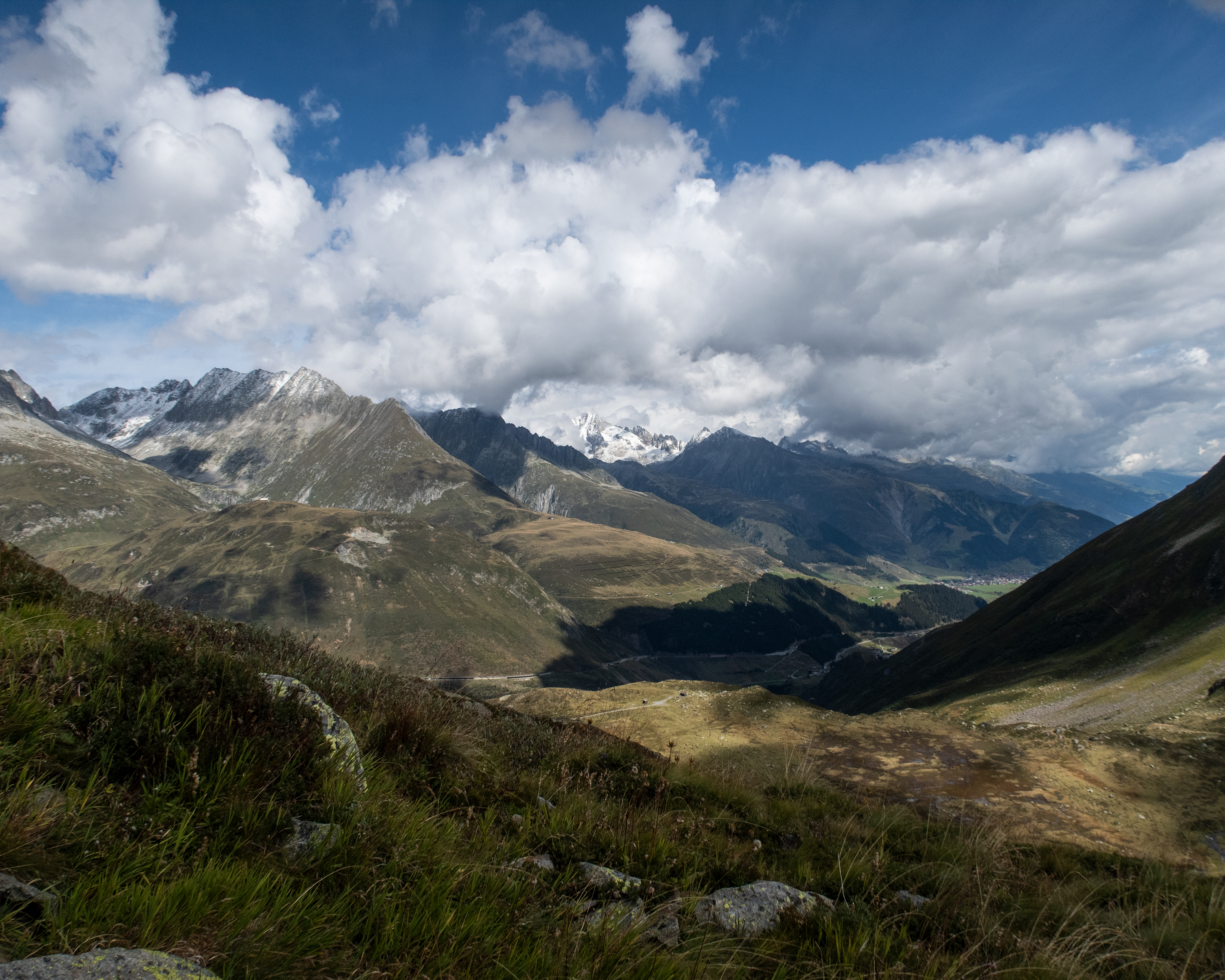
An impressive trail climbs steeply through the barrier woodland to the Gütsch. The view of the Urseren Valley and the Uri Alps is magnificent here. The high-altitude hike continues past Lake Lutersee and up to Felli Gap. Down through the valley, marked by watercourses, it ends at the Oberalp Pass with its lighthouse.
13km1100m500m5h 0mBarrier free: No
Tour provided by:
SwitzerlandMobility
Learn more on
schweizmobil.ch
Select an alternative stop on the map.
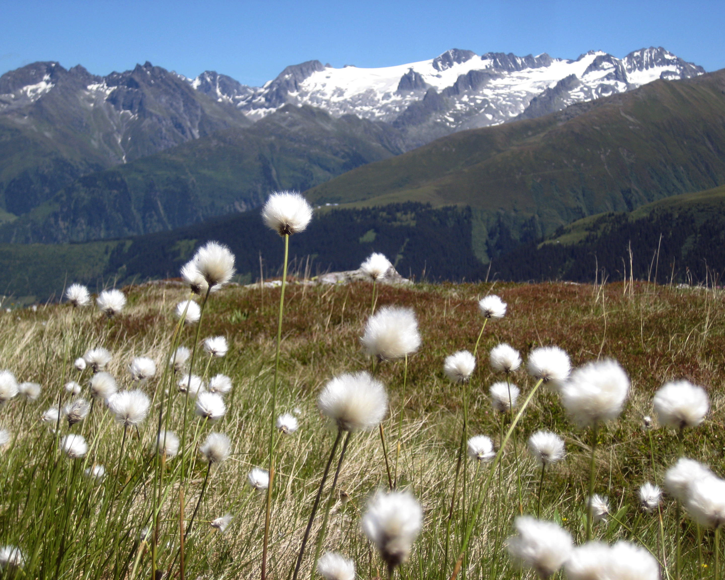
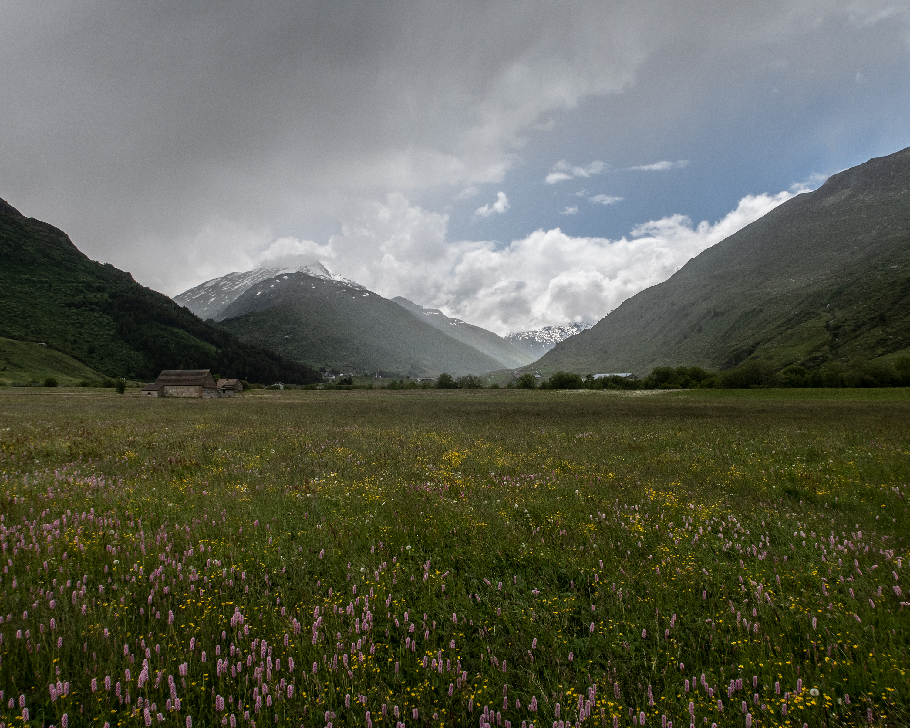
At over 2,000 metres above sea level, this hike leads across lush, scree-strewn meadows between massive slanting rock faces. Gentian, alpine roses and white cotton grass thrive around the high-moor lakes. One can cross the Rhine with three steps at its source; its water is even drinkable here.
13km820m820m4h 35mBarrier free: No
Tour provided by:
SwitzerlandMobility
Learn more on
schweizmobil.ch
Select an alternative stop on the map.

This stage goes past small Oberland municipalities in Grisons such as Capaul, Capeder and Casu. The Sant’Onna chapel in Trun is steeped in history. Brigels is a friendly family holiday destination. Attractive view from Adlerstein on the edge of the village.
14km880m640m4h 40mBarrier free: No
Landscape: Onto a mountain peak, With panoramic views
Tour provided by:
SwitzerlandMobility
Learn more on
schweizmobil.ch
Select an alternative stop on the map.
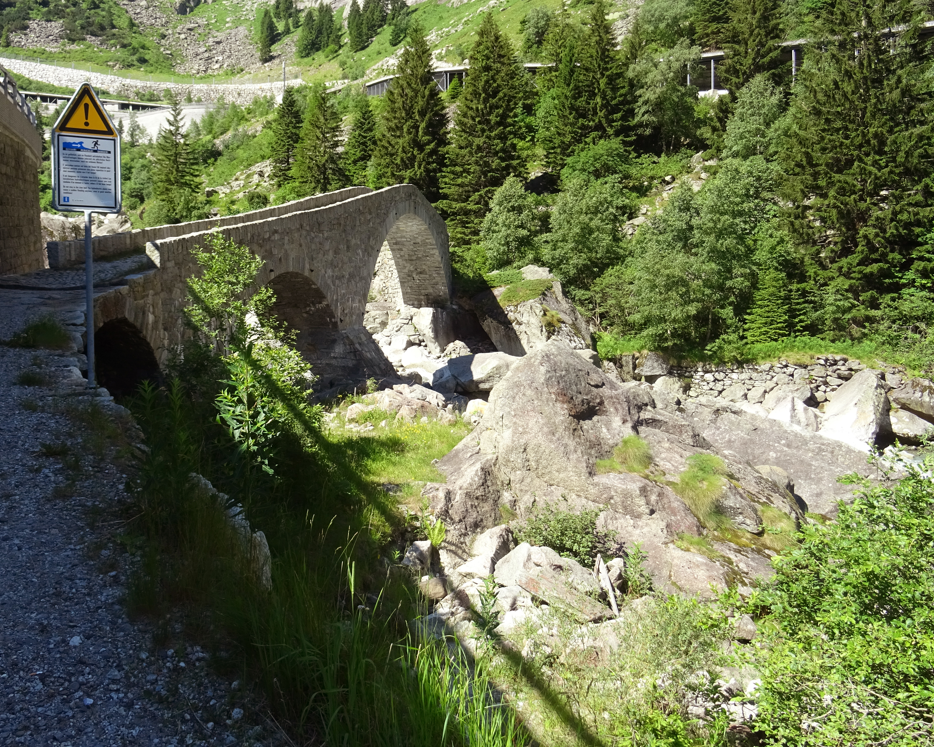
A stage for railway enthusiasts: part of the trail runs directly alongside the railway tracks and passes Göschenen and Andermatt, which played a key role in the history of Gotthard Pass transport. It includes the legendary Teufelsbrücke bridge, which spans the impressive Schöllenen Gorge.
10km680m160m3h 15mBarrier free: No
Landscape: Through a gorge, Over a pass, Along the water
Tour provided by:
SwitzerlandMobility
Select an alternative stop on the map.
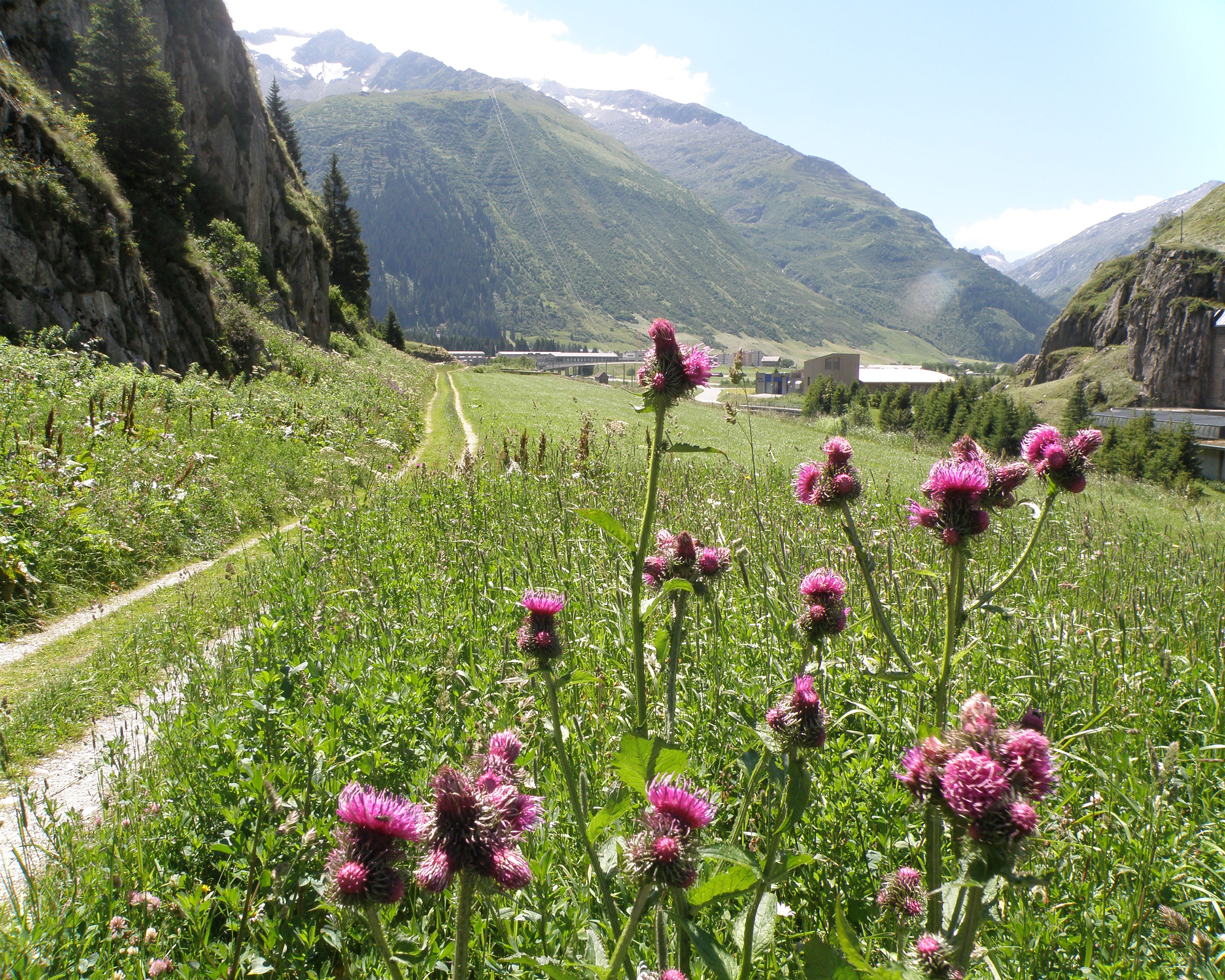
Follow the footsteps of the muleteers from Andermatt to the Gotthard Pass on the centuries-old north-south axis. The route along the Reuss through the romantic Urseren Valley to Hospental is mostly flat. From there, climb the historic mule trail to Switzerland’s most important Alpine pass, accompanied by the burbling Gotthard-Reuss River.
13km780m120m4h 0mBarrier free: No
Landscape: Over a pass, With panoramic views
Tour provided by:
SwitzerlandMobility
Select an alternative stop on the map.
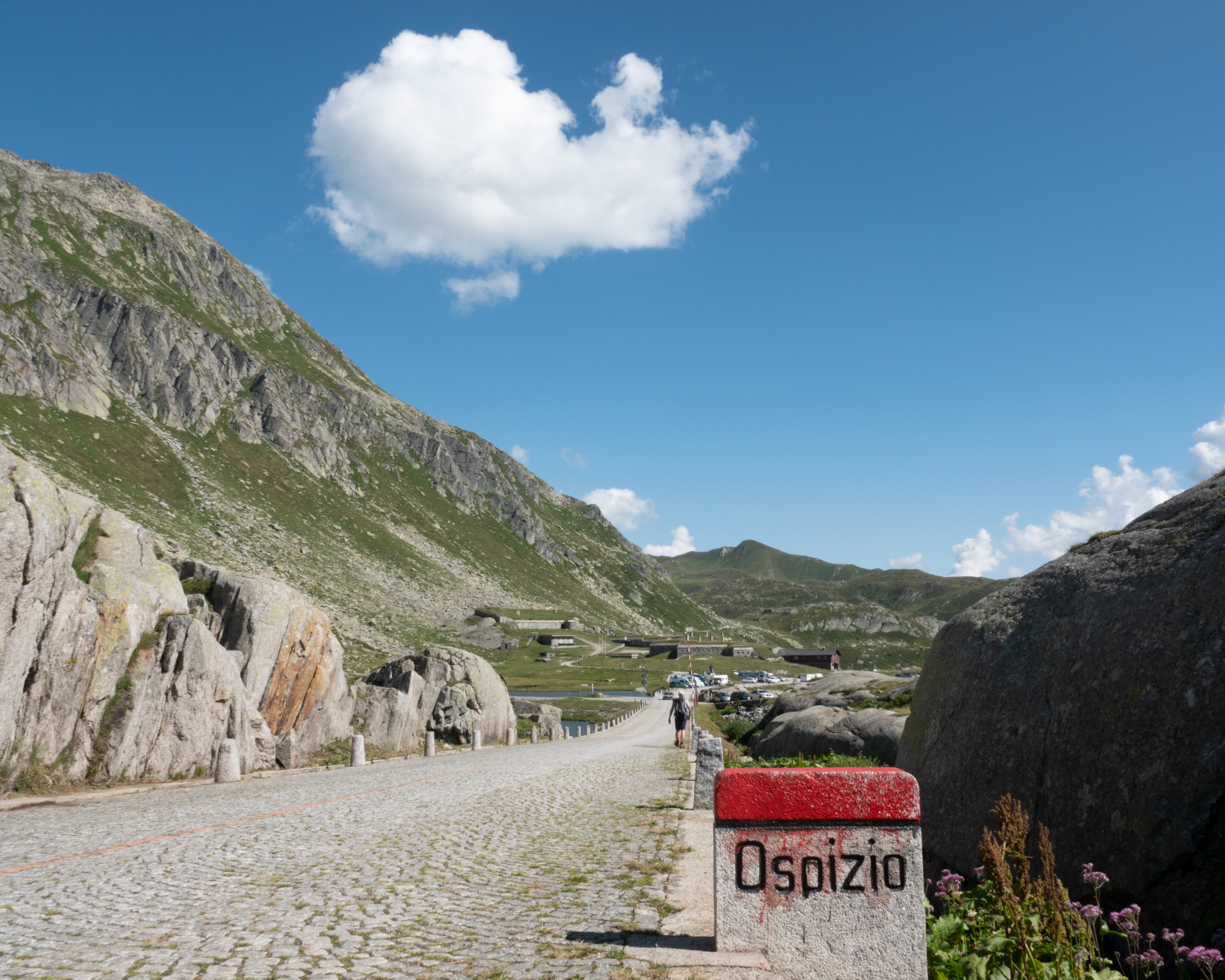
From Andermatt the hike continues to Hospental, a typical mountain-pass village with refuge shelters, a customs post and guest houses. The route then leads along part of the cobbled post coach road dating from 1830 and the old pack-animal trail up to the pass to the Hospiz (hostel).
13km780m120m4h 0mBarrier free: No
Landscape: Over a pass, Along the water, With panoramic views
Tour provided by:
SwitzerlandMobility
Select an alternative stop on the map.
Closely watched by the devil, the route leads from Wassen to Göschenen and through the bottleneck of the Schöllenenschlucht gorge to Andermatt. The sequence of historic routes, bridges, customs posts and hostels bring pre-modern transport to life.
10km680m160m3h 15mBarrier free: No
Landscape: Through a gorge, Along the water
Tour provided by:
SwitzerlandMobility
Learn more on
schweizmobil.ch
Select an alternative stop on the map.
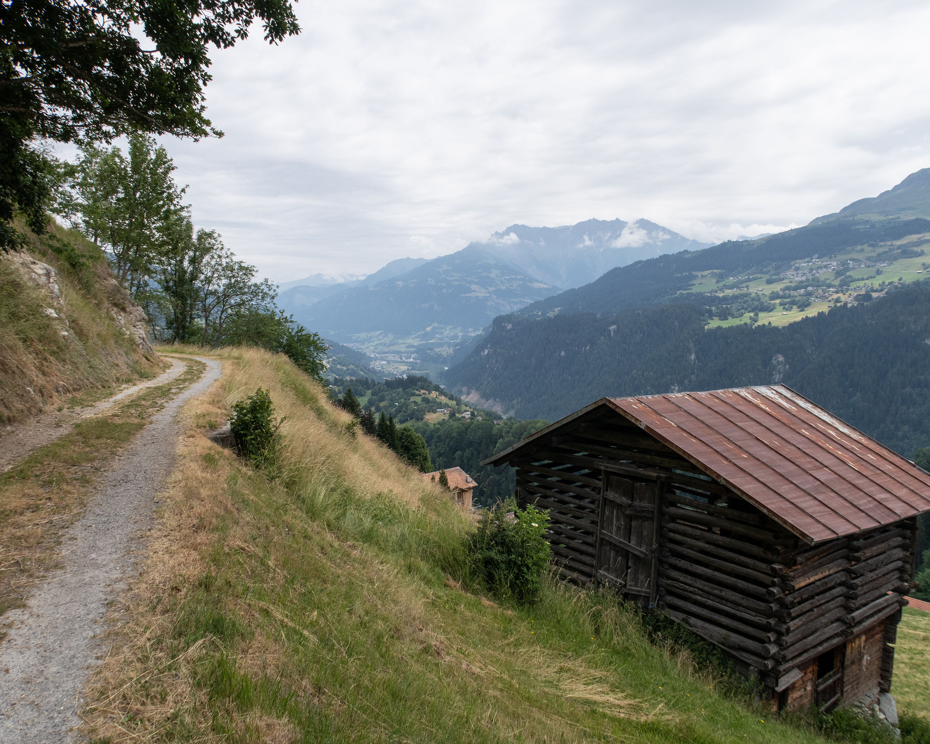
From Andiast, this stage leads to sun-drenched Brigels, which sits on a high plateau with its houses that are browned by the sun, the historic village centre and the stunning Lake Brigels. With a view of the Vorderrhein, you cross alpine meadows and mountain streams until you arrive in historic Trun.
16km640m950m4h 50mBarrier free: No
Tour provided by:
SwitzerlandMobility
Learn more on
schweizmobil.ch
Select an alternative stop on the map.
Steep climb through a gorge and to the heights of Alp Soliva. High above the valley floor with superb views of Disentis and the Surselva, the path winds through torrent gorges, and across alpine meadows to the idyllic Lag da Laus. Finally, there follows the long descent to Val, located in a quiet side valley of the Surselva.
16km1300m1400m6h 40mBarrier free: No
Tour provided by:
SwitzerlandMobility
Learn more on
schweizmobil.ch
Select an alternative stop on the map.
Learn more on
schweizmobil.ch
Learn more on
schweizmobil.ch
Learn more on
schweizmobil.ch