Whether skating or classic: these ten cross-country skiing destinations are all reachable from Olten by public transport. From romantic forest tracks to scenic high-altitude loops, there’s something for every level of Nordic skier.
The destinations below are sorted by travel time from Olten to make your planning easier. Make sure to visit the map to explore all cross-country skiing areas and thousands of other outdoor activities reachable from any starting point in Switzerland.
Much more on ovunta.com/en/map
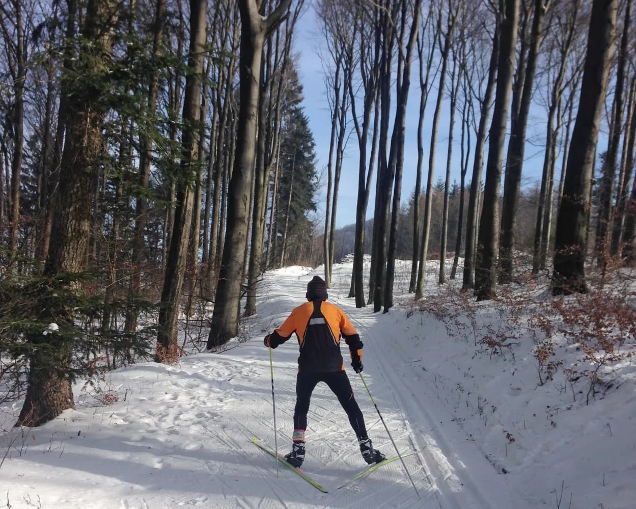
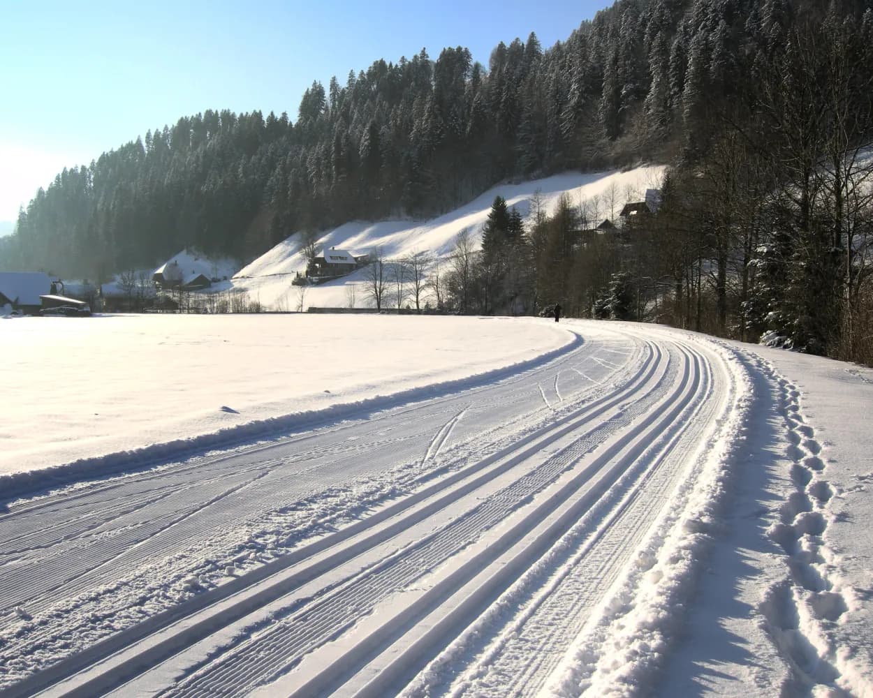
Home to Switzerland's national sports centre, this resort above Biel/Bienne in the Jura foothills combines athletic heritage with forest trails. The terrain attracts both recreational skiers and those with a more competitive mindset seeking structured training conditions.
 12.5km
Learn more on
j3l.ch
| Olten (08:41) | |
| IC5 (33m) | |
| Biel/Bienne (09:14) |
| Biel/Bienne Magglingenb.(Funi) (09:27) | |
| 22 (6m) | |
| Magglingen/Macolin (09:33) |
| Magglingen, Seilbahn (09:40) | |
| 79 (3m) | |
| Magglingen, End der Welt (09:43) |
Located in the Bernese Oberland near Adelboden, Feldenmaas provides a compact network of trails winding through gentle alpine meadows. This peaceful spot suits those looking for a relaxed outing amid mountain scenery without venturing into high-altitude terrain.
5.4kmLearn more on
loipe-feldenmaas.ch
| Olten (08:30) | |
| IR35 (30m) | |
| Zürich Altstetten (09:00) |
| Zürich Altstetten (09:15) | |
| S5 (14m) | |
| Bonstetten-Wettswil (09:29) |
| Bonstetten-Wettswil, Bahnhof (09:35) | |
| 227 (4m) | |
| Bonstetten, Sunnenberg (09:39) |
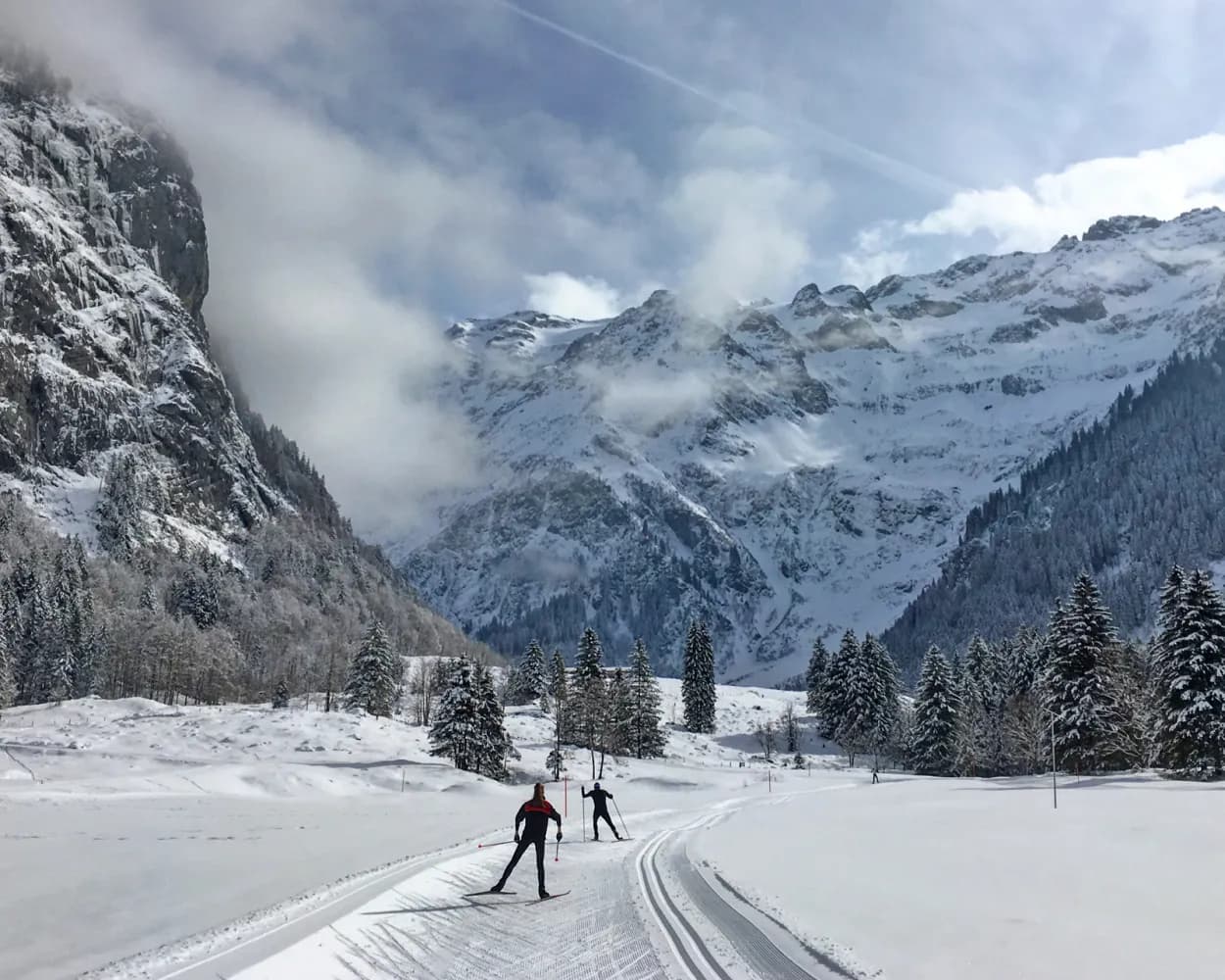
Dominated by the glacier-capped Titlis peak, this monastery village in central Switzerland hosts an extensive valley trail network. Routes stretch along the Engelberger Aa river through wide Alpine meadows surrounded by dramatic cliffs and forested slopes.
32.4kmLearn more on
snow.myswitzerland.com
and on
schweizmobil.ch
| Olten (08:30) | |
| IR26 (35m) | |
| Luzern (09:05) |
| Luzern (09:10) | |
| IRLEX (43m) | |
| Engelberg (09:53) |
Varied circular route under the crest of the Gisliflue in the Jura mountains of Aargau. Partly through the wood, and partly along the wood's edge, the route provides magnificent views over the Jura mountains close by to the entire Alpine range.
9.6kmTour published by:
SwitzerlandMobility
Learn more on
schweizmobil.ch
| Olten (08:35) | |
| RE12 (9m) | |
| Aarau (08:44) |
| Aarau, Bahnhof (09:02) | |
| 135 (15m) | |
| Staffelegg, Passhöhe (09:17) |
The Kalthof-Wiliberg ski run is seen as an insider tip in the centre of the country. The varied and slightly hilly route over the plateau between the Suhrental and the Uerkental valley provides a view of the Alps and the Jura mountain chain.
7.3kmTour published by:
SwitzerlandMobility
Learn more on
schweizmobil.ch
| Olten (08:35) | |
| RE12 (9m) | |
| Aarau (08:44) |
| Aarau (08:54) | |
| S14 (24m) | |
| Schöftland (09:18) |
| Schöftland, Bahnhof (09:35) | |
| 85 (3m) | |
| Staffelbach, Gemeindehaus (09:38) |
You can also enjoy cross-country skiing in Aargau: in the natural arena of Moos near Leutwil for example. The loop with several challenging uphill and downhill sections first crosses an open landscape before taking you around the edge of the wood.
3.3kmTour published by:
SwitzerlandMobility
Learn more on
schweizmobil.ch
| Olten (08:35) | |
| RE12 (9m) | |
| Aarau (08:44) |
| Aarau (08:56) | |
| S14 (15m) | |
| Teufenthal AG (09:11) |
| Teufenthal AG, Bahnhof (09:34) | |
| 395 (9m) | |
| Leutwil, Dorfplatz (09:43) |
Get to know Switzerland from its authentic side: far from any main road, the Rickenbach cross-country skiing trail wends its way through the scenic Michelsamt region amid hills, open fields and rustic farms.
7.6kmTour published by:
SwitzerlandMobility
Learn more on
schweizmobil.ch
| Olten (08:35) | |
| RE12 (9m) | |
| Aarau (08:44) |
| Aarau (08:56) | |
| S14 (37m) | |
| Menziken (09:33) |
| Menziken, Bahnhof (09:36) | |
| 399 (9m) | |
| Rickenbach LU, Dorf (09:45) |
A baroque abbey, the delightful landscape of Lake Sihl, the Schwyz mountains and the peaceful Schwantenau moor – the Schwedentritt half-marathon trail demands a huge effort from skiers, but also rewards them with magnificent views.
21.9kmTour published by:
SwitzerlandMobility
Learn more on
snow.myswitzerland.com
and on
schweizmobil.ch
| Olten (08:30) | |
| IR35 (1h 1m) | |
| Wädenswil (09:31) |
| Wädenswil (09:34) | |
| S13 (16m) | |
| Biberbrugg (09:50) |
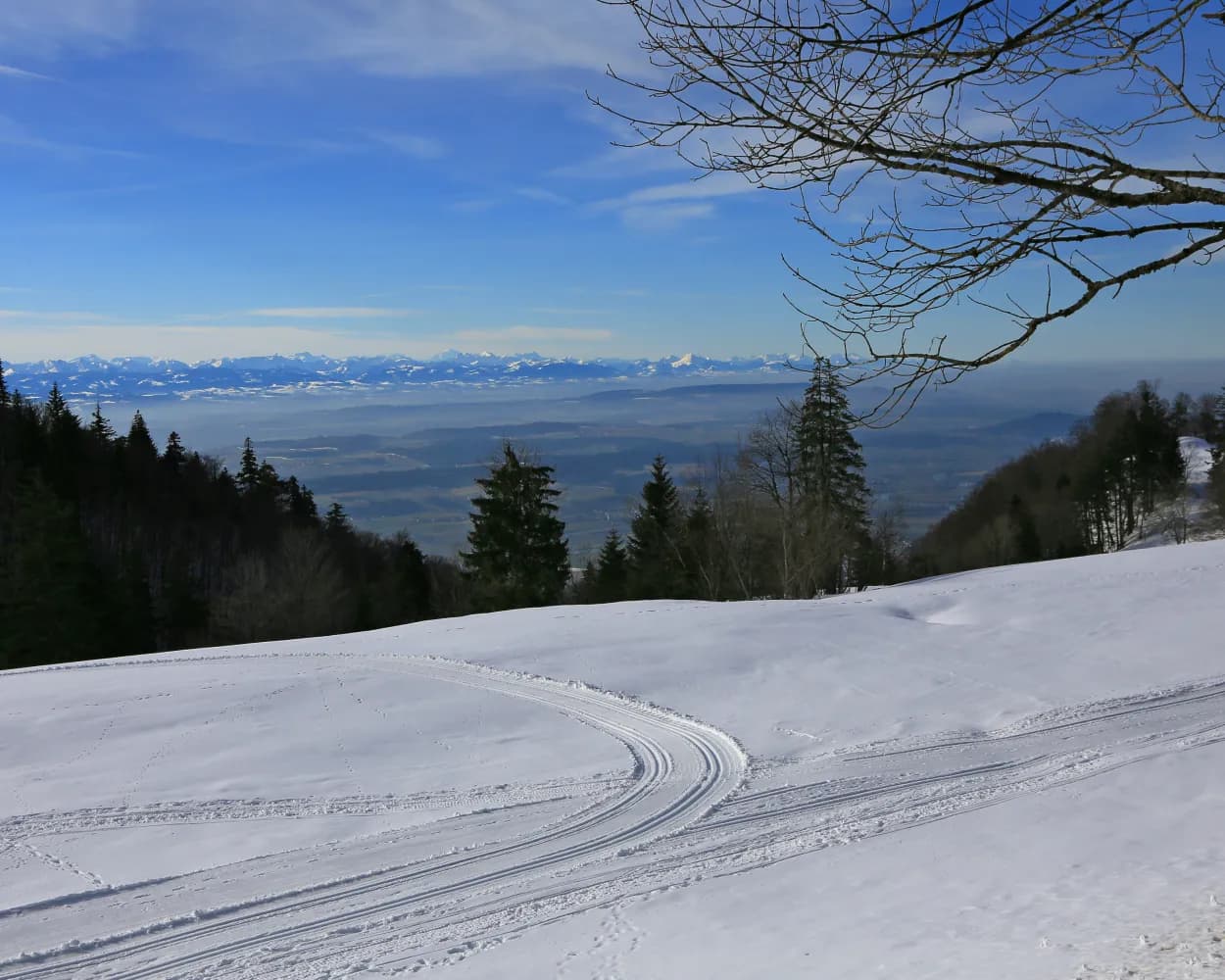
Whether it’s a leisurely stroll or fast-paced cross-country skiing – on Mount Weissenstein above Solothurn, everyone can escape the fog of the Swiss Plateau and enjoy marvellous views.
3kmTour published by:
SwitzerlandMobility
Learn more on
schweizmobil.ch
| Olten (08:41) | |
| IC5 (17m) | |
| Solothurn (08:58) |
| Solothurn, Hauptbahnhof (09:04) | |
| 1 (15m) | |
| Oberdorf SO, Endhalt (09:19) |
| Oberdorf SO (Talstation) (09:49) | |
| 2026 (12m) | |
| Weissenstein (10:01) |
Cross-country skiing in the upper Emmental surrounded by unspoiled hills. Lined with wooded slopes, this flat trail winds its way along the valley floor between Langnau and Trubschachen, following the Ilfis river. Impressive Emmental farmhouses are dotted along both sides of the cross-country skiing trail.
4.5kmTour published by:
SwitzerlandMobility
Learn more on
schweizmobil.ch
| Olten (08:36) | |
| IR35 (29m) | |
| Burgdorf (09:05) |
| Burgdorf (09:11) | |
| S44 (18m) | |
| Ramsei (09:29) |
| Ramsei, Bahnhof (09:31) | |
| 284 (26m) | |
| Bärau, Schwimmbad (09:57) |