Whether skating or classic: these ten cross-country skiing destinations are all reachable from Lucerne by public transport. From romantic forest tracks to scenic high-altitude loops, there’s something for every level of Nordic skier.
The destinations below are sorted by travel time from Luzern to make your planning easier. Make sure to visit the map to explore all cross-country skiing areas and thousands of other outdoor activities reachable from any starting point in Switzerland.
Much more on ovunta.com/en/map
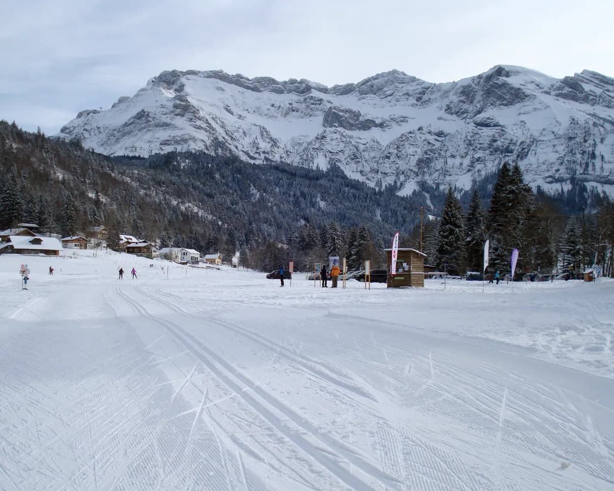
Dominated by the glacier-capped Titlis peak, this monastery village in central Switzerland hosts an extensive valley trail network. Routes stretch along the Engelberger Aa river through wide Alpine meadows surrounded by dramatic cliffs and forested slopes.
 32.4 km
Learn more on
snow.myswitzerland.com
and on
schweizmobil.ch
| Luzern (09:10) | |
| IRLEX (43m) | |
| Engelberg (09:53) |
The Finsterwald cross-country trails above the Entlebuch rank amongst the most scenic in Switzerland. The Wissenegg trail passes through a varied forest and moorland area within the boundary of the UNESCO Biosphere Entlebuch.
17.1 kmTour published by:
SwitzerlandMobility
Learn more on
langlauf-finsterwald.ch
and on
schweizmobil.ch
| Luzern (08:57) | |
| RE7 (25m) | |
| Entlebuch (09:22) |
| Entlebuch, Bahnhof (09:25) | |
| 232 (7m) | |
| Finsterwald LU, Chilenwald (09:32) |
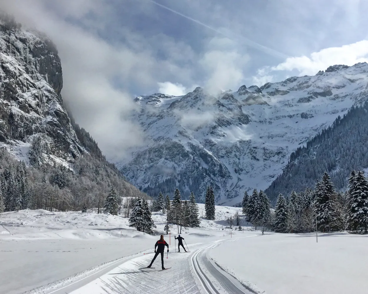
Go cross-country skiing in the home patch of an Olympic medal winner: the local trail of skiing legend Sepp Haas is nestled in the UNESCO Biosphere Entlebuch. Skiers enjoy extensive views of the impressive karst terrain at the foot of the Schrattenfluh.
31.9 kmTour published by:
SwitzerlandMobility
Learn more on
schweizmobil.ch
| Luzern (08:57) | |
| RE7 (39m) | |
| Escholzmatt (09:36) |

The Eigenthal valley lies at the northern foot of the Pilatus, not quite 15 kilometres south-west of Lucerne. Its popularity in winter is due to two factors: it is generally fog-free, and it boasts cross-country skiing trails.
16.1 kmTour published by:
SwitzerlandMobility
Learn more on
schweizmobil.ch
| Luzern, Bahnhof (08:40) | |
| 71 (32m) | |
| Eigenthal, Eigenthalerhof (09:12) |

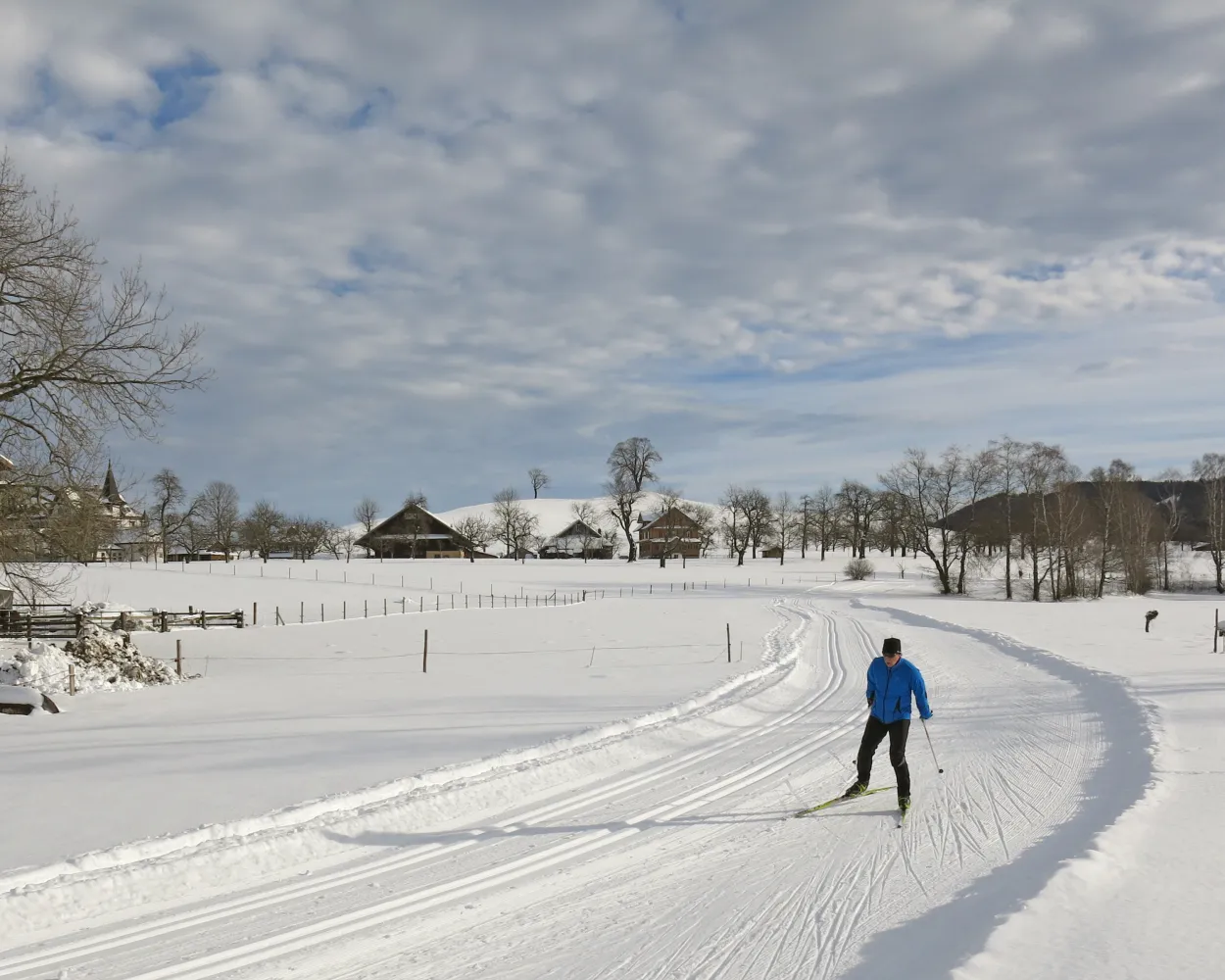
Cross-country skiing in the upper Emmental surrounded by unspoiled hills. Lined with wooded slopes, this flat trail winds its way along the valley floor between Langnau and Trubschachen, following the Ilfis river. Impressive Emmental farmhouses are dotted along both sides of the cross-country skiing trail.
4.5 kmTour published by:
SwitzerlandMobility
Learn more on
schweizmobil.ch
| Luzern (08:57) | |
| RE7 (47m) | |
| Trubschachen (09:44) |
Escape the fog in the beautiful Ägerital valley and enjoy the winter landscape of Unterägeri on cross-country tracks with views of Ägerisee lake.
17.3 kmTour published by:
SwitzerlandMobility
Learn more on
schweizmobil.ch
| Luzern (08:35) | |
| IR75 (22m) | |
| Zug (08:57) |
| Zug, Bahnhofplatz (09:04) | |
| 601 (19m) | |
| Unterägeri, Spinnerei (09:23) |
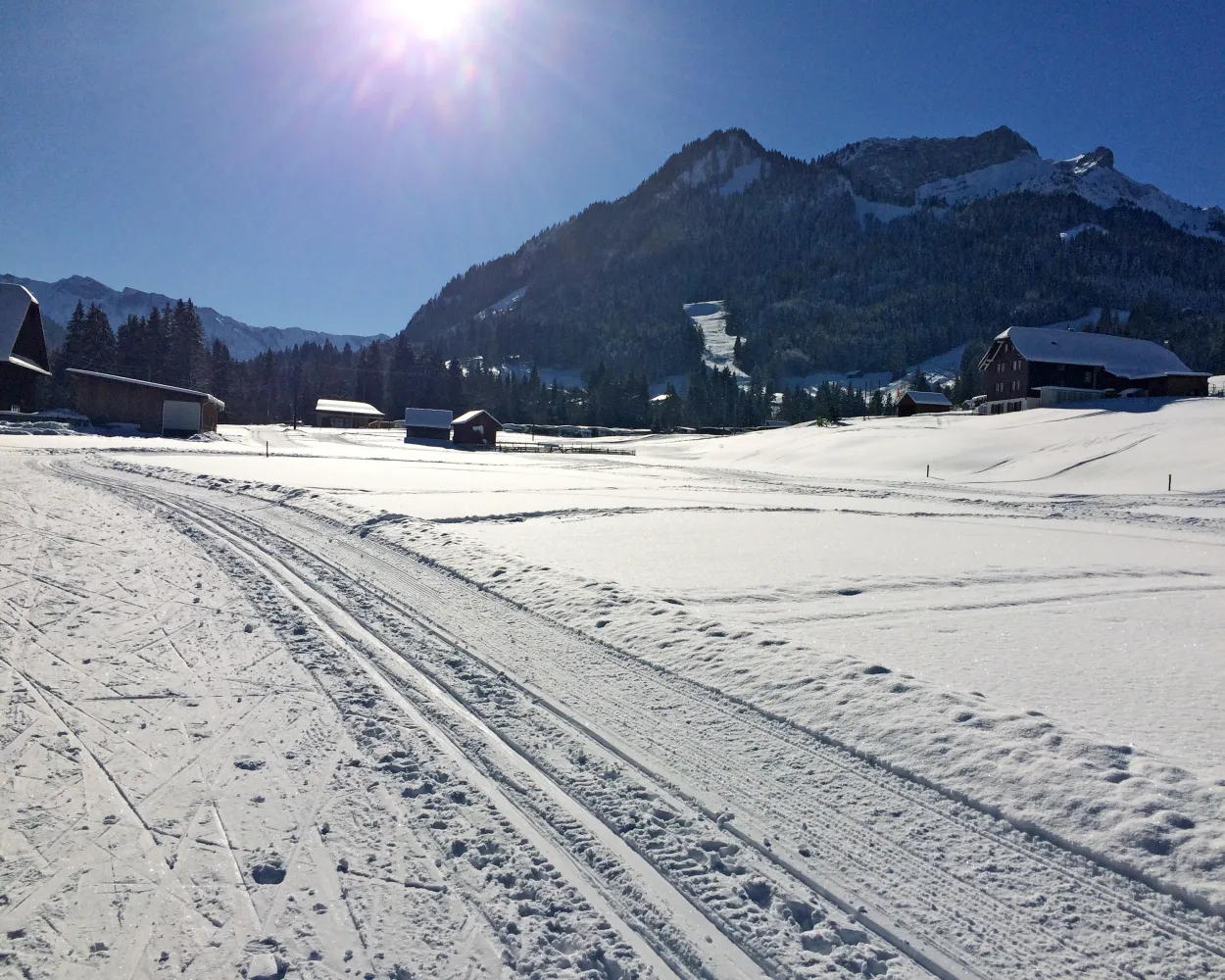
With ideal winter and cross-country skiing conditions, the Menzingen-Loipe trail, also known as the Schurtannenloipe, has become a real insider tip for cross-country skiers. The beautifully designed cross-country trail leads through stunning countryside with views of Menzingen and its monastery.
5.2 kmTour published by:
SwitzerlandMobility
Learn more on
schweizmobil.ch
| Luzern (08:35) | |
| IR75 (22m) | |
| Zug (08:57) |
| Zug, Bahnhofplatz (09:08) | |
| 602 (16m) | |
| Menzingen, Dorf (09:24) |
A little gem: The Thorbach cross-country skiing trail passes through simple terrain with view of the Schrattenfluh with its striking peaks.
1.6 kmTour published by:
SwitzerlandMobility
Learn more on
schweizmobil.ch
| Luzern (08:57) | |
| RE7 (31m) | |
| Schüpfheim (09:28) |
| Schüpfheim, Bahnhof (09:33) | |
| 241 (13m) | |
| Flühli LU, Torbach (09:46) |
Switzerland's largest upland moor can be found in the high valley of Rothenthurm, a Nordic-looking landscape crossed by the varied Finnenloipe track. This long route amid a protected landscape offers a unique opportunity to enjoy the pleasures of nature.
24.5 kmTour published by:
SwitzerlandMobility
Learn more on
snow.myswitzerland.com
and on
schweizmobil.ch
| Luzern (08:39) | |
| VAE (50m) | |
| Rothenthurm (09:29) |
Get to know Switzerland from its authentic side: far from any main road, the Rickenbach cross-country skiing trail wends its way through the scenic Michelsamt region amid hills, open fields and rustic farms.
7.6 kmTour published by:
SwitzerlandMobility
Learn more on
schweizmobil.ch
| Luzern (08:30) | |
| IR27 (17m) | |
| Sursee (08:47) |
| Sursee, Bahnhof (09:06) | |
| 399 (16m) | |
| Gunzwil, Hasenhusen (09:22) |


