Discover diverse hiking trails accessible by public transport from Porrentruy. From the charming old town, venture into the cultivated landscapes of the Ajoie region, across forested Jura chains, and along the picturesque Doubs river. Experience the rich variety of the Swiss Jura, from peaceful countryside dotted with farms to dramatic gorges and panoramic ridges offering sweeping views.
The following hikes are sorted by travel time from Porrentruy, making it easy to plan your next outdoor adventure. Check out the map to explore thousands of destinations and activities, reachable from any starting point in Switzerland.
Much more on ovunta.com/en/map
The walk from Delémont is a tour through the Canton Jura and its attractive scenery, from the heights of the Delémont Valley via the Ajoie region and the Doubs Valley, through the Combe Tabeillon nature preserve and to the Freiberge Mountain plateau with lovely, historic towns such as Porrentruy and St-Ursanne.
 94 km
94 km 3200 m
 2600 m
Landscape: With panoramic views
Tour published by:
SwitzerlandMobility
Learn more on
schweizmobil.ch
| Porrentruy, gare (10:02) | |
| 73 (2m) | |
| Porrentruy, ville (10:04) |
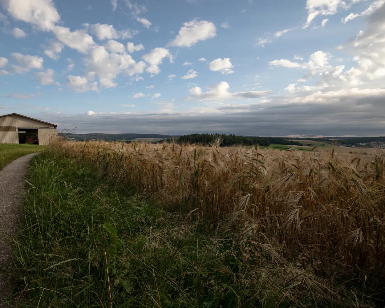
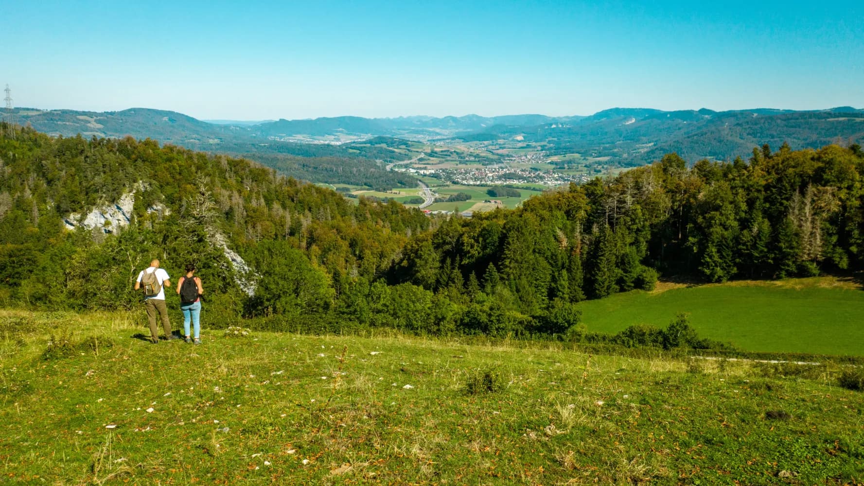
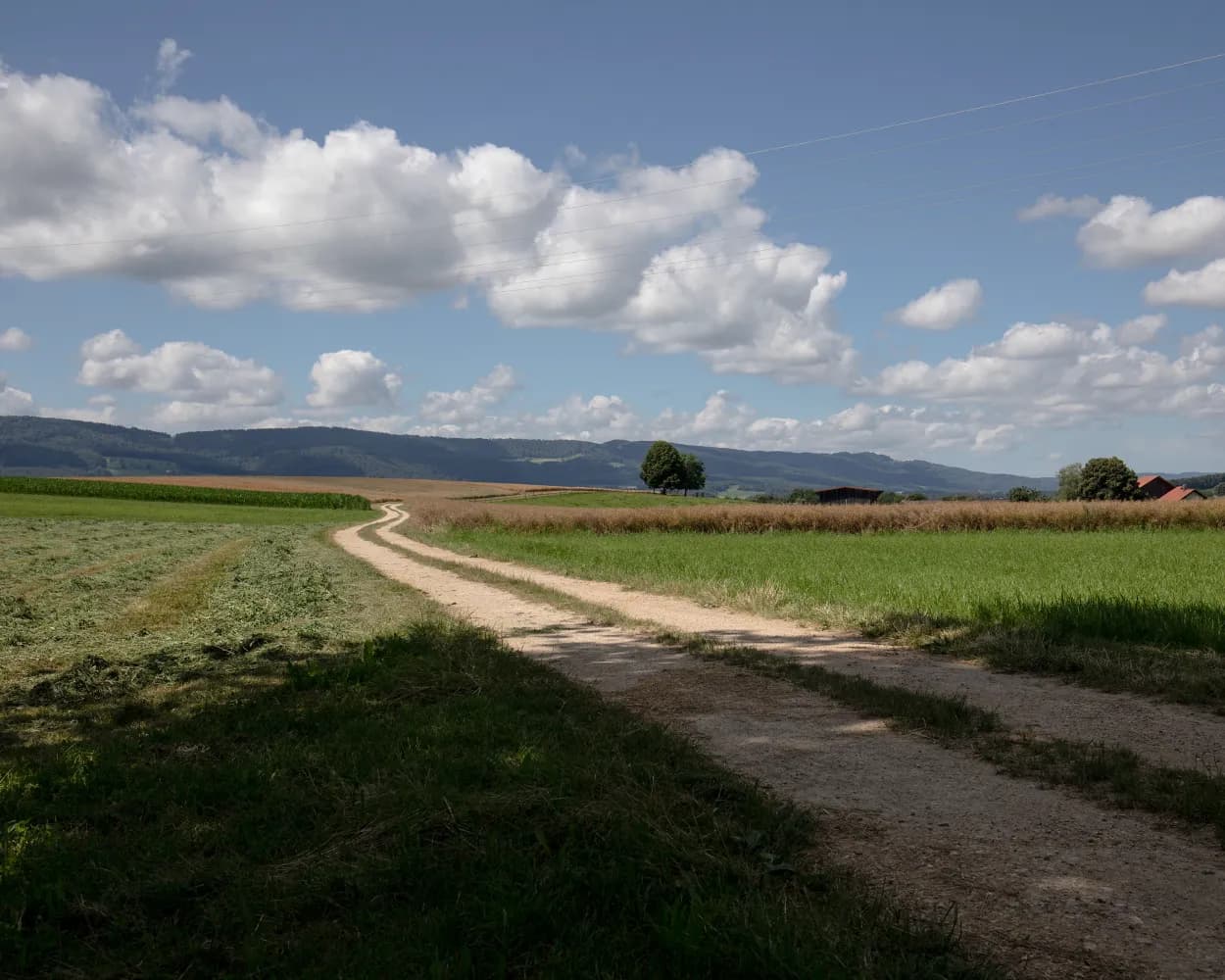
The route leads through the cultivated landscapes of the Ajoie region and across a ridge into the Clos du Doubs. Bands of rock and erosion gullies crisscross the forests on steep slopes. The stage ends in the narrow medieval streets of St-Ursanne on the banks of the Doubs.
17 km620 m600 m 4h 45m
Tour published by:
SwitzerlandMobility
Learn more on
schweizmobil.ch
After the lovely old town of Porrentruy, across fields to the forested Jura chain. Then a descent through deep folds carved in the karst rocks by the River Doubs. St-Ursanne is a bijou. The breath of another age permeates the monastery cloister..
17 km620 m600 m4h 45mLandscape: With panoramic views
Tour published by:
SwitzerlandMobility
Learn more on
schweizmobil.ch
The long-distance Trans Swiss Trail from Porrentruy to Mendrisio is one of the last great adventures in highly-developed Switzerland. A variety of landscapes, cultures and places of interest await along the 32 stages of the 488-km trail.
510 km17800 m17900 mLandscape: With panoramic views,Over a pass
Tour published by:
SwitzerlandMobility
Learn more on
schweizmobil.ch
| Porrentruy, gare (09:02) | |
| 71 (2m) | |
| Porrentruy, Joseph Trouillat (09:04) |
The relatively flat route first leads along the French-Swiss border through the forests of the Ajoie region. Again and again, the view opens up to the surrounding hills all the way to the Vosges Mountains. The old town of Porrentruy and its castle are well worth a visit.
20 km440 m660 m5h 10mTour published by:
SwitzerlandMobility
Learn more on
schweizmobil.ch
| Porrentruy, gare (09:02) | |
| 72 (3m) | |
| Porrentruy, Ô Vergers d'Ajoie (09:05) |
From St. Ursanne, the route follows the Doubs river to Tariche. It then meets the trail commemorating the 40th anniversary of the canton of Jura, and continues on to the intersection of the three Jura districts. You then continue hiking on the ridge. In view: the Delémont and Doubs valleys. The descent leads to the destination for this stage at Glovelier.
18 km620 m540 m5h 0mTour published by:
SwitzerlandMobility
Learn more on
schweizmobil.ch
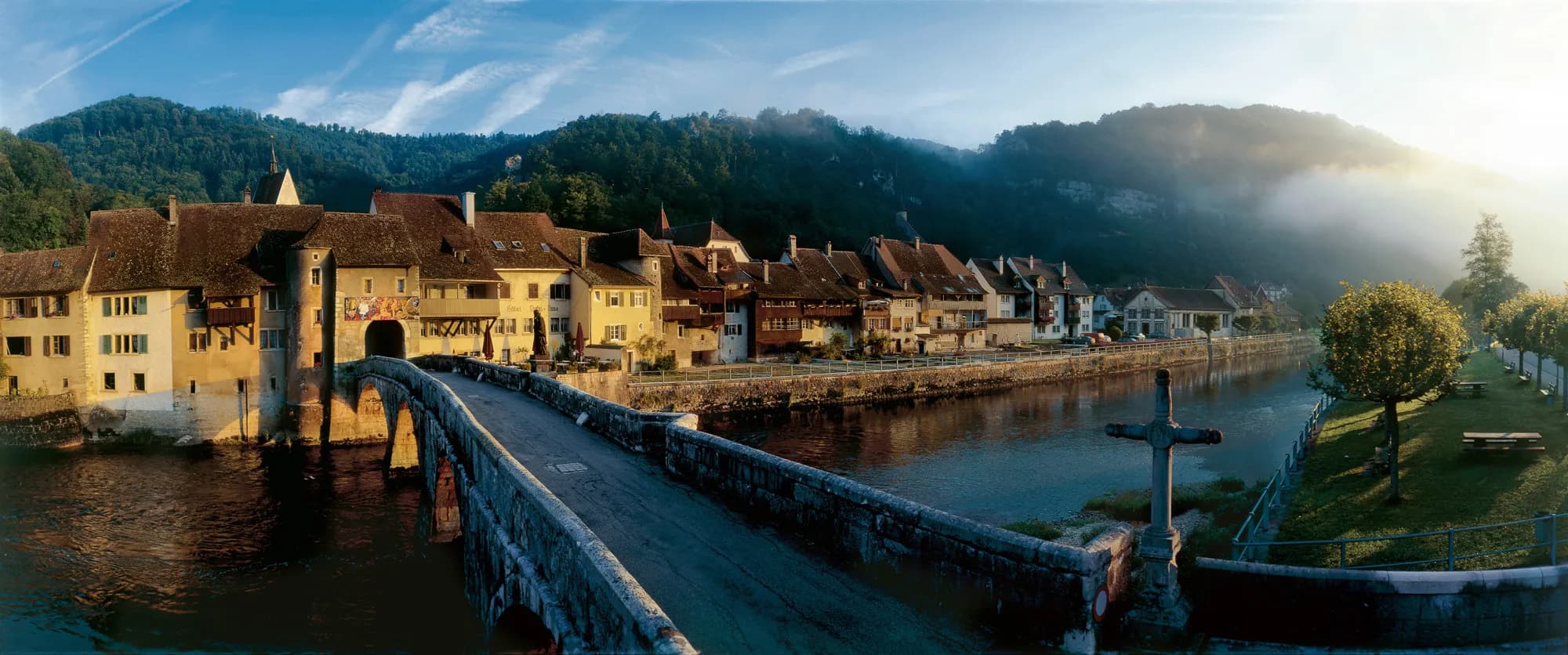
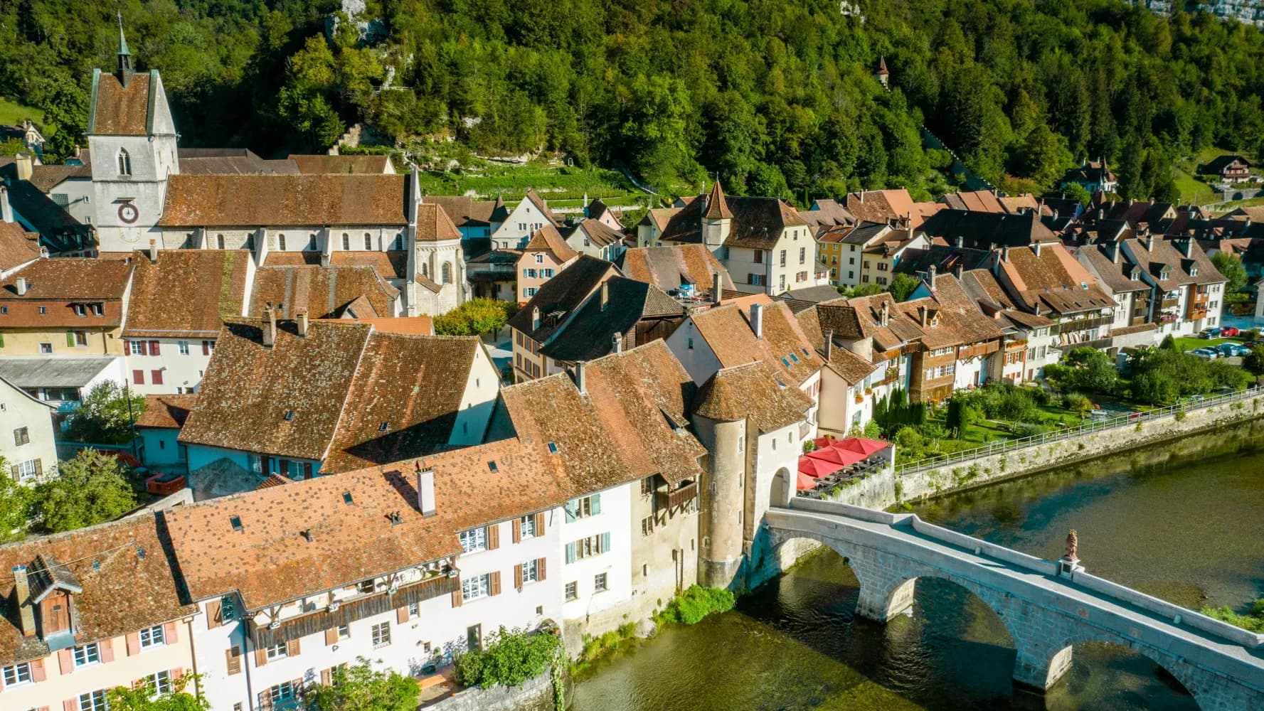
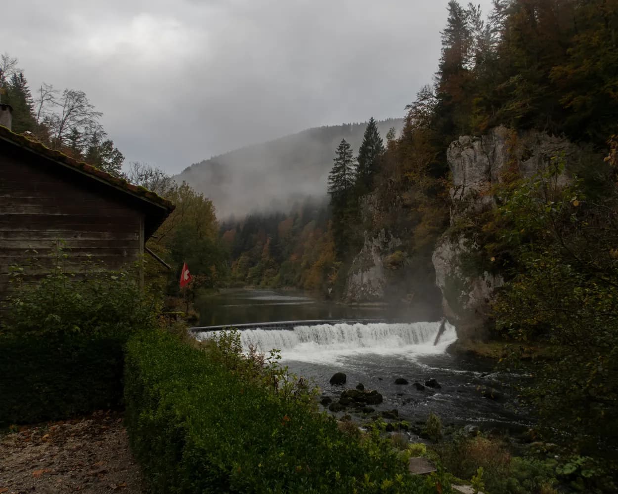
Just before St. Ursanne, the Doubs makes a sharp 180-degree arc as it if were unsure where to go. Perhaps this radical change of direction is the reason why the Romans called the meandering river the Doubs. The word comes from the Latin dubitus, the hesitant, the doubting.
15 km220 m260 m3h 45mLandscape: Through a Swiss Park,Along the water
Tour published by:
SwitzerlandMobility
Learn more on
schweizmobil.ch
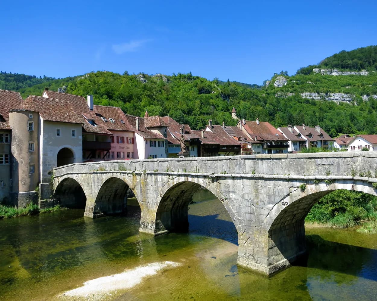
The route in and around the charming town of St-Ursanne in Canton Jura is a treat for history lovers. The captivating little town on the River Doubs has changed little over the centuries. It is impressive and well worth a visit.
9 km100 m100 m2h 20m
Barrier free: Yes
Landscape: Along the water
Tour published by:
SwitzerlandMobility
Learn more on
schweizmobil.ch
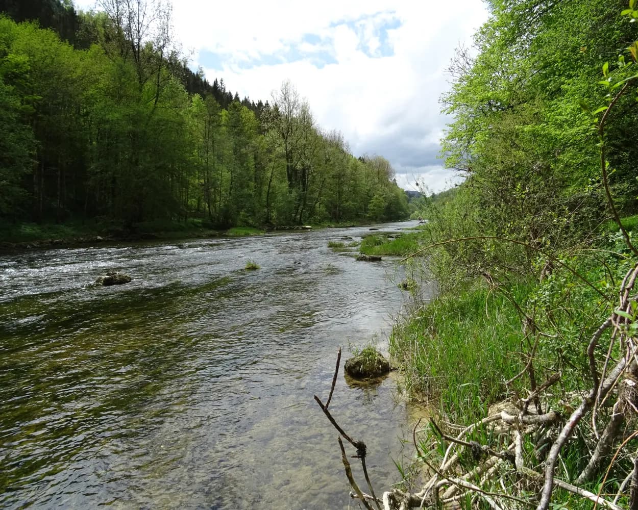
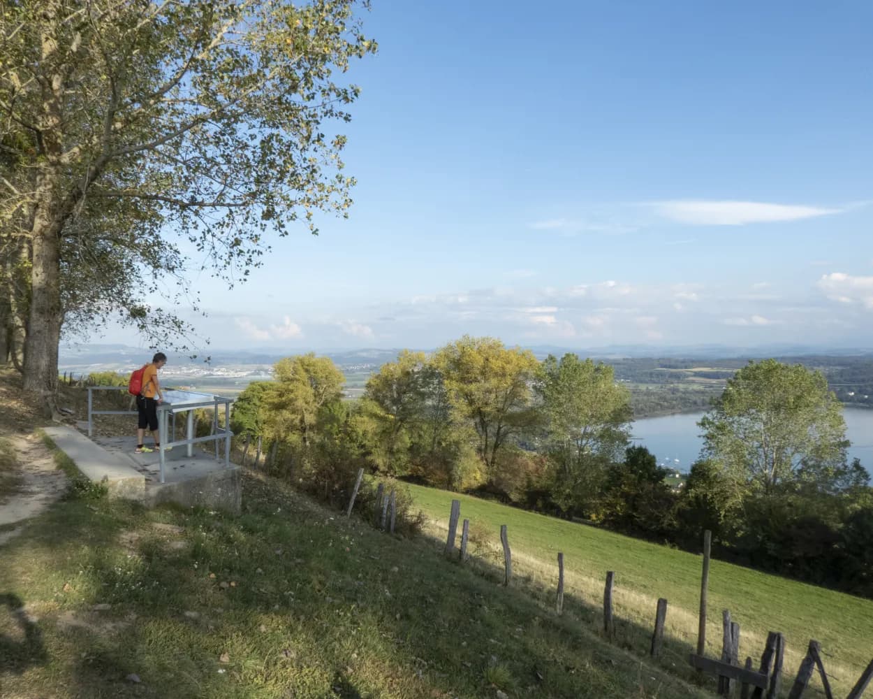
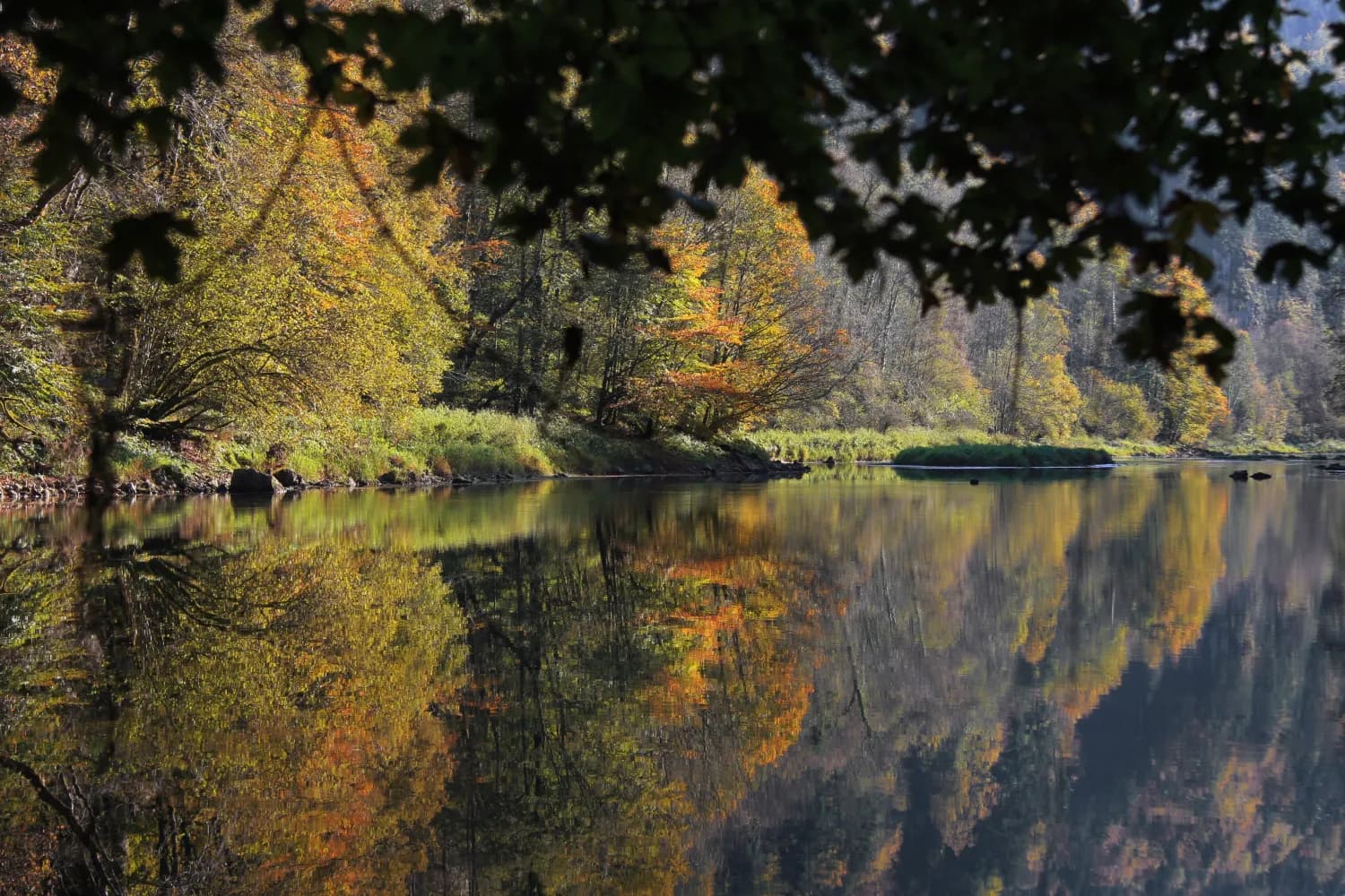
The Doubs is a moody, fascinating river. The hike along the south bank from St-Ursanne to La Charbonnière is almost always along nature trails, close to the shimmering, blue-green waters. Many dragonflies and birds inhabit the river banks.
15 km260 m220 m3h 50mLandscape: Along the water
Tour published by:
SwitzerlandMobility
Learn more on
schweizmobil.ch
This hike does full justice to its name. The trail leads from Les Brenets near La Chaux-de-Fonds to St. Ursanne, almost always alongside the River Doubs and crossing the Doubs Regional National Park from west to east.
68 km1500 m1900 mLandscape: Through a Swiss Park,Along the water
Tour published by:
SwitzerlandMobility
Learn more on
schweizmobil.ch
| Porrentruy (08:40) | |
| R1 (10m) | |
| St-Ursanne (08:50) |