Discover a world of hiking possibilities accessible by public transport from the charming village of Adelboden. From gentle walks along babbling streams to challenging treks over high mountain passes, this region offers a diverse range of trails. Explore the stunning Bernese Oberland, with its flower-filled Alpine meadows, crystal-clear lakes, and impressive mountain vistas.
The hikes listed below are sorted by travel time from Adelboden, making it easy to plan your next adventure in the Swiss Alps. Check out the map to explore thousands of destinations and activities, reachable from any starting point in Switzerland.
Much more on ovunta.com/map

Gentle climb alongside the Glisbach stream, through forest and moorland, over the Hahnenmoospass, then down to Lenk, superbly set in the Hinter Simmental basin, with spectacular waterfalls and the perfect backdrop of the Wildstrubel massif.
 14km
14km 700m
700m 1000m
1000m 4h 30m
Barrier free: No

Landscape: Over a pass, With panoramic views
Tour provided by:
SwitzerlandMobility
Learn more on
schweizmobil.ch
Select an alternative stop on the map.

From Kandersteg’s traditional wooden chalets over flower-filled Alpine pastures towards the rock walls of the Lohner, a firm favourite with chamois. Over numerous steep sections to reach the Bunderchrinde, the breathtaking pass into Engstligental, and on to Adelboden.
16km1400m1250m6h 45mBarrier free: No
Landscape: Over a pass, With panoramic views
Tour provided by:
SwitzerlandMobility
Select an alternative stop on the map.
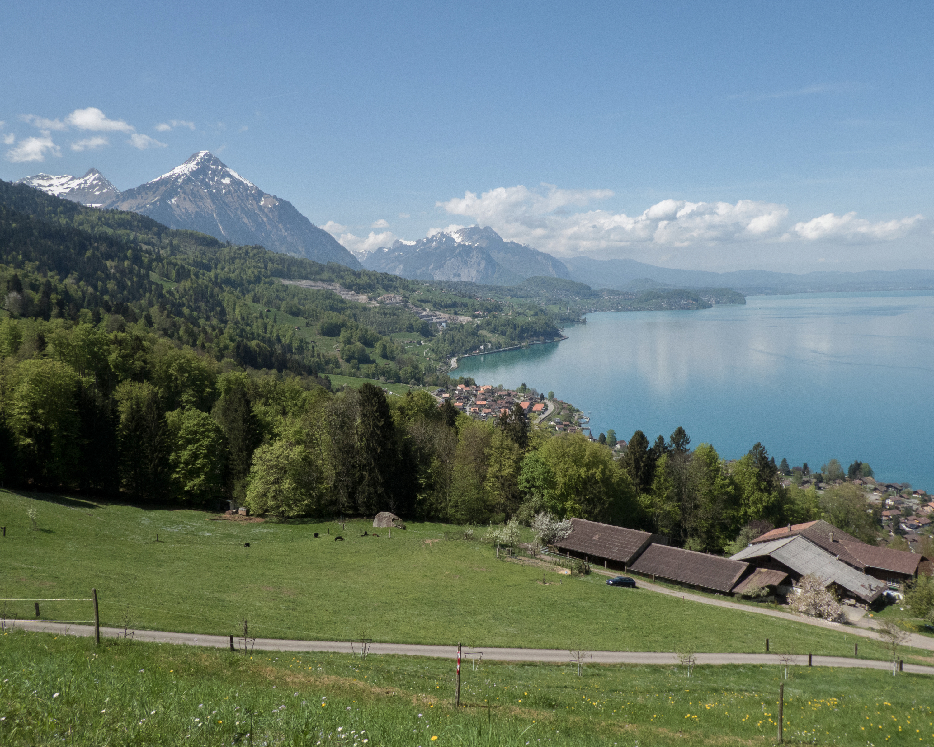
Starting in Interlaken, the hike hugs Lake Thun before continuing on via Därligen to the Meielisalp up above Leissigen. Enchanting panoramic views are provided by the suspension bridge over the Spissibach stream. Finally, the route continues past Faulensee via Krattigen. The end point for this stage is Spiez with its vineyards and castle – the latter, towering over the town, serves as its characteristic symbol.
20km740m740m5h 50mBarrier free: No
Landscape: Onto an alp, Past castles, Along the water, With panoramic views, Over a suspension bridge
Tour provided by:
SwitzerlandMobility
Select an alternative stop on the map.
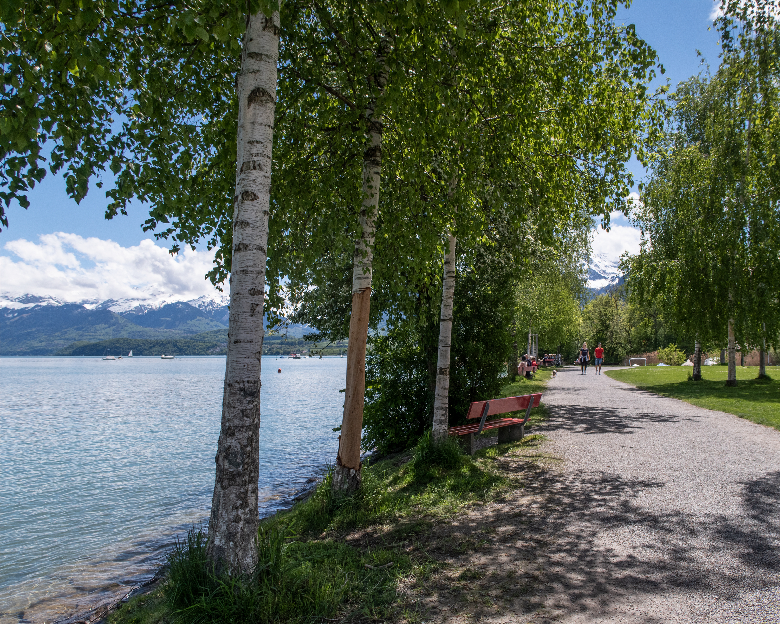
You leave Thun through the park-like shore landscape towards Gwatt. Above Lake Thun, crossing the Kander Gorge, you reach Spiez via meadows and forests. Following the idyllic path to Faulensee, you finally leave the shore here. The destination is the village of Aeschi with a view of the Niesen and the lake.
20km680m360m5h 25mBarrier free: No
Tour provided by:
SwitzerlandMobility
Learn more on
schweizmobil.ch
Select an alternative stop on the map.
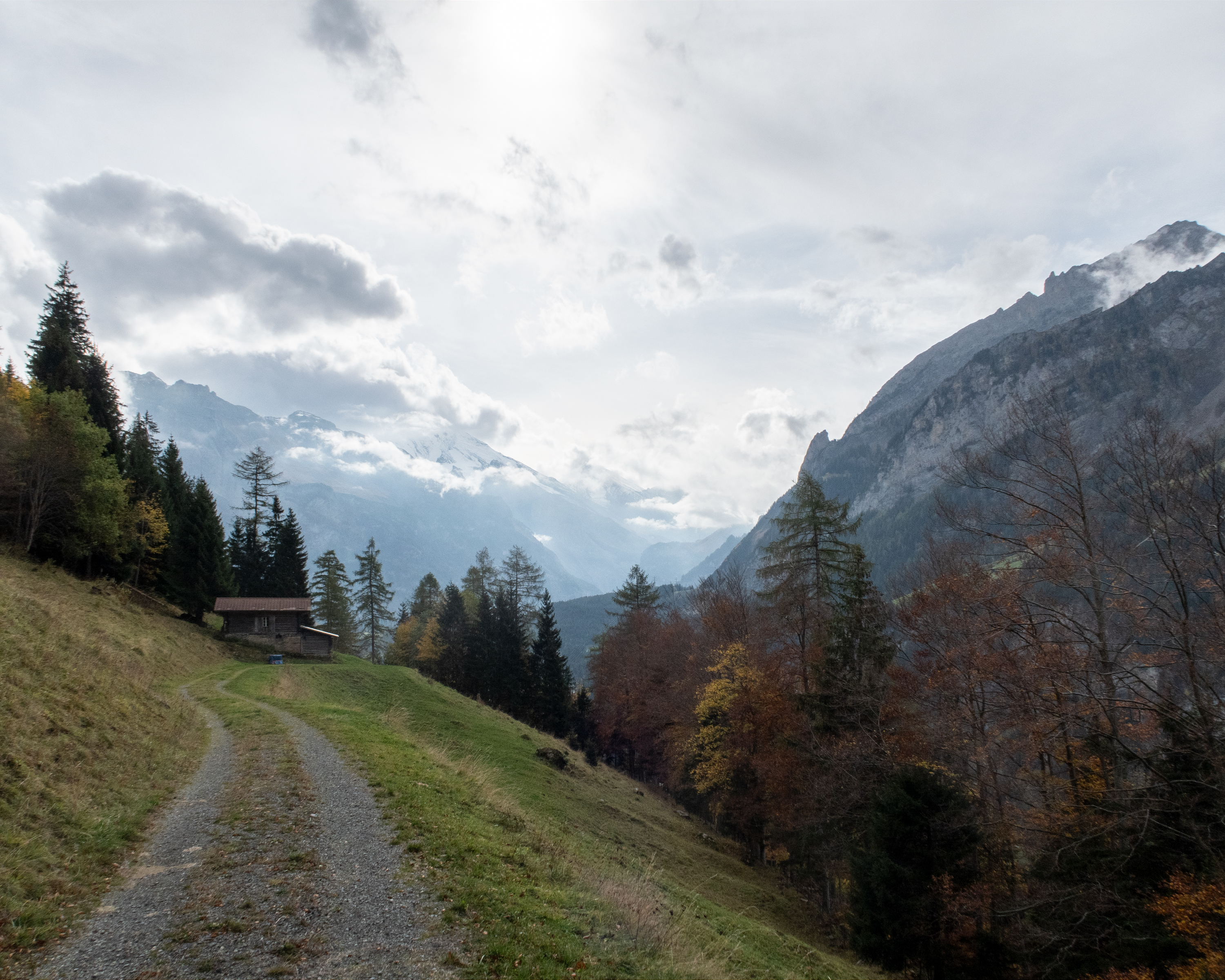
High-level path in Alpine foothills from Kiental to Kandersteg. High above the Kandertal through forests and over Alpine pastures. Fascinating views down to the trains of the Lötschberg Railway, which roll through the Kandertal like a model railway.
20km1150m950m6h 35mBarrier free: No
Landscape: With panoramic views
Tour provided by:
SwitzerlandMobility
Learn more on
schweizmobil.ch
Select an alternative stop on the map.

The king’s stage over the 2778m-high Hohtürli. Rewarding detour to the Blümlisalphütte and eternal glacier ice. Down over moraine to beautiful, deep-blue Oeschinensee backed by steep cliffs; one of the most beautiful mountain lakes in the Alps.
17km1450m1700m7h 15mBarrier free: No
Landscape: Onto a mountain peak, Over a pass, With panoramic views
Tour provided by:
SwitzerlandMobility
Learn more on
schweizmobil.ch
Select an alternative stop on the map.
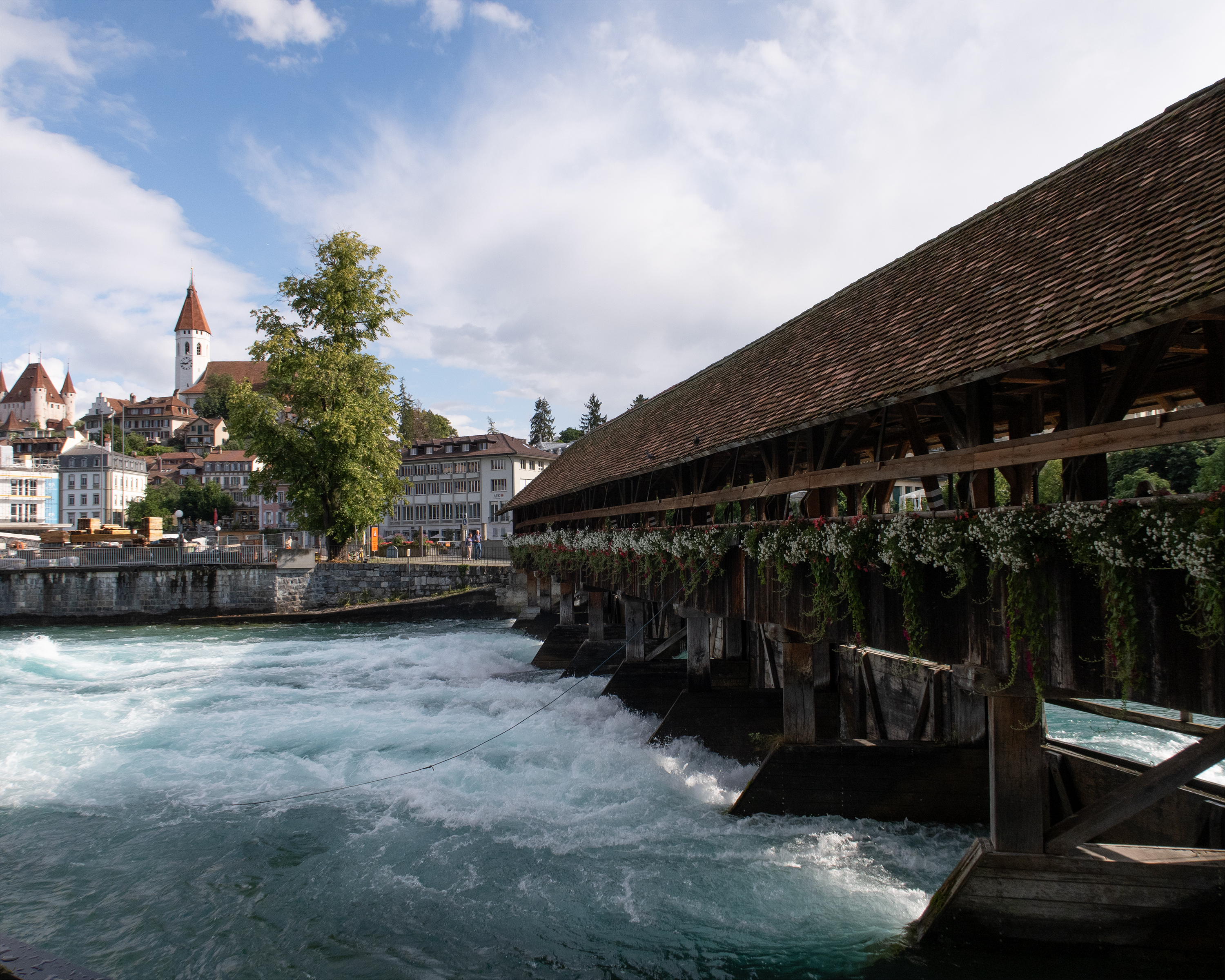
Starting in the historical town of Thun with its mediaeval castle, the hike takes you past a number of idyllic places including Hünibach and Aeschlen, shortly before you reach the spectacular Sigriswil bridge with its panoramic views high above Lake Thun.
11km640m400m3h 40mBarrier free: No
Landscape: Along the water, With panoramic views, Over a suspension bridge
Tour provided by:
SwitzerlandMobility
Select an alternative stop on the map.
Panoramic hike on high-level BLS railway Südrampe (south ramp). Popular classic hike beside the Lötschberg Railway tracks to imposing Bietschtal bridge. Lovely path beside historic water channels (suonen) to hanging bridge; superb views at Brägji and Riedgarten.
12km640m260m3h 40mBarrier free: No
Landscape: With panoramic views
Tour provided by:
SwitzerlandMobility
Learn more on
schweizmobil.ch
Select an alternative stop on the map.
Across meadows and pastures, it is a leisurely climb to the entrance of the Suld Valley. Then the mountain path, which becomes increasingly narrower, goes up along roaring streams and waterfalls to the Renggli Pass. Over the intensively exploited alps, you descend to the remote mountain village of Saxeten.
17km1200m950m6h 10mBarrier free: No
Tour provided by:
SwitzerlandMobility
Learn more on
schweizmobil.ch
Select an alternative stop on the map.
Alpine hike in the lower Diemtigtal valley with the cultural highlight of visiting the Wakker prize winning village of Diemtigen. Later, fresh alpine air, views of the Simmental valley and subsequent immersion into the forests as you hike downhill.
10km720m400m3h 20mBarrier free: No
Landscape: With panoramic views
Tour provided by:
SwitzerlandMobility
Learn more on
schweizmobil.ch
Select an alternative stop on the map.
Learn more on
schweizmobil.ch
Learn more on
schweizmobil.ch
Learn more on
schweizmobil.ch